East Truong Son Highway: Thanh My to Nong Son
In Central Vietnam, there is currently a new highway under construction that will connect Thanh My, in Quang Nam, with Da Lat, in Lam Dong. This project is known as the "Duong Truong Son Dong", or East Truong Son Mountains Road. This project is still under construction, so only various stretches are drivable at the moment. As of this writing (October 2016), the section from Thanh My to Nong Son remains about 75% completed, with only the long descent from "Ghost Valley" down to Nong Son yet to be completed. When this section is finished I will finish this guide!
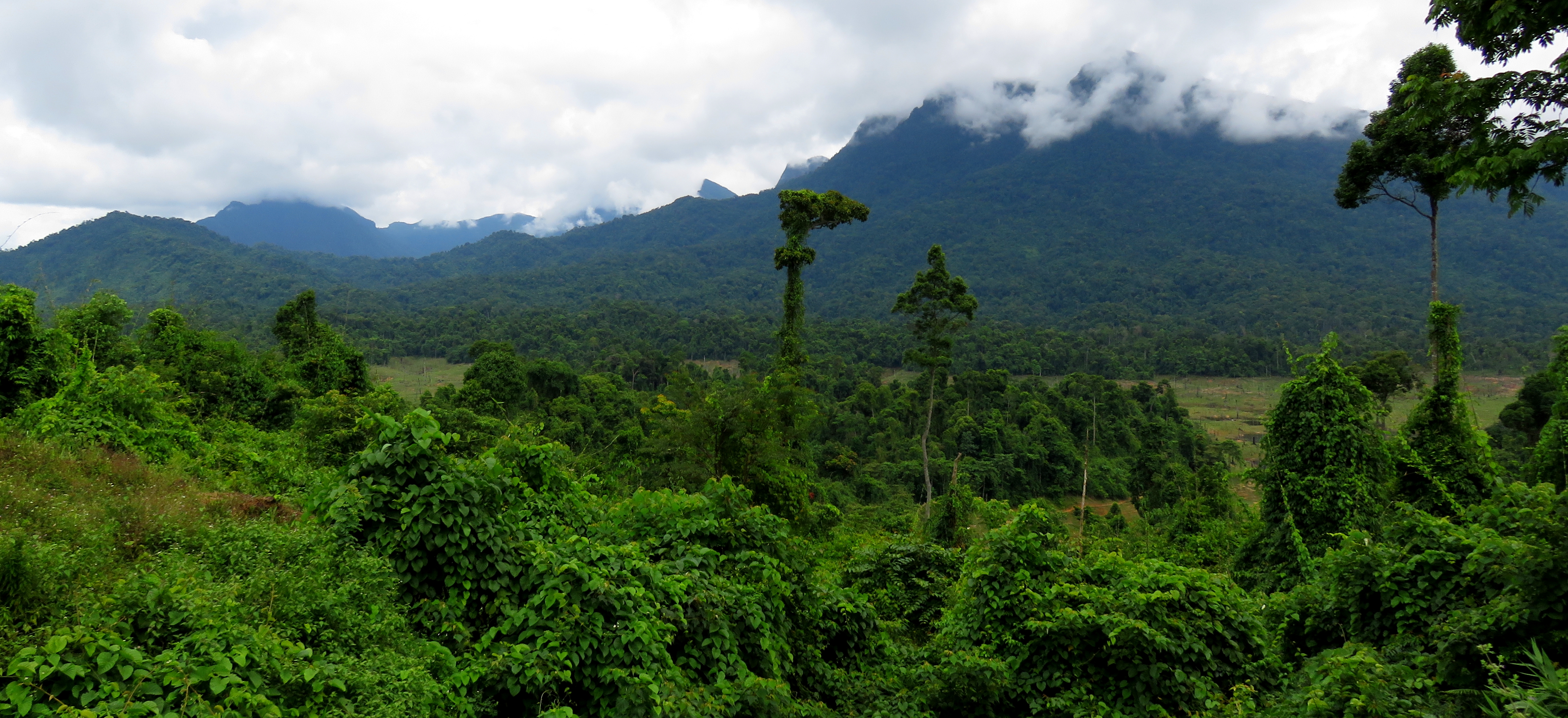
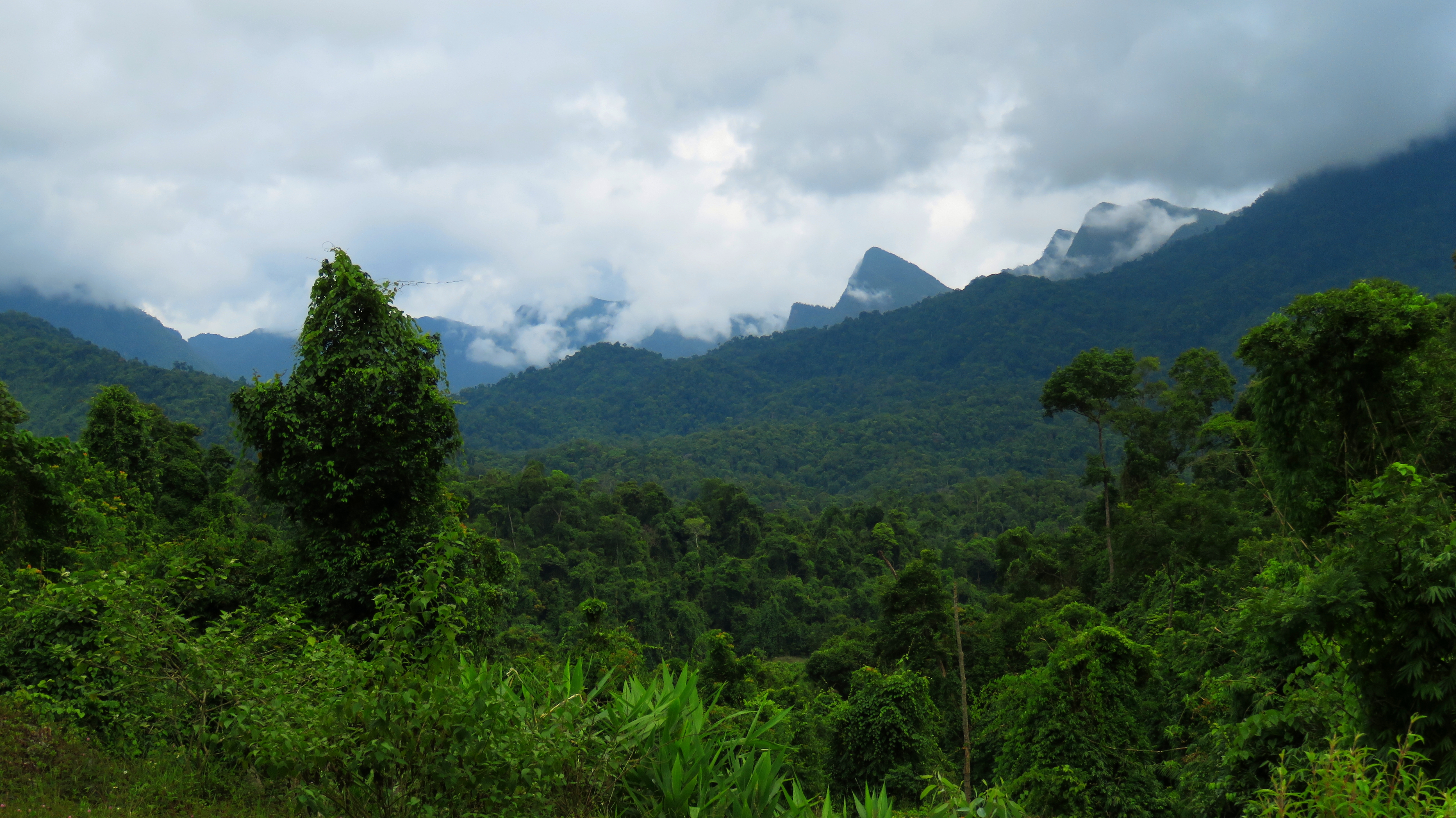
"Ghost Valley" and Nui Mo'Ra rising behind.
During our trip to nearby Thac Grang in April of 2016, we noticed a new sign pointing to a new looking road that looked like it went into the mountains outside of town. This sign says "Nong Son 7 Km ->". Looking on Google Earth at the area, I knew there was a fairly new hydropower reservoir in the hills of Nong Son (the neighboring district to Thanh My's Nam Giang) so I began to wonder if perhaps this new road connected to that reservoir, and could ultimately provide a link between the two places. As the crow flies they are quite close, merely on opposite sides of a mountain range. However, on Google Maps, it shows the road out of Thanh My ending at one of the arms of the lake, and the road from Nong Son ending quite a ways below it. We wagered that maybe the Google Earth satellite coverage hadn't been updated in a while, and perhaps the road was completed. It was a bit of a gamble but we were willing to give it a go, so in October 2016 we headed out to get a look at what this road would bring.
"Ghost Valley" and Ho Khe Dien.
The road takes off from inside Thanh My town, and starts climbing at first, before dropping into the valley of Khe Dieng. The views to the north and northwest and nice from this section, especially over the rice paddies in the first valley. The various ranges of mountains in Nam Giang and Dong Giang rise in the background. Khe Dieng, the stream that the road follows for quite a ways up, is the primary stream for the town of Thanh My, cutting right through the heart of town and providing it power thanks to a small hydropower plant. There is a large gravel quarry just outside of town, but the road goes by it so quickly that it's gone and quickly forgotten.
Looking northwest towards the wilds around the A Vuong and Song Bung Rivers.
Looking north towards Thanh My (in the valley on the left), and the mountains of Dong Giang .
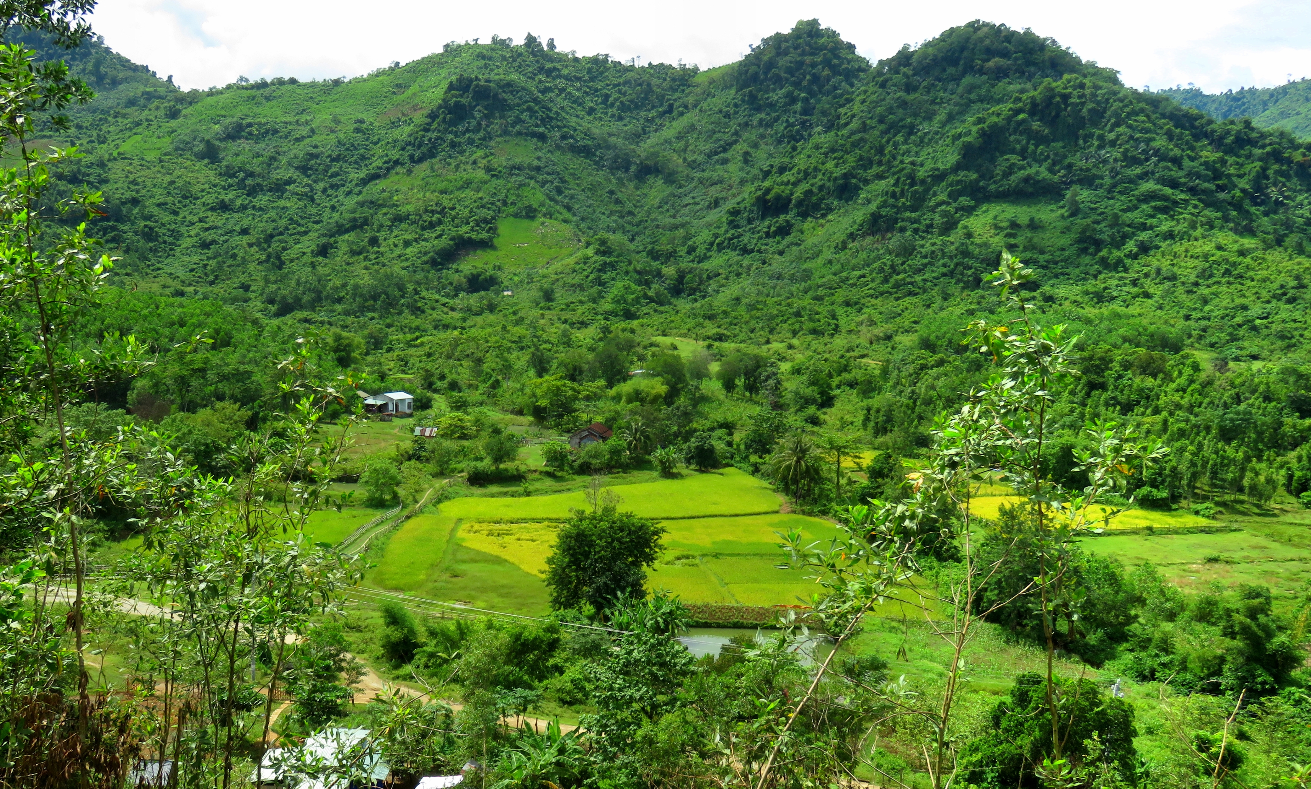
Rice paddies near Thanh My.
|
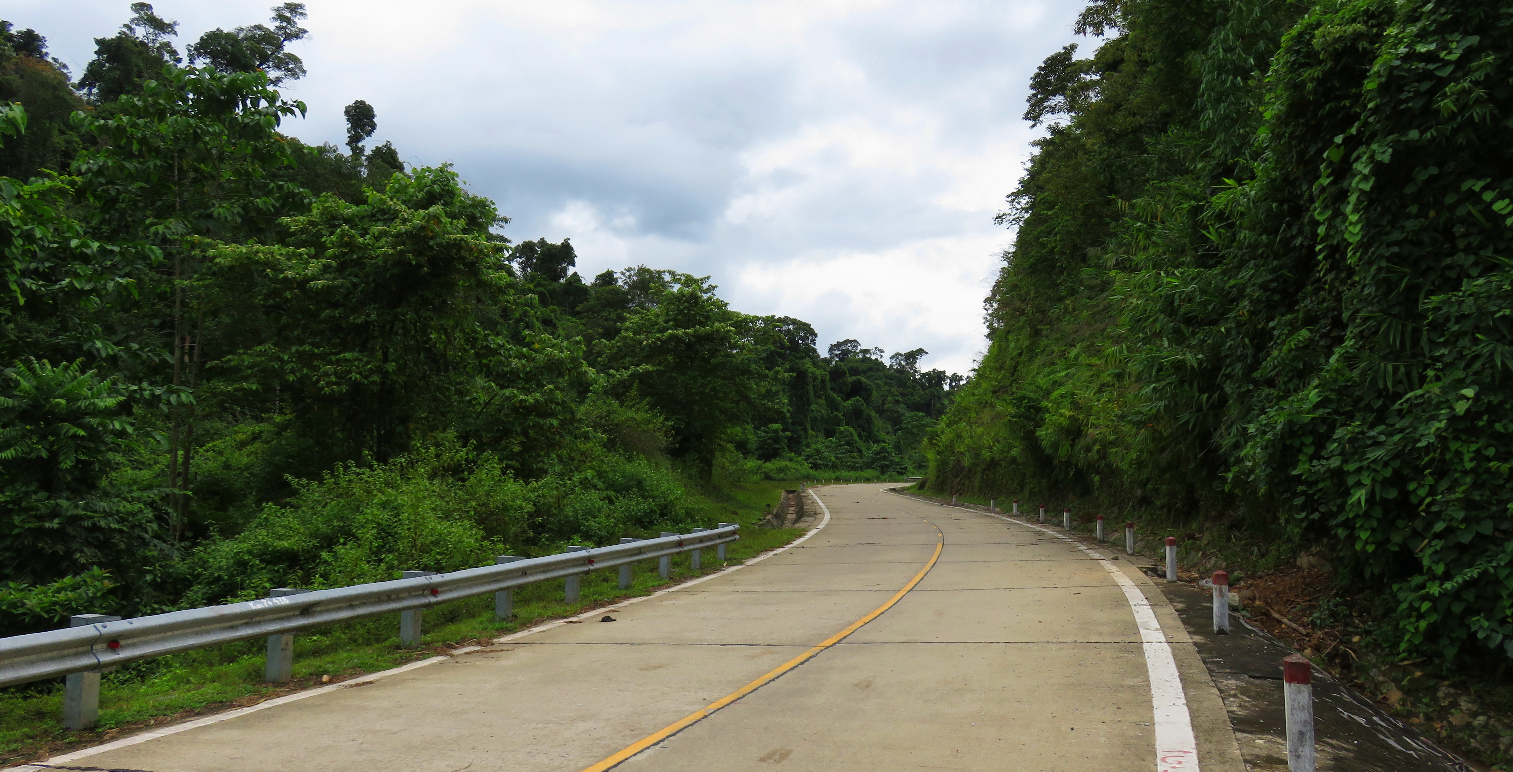
Nice road.
|
|
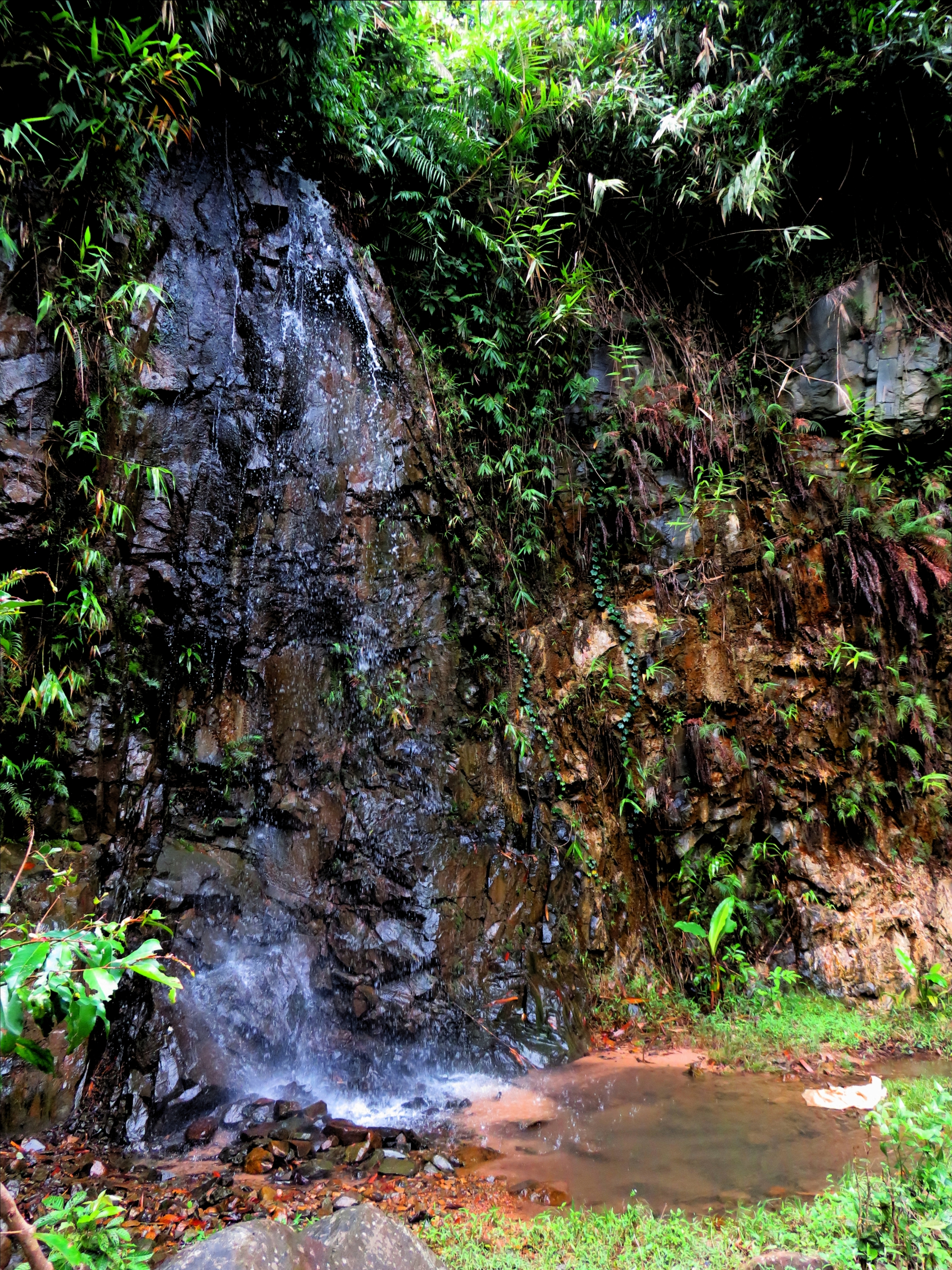
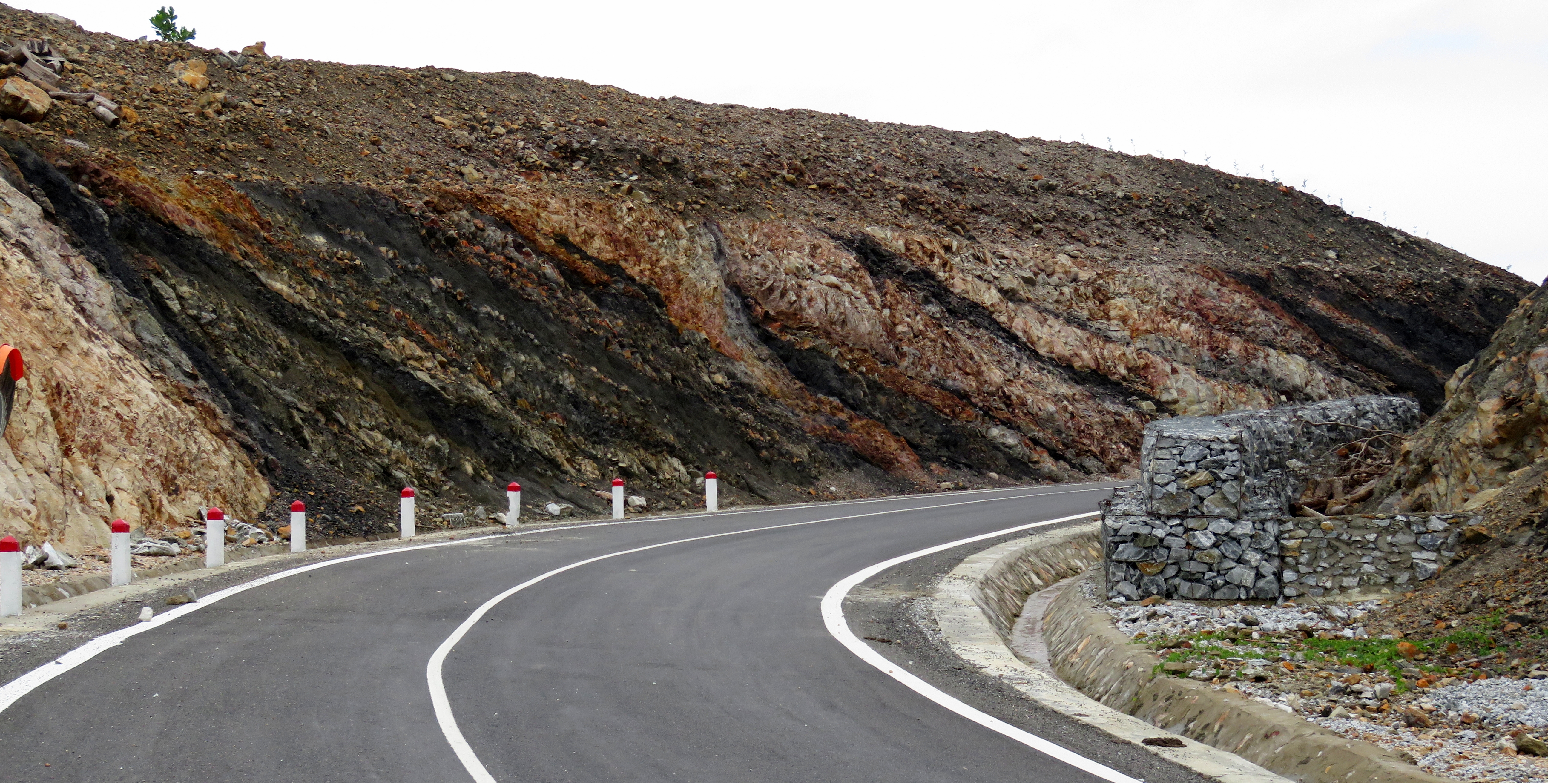
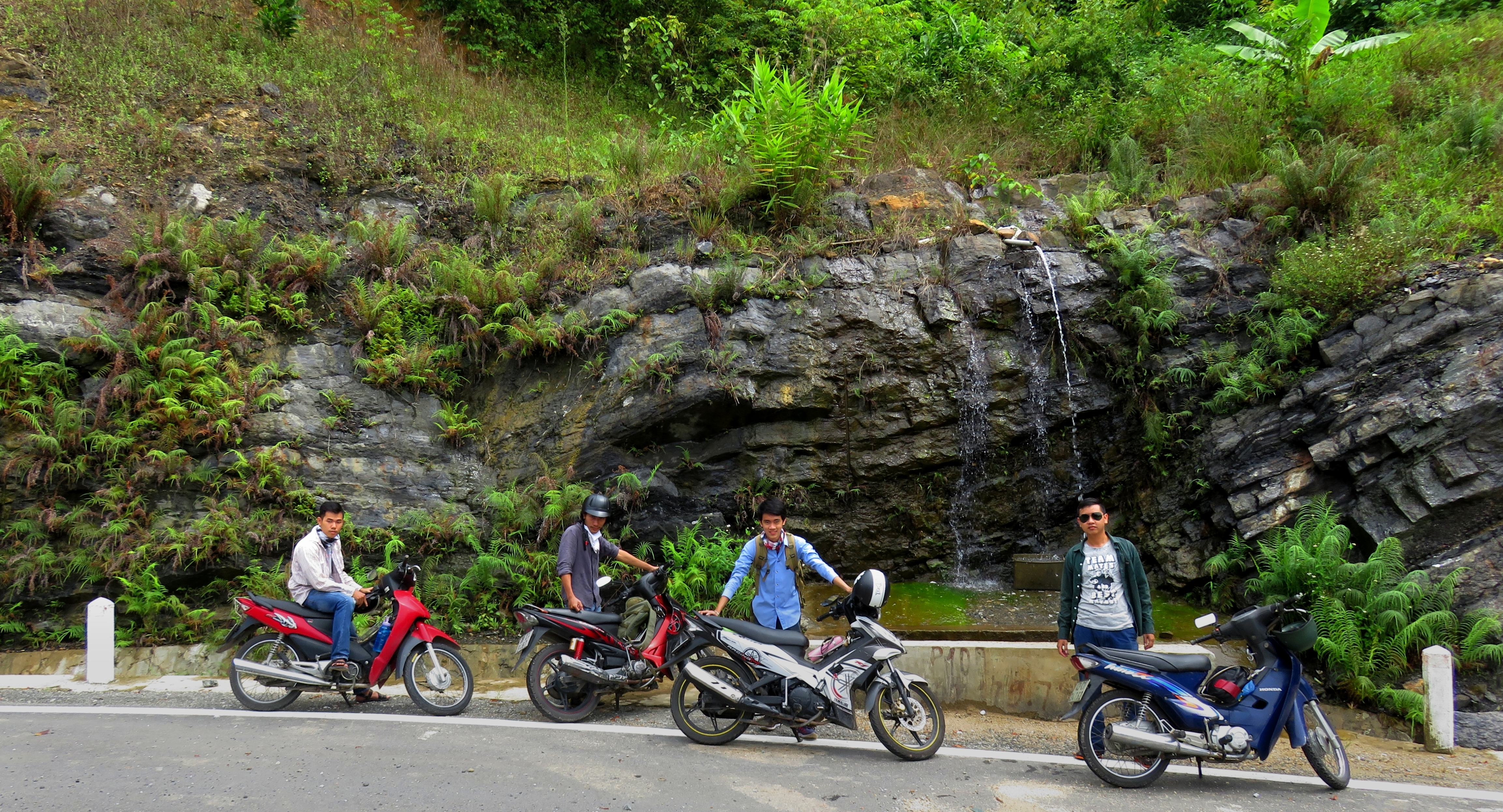
The first bit of the climb up the valley of the Khe Dieng is wonderful. It's quiet, there's still quite a bit of old growth surrounding the forest, and small creeks come babbling out of the mountains consistently. The road is wide and smooth and capable of high speeds, but you shouldn't be going that fast on this trip, slow down and enjoy it. Along the way there is a decent waterfall that was created by the construction of the road that's worth a five minute stop.
Travertine waterfall.
|
Small roadside falls.
|
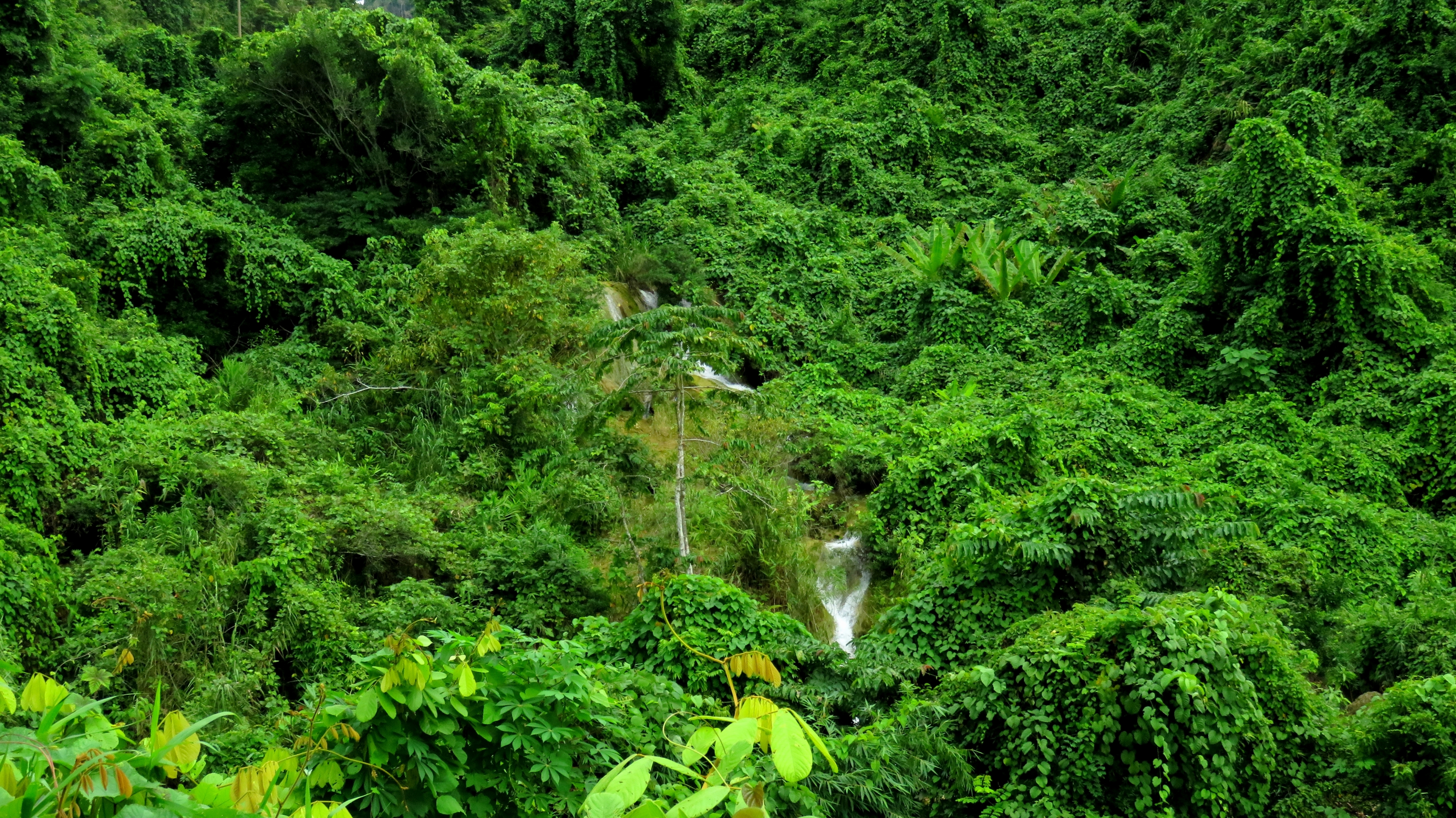
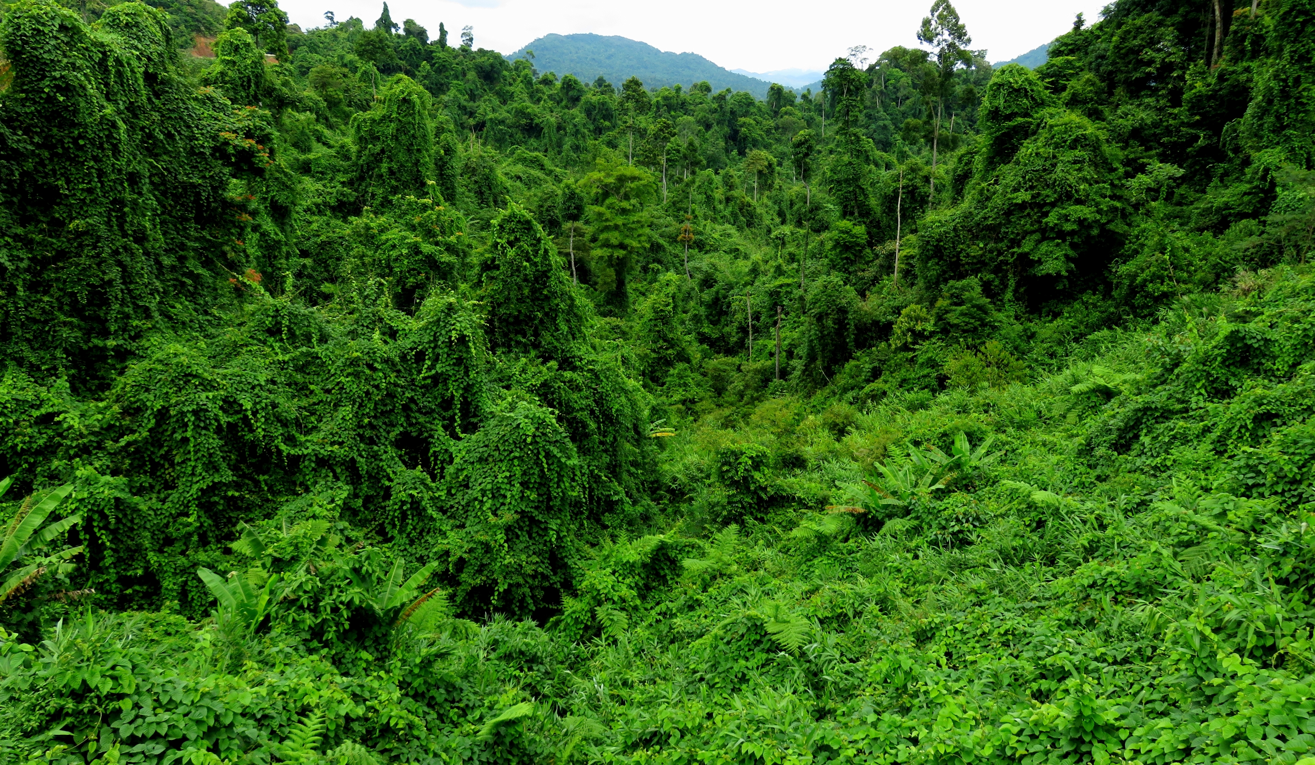
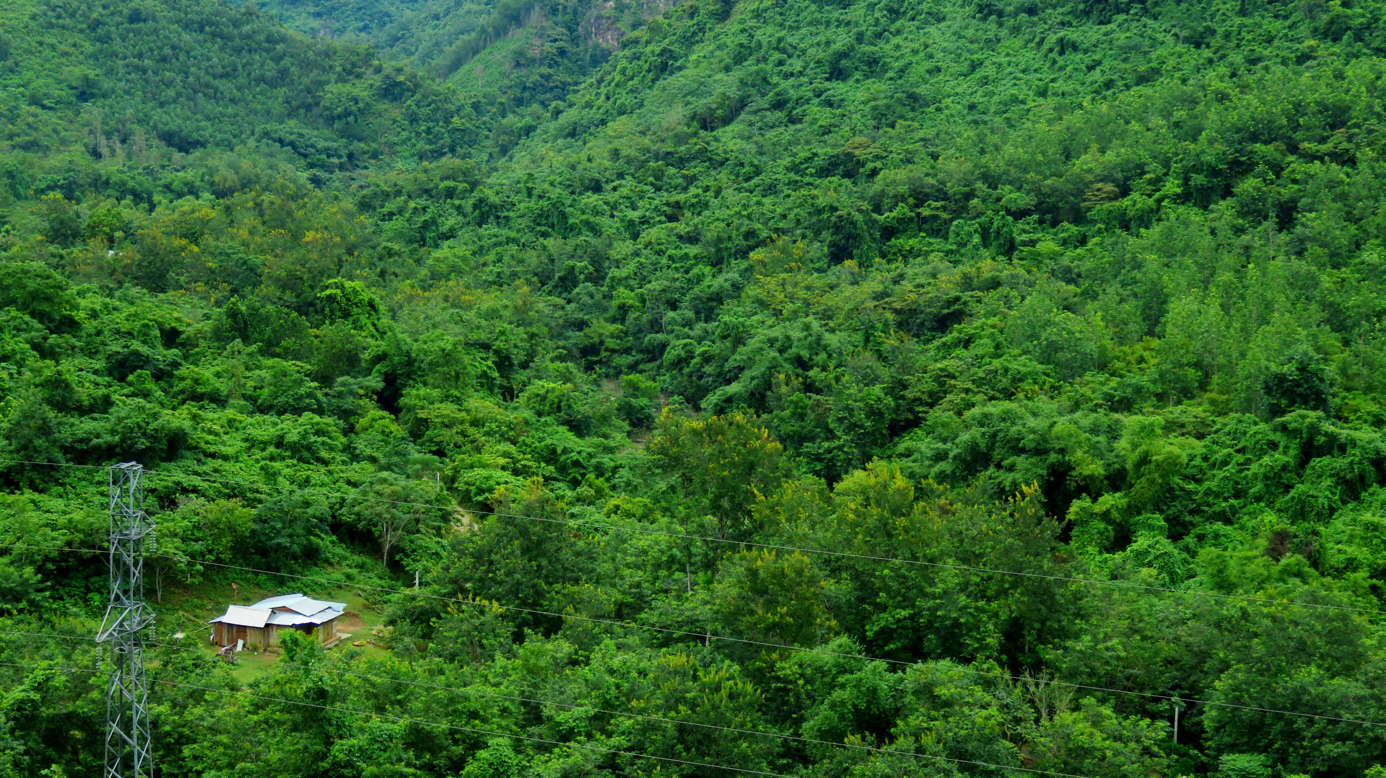
The road gets deeper into the mountains, and the forest keeps getting more wild to match. On Google Earth you can see that there have been some small areas that have been hit by logging, but there still remains some huge areas of old growth,, and this road cuts through a good chunk of that. The impressive white boles of the big dipterocarp and fichus trees stand out starkly against the massive blanket of green in the background. Eventually the last of the remote farms drop away too and it becomes close to wilderness.
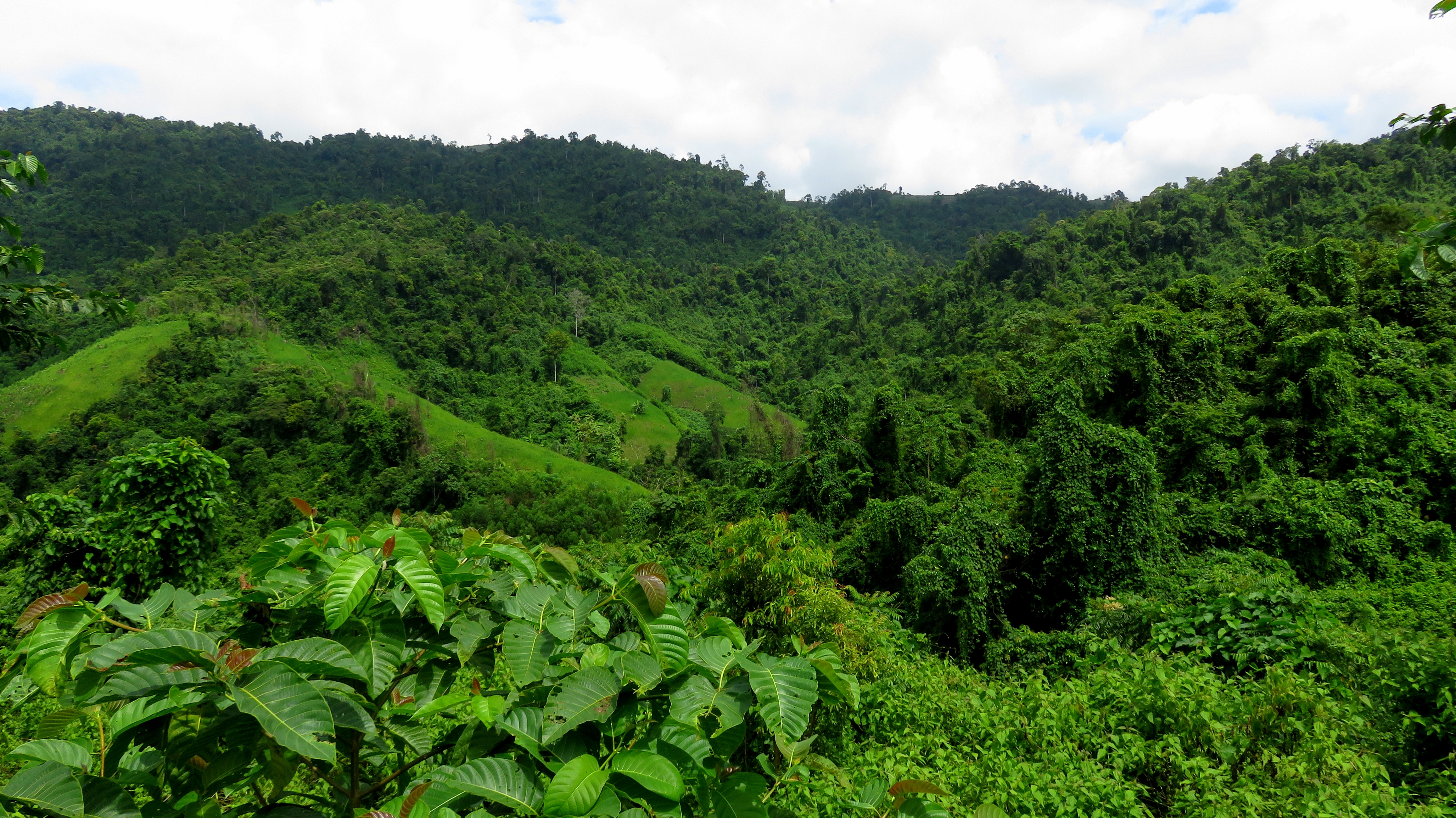
Blanket of green covering the hills.
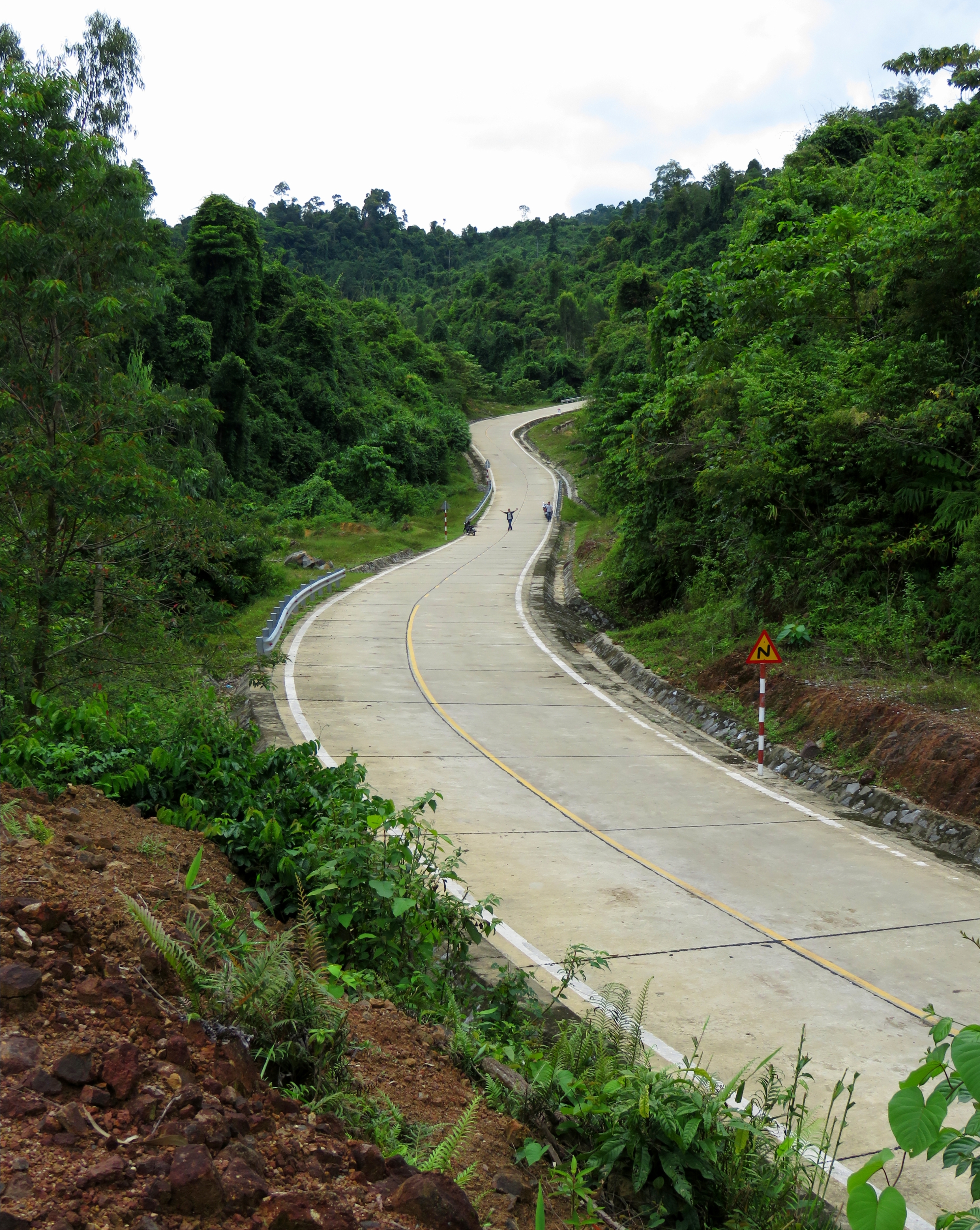
Winding road headed up.
|
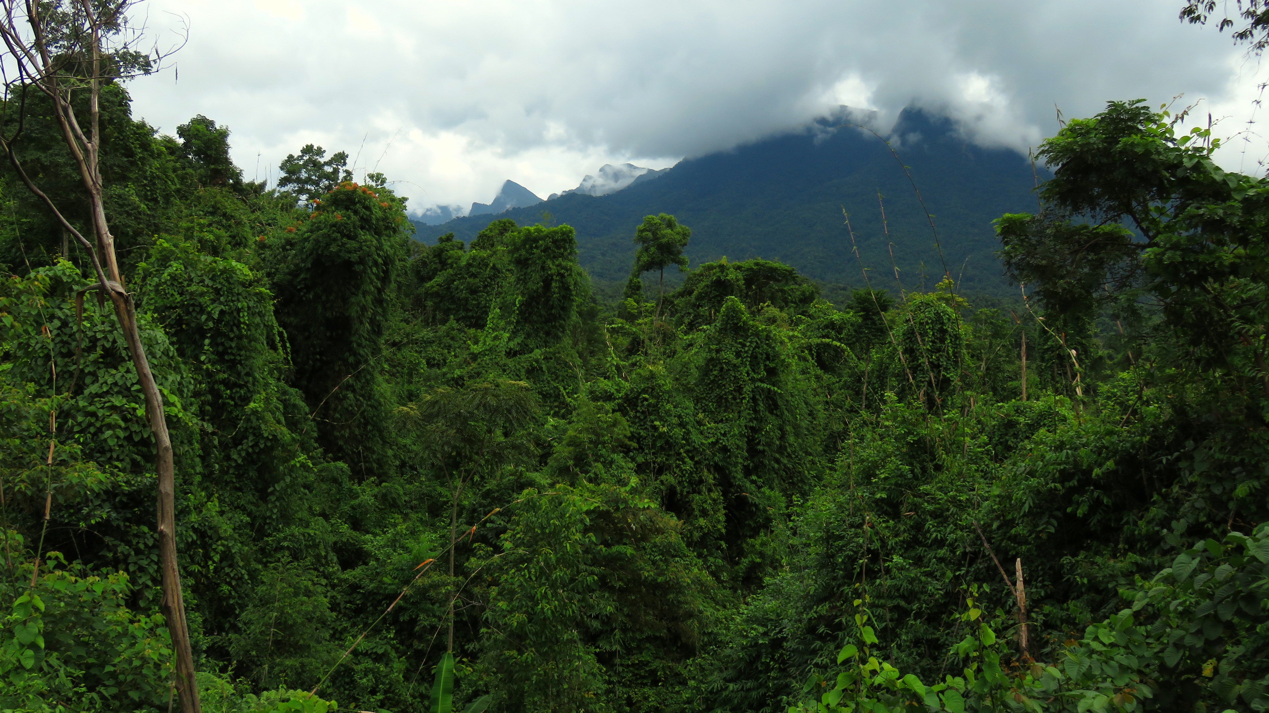
Eventually, the road climbs around a couple of small hills, and an impressive set of mountains begins to appear to the north. It's hard to find a good shot at first, as the heavy old growth roadside vegetation prevents a good photo opportunity. However, if you keep going it will open up soon, and several good spots for some extremely dramatic photos of these mountains will appear. These peaks are limestone with basalts mixed in, and are part of the same large uplift of the Nui Bang Am to the north, and the caldera-like structure around Ho Khe Tan. These are the same peaks that rise majestically over the AH-17 between Ha Nha and Thanh My.
Old growth & mountains.
|
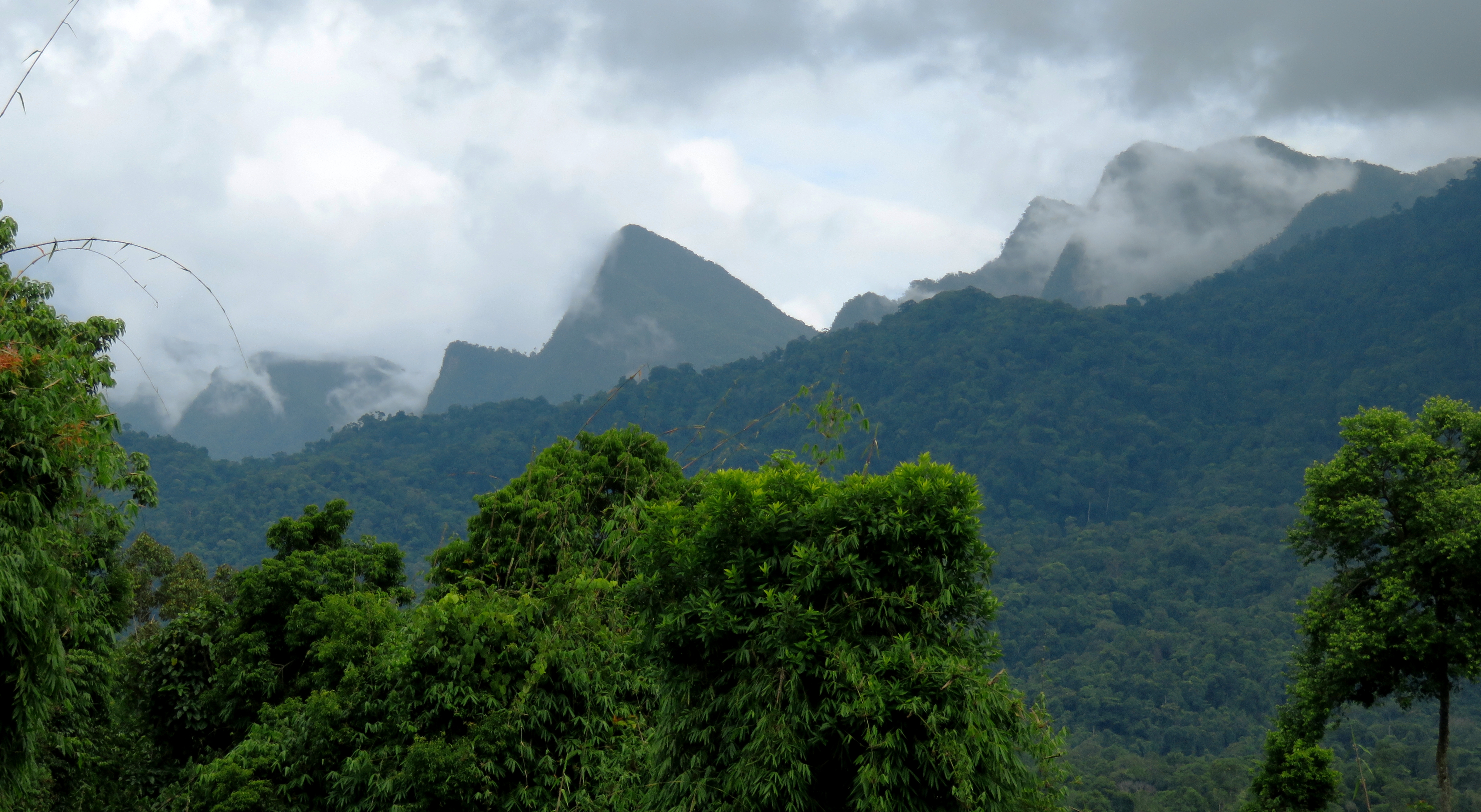
Jagged, impressive peaks of the Nui Bang Am.
Zoomed-out view of the mountains and the old growth in front of them.
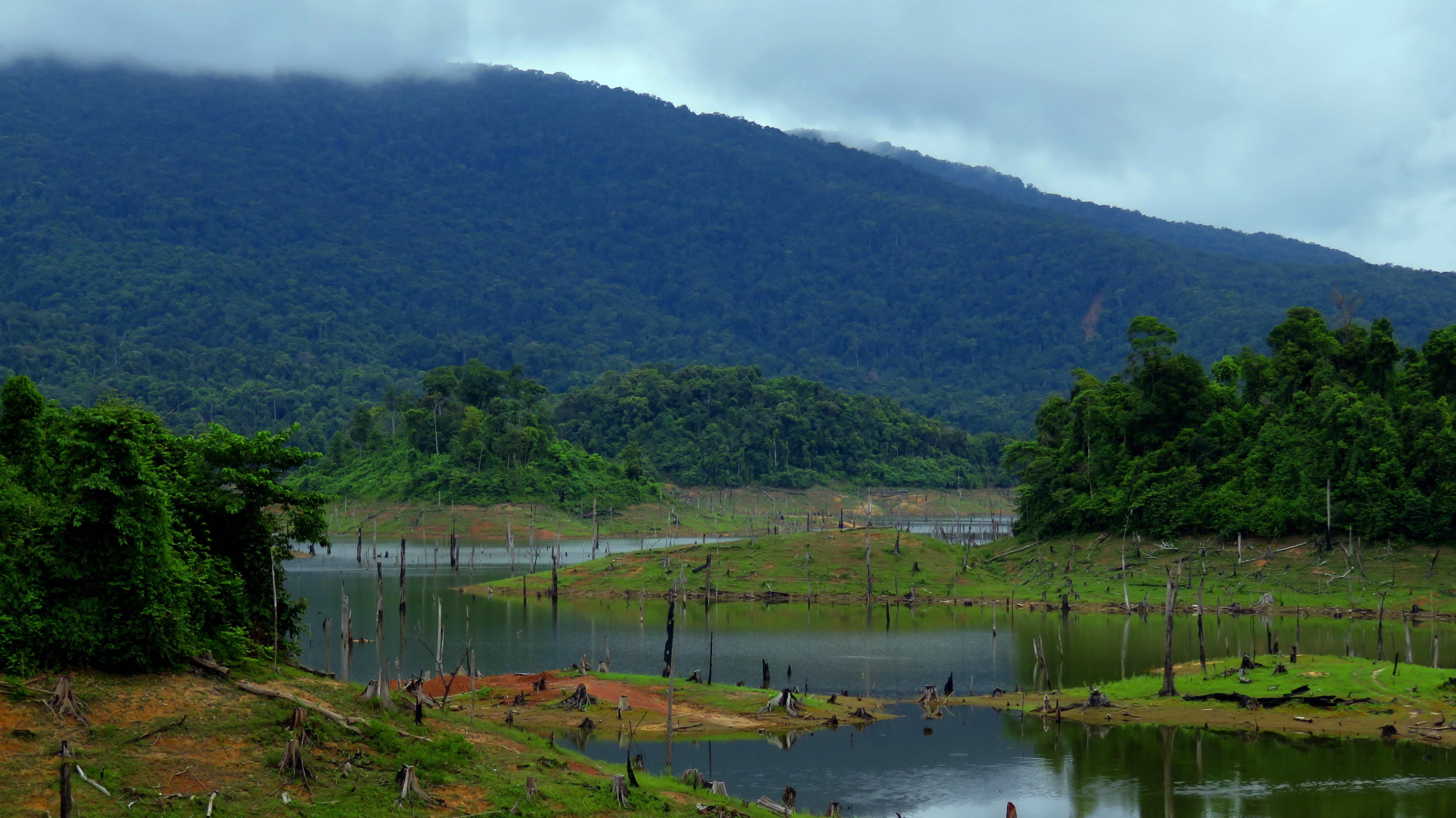
Around a couple more corners and it becomes clear that you've now reached a valley hanging high in the mountains. After a few minutes a small lake appears down in the bottom, surrounded by old growth. This is Ho Khe Dien, and is part of the Song Ba hydroelectric power project. It's normal to stop quite often several times within a couple kilometer stretch here, but that is to be expected considering the impressive views of the peaks to the north across this valley. The road remains wide, fast and fun, and there are very few people except for locals hunting/foraging/extracting resources.
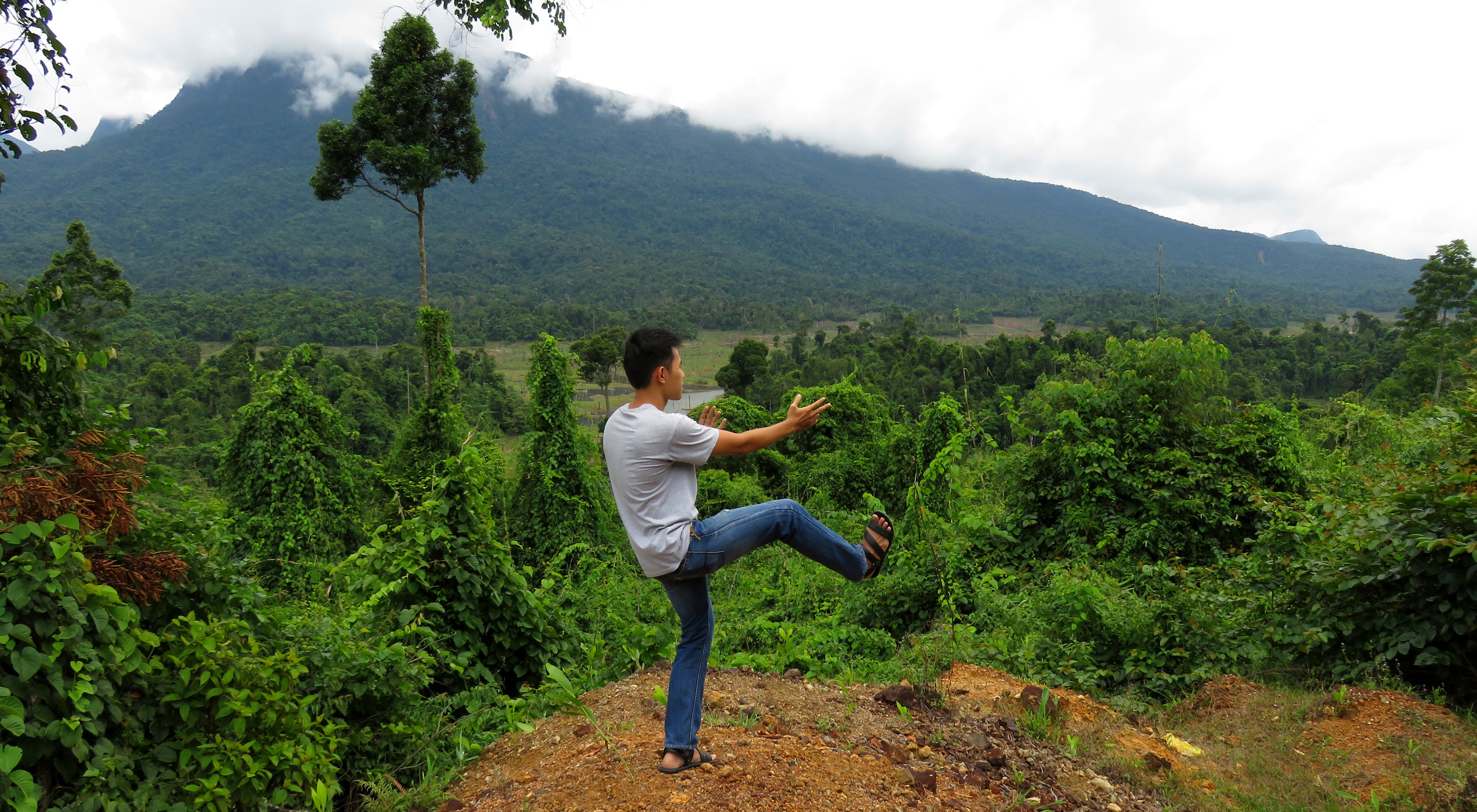
Dat showing us some fine form with a fine backdrop.
First glimpse of Ho Khe Dien, underneath the peak of Mo'Ra.
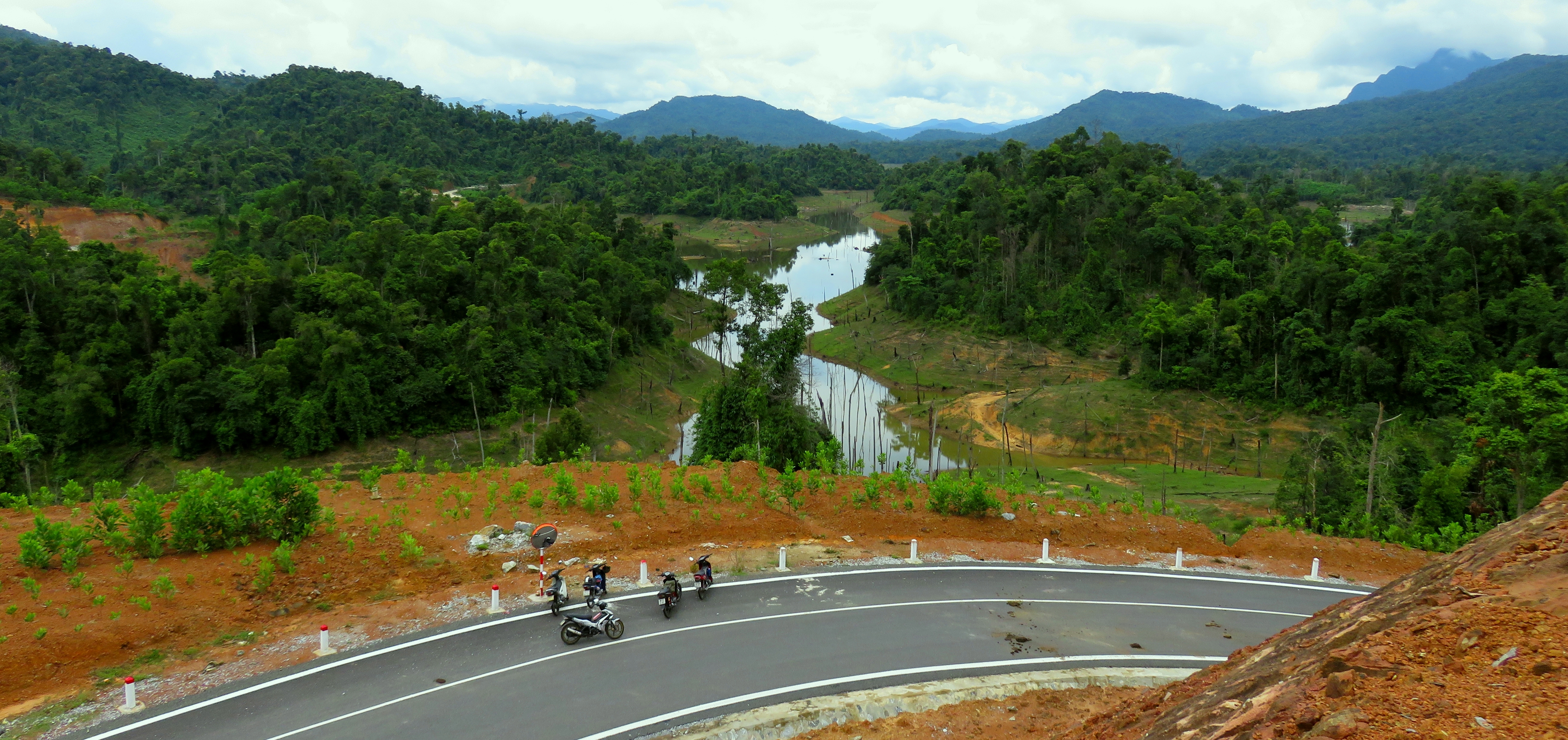
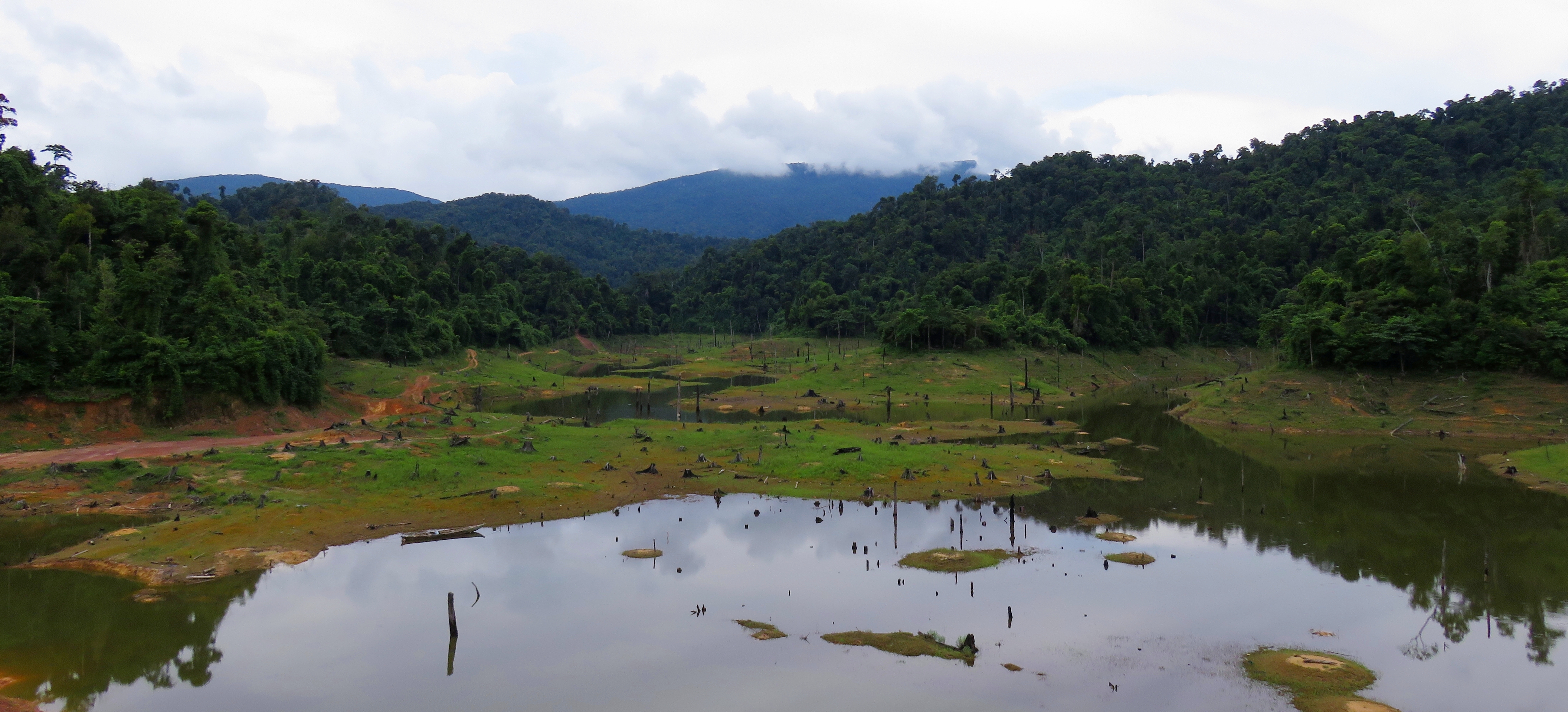
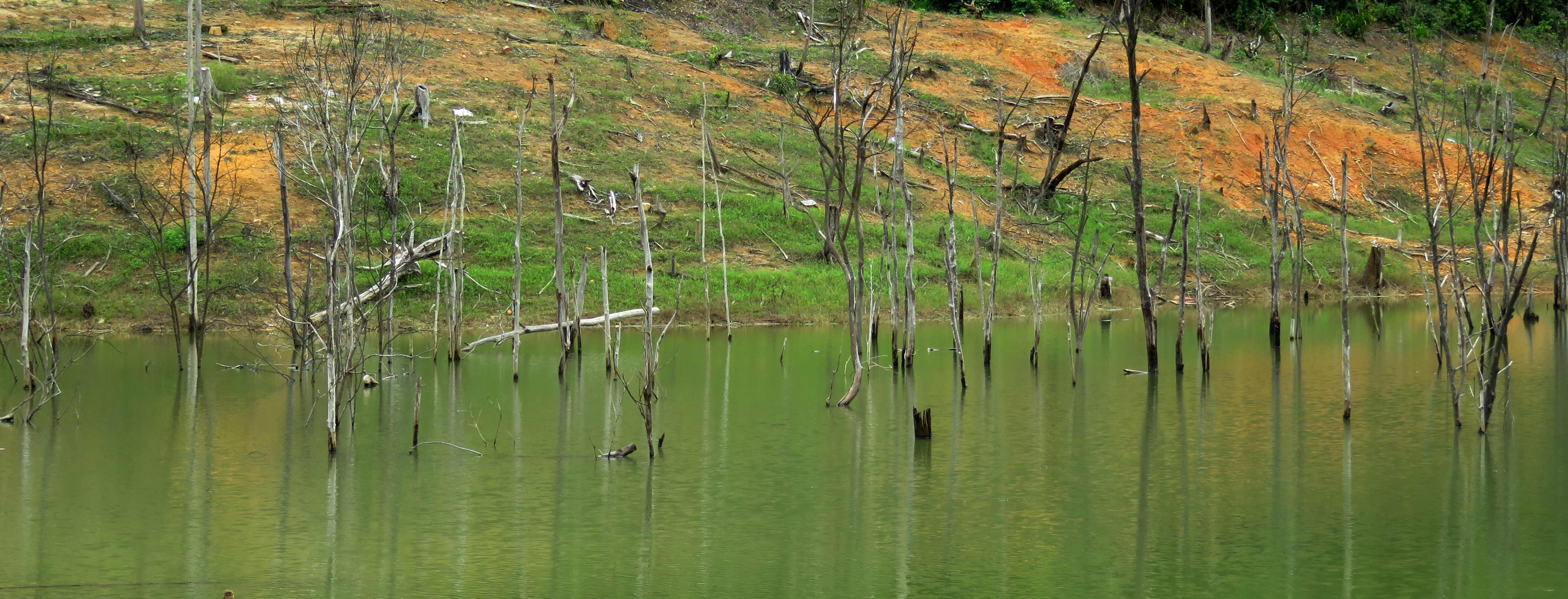
The road cuts into the hills and away from the lake for a minute, which reveals a couple of beautiful small valleys below the road filled with nothing but old growth. Beyond this the road then drops down to a bridge over the lake. Most of this reservoir is quite shallow, and since our visit was not during a time of year when it is full, the bridge stretched over a lot of mud more than water. The "bathtub ring" of exposed dirt that shows how full the reservoir can get was quite tall, perhaps 20 meters or more. Because the lake is so shallow, when it filled it flooded out a lot of the forest. A great many trees were suddenly up to water 20 to 30 meters deep, and over time those trees died, and remained standing, emerging from the waters as silent toothpicks. In other parts of the world, these groves of dead trees are called "ghost forests", because the trees are there but they have no souls. Ho Khe Dien has created plenty of these interesting places, and you can see them quite well from any vantage point of the lake. It is from these ghost forests that the nickname for this valley comes from.
Deep old growth in a small canyon off the lake.
View upstream from the bridge....
|
....and down into the lake.
|
Ghost forests fill Ho Khe Dien.
Beyond the bridge, the road climbs up around another arm of the lake, and begins climbing a small hill. There has been quite a bit of earth moved to make the highway here, indicating just how big of plans Vietnam has for this new highway. Around one of the corners in this section, there is a flood-control concrete stairway that climbs up the hill to the right of the road, and by walking up here you can get a fantastic view over the area. We called this the "Stairway to Heaven" viewpoint. To the west you can see the hills and ranges around Thanh My fading all the way to the horizon. To the south you can see the mass of the Yanh Brai, another series of peaks south of Thanh My along the Ho Chi Minh Road. Everywhere is covered in old growth.
Impressive road cuts along the East Truong Son Highway.
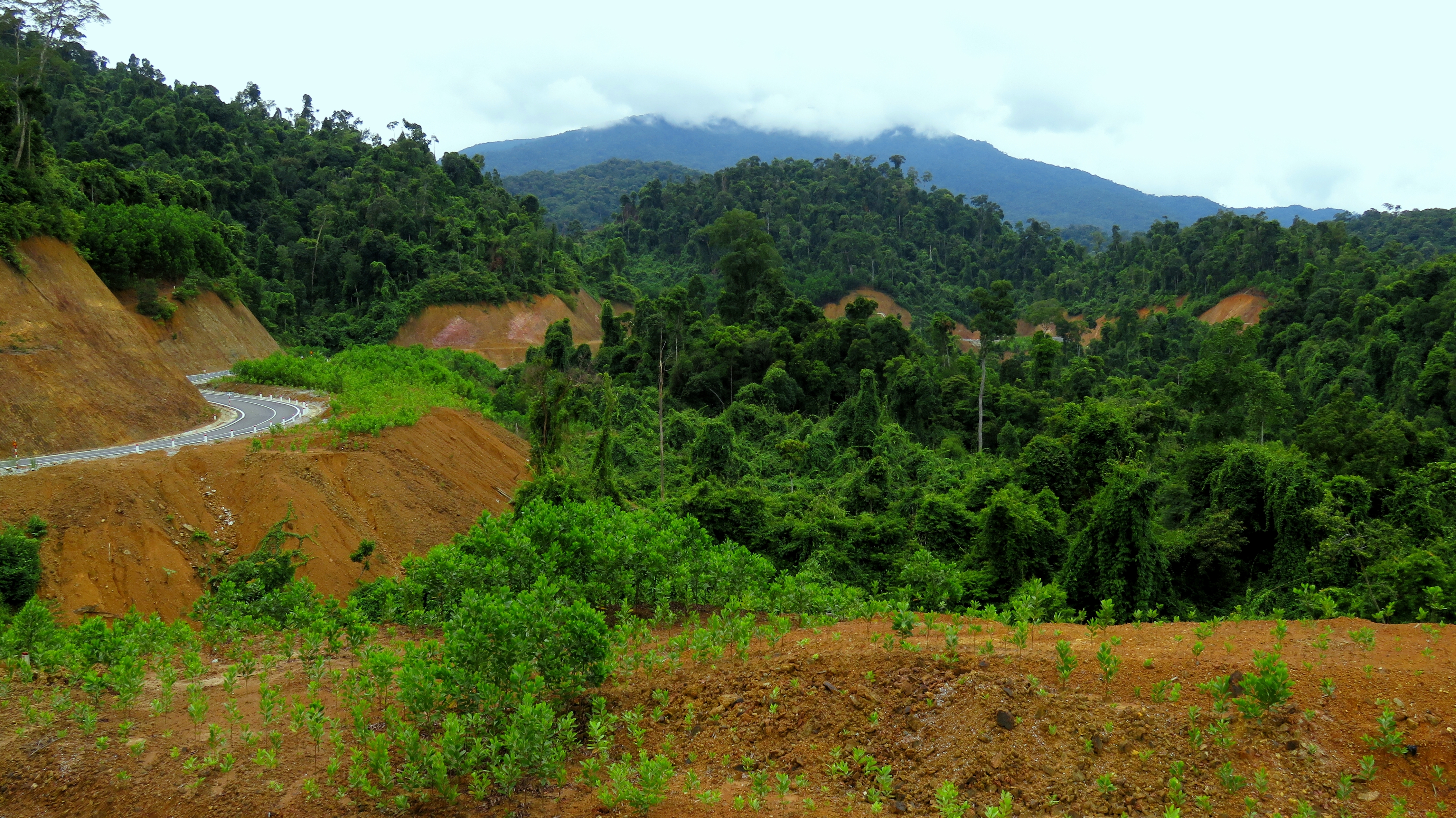
Road in the foreground, Nui Yanh Brai in the background.
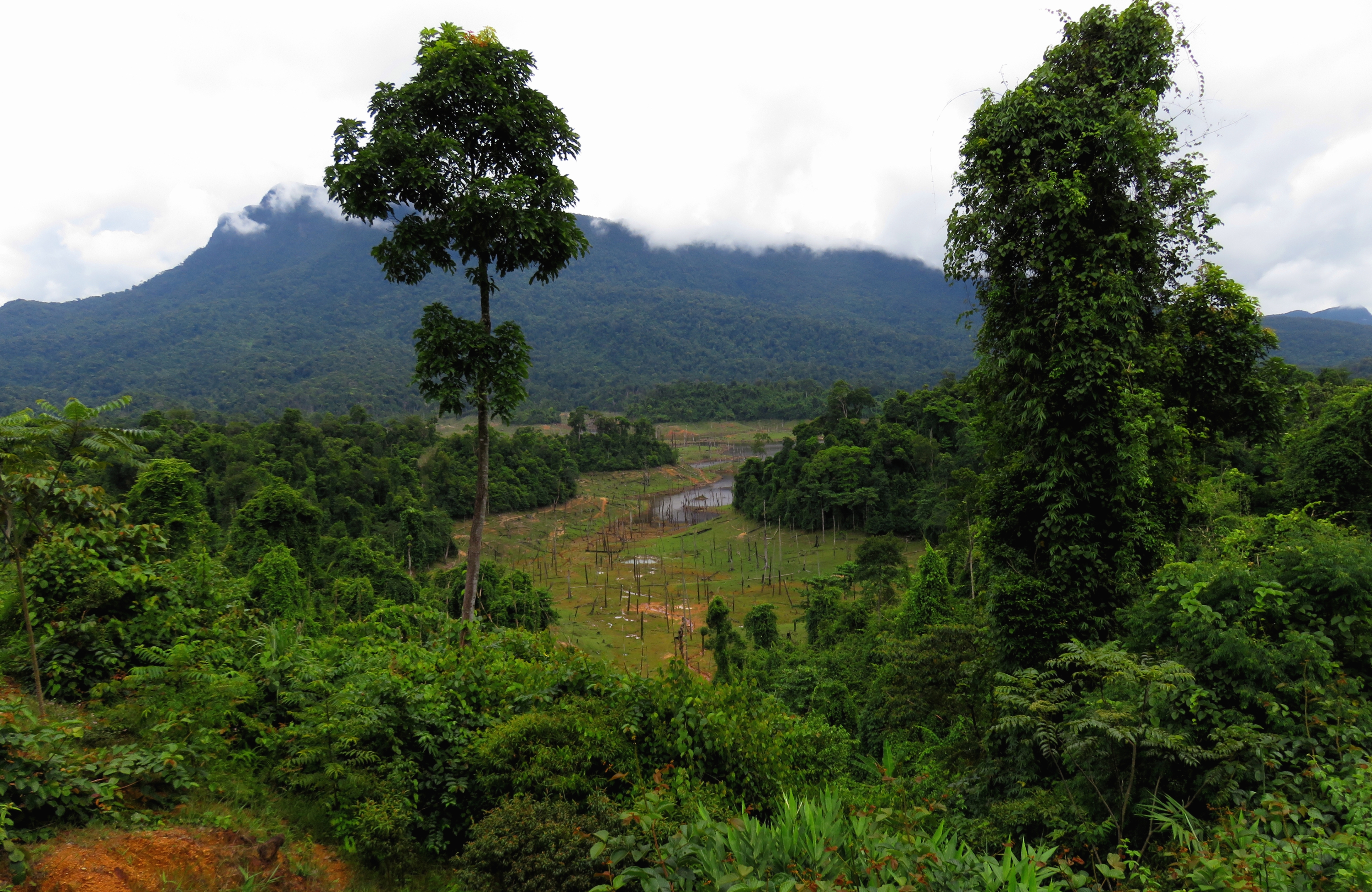
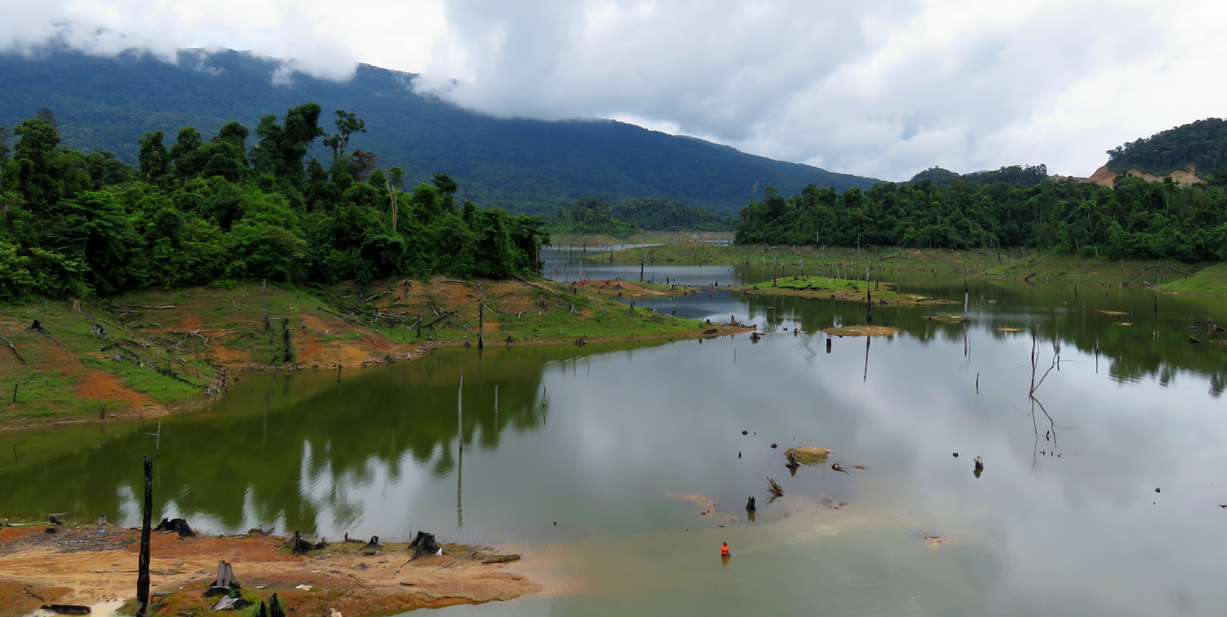
But, the view from this area is mostly of the lake below. Because Ho Khe Dien is so shallow, and because it fills a valley that has rolling limestone hills popping up here and there, the lake has a multitude of islands. Almost all of these are covered with a small blob of old-growth jungle, and the scene is a classic snapshot of rural mountainous Vietnam. Just down the road from the 'Stairway to Heaven" view is another nice view, this one from an old road construction camp, that has a nice view over one of the larger islands. This island has a small farm as well, huddled between the lake and the old growth. If you get lucky enough to see this lake when it is full, make sure to enjoy the view, as it does not seem like this lake is full that often.
View from the stairway viewpoint.
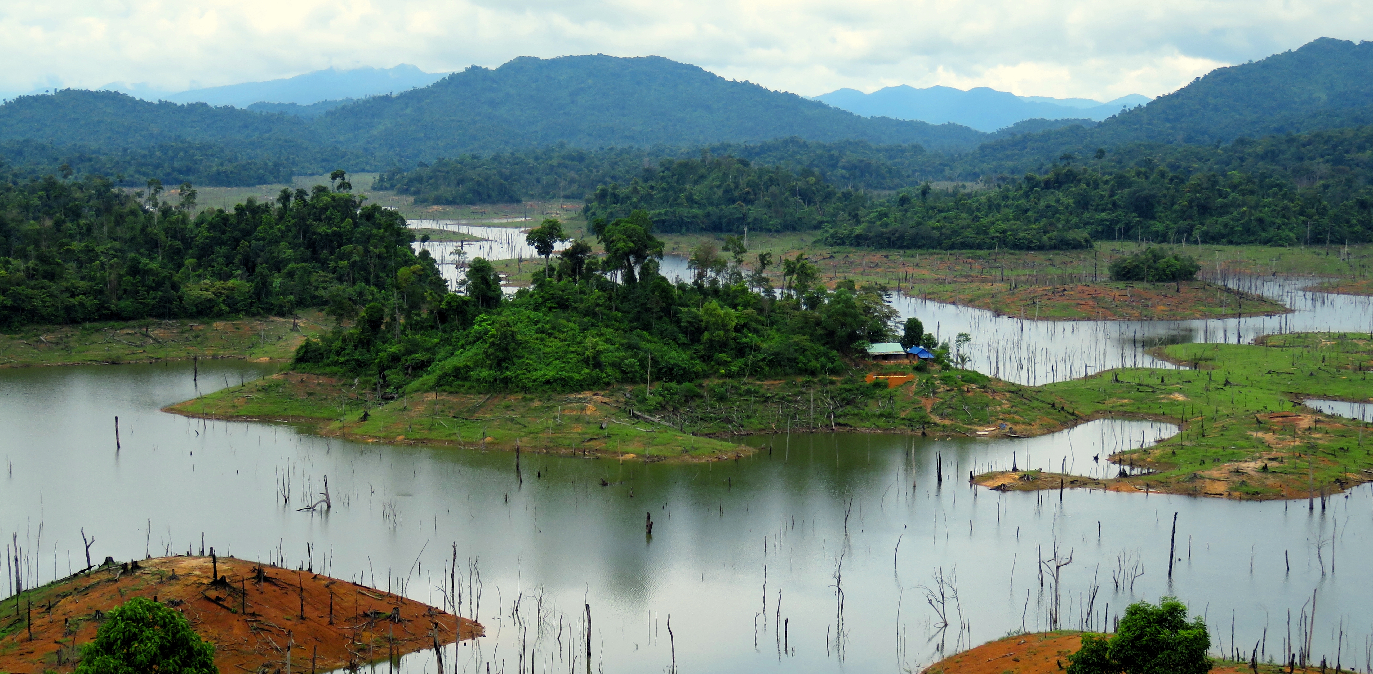
Ho Khe Dien, with the small farm island in the center.
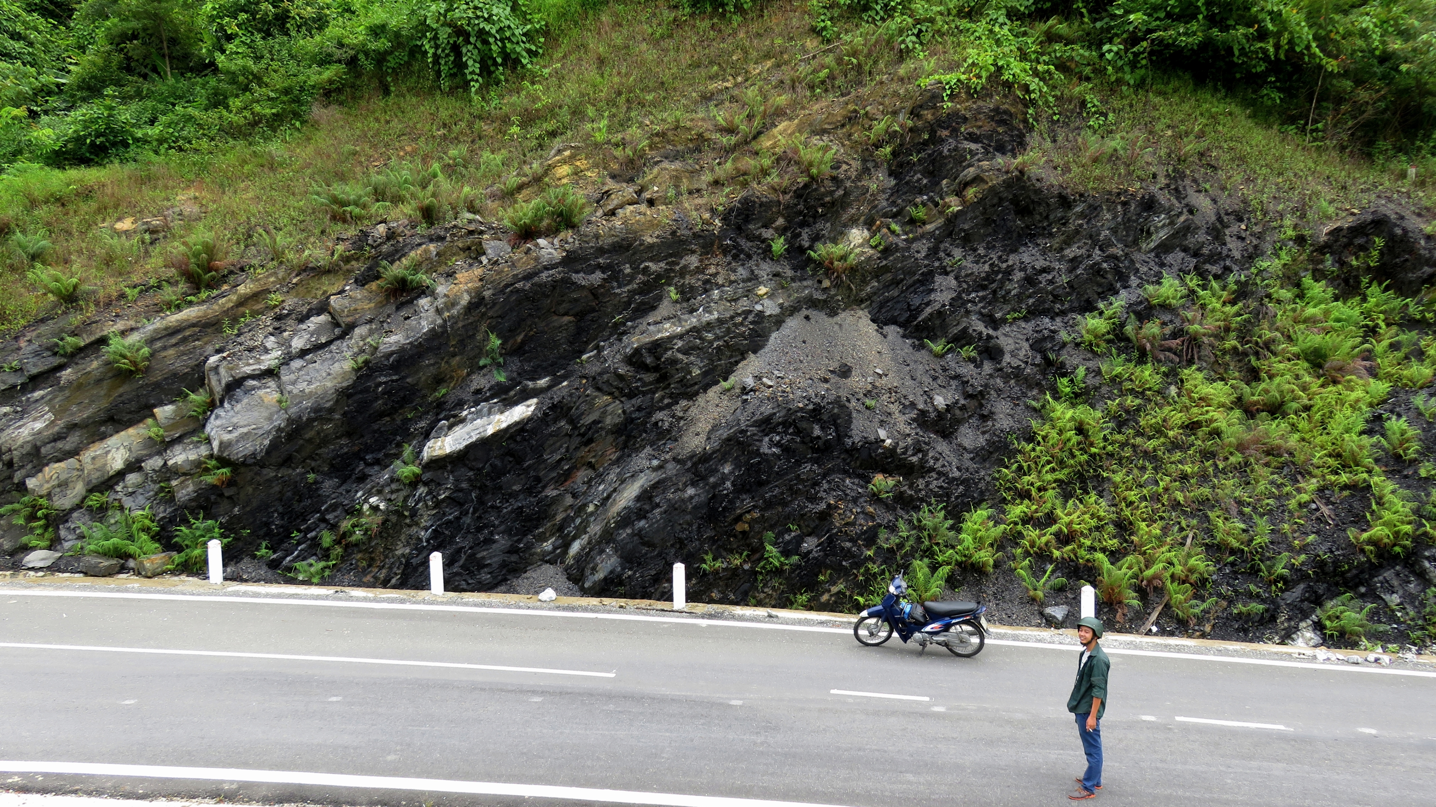
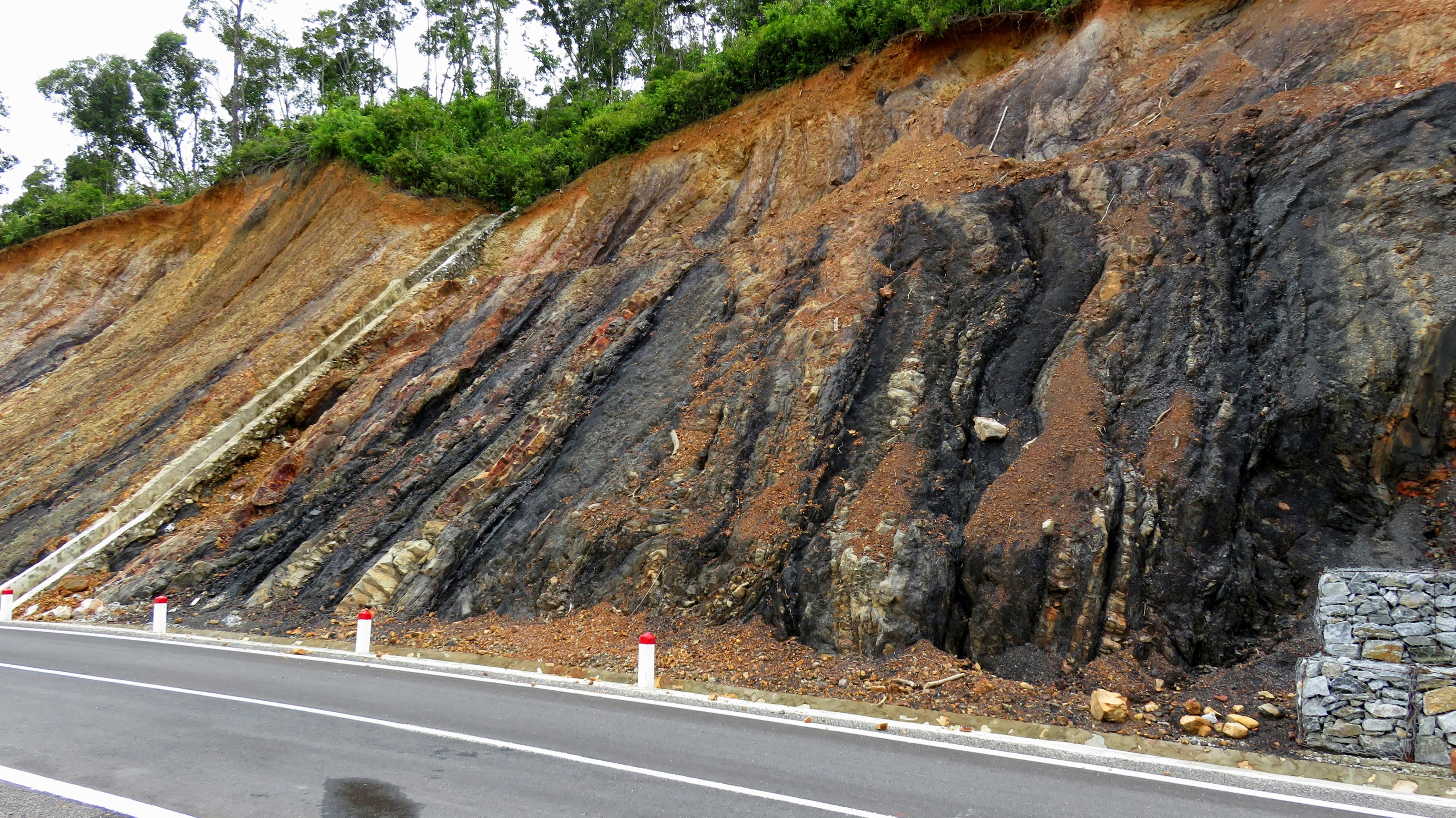
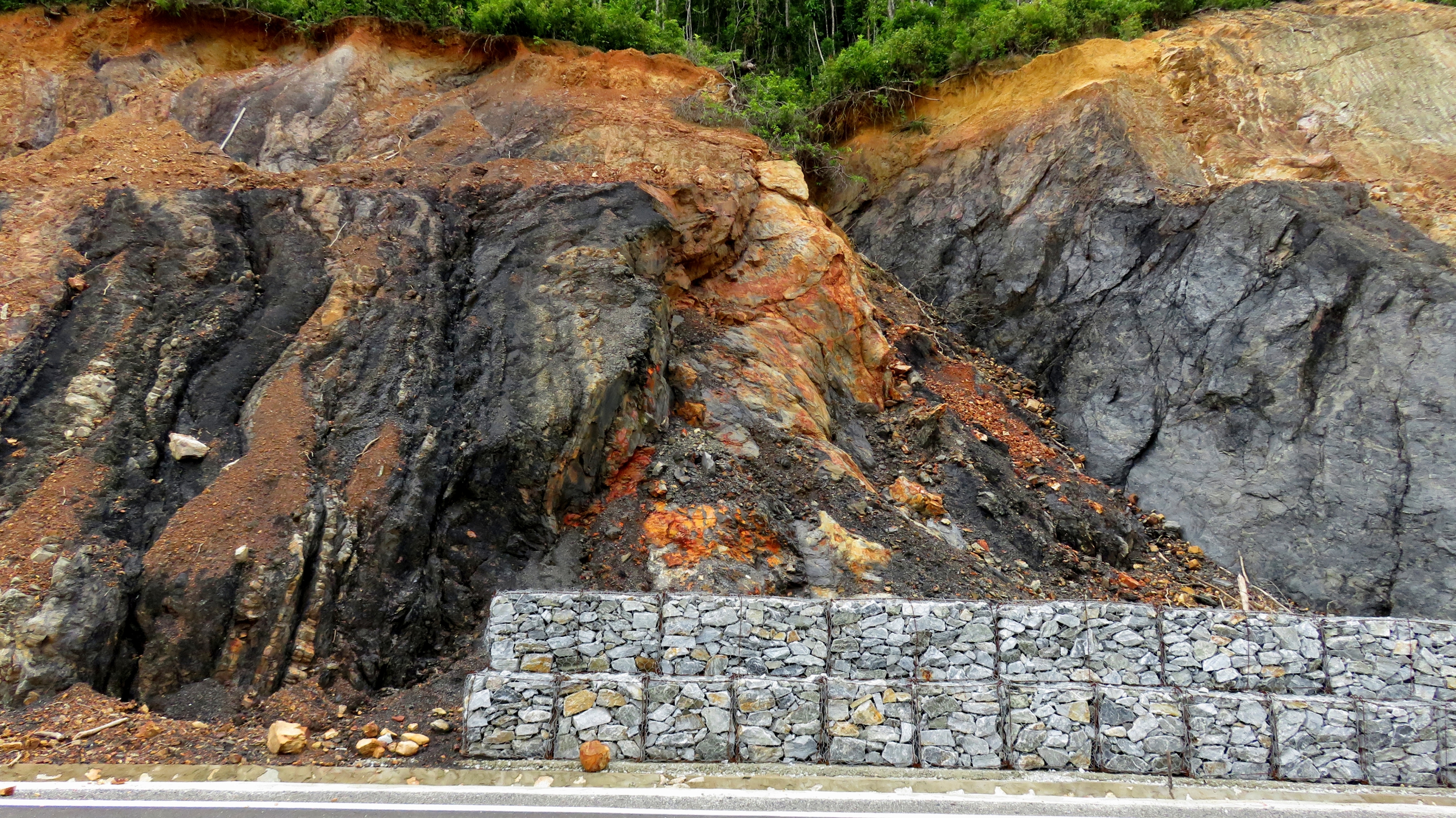
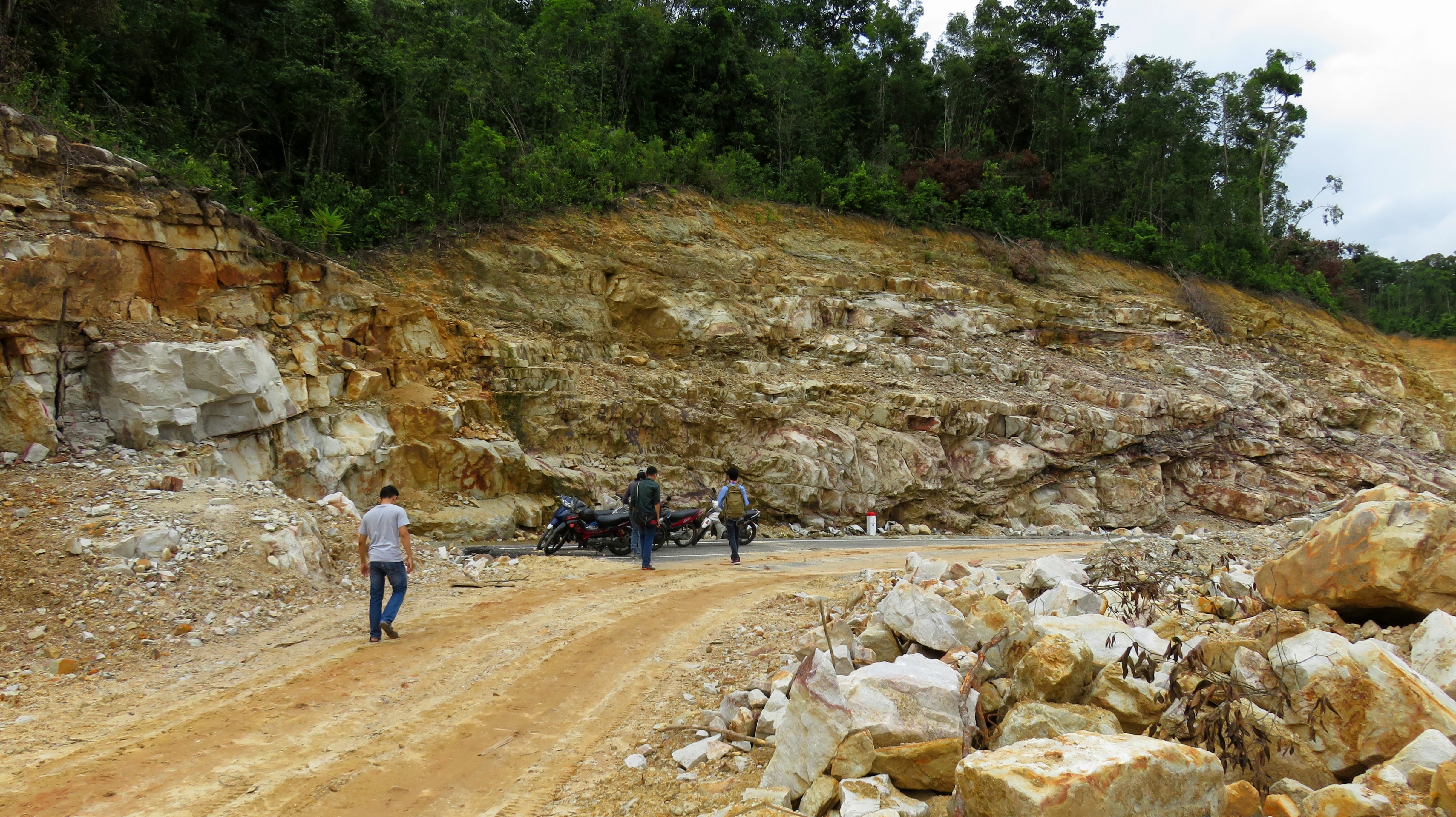
Coming around the corner, an interesting geologic feature comes into view. This road, in an effort to keep it smooth, high speed, and of good quality, goes through numerous large road cuts through the area's hills, and in a couple of these cuts several good seams of coal appear. This coal, which trends through the mostly-limestone layers of the local strata, is especially important just a handful of miles north of here, because of the Nong Son Power Plant, a coal-fired power plant that helps give power to Vietnam's energy grid. This power plant, is located very near the Thu Bon River, and the coal is mined not far away where the coal emerges at the bottom of the mountain. Up here in "Ghost Valley", the layers are dipped (or tilted) quite impressively, and by following the direction of their trend, you can see that they indeed point downhill, towards the coal mines at the foot of the mountain far below.
Coal seam exposed by a road cut near Ho Khe Dien.
Coal seam exposed by a road cut.
|
|
Coal seams along the road cut. You can see in the photo on the right where they extracted a good chunk of it.
After the coal seams, the road wraps up and around a small ridge, and then begins dropping down into the next river valley, and another arm of Ho Khe Dien. This arm is actually the main stem of Khe Dien, the creek that has been dammed to create the reservoir of the same name. In old maps of the area, the name appears as Khe Dienne, so it's interesting to see how the spelling has changed over the years. As we got closer to lake level, we rounded a corner and quickly came to a halt. Just below us, the road ended abruptly at a large construction site where they are building another bridge that will cross over the lake. However, as of this writing [Oct. 2016] the workers have only erected most of the columns, and the decking and both approaches are non-existent.
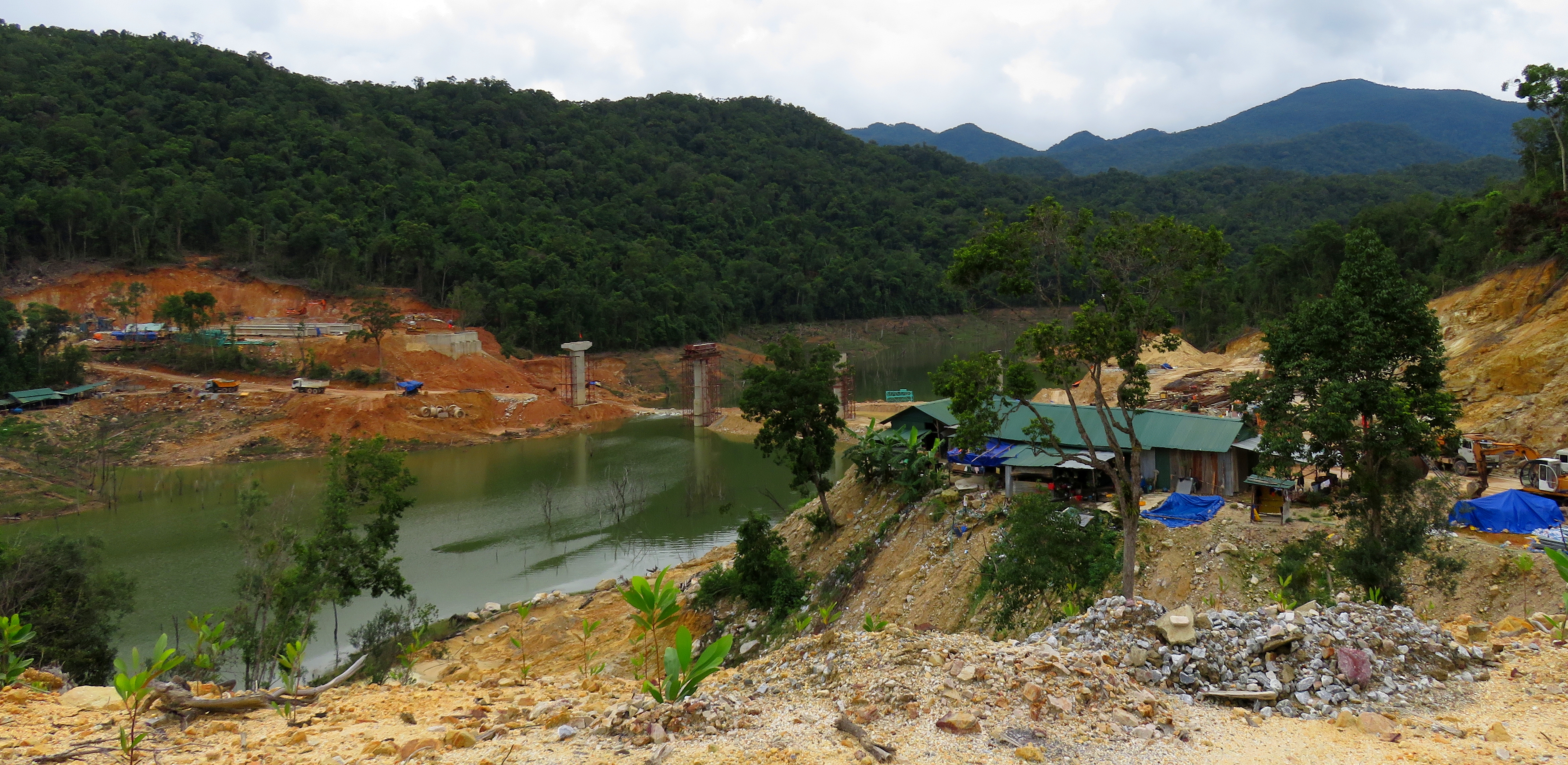
This bridge is still a ways off from being completed.
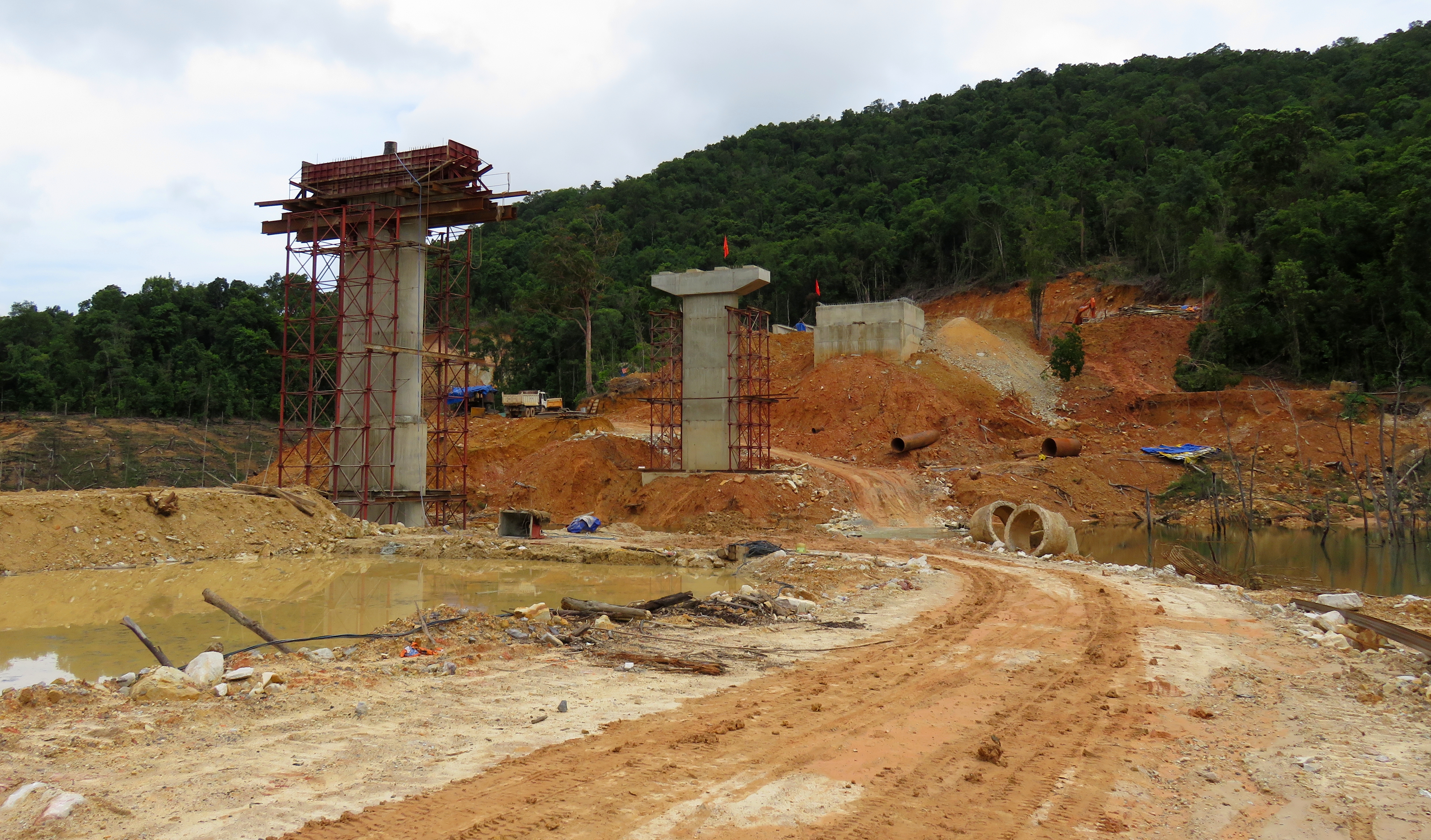
Bridge under construction over Khe Dien.
We stopped for a minute and asked a couple of locals who happened to be driving by what the story was in regards to continuing. They were friendly, and told us the road did connect down to Nong Son, but that it was all dirt (and therefore mud, thanks to recent rains) and very slow going, with lots of trucks. Seeing as how we had already had one flat tire that day, and not wanting to get covered head to toe in mud and dirt, we elected to stroll down to the lake first, and then turn around and head back. This turned out to be a good choice, as we got to see two interesting things. The first was a nice stand of ghost trees in the lake, which were quite photographic, and the second was some rock that looked almost like marble. It was hard, heavy, and dense, but it just lacked the smooth, small grained texture. It's likely it was some limestone that got metamorphosed, but not quite all the way into marble. Still, it's not an everyday sight so it was pretty cool to look at and examine.
Ghost forest grove near the bridge construction site.
Layer of rock very similar to marble.
|
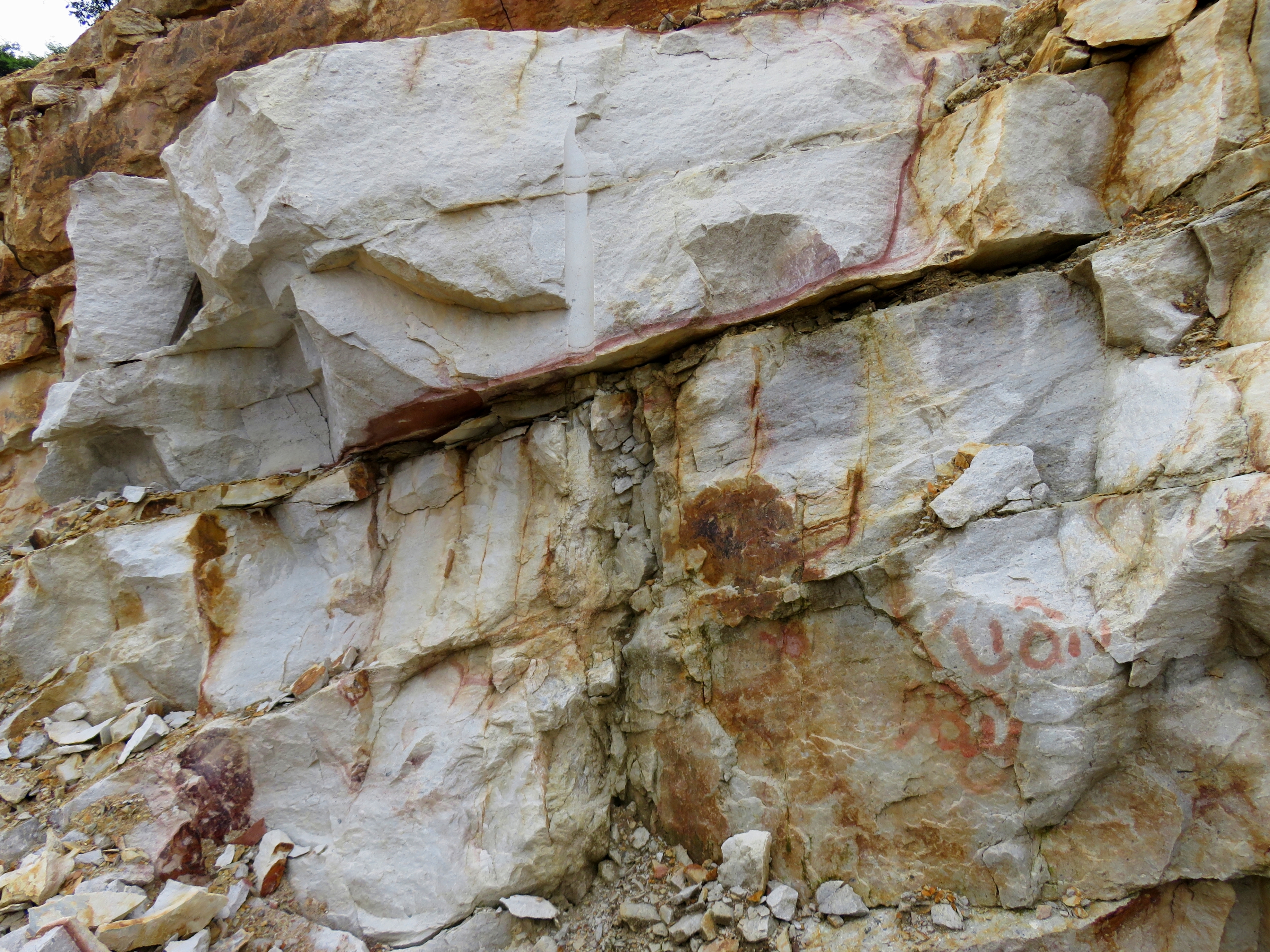
Marble-looking rock.
|
After returning to the bikes, there wasn't much left to do but turn around and head back the way we came. We stopped briefly at one of the numerous small waterfalls the road crossed, so I could splash some water in my face and cool off a bit. Despite some light rain, the drive back to Thanh My was extremely quick and easy, and after a lunch of some rice and pork, it was less than 2 hours back to Da Nang. Despite being turned around and having to return the way we came, simply making it to "Ghost Valley", and seeing Ho Khe Dien and Nui Mo'Ra, made the trip well worth it. And, when the road is finally completed in the future, there's plenty of motivation to come back to this quiet valley in mountains and see it all the way down to Nong Son. Stay tuned and thanks for reading!
Tough guy crowd at a pretty waterfall.
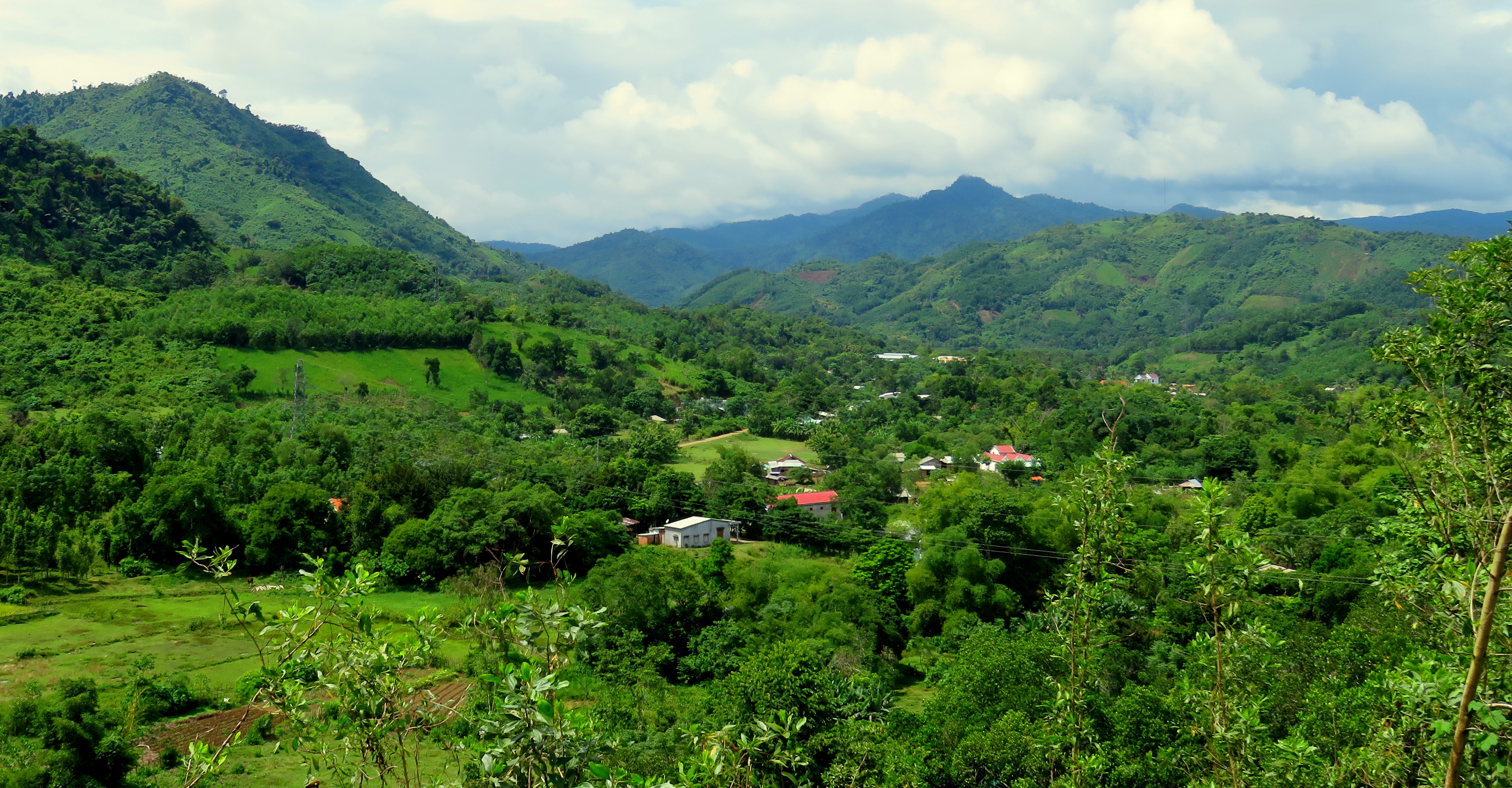
Parting shot over the valley of Khe Dieng, outside Thanh My.
All photos copyright Kit Davidson.
All maps copyright GoogleMaps.
All maps copyright GoogleMaps.
