HK Part II - A Cross Island Hike
|
Our next step in Hong Kong was to go do some hiking. As the city sprawls across what is basically a jagged mountain range rising from the sea, there is a lot of land that is yet undeveloped, thanks to the vertical nature of the developed areas of the city. Nature was always important to the British when they owned it, and the generations of HK'ers all the way until now have kept that tradition around. Appreciation of nature is a big deal in Hong Kong, with lots of trash cans and campaigns to keep the limited amount of natural space in as good of shape as possible. And in a lot of ways, for a city of nearly 8 million people, it has worked well. Even on Hong Kong Island, just scant kilomteres from the bustling world city, there is still wild jungle, with birds, insects, and wildlife, as well as quiet spaces and falling water. There are trails spread all across the islands and New Territories, varying from wide roads to single track through the jungle. We wanted to do get out and enjoy some of that while we were here, so I found a nice route on the internet and we set out to go see a side of HK not usually seen by most tourists.
|
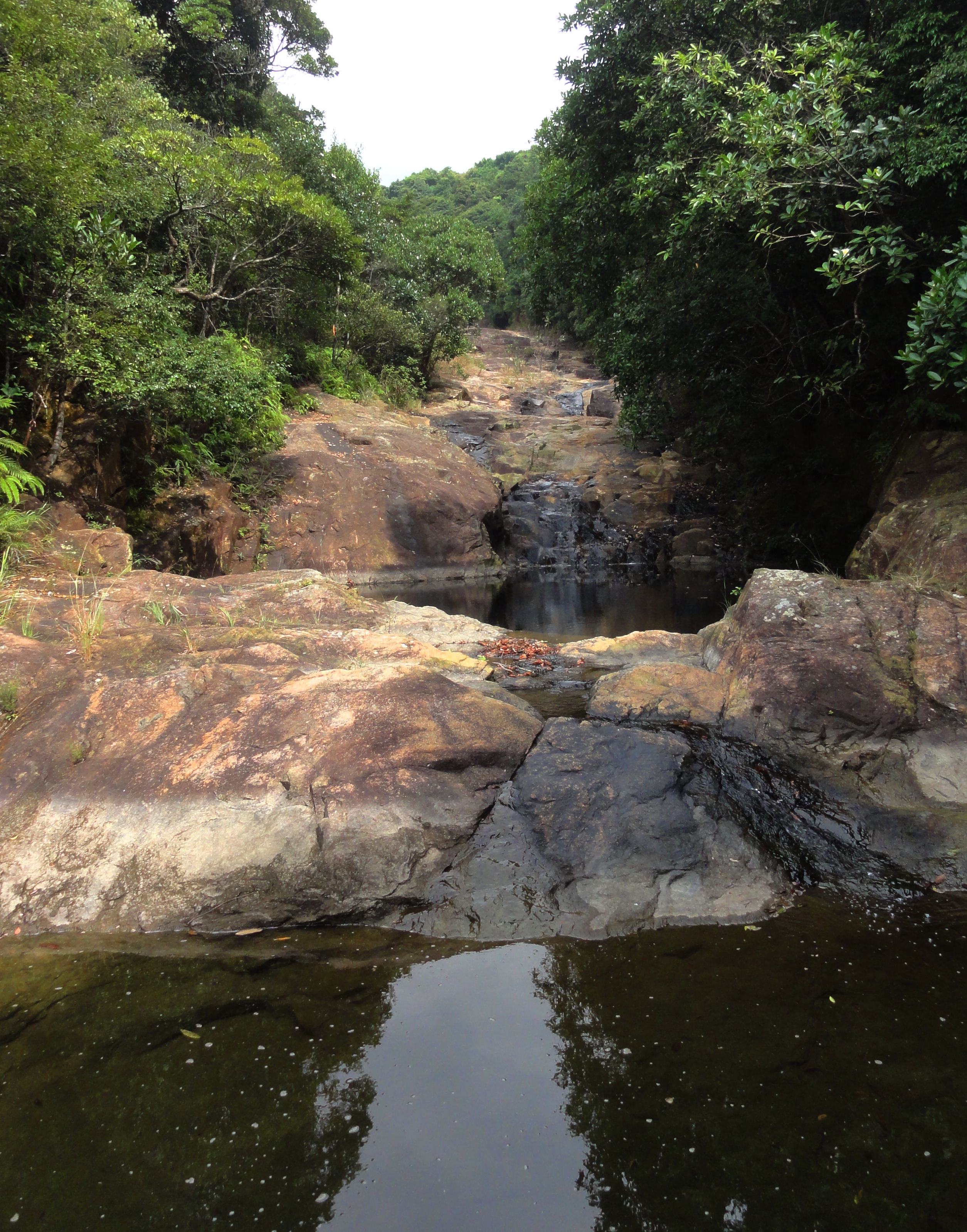
Lower Sheung Nam stream.
|
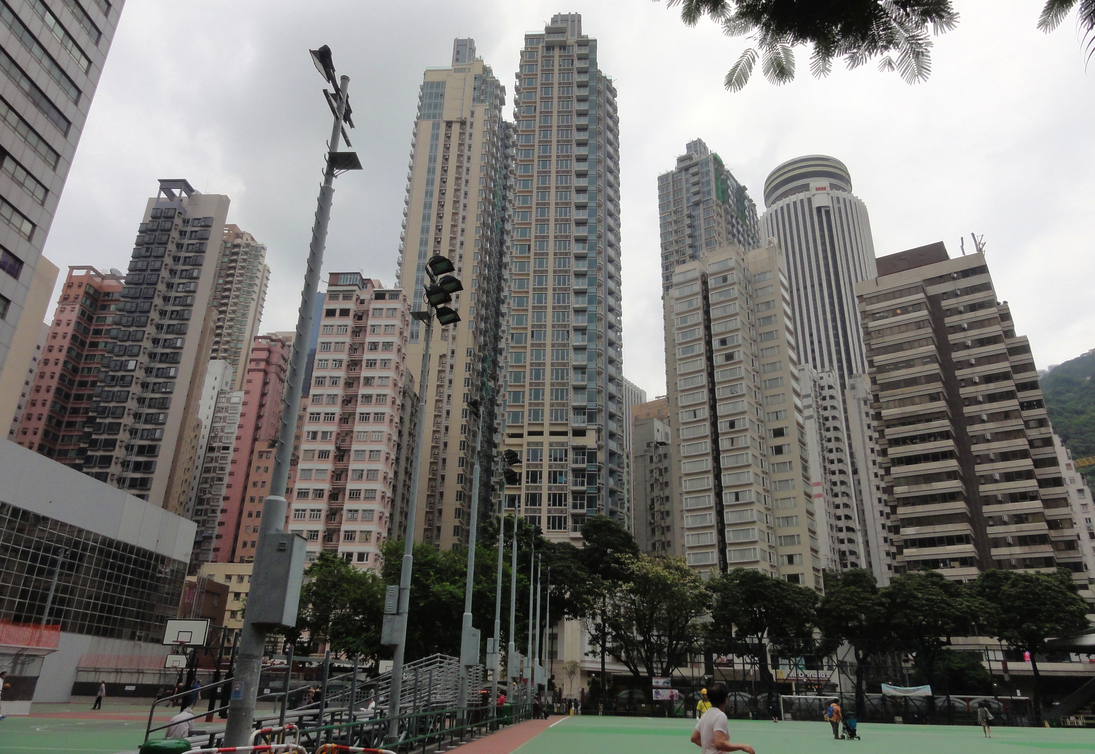
Wan Chai on our way out of town.
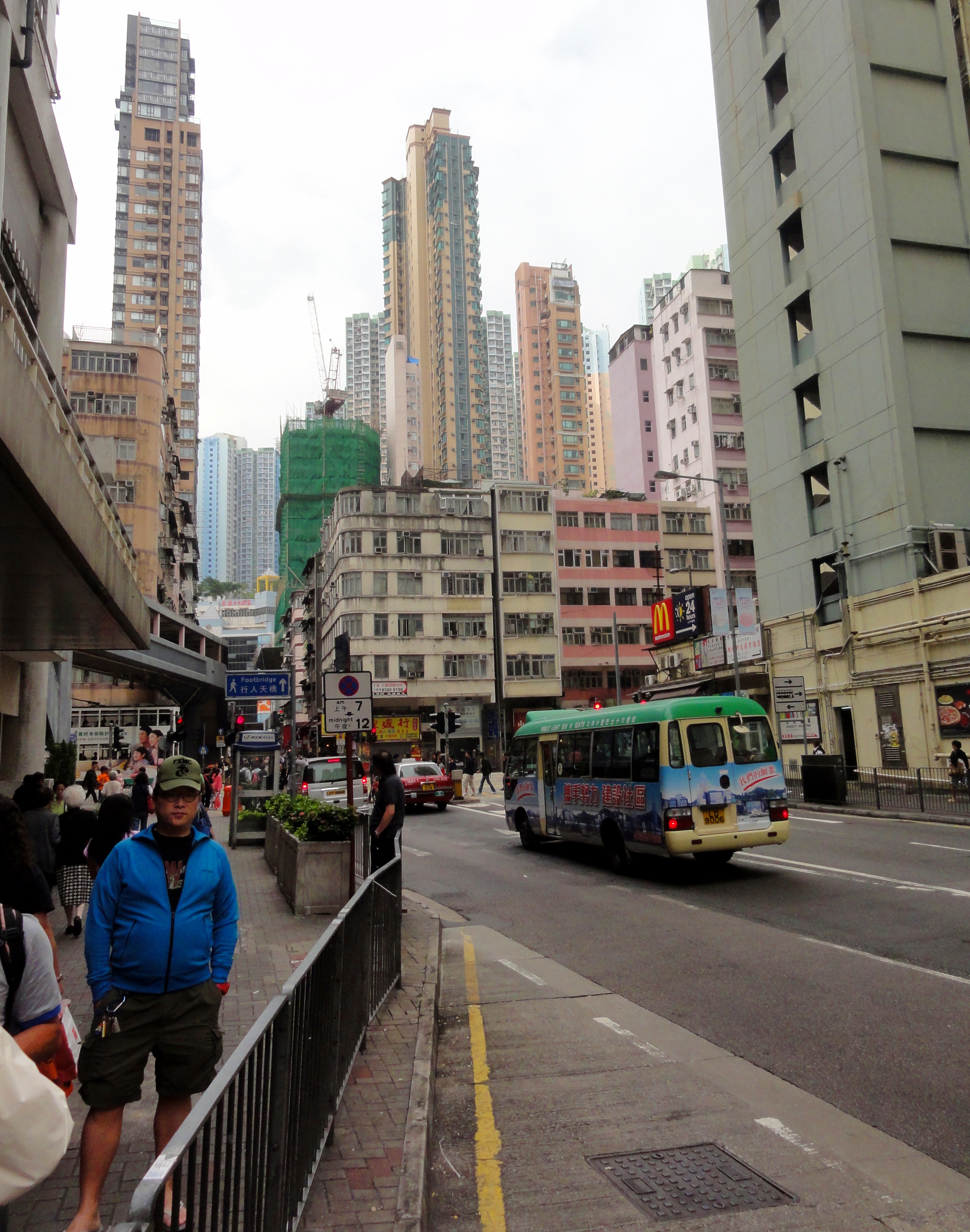
The neighborhood around Sai Wan Ho.
|
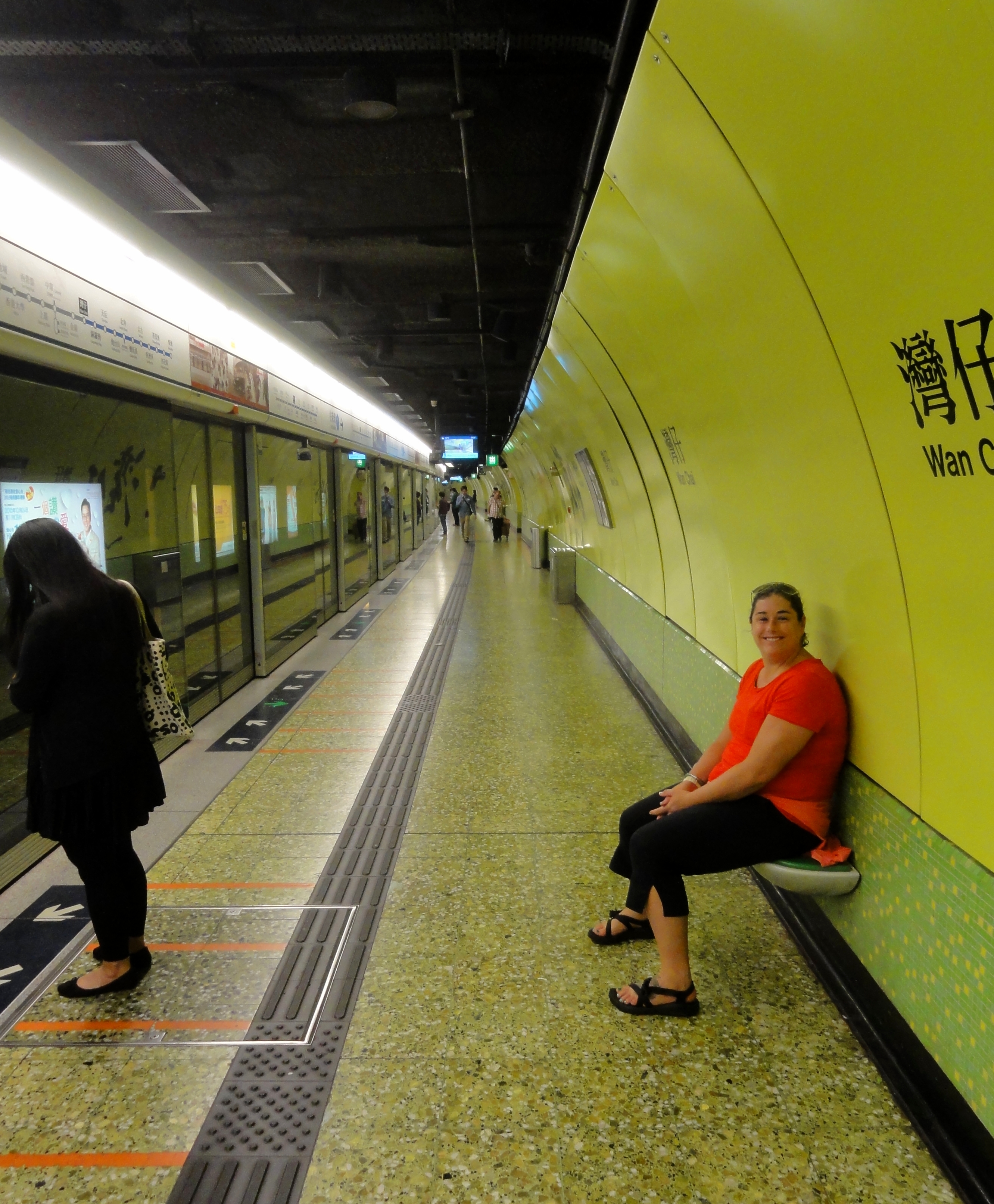
Kelsey in the MTR station.
|
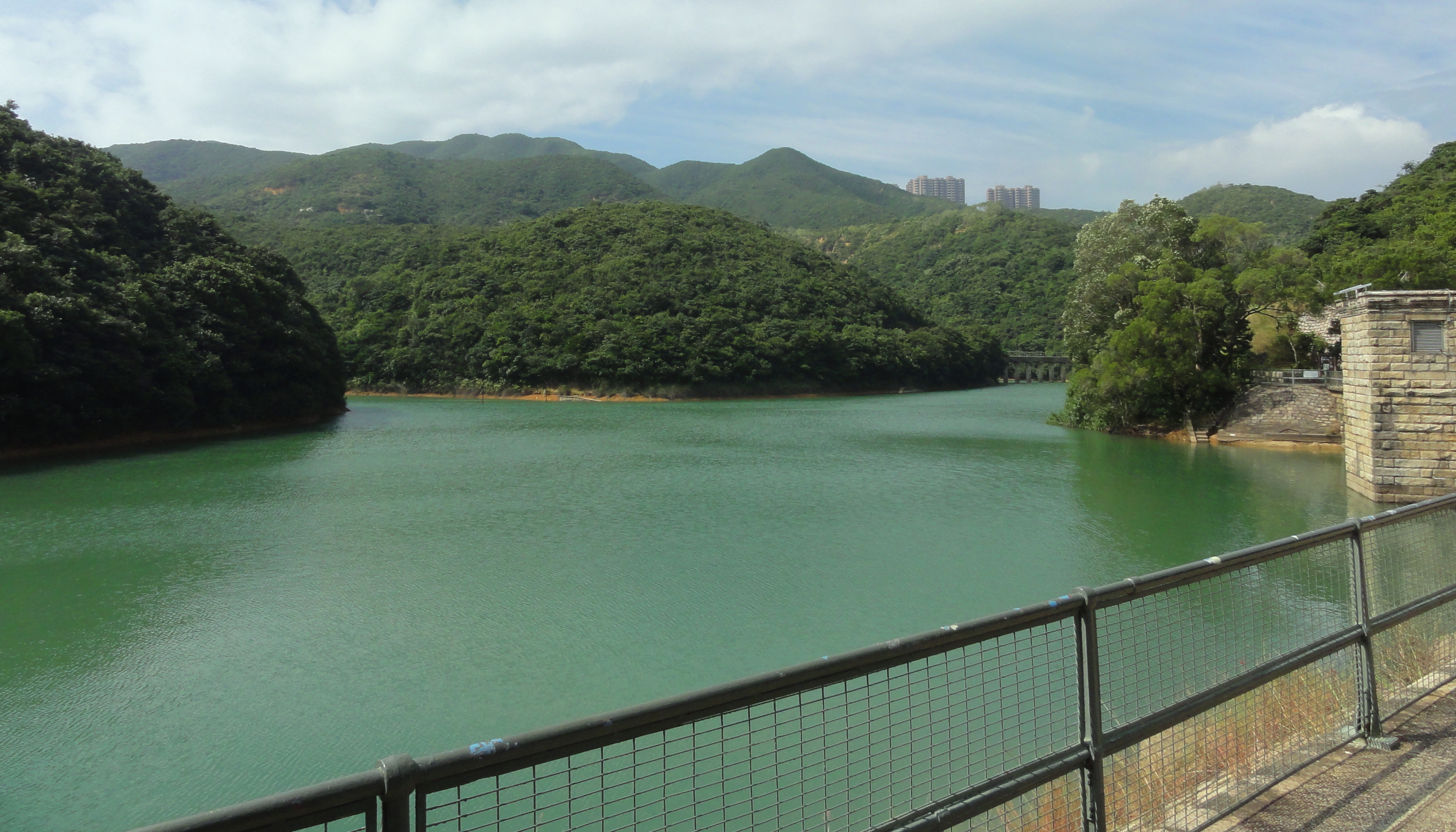
The public transport on Hong Kong is unreal. We did a fairly serious hike and yet were able to utilize public transport to get to and from that hike with no problems. In the States a hike like this would have been a fairly serious undertaking with proper staging and prep. Here we just left our hotel, hopped on the Metro, rode it seven stops east, got out and promptly got on a bus, and rode that for about 25 minutes before we got dropped off on top of a small dam on the south side of the island. The trailhead was 10 meters away and apart from a couple small developments, our view was almost entirely natural, with lush green forests filling the view.
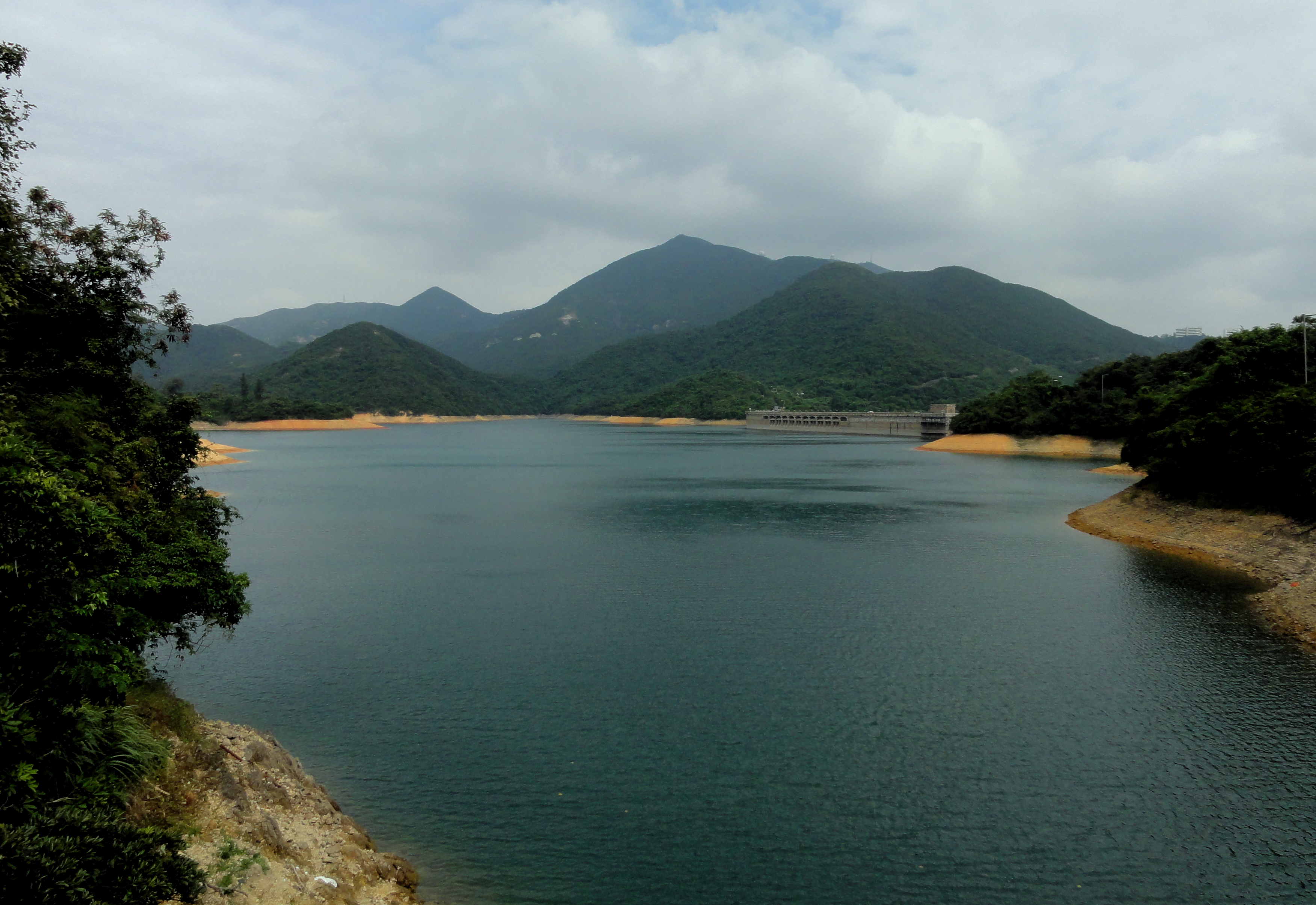
Tai Tam Reservoir. Notice the tiny tower in the farthest back ridge in center right. We would later walk right under that tower!
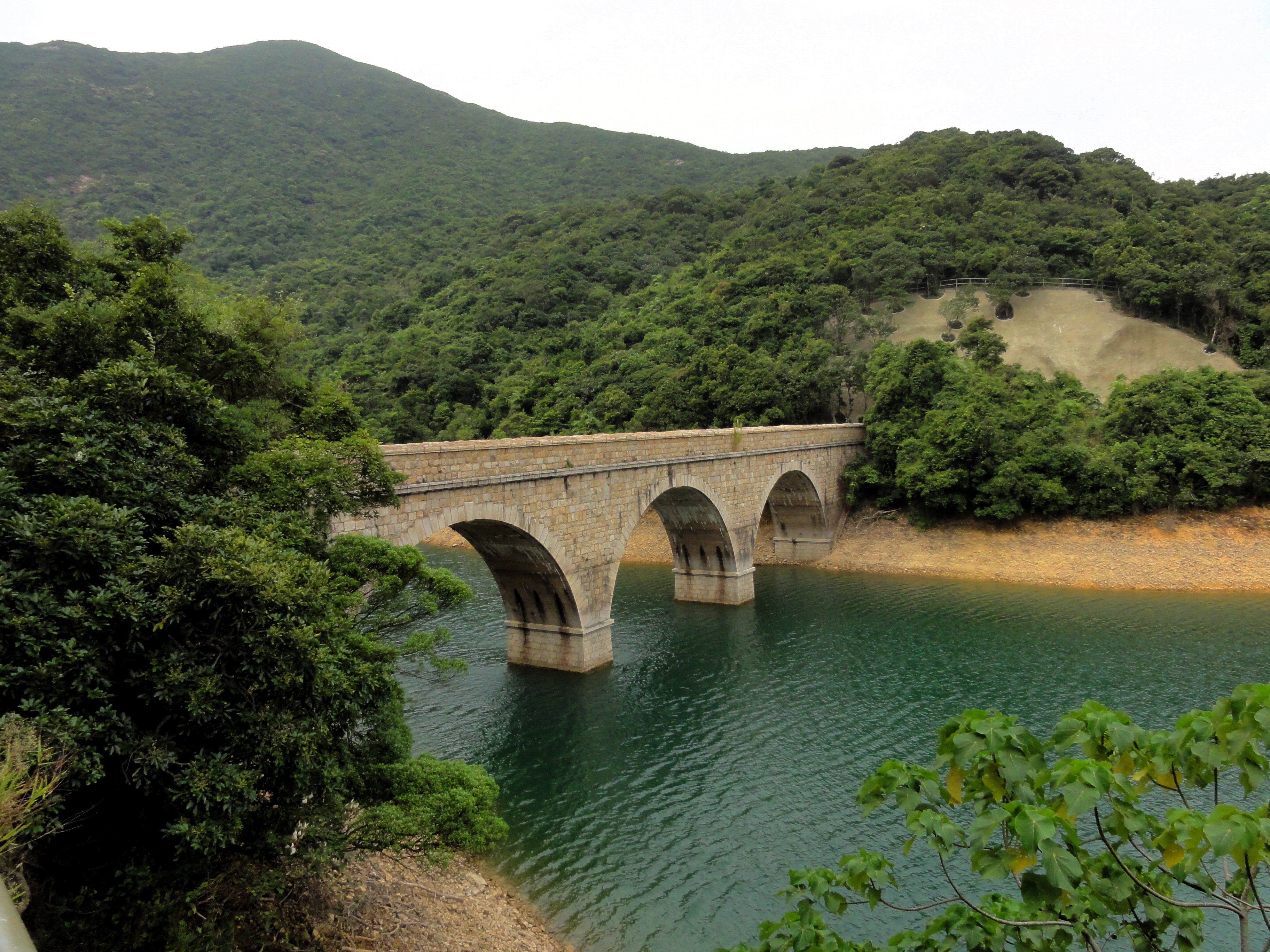
Stone bridge from the early 20th century.
|
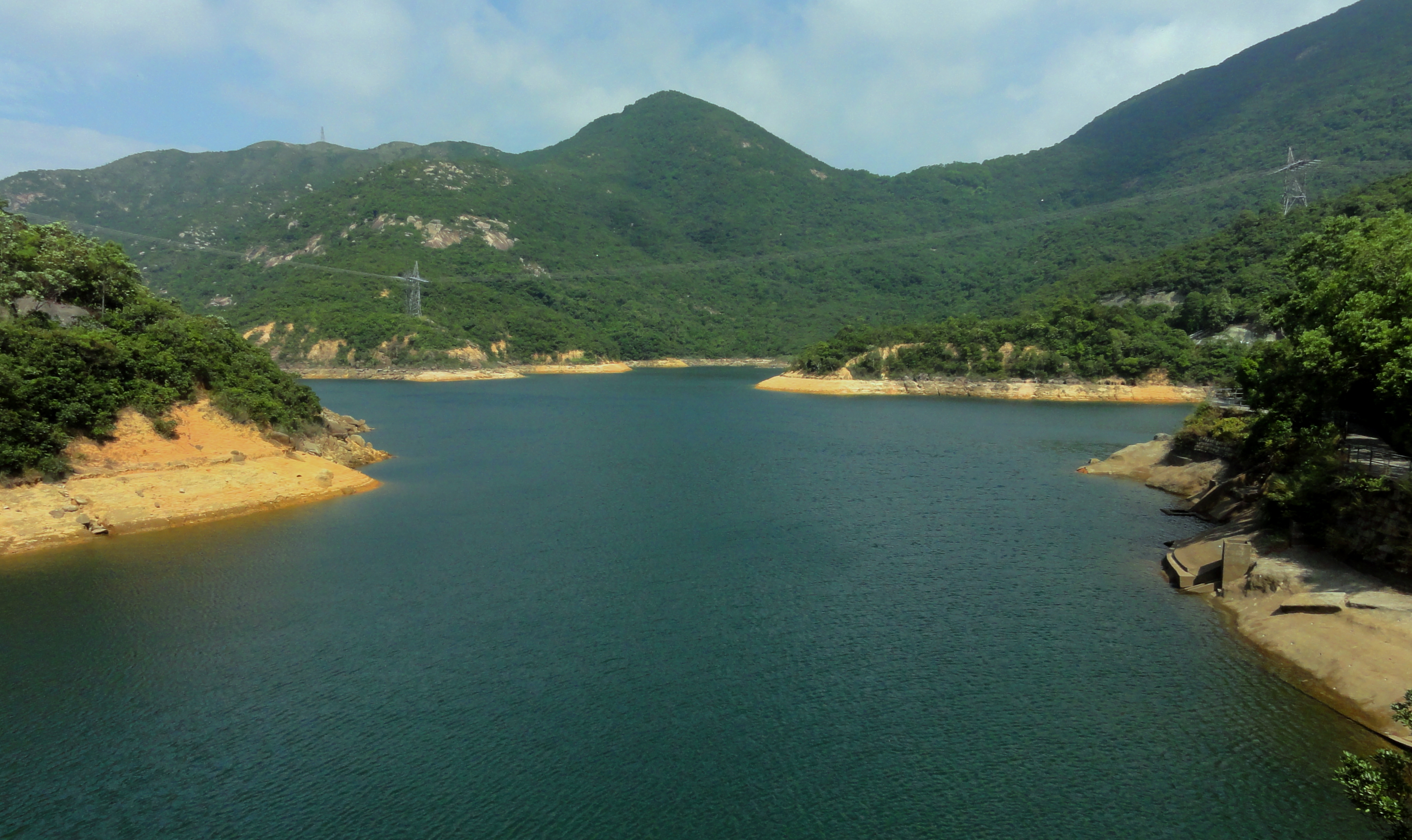
Tai Tam Reservoir.
|
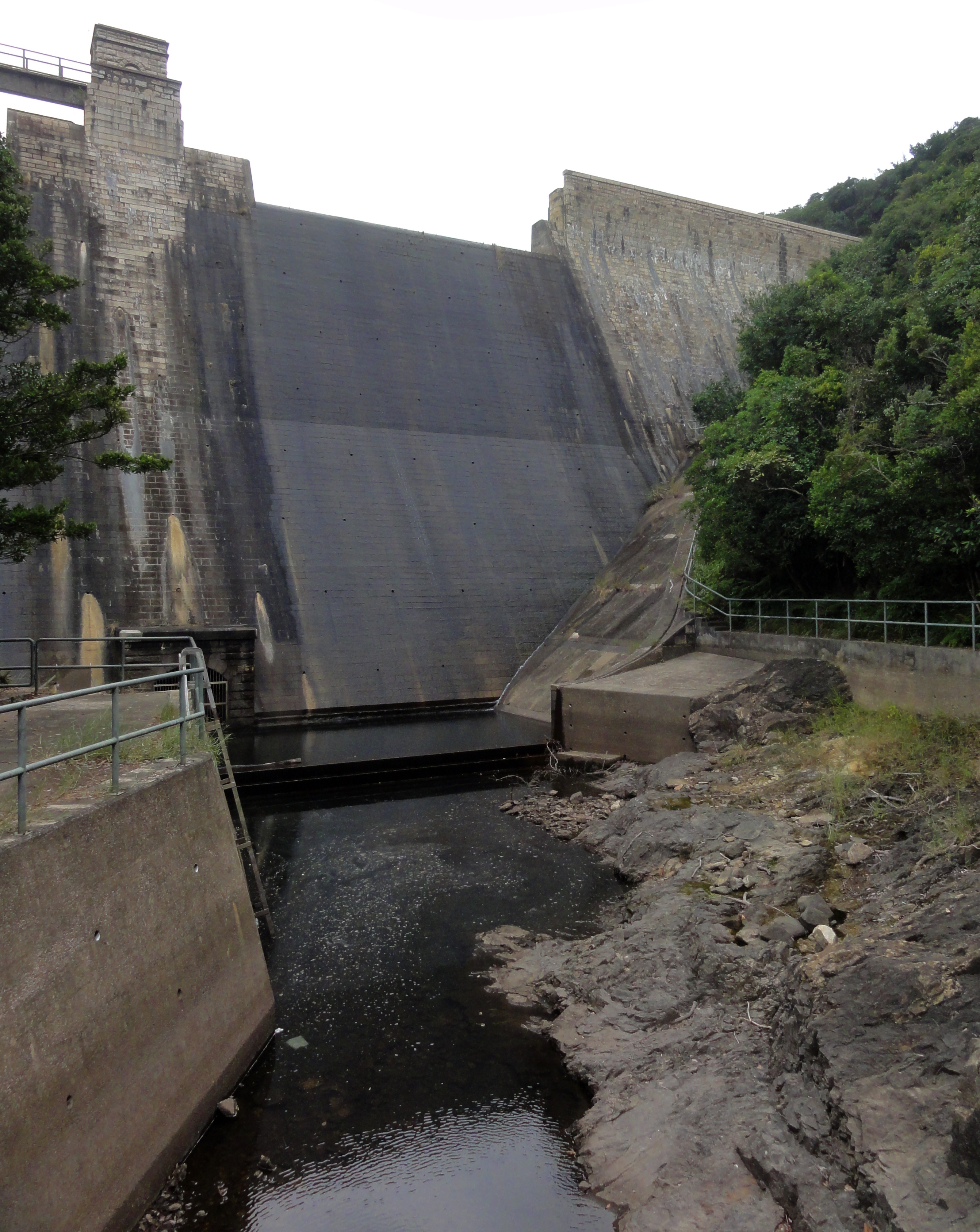
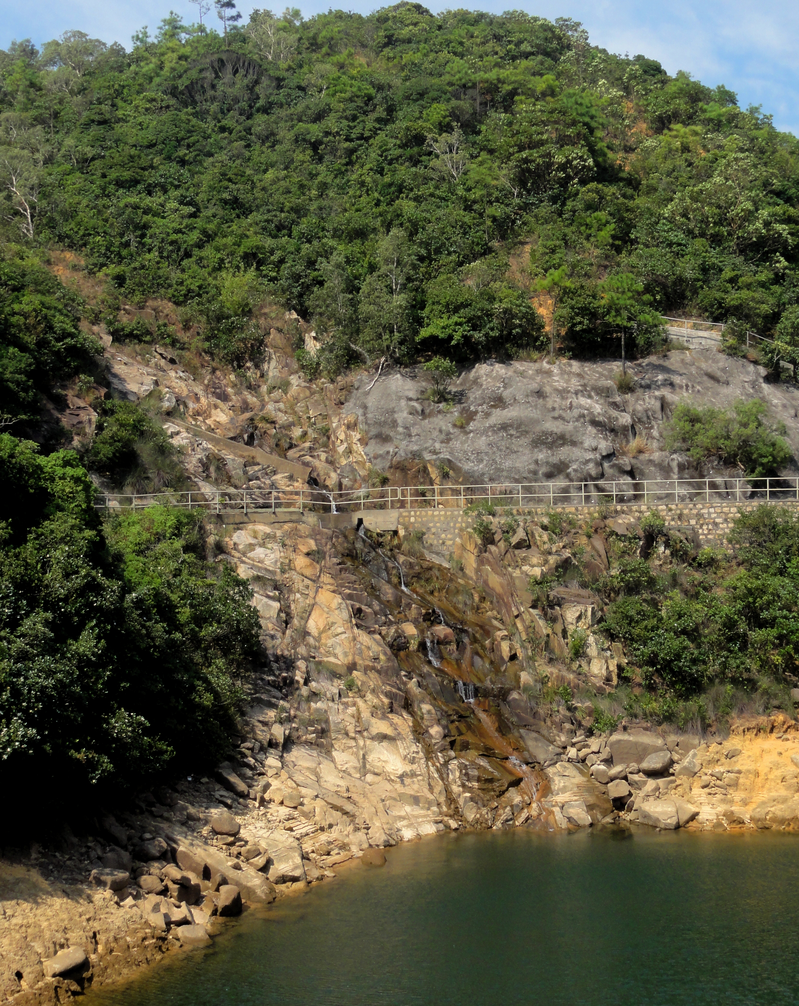
A catchment dam for an unnamed reservoir.
|
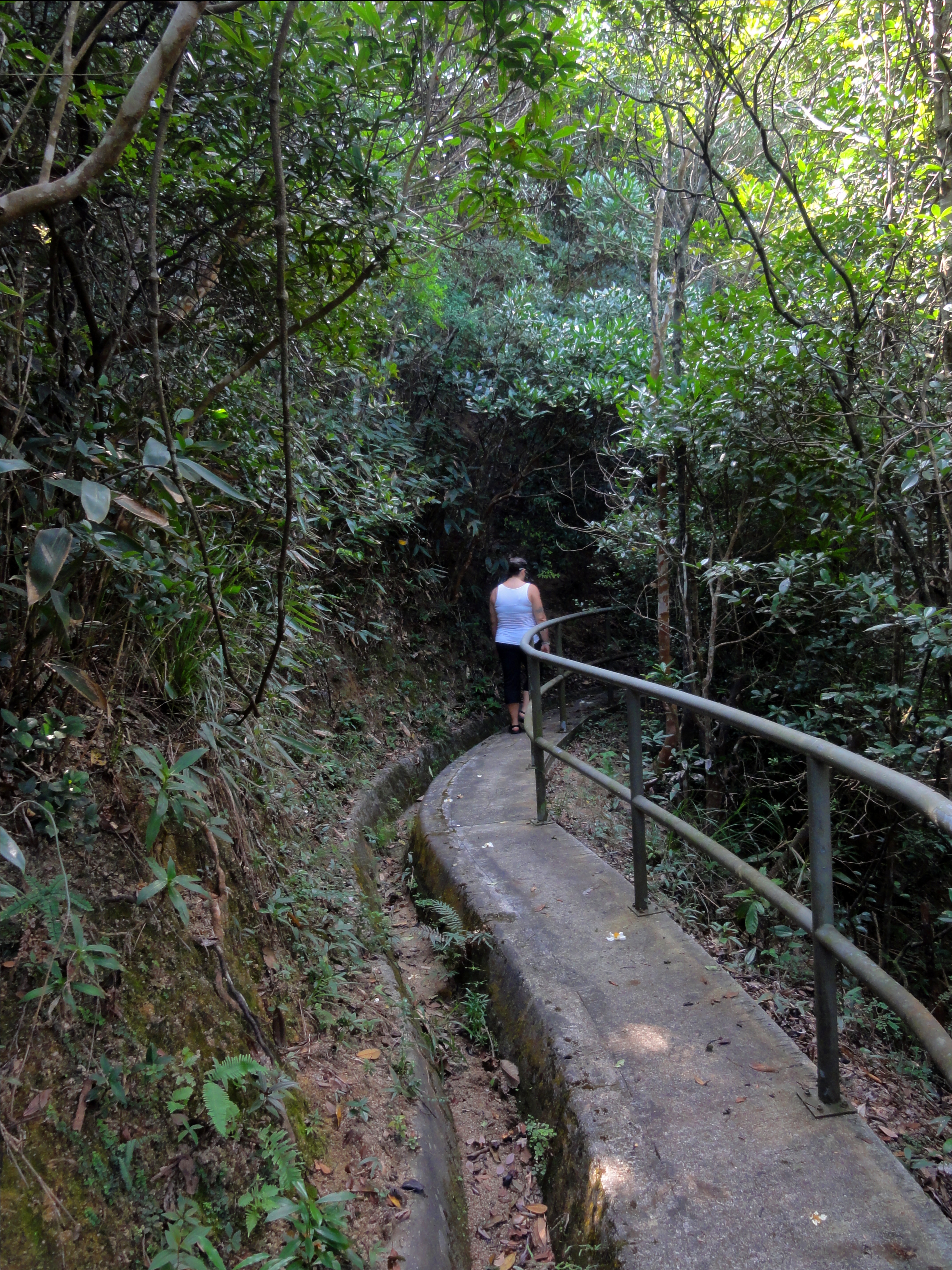
At first we were on a nice wide path, wide enough for cars but closed to all but special and authorized vehicles. It wrapped around the shores of the lake, a nice water storage reservoir known as Lower Tai Tam Reservoir, going in and out of several small bays and inlets. We passed a middle aged guy who had just caught a fish and was taking a picture of it with his iPhone. He was really excited about it!
The reservoir was surprisingly clean and was very beautiful, especially the early-20th century bridges that the path crosses. Eventually we came to a dam across a side stream, and we crossed the river one last time, and then started up a small path in the jungle. We followed this for about 50 m, through some thick jungle, before being spat onto the riverbed of a small stream. |
Lower Sheung Nam Stream.
|
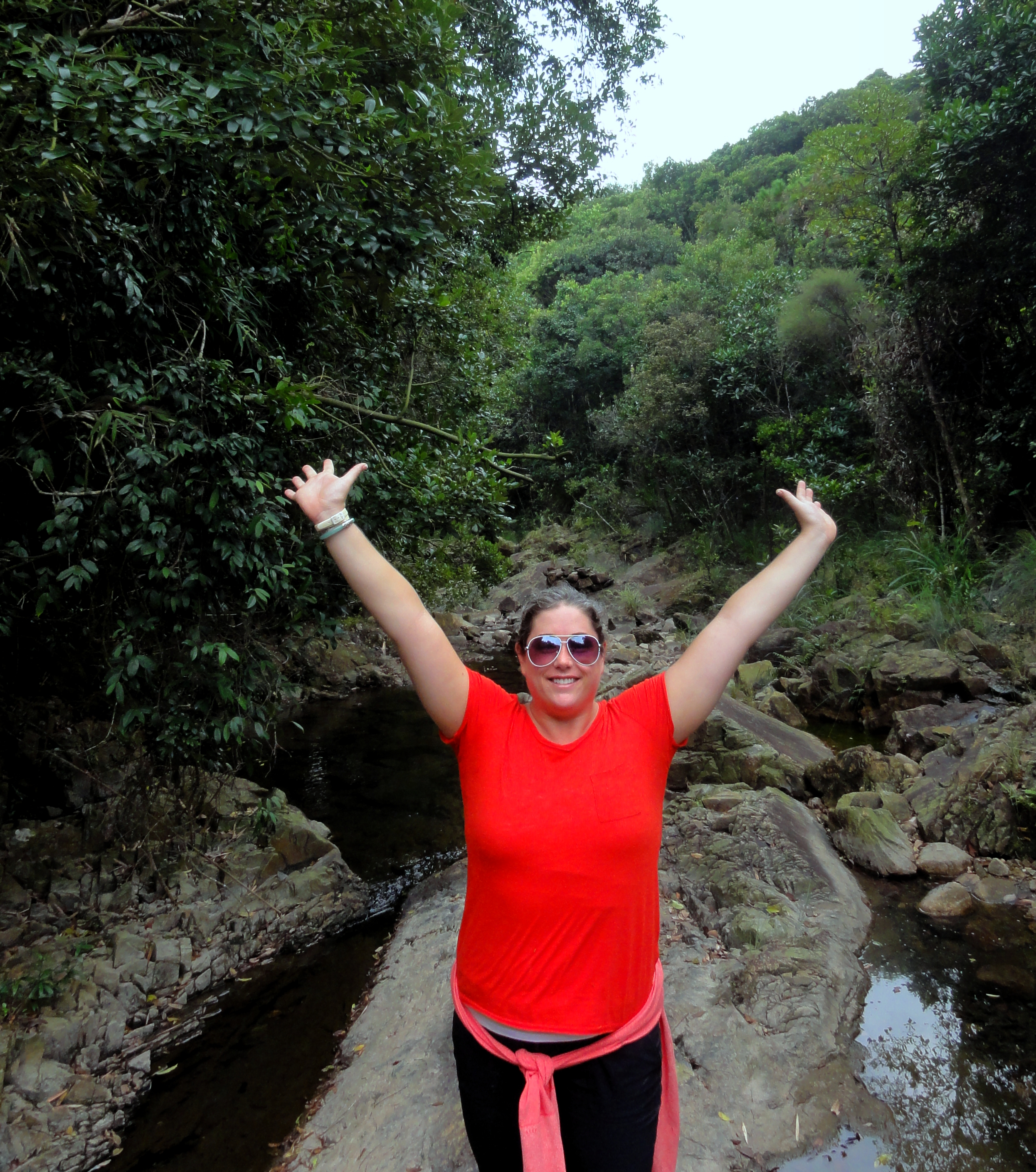
Kelsey excited to be out in nature.
|
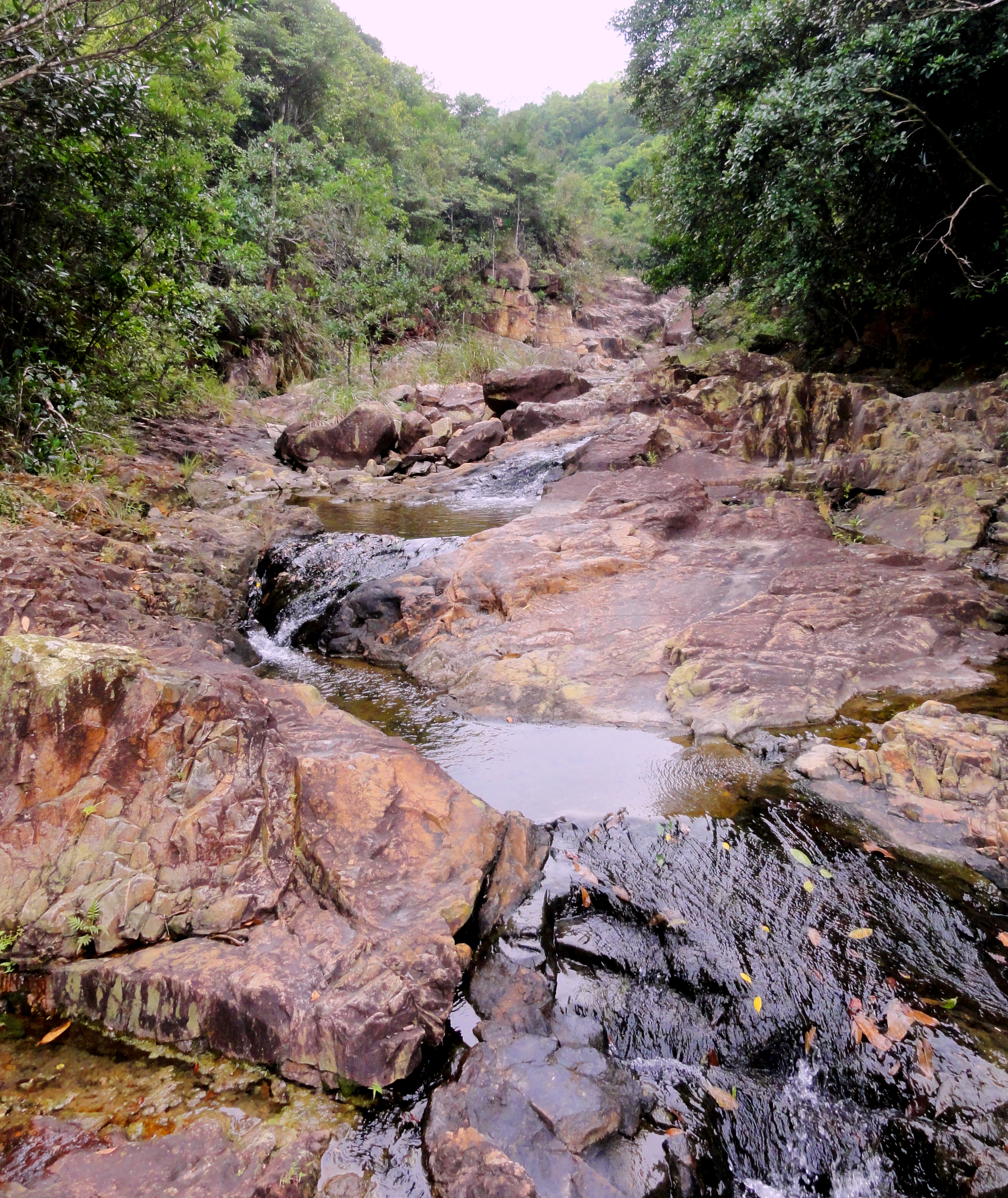
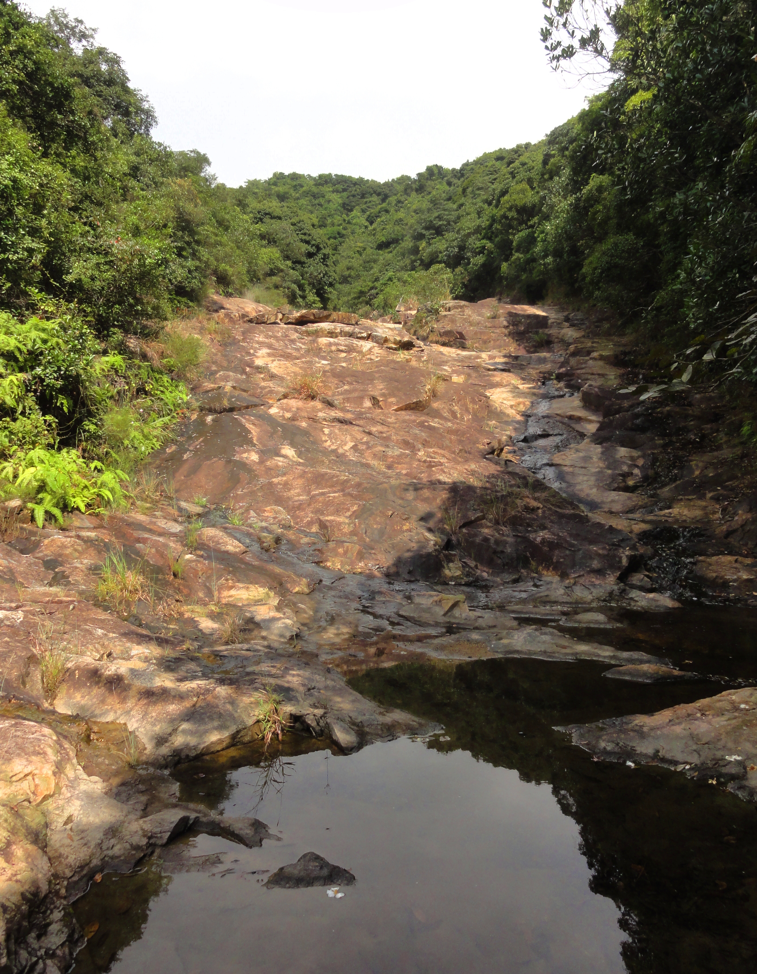
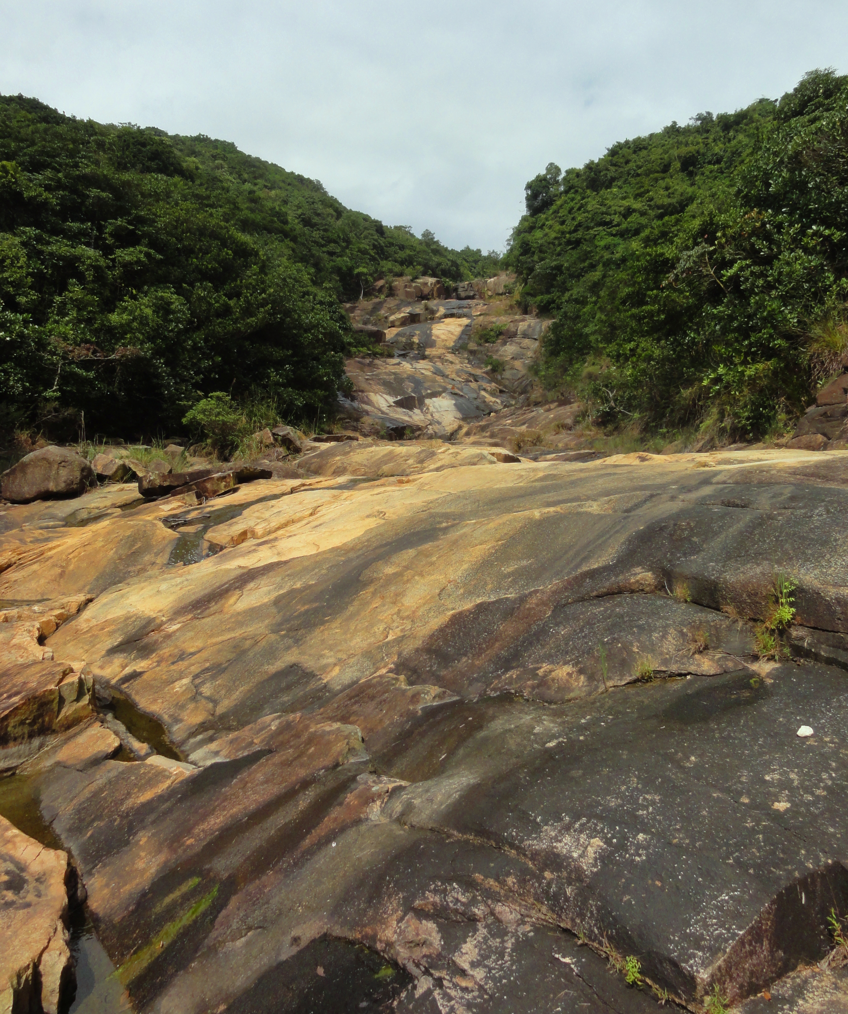
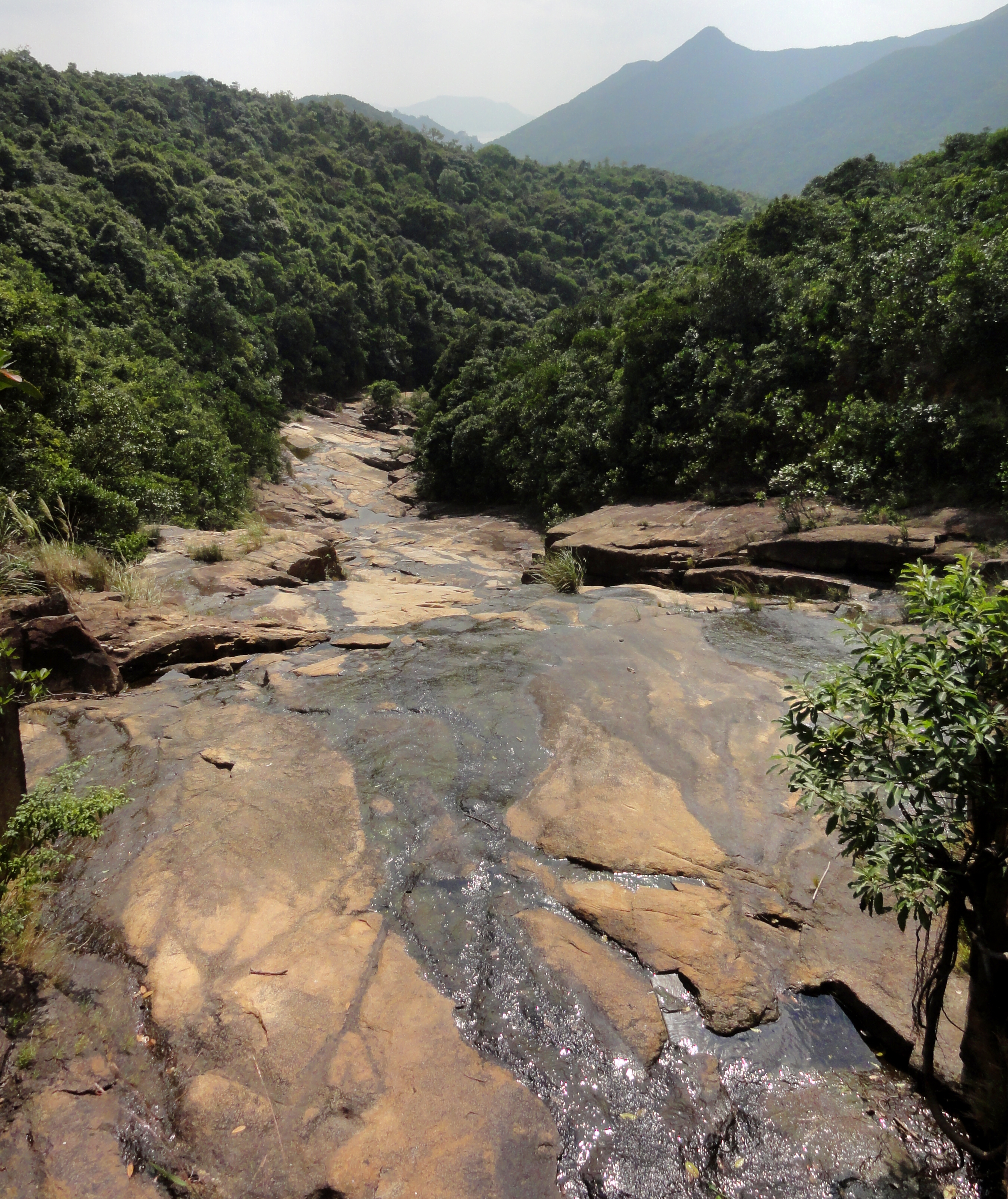
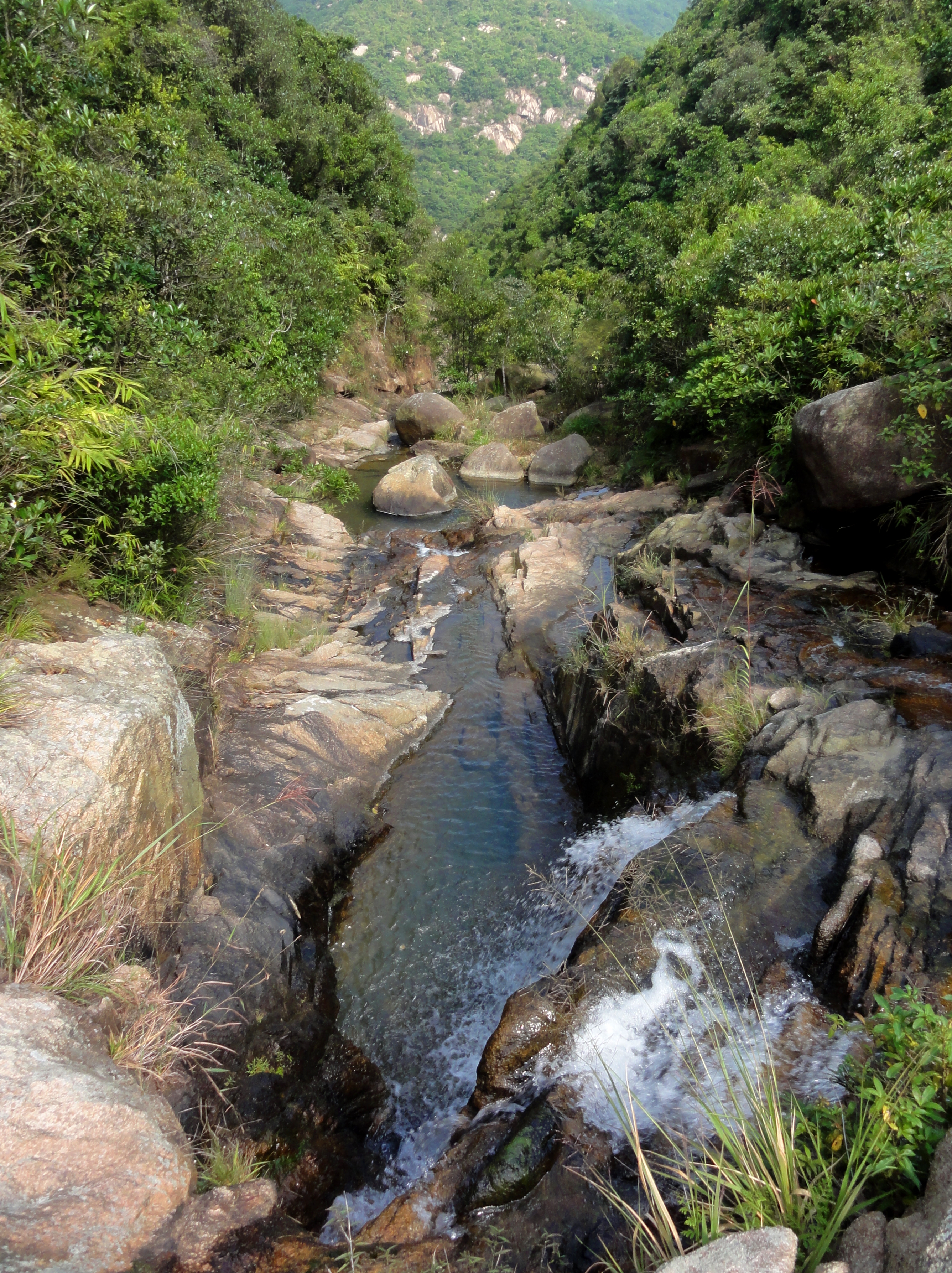
Lower Sheung Nam Stream
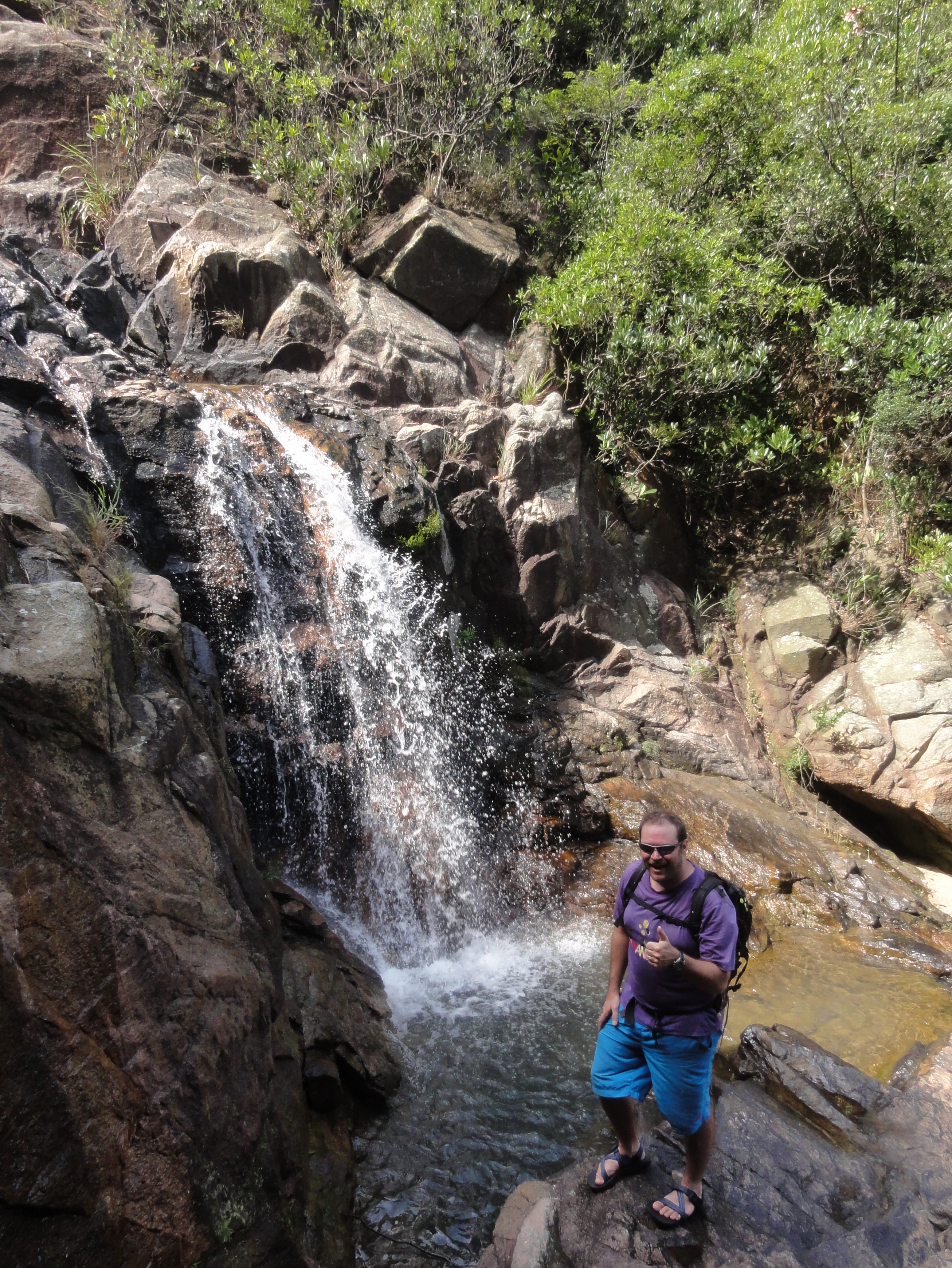
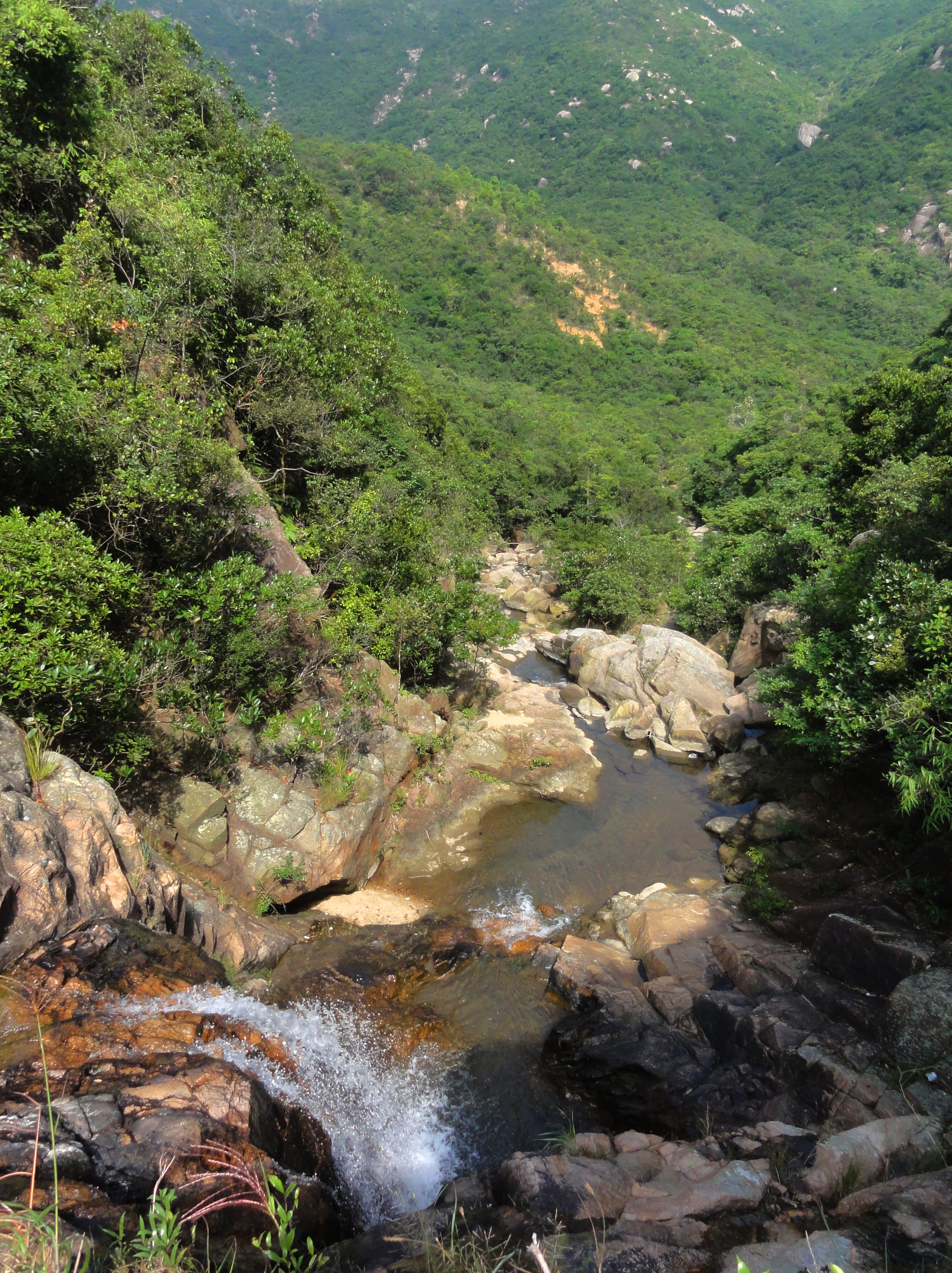
The plan for our day had us hiking up two streams, which ended up being the same stream, just different parts of it, called the Sheung Nam Stream. We were now in the riverbed of the Sheung Nam, and started hiking up. This section of the stream was wide, with huge slabs of bedrock providing most of the stream bed. Large slides, and small chunky waterfalls, made up the riverbed landscape, and while there was a couple of small upclimbs that didn't slow us down much, it was mostly simple hiking up the slabs. There was just a trickle in the stream, so the pools were full but the whitewater between the flat spots was just a splash across the rocks. It was easy to hop back and forth on the slabs on either side of the stream. The whole area was very reminiscent of the southeastern United States, in states like North Carolina and Georgia, with lush green forests and big bedrock streams.
Pretty "crack" waterfall.
|
Big dry slide in the bedrock.
|
Bottom of a huge slide sequence....
|
...and the same series from above.
|
|
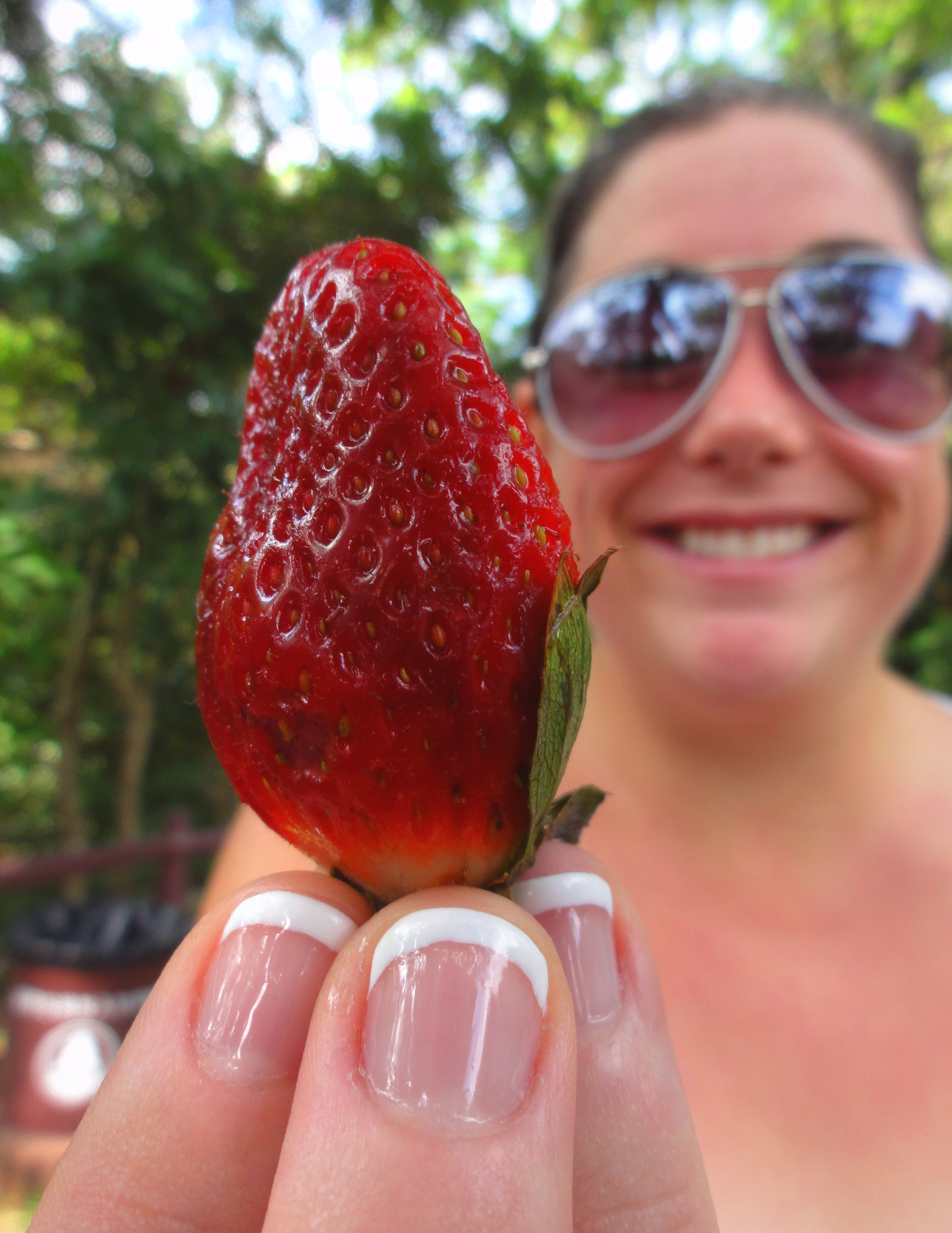
Finally we reached out exit, which happened to be a nice quiet barbecue site along the side of a nearby road. Hong Kong has given it's residents many, many opportunities to get out and enjoy their natural spaces, and one way they've offered this is through barbecue sites. It's amazing how many of them there are, and they are all nice, quiet, and well maintained sites. If I lived in HK I would be having barbecues all over the island all the time. It was here that we stopped for a small snack. The night before we had gone to a supermarket and ended up buying a whole bunch of delicious snacks and foods that we can't get in Vietnam. Our backpack was a smorgasboard of strawberries, blueberries, blackberries, Chips Ahoy!, turkey breast, ham, some dip, crackers, and real chocolate. It was so delicious to eat some snacks in the quiet forest!
|
|
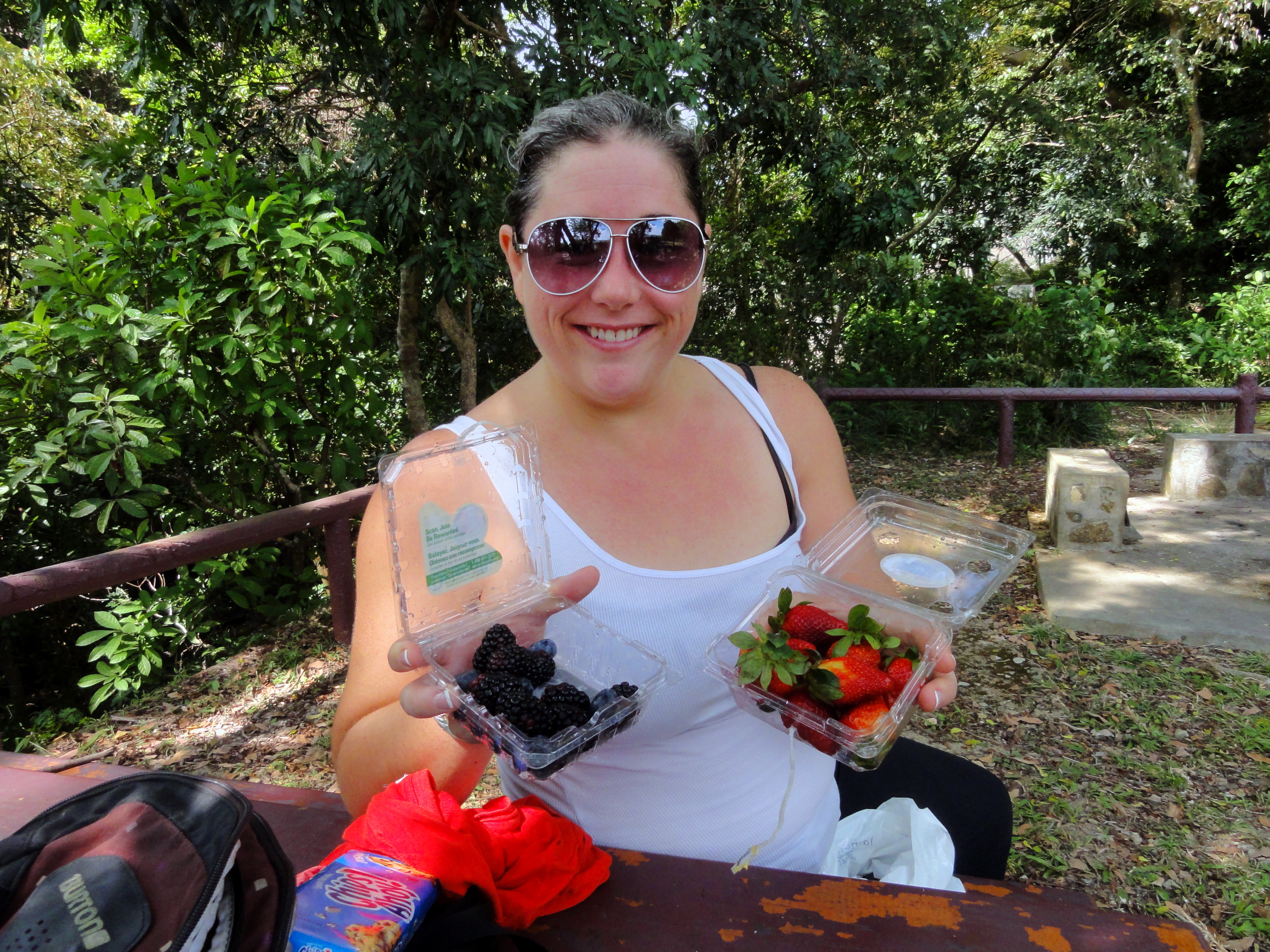
Two sweet treats: Kelsey and berries.
Lake with HK Parkview Apartments behind.
|
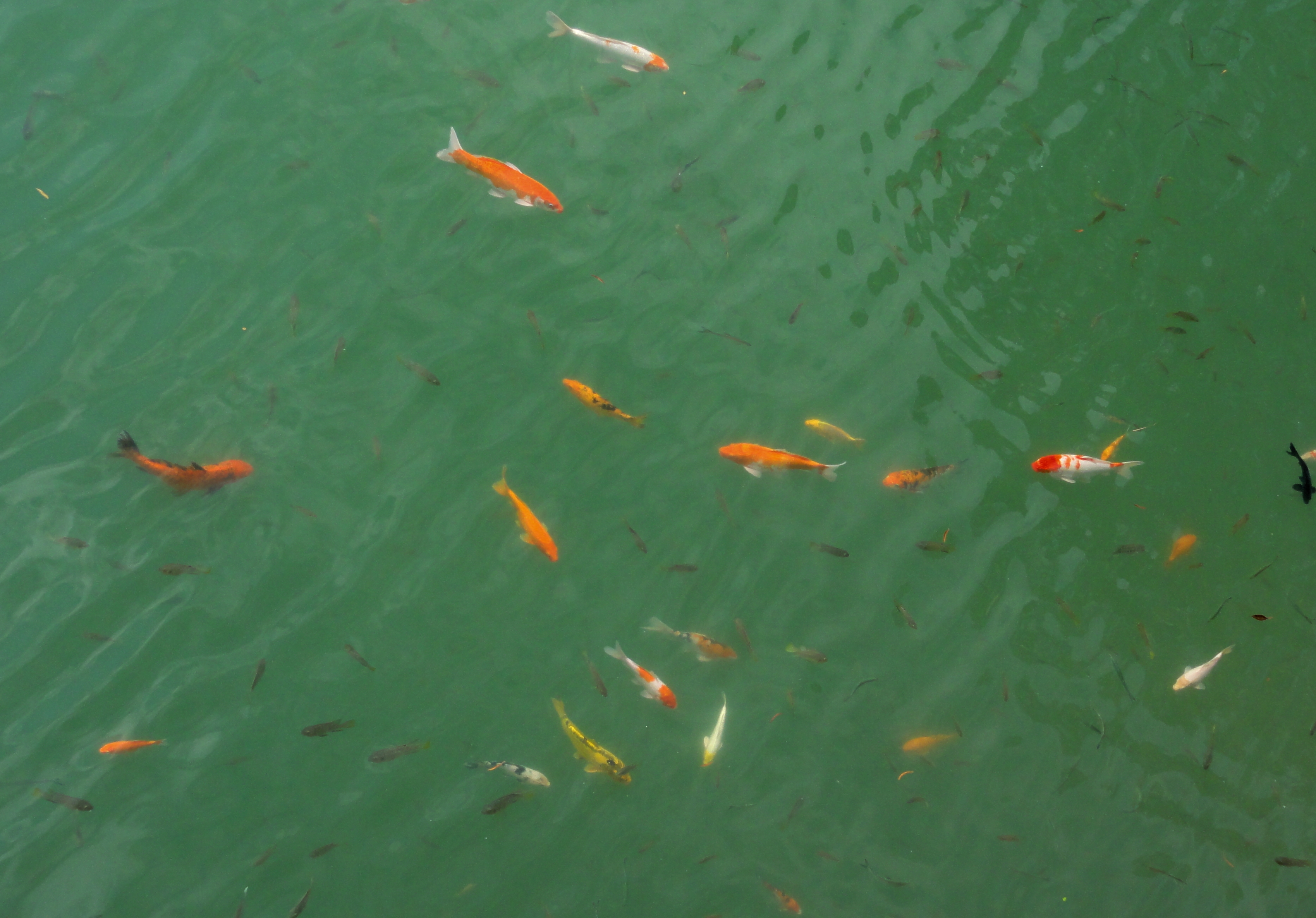
Koi in the reservoir.
|
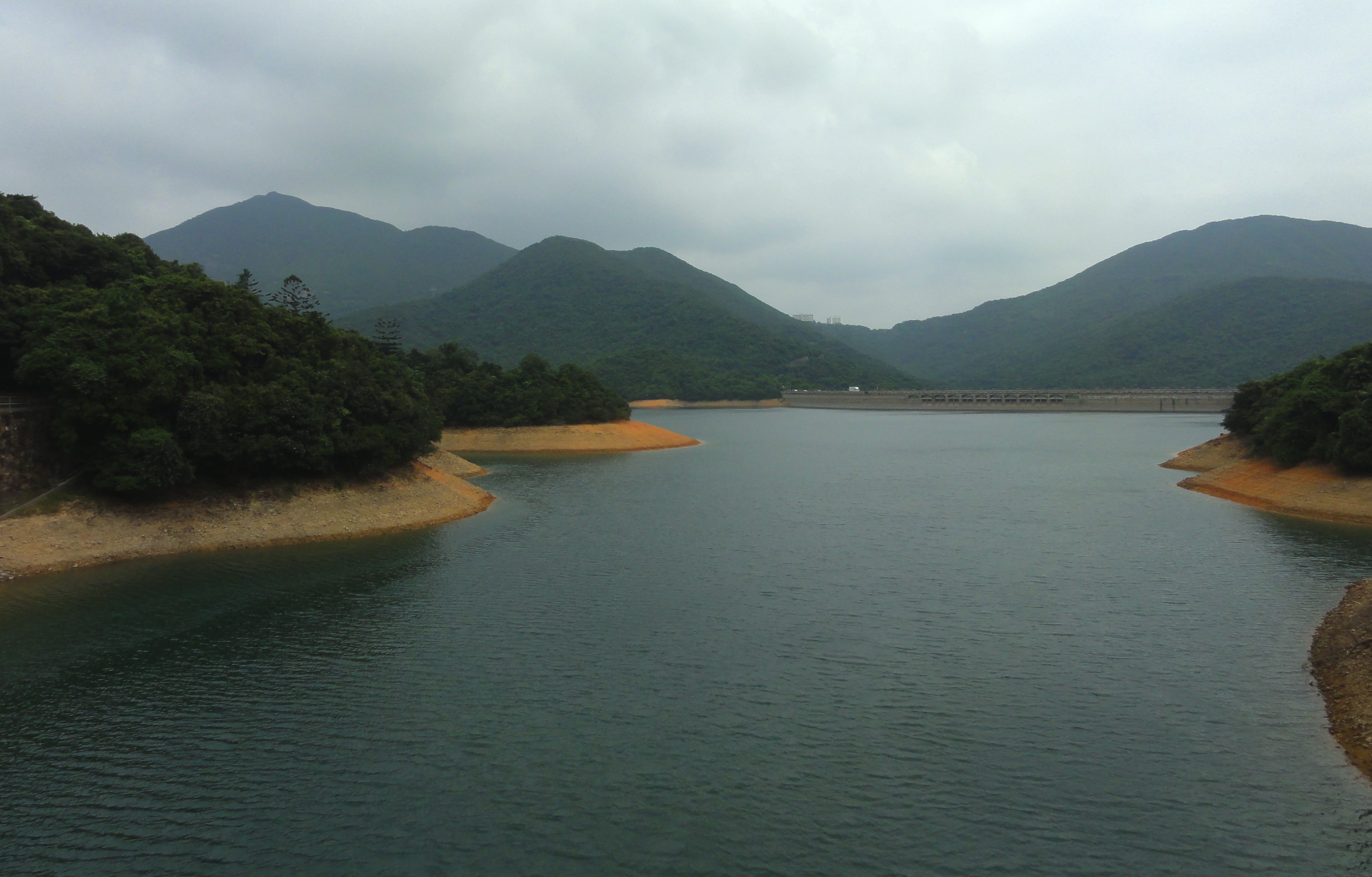
Upper Tai Tam Reservoir. Notice the tower on the ridge in the background is getting bigger.
Next, we walked across a dam that was one of several that retained another reservoir, this one conveniently known as "Upper Tai Tam Reservoir". Along the dam we saw some guys feeding the koi in the lake. I had never seen koi anywhere outside of a small pond or artificial habitat. I had never seen them in a wild state, but yet, here they were! Very colorful and very interesting to see. We strolled along the side of this upper reservoir for a while, past a nice waterfall and along a concrete path through the jungle. It was quiet, peaceful, and we spent some time strolling very slowly, enjoying the unique dichotomy that Hong Kong Island can offer.
Small falls right next to the trail.
|
Kelsey along the concrete path.
|
Upper Sheung Nam Stream
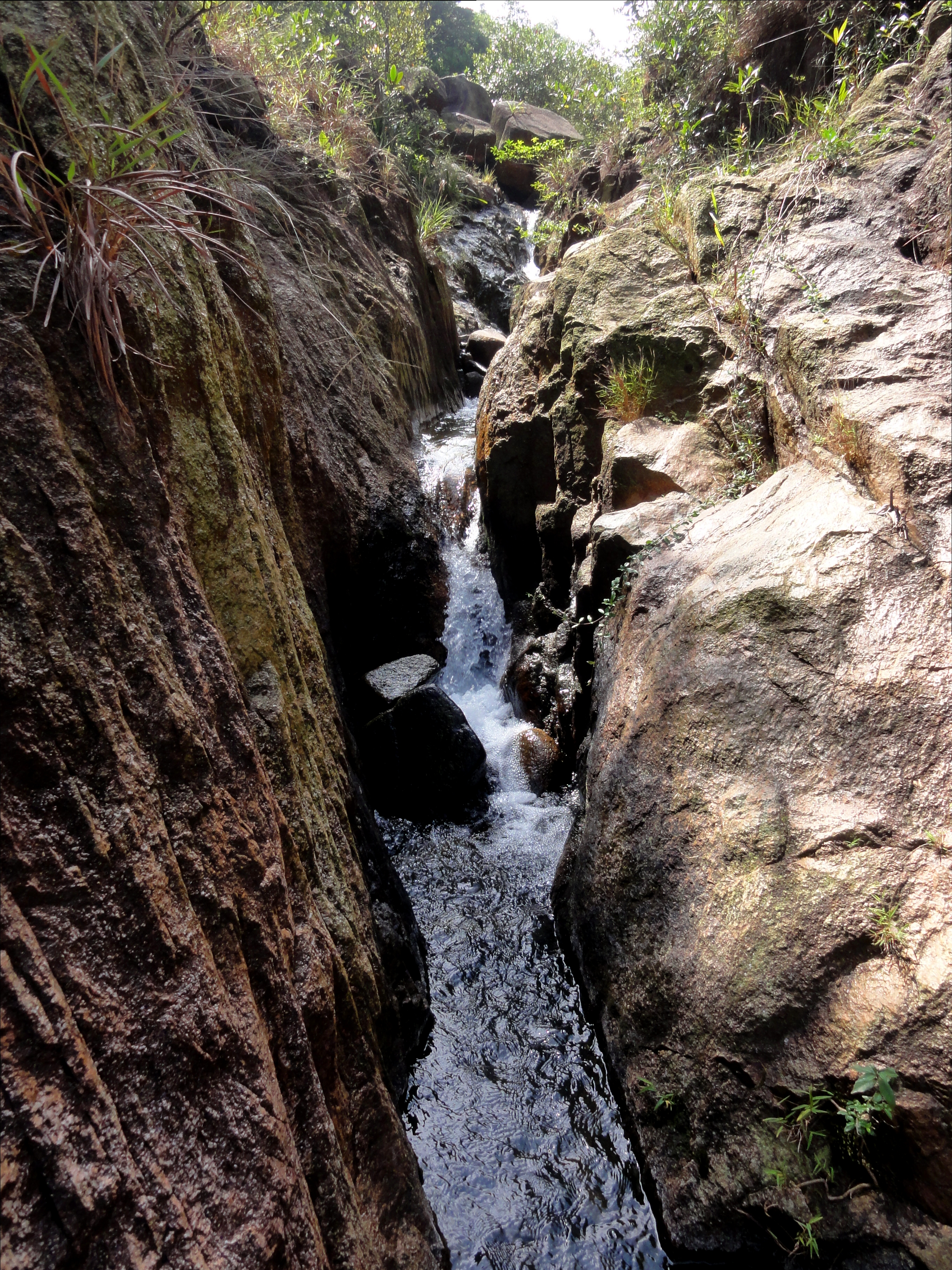
Finally we rounded a corner and started up a small canyon. The path we wanted took off from the main path and dropped us down into the streambed. This was our second stream for the day, the Upper half of Sheung Nam. This canyon was much different than it's lower twin, in that it was much steeper, narrower, and chunky. There was a fair amount of bedrock, including some good waterfalls, but there was also lots of big boulders to hop on and around as well. A couple of the waterfalls required a bit of scrambling to get around, but thanks to a pre-existing handline we had no problem getting around. It was a really neat place, and the number of spiderwebs we passed showed that nobody had been up the canyon in some time. The water was just enough to splash around but not too much to get us wet. It was perfect. I even got to chimney up one of the drops and do some real life canyoning.....if only for about 20 feet.
|
|
All four shots inside Upper Sheung Nam Stream.
|
|
Soon enough we reached a road, and popped out on a quiet street running through the mountains. Just half a kilometer to the right was a large development called The Hong Kong Parkview. It's incredible, and often jarring, how close the two worlds of Hong Kong exist together. In the States, a canyon like that would be somewhere out in nature, but here you are but a stones throw from a gigantic private residential tower complex. Hong Kong. We settled down and had a nice lunch here, enjoying the rest of our supermarket bounty. To get to the next part of our hike, we had to walk along a road for a while to get to the next trailhead. Whilst walking this path, which was popular with many locals, we overtook a man walking backwards. It was slightly disconcerting to walk behind him. It's hard to explain; walk behind someone who is walking backwards, for like 50 m, and tell me how it feels. It's strange. The next trailhead, which I failed to get a picture of, was part of the major cross-island trail known as the "Hong Kong Trail".
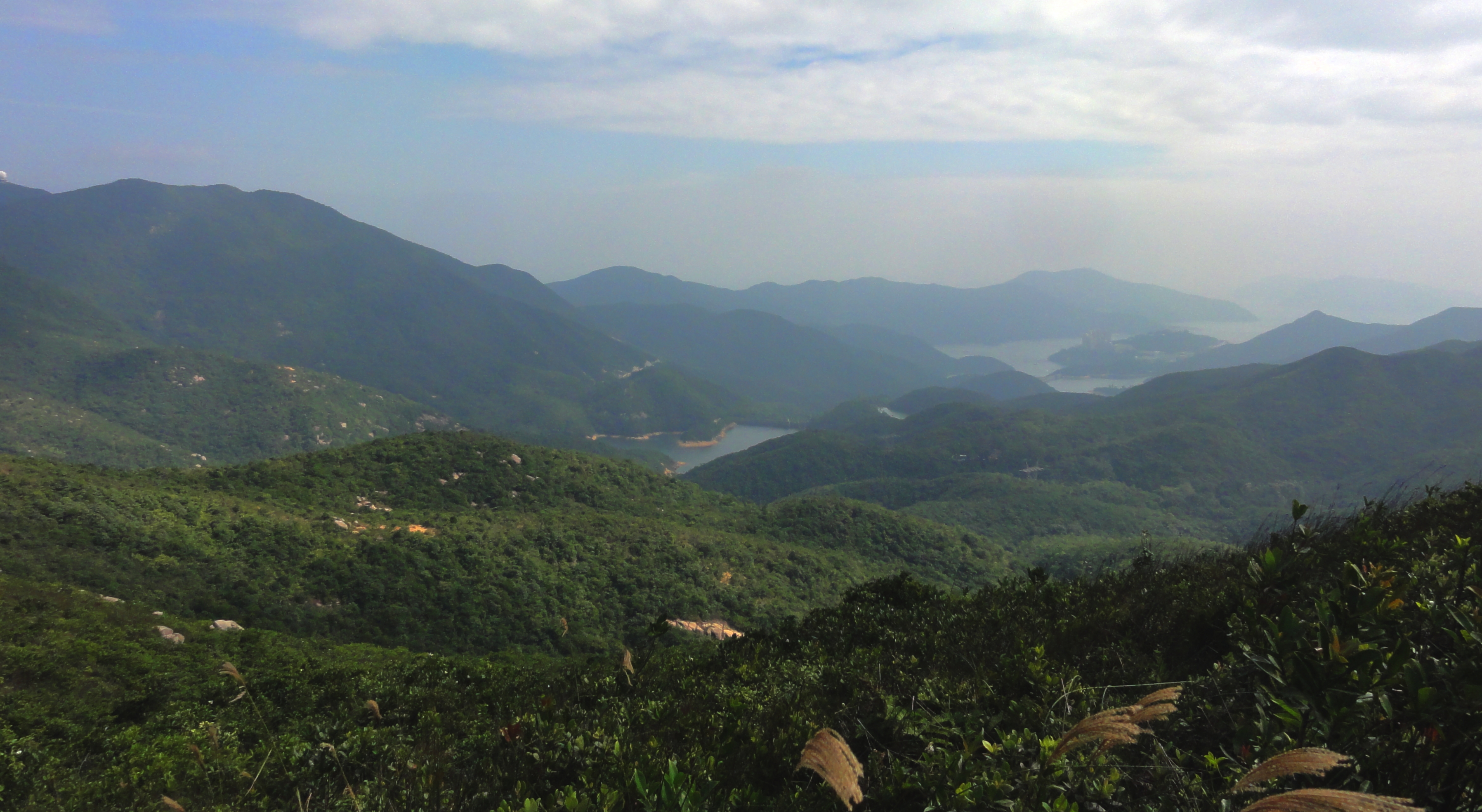
The view south over Upper Tai Tam Reservoir.
Jardine's Lookout and Sui Ma Shan
The next section of our hike was a bit of a mystery. I thought that our trail out of this second stream would take us to a pass in the mountains, where we would drop down a trail onto the other side of the island. However, we soon found ourselves along the popular and busy Hong Kong Trail, and the next section was a pretty strong one, with two peaks to climb before our exit from the route. We of course didn't know that at the time, but man we sure did by the time we were done. Almost immediately after starting we had to make way for a group of Patagonia-sponsored elite trail runners who were on a mission of some kind. After that we saw a good number of people all the way.
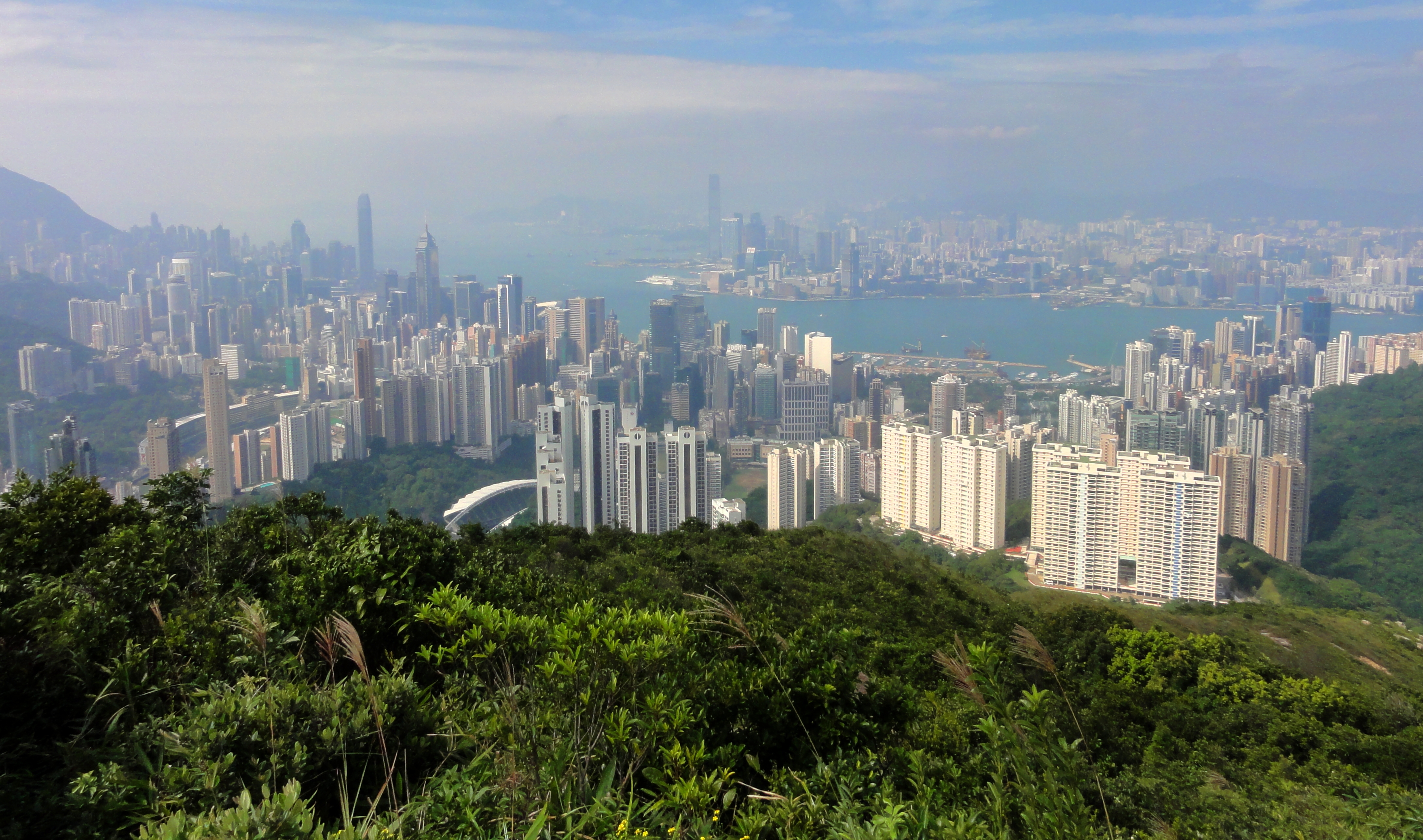
Hong Kong from Jardine's Lookout.
The first peak we topped out on was called Jardine's Lookout, named for the lookout post that used to be located up here. It has an interesting backstory. Jardine's company would put men high up on this lookout, to glimpse the first sight of an inbound ship. They would then immediately dispatch rowers to go out as fast as possible, and get the news from London's markets, and then signal back to headquarters what to do. In doing so it gave them quite the decisive edge over the competition. Today it is merely yet another summit on Hong Kong's impressive ridgeline. It's a bunch of stairs to get to the top but it is a hell of a viewpoint.
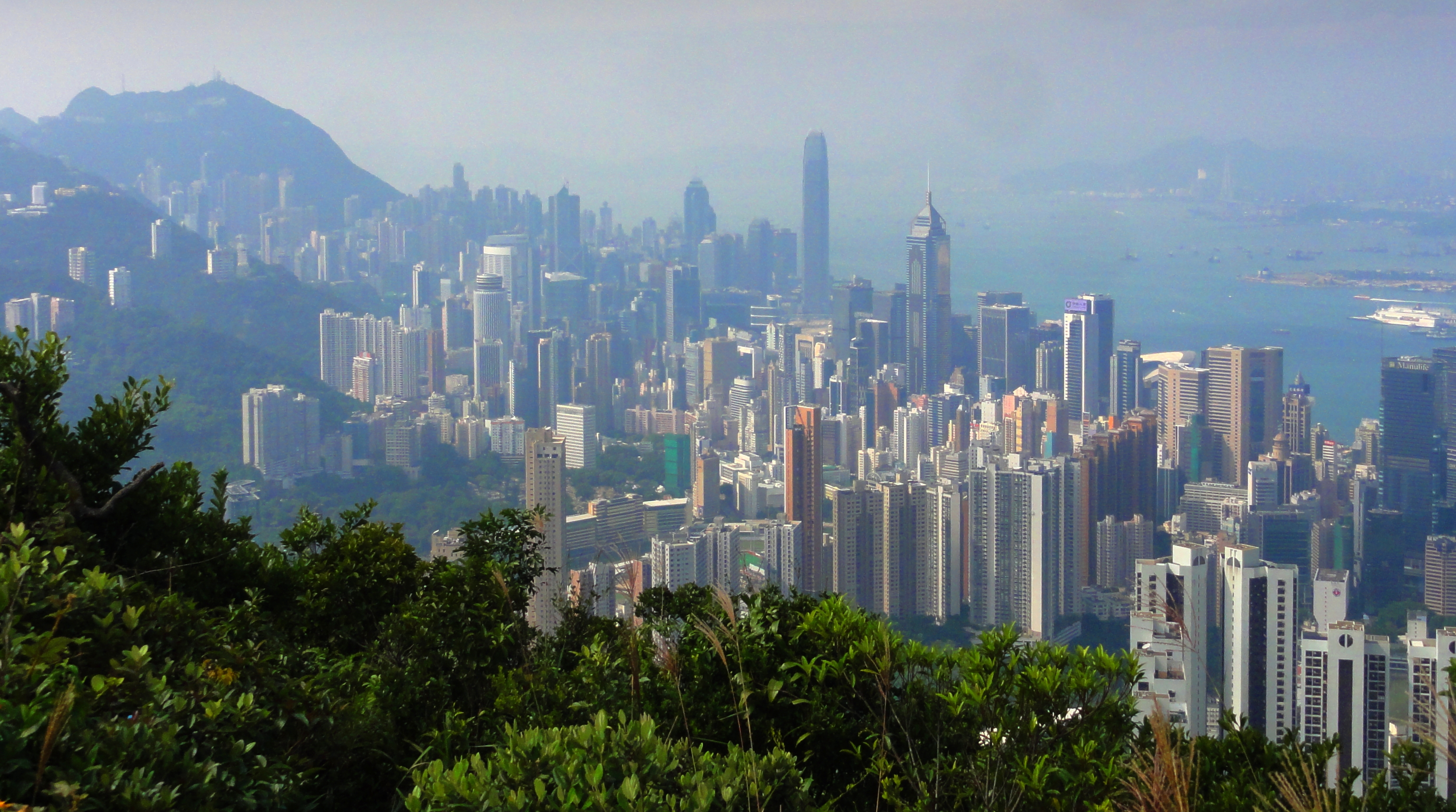
HK cityscape.
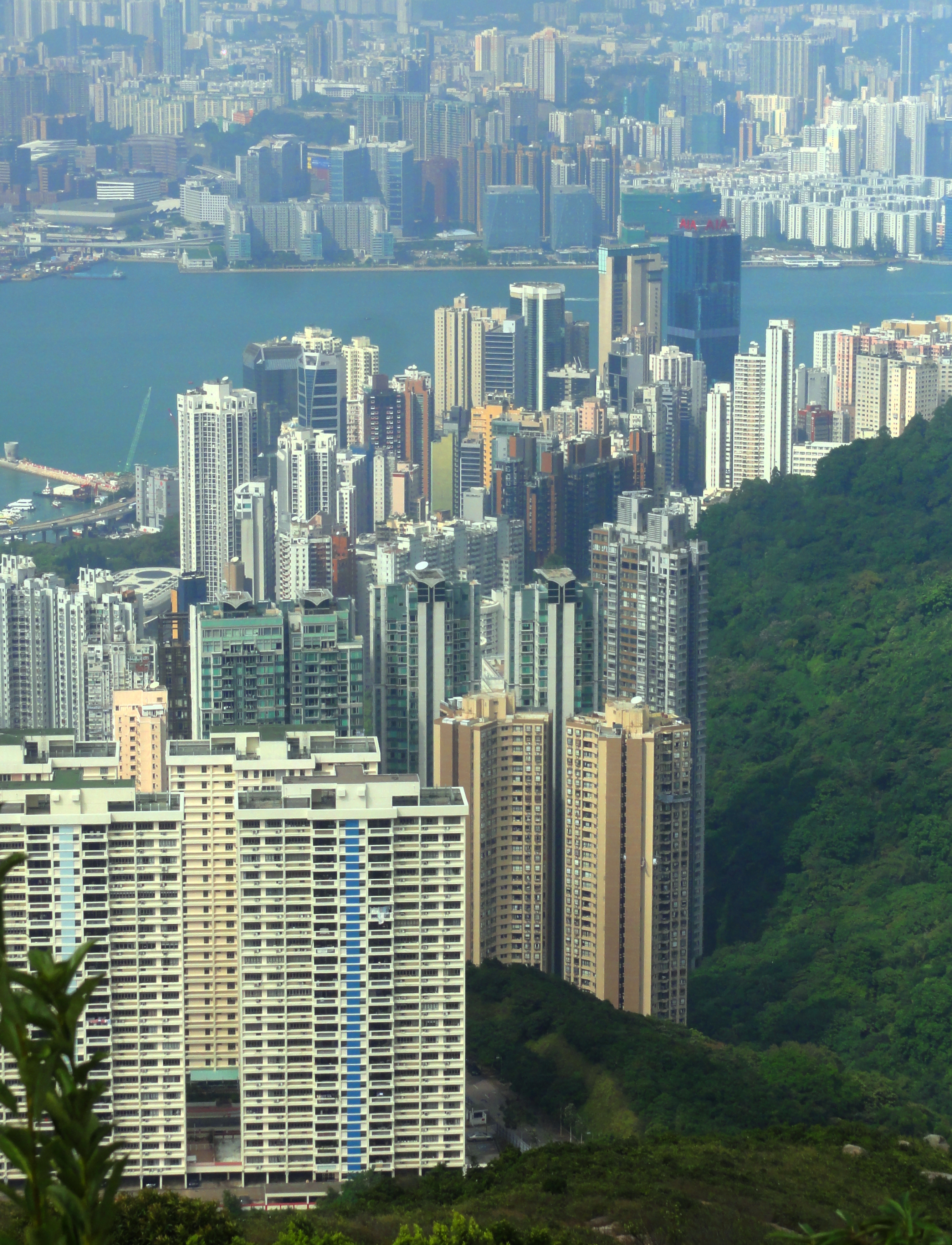
So many towers!
|
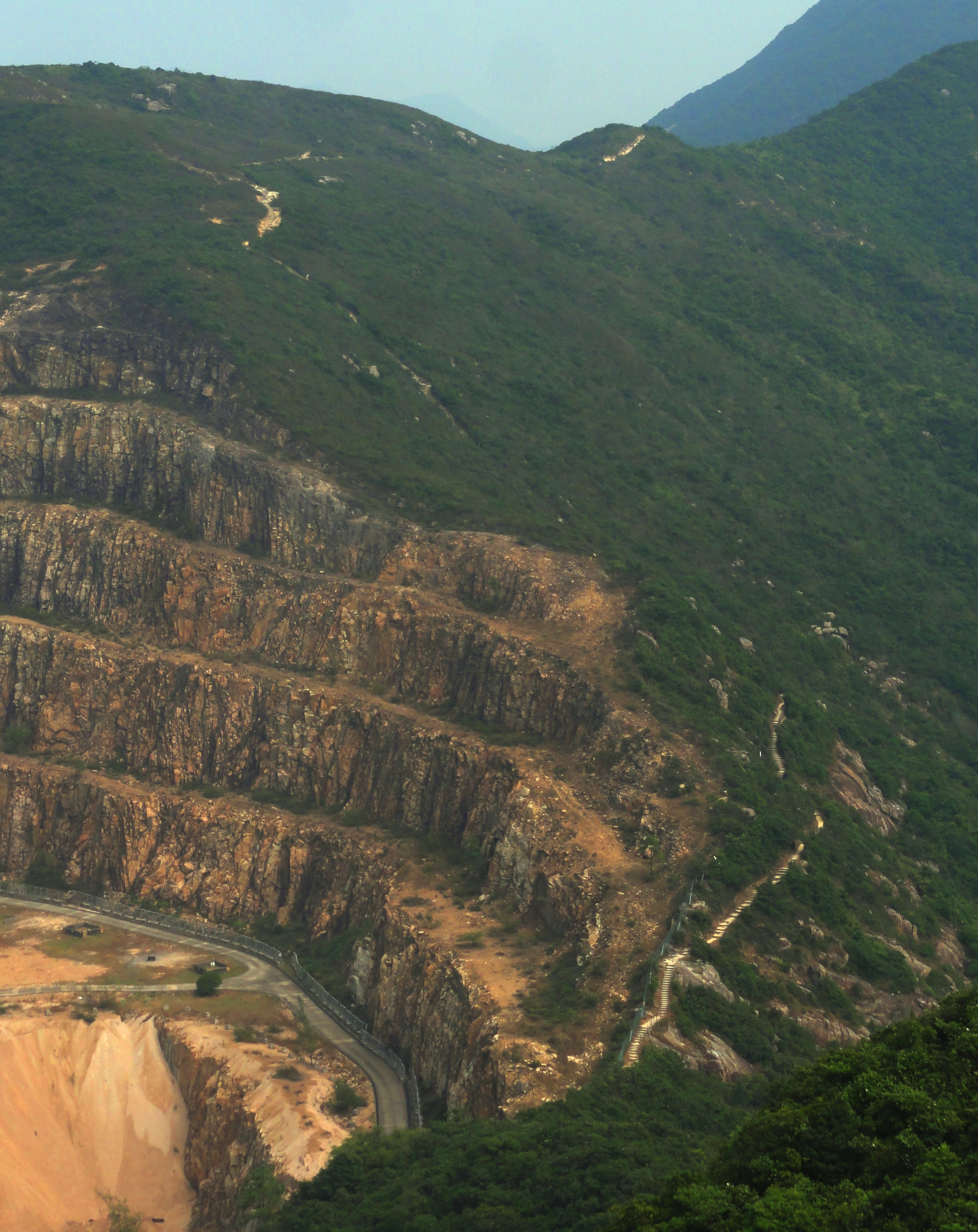
The trail just to the right of the quarry. It's steeper than it looks.
|
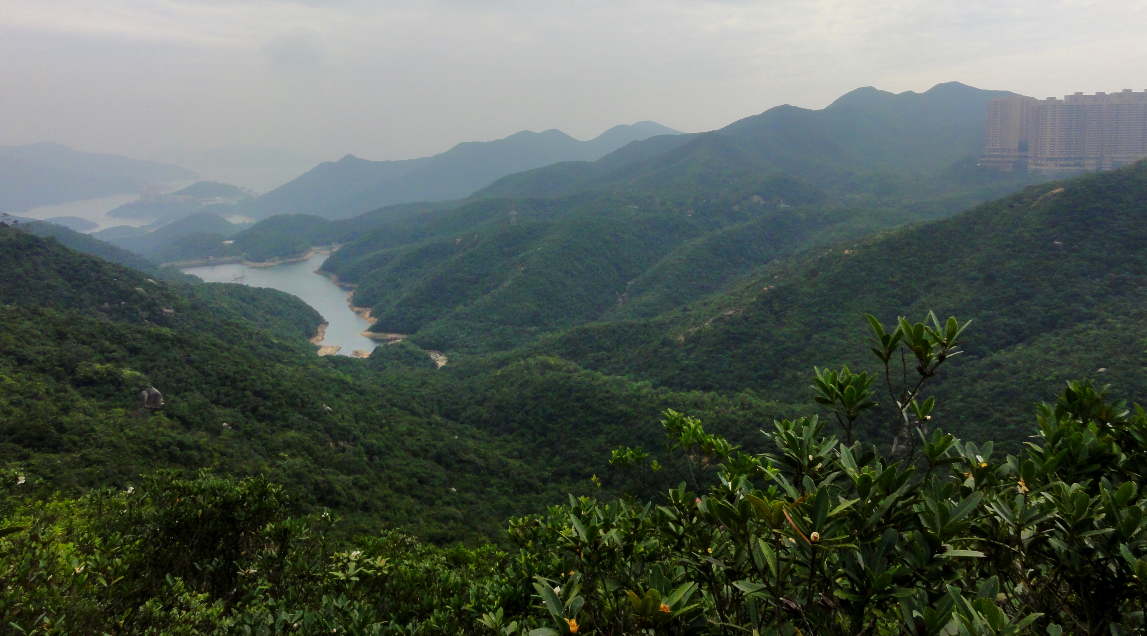
Looking back at our route. We started not at the reservoir on the left, but at the reservoir just visible behind and above it. We then ended up coming up the obvious drainage visible in the center of the photo.
The next section involved dropping down a steep trail (more stairs, this time bigger and steeper) down to a place called Quarry Pass, right above- you guessed it- a quarry. From there it was another punishing climb along the side of the quarry up to the broad gentle summits of Siu Ma Shan, another small bump in Hong Kong's Ridgeline. Here our trail, the "Wilson Trail", turned off to the left, leaving the Hong Kong Trail to continue it's journey to the top of Mt. Parker. It was windy on top but the view was spectacular again, and the breeze felt quite nice as we struggled on. On this part of the island the dominating feature was the "One Island East" tower, a 298 m / 979 ft supertall building that rises out of Quarry Bay. When we topped out on Sui Ma Shan we were above the level of the top, but as we dropped down, we soon began to look farther and farther up to the top.
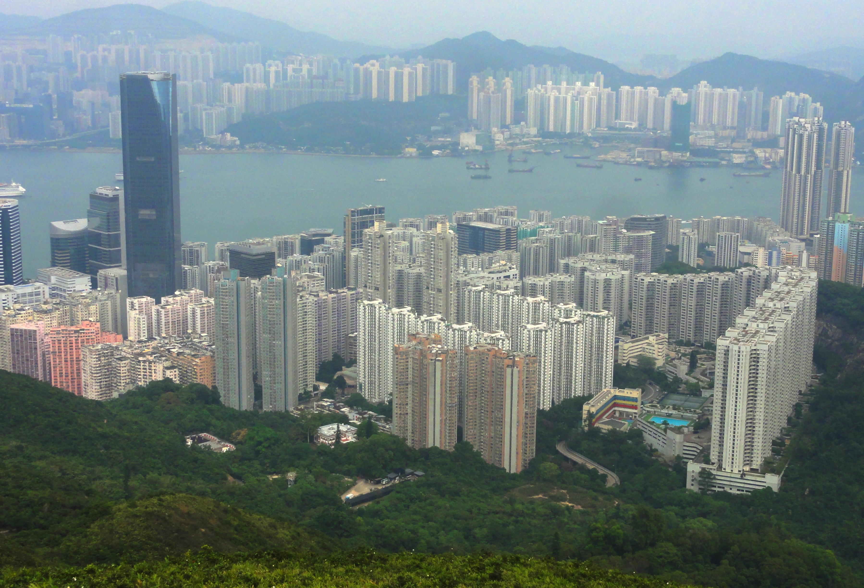
Quarry Bay and the One Island East tower.
The descent down to Quarry Bay was brutal. It was steep, and even though we eventually hit a bigger path, and then the Mt. Parker Road, it never seemed to stop. Finally though, we rounded a corner, and just like that, we were back in the city. We had originally planned to walk to one of the nearby MTR stations, but we were so beat we just got the first taxi that would answer our hail and went first class all the way back. That night we had an early night and we laid around feeling rather beat. But, with any good deathmarch, this one was plenty of fun and the sense of satisfaction after finishing was well worth the pain! We figured we had logged around 12 km, and close to 1,200 meters of total elevation gain and loss, in about 6.5 hours. We sweated a lot and were hurting a bit but it was a great hike overall.
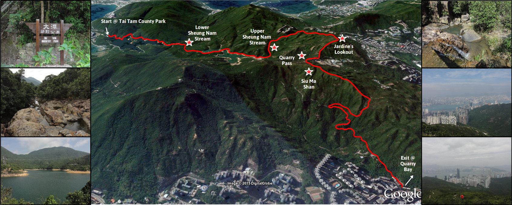
I made a small infographic to show the hike as best as I could. Although it doesn't quite convey the steepness of the pitches around Quarry Pass, it does show just how big of a dash across the island we made.
I made a small infographic to show the hike as best as I could. Although it doesn't quite convey the steepness of the pitches around Quarry Pass, it does show just how big of a dash across the island we made.
Map copyright Google. Photos copyright Kit Davidson.
All photos copyright Kit Davidson unless otherwise noted.
