Myanmar -Part VIII
|
<- Back to Part VII
|
|
I have a bad habit. I am a grown man and can admit that. Especially after the adventure that we had at the end of our Myanmar trip in the northern part of Shan State. My problem is that I like to get "off the grid". I like to poke around in the corners of the map, away from the known places and into the gray areas. It's called "bear went over the mountain" syndrome, and while it really hasn't been a big problem too far, it did cause us some mild frustrations in Lao. When the planning of this trip came around, naturally I voiced that I would like to go somewhere a bit off the grid. I figured in Myanmar, a country that is still newly opening, would have lots of off-grid areas to explore. In retrospect, it was a classic example of "be careful what you wish for". While nothing bad happened, it ended up being a strange, and at times, trying section of trip. There were some bright moments, as well, and I'm happy that we ended up doing it. Sometimes it's better to have done something than it is to actually do it. Lashio was one of those times.
|
|
Hills above Mandalay.
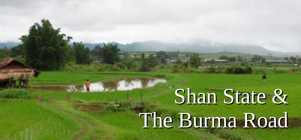
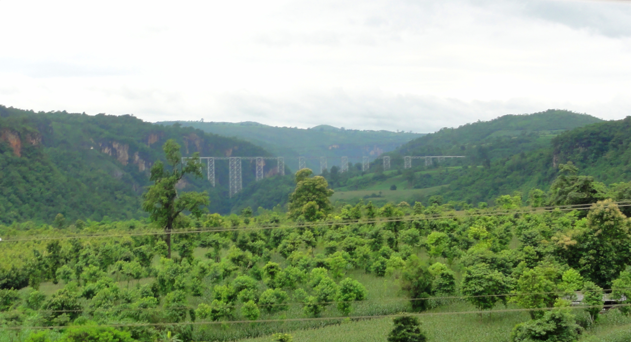
Shan State encompasses the broad plateau that covers all of Myanmar's bulge east into Thailand, Lao, and China. The whole area is fairly geologically active, with the sizeable Sagaing Fault running through the center of Myanmar and forming the western side of the plateau. Thanks to a range of mountains that have sprung up as a result of the Indian and Sunda Plates grinding against each other, the vertical demarcation between Mandalay and the Shan Plateau, scarcely 30 kilometers to the east, is remarkable. In Mandalay, all you can see is a large mass of dark mountains rising abruptly into the sky, not far away, and the feeling of separation between the two areas, though they are geographically quite close, is very pronounced, and once you climb over those mountains and reach the plateau it feel like a world apart. The plateau levels out futher east and turns into more rolling country with isolated small hills. Overall elevations range from 6,000 to 8,000 feet, or around 1,500 to 2,500 meters, and the weather is actually somewhat brisk at times. Apparently in the winter it can actually be downright cold. In the center area of the plateau, a major tributary of the Irrawaddy, the Myitnge River, or Namtu River, and it's feeder streams have carved several impressive gorges through the limestone of the plateau, one of which (the Gokteik) we would have to cross to make progress.
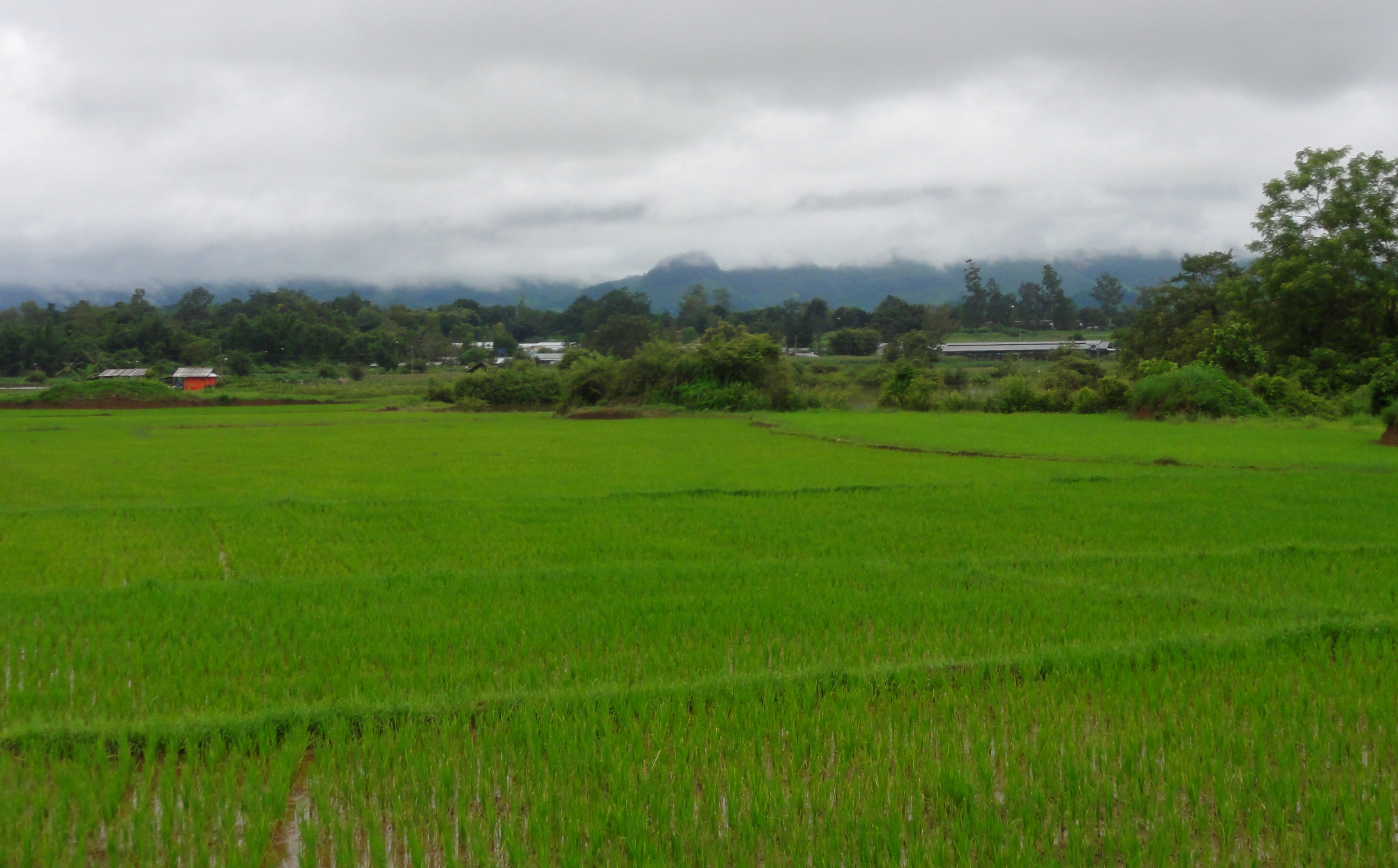
Shan State rice paddies.
The people of Shan State are actually quite a melting pot of people, with quite the patchwork history. Some of the people further south have bloodlines from Thailand, while others have bloodlines with those in Myanmar, including the majority Bamar AND small groups like the Karen, Kachin, and Arkan. Some of the bloodlines stretch back to the kingdoms around Lake Dali in southwest China, and others even with groups in modern-day Lao. The history of the area is also quite complex, and various parts of the plateau and various familial and ethnic groups have at times been controlled by, or worked with, Burmese armies from Bagan or Pegu, Chinese interests from Yunnan Province, and the Siamese/Thai kingdoms to the south. But rarely has the entire plateau and it's full population ever been fully under the control of one centralized ruler or ruling group. So the area has long been a wild area, a remote region of adventure and mystery in an ever-modernizing world.
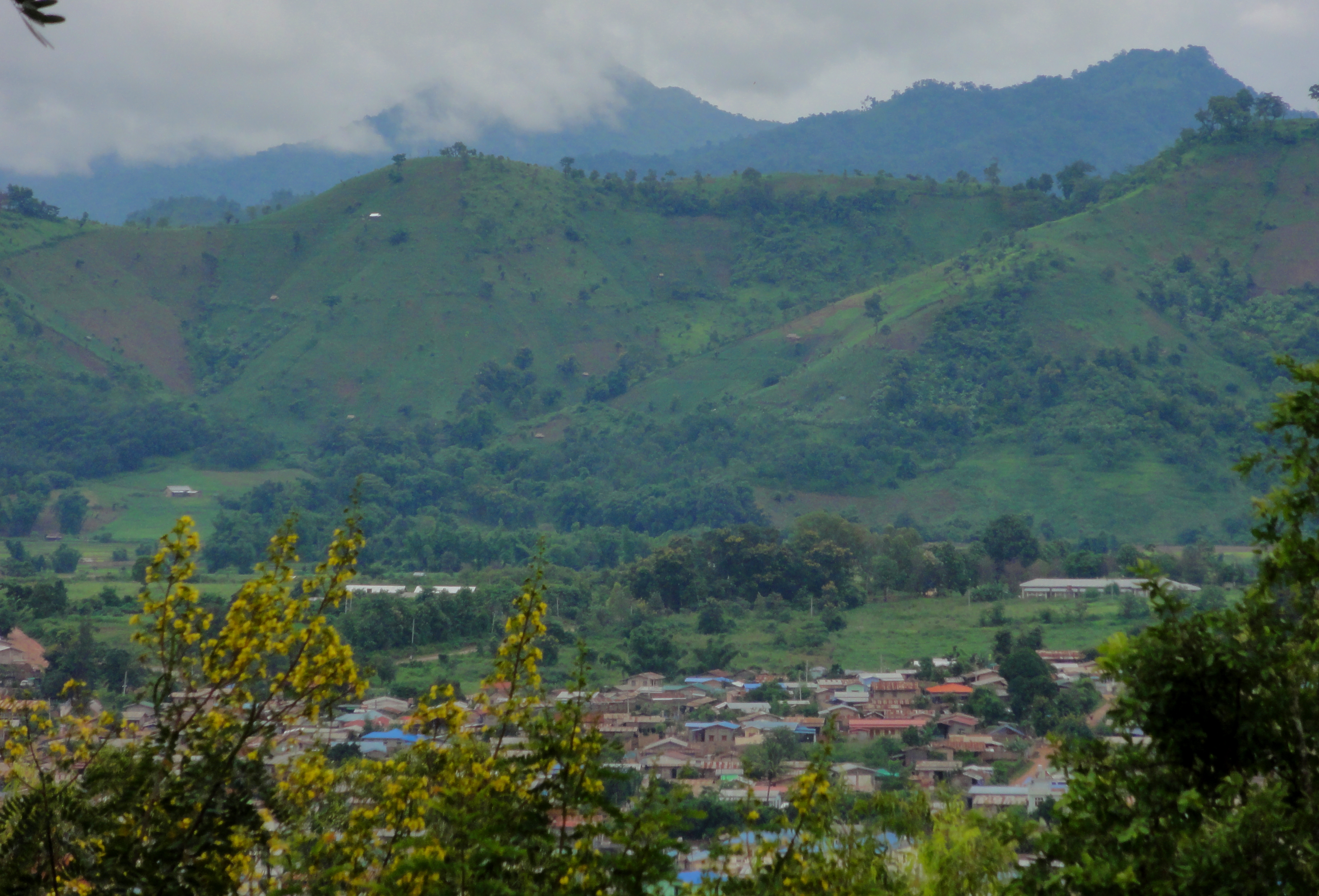
Lashio, nestled in the Shan Hills.
So, thanks to geographic isolation of the State, a patchwork history of alliances and conflict, and a less-than-homogeneous population mix, Shan State has always been an area of independence and autonomy, and today is home to one of, if not THE, longest-running civil wars in the world. The people of the Shan State want to create their own nation, or at the very least want as much autonomy from Myanmar as humanly possible. While the conflict has waxed and waned from time to time, the local people have been fighting the government for over 60 years, and the various fighting groups, including the Shan State Army, are not going to back down until they are granted more independence from Myanmar. All of these we knew going into the trip, but it would only be after going there and trying to move around that we would realize other issues are in play as well, of which I will speak later. For know, all we knew was we were going to a place that was much more off the grid than anything else prior on this trip, and maybe even in our travelling history together.
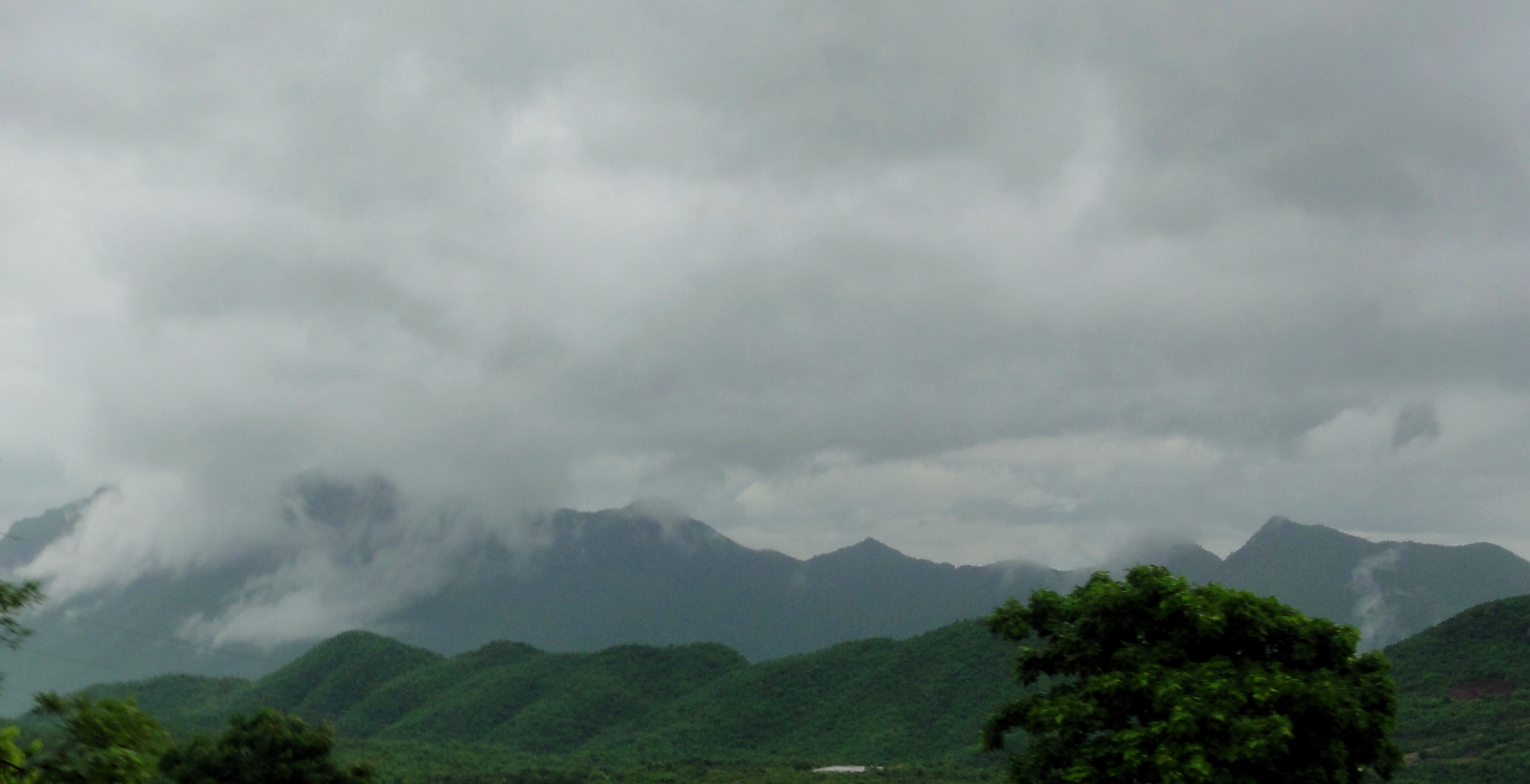
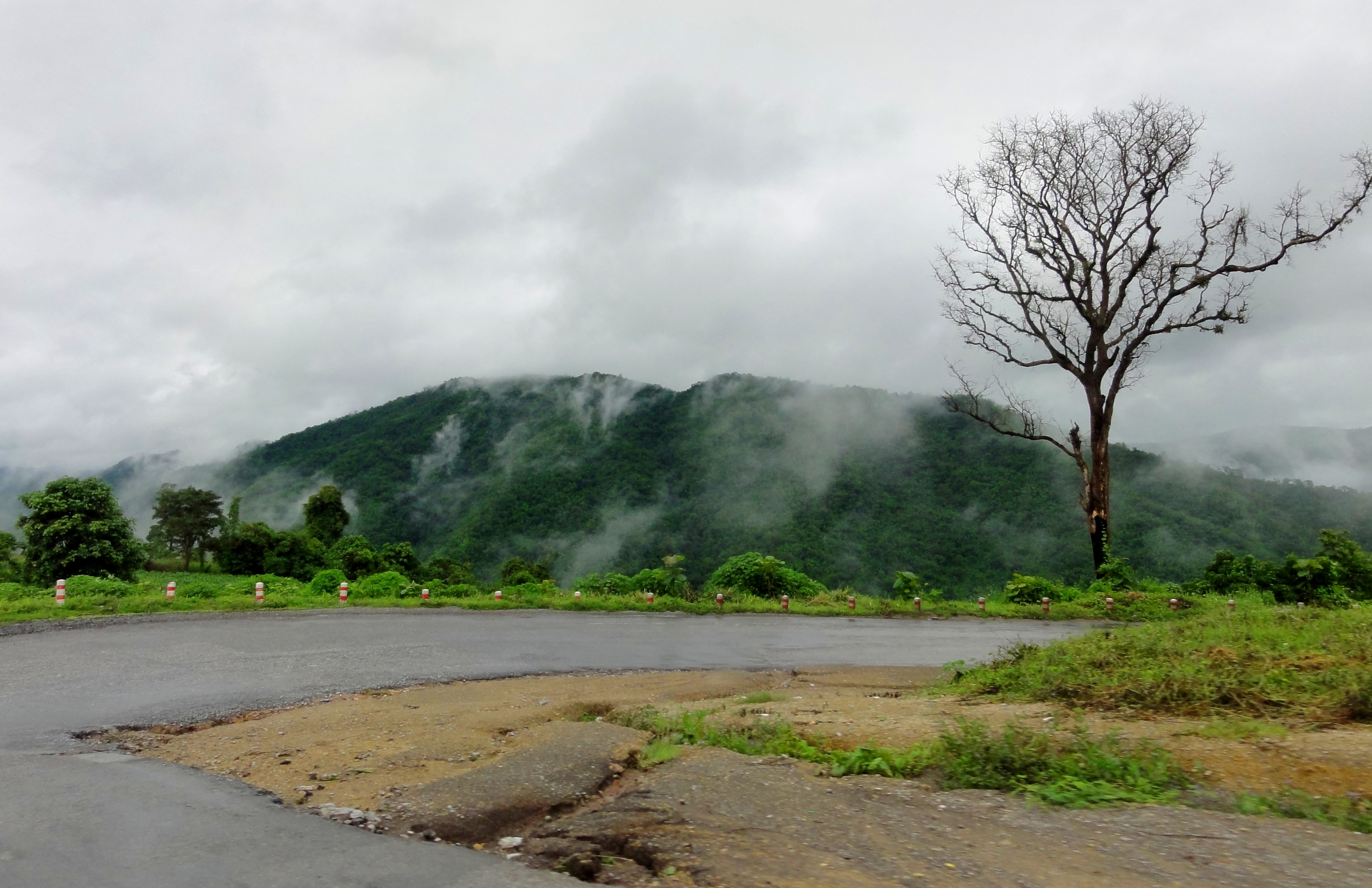
Misty mountains of mystery in Shan State.
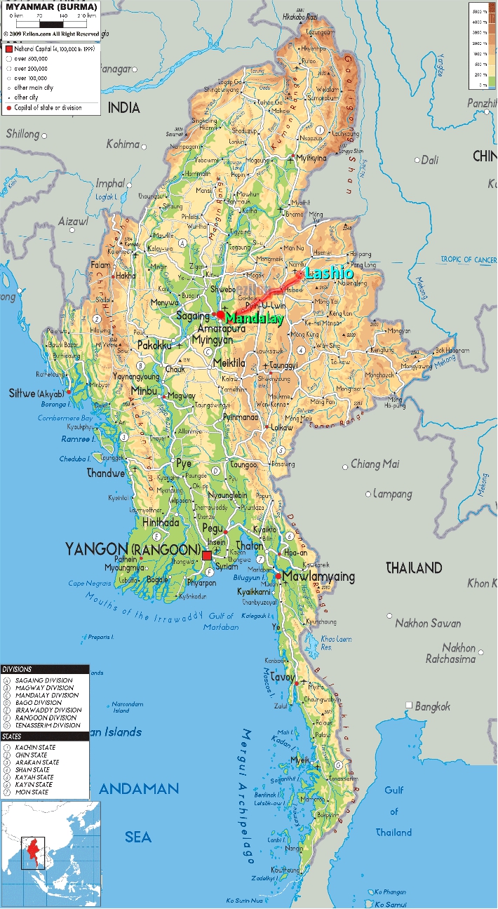
Our destination was the sprawling town of Lashio, located four hours' trip by car from the Chinese border, and deep in Shan State. We asked around a bunch of tour companies before hand about travel time to Lashio, and got answers from 4 hours to 6 hours by car, 6 to 8 hours by bus, and 12 to 16 hours by train. So really we weren't sure at all what to expect, we just knew we needed to be in Lashio that night, as we had a hotel reservation. We didn't want to end up on some sketchy local bus (we'd had enough fun with those in Lao) and the 16 hour train ride sounded not great, so we booked a private taxi and set off into the wild.
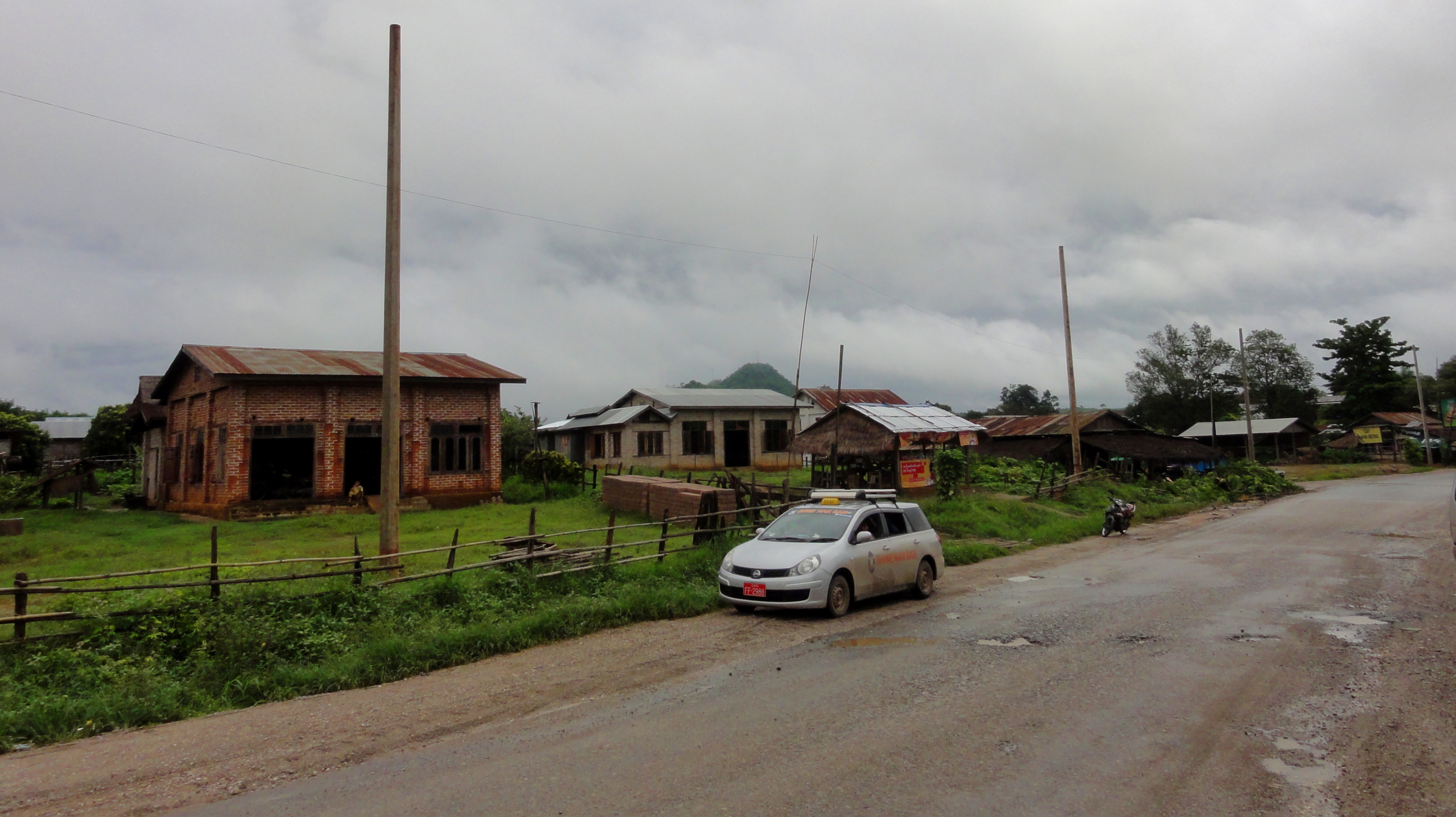
Stopped for lunch along the road.
Since the transition from the plains of the Irrawaddy to the Shan Plateau is so abrupt, the road between the two has quite a steep climb right outside of Mandalay. The road was quite steep, and extremely twisty and windy. Thankfully many stretches of it were actually split lane, with each lane sticking to it's own side of a small canyon. To make matters worse, the road we had to drive on to get to Lashio, the AH14, was the number 1 link between China and Myanmar, so truck traffic was extremely constant and thick. Right off the bat, five minutes up the road, we rounded a corner and saw our first accident, a truck that ended up on it's side. Sobering.
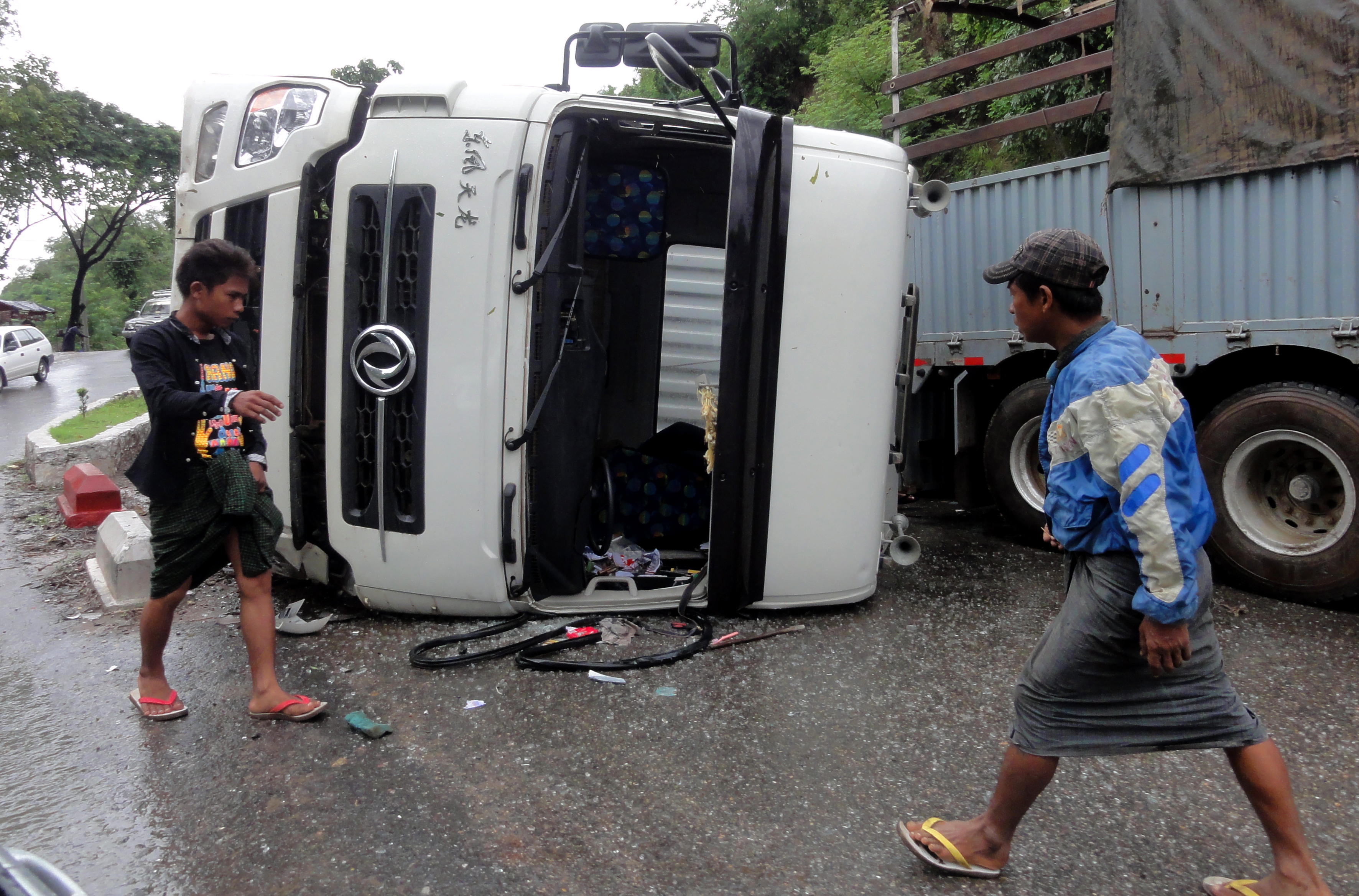
Truck on it's side.
|
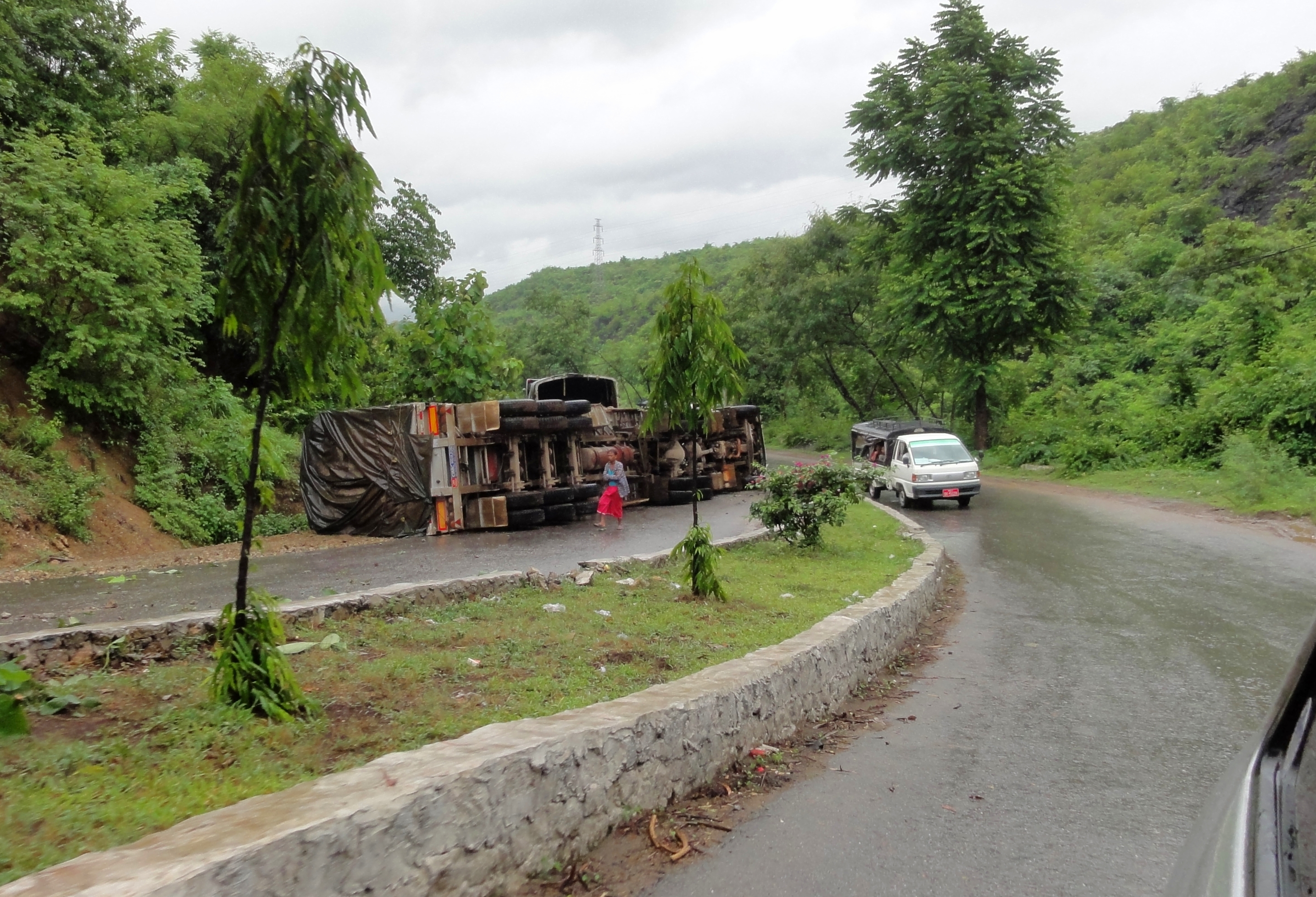
...and again from above.
|
|
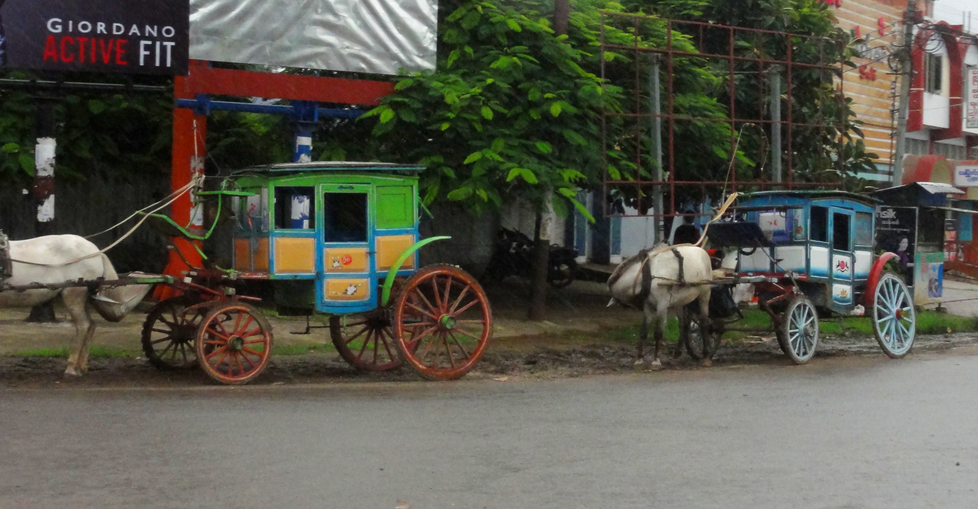
Pretty soon we ended up in the town of Pyin-Oo-Lwin, which was an old colonial British hill station, and currently home to the Defense Forces Academy, and a sizeable Burmese military base. Seems kind of coincidental to have one of the largest concentrations of military hardware, and the number one military academy, inside the Shan Plateau, but that's none of my business. Pyin-Oo-Lwin was nice because it was up in the pine trees, and the air was cool. Here, they utilized lots of horse-drawn carts to transport people and goods around, a small nod to the colonial heritage that has survived over the years.
|
|
Traffic Jam in the Gokteik
One thing I was looking forward to on this trip was the crossing of the Gokteik Gorge. A rather large gash in the limestones of the plateau, the Gokteik is most famous around the world for it's famed train bridge, known as the Gokteik Viaduct. Originally built in 1900, but later strengthened in the later part of the 20th century, this impressive bridge is currently the highest span of any bridge in Myanmar, at 335 feet above river level. It was the 2nd-highest bridge in the world when it opened, and had the tallest piers of any bridge in the world for almost 50 years. Although we wouldn't be crossing the viaduct, we would still get to see it, and the highway actually twisted and wound it's way down and back out of the gorge. So, in addition to seeing the bridge we would also get to see this impressive limestone gorge from the bottom up.
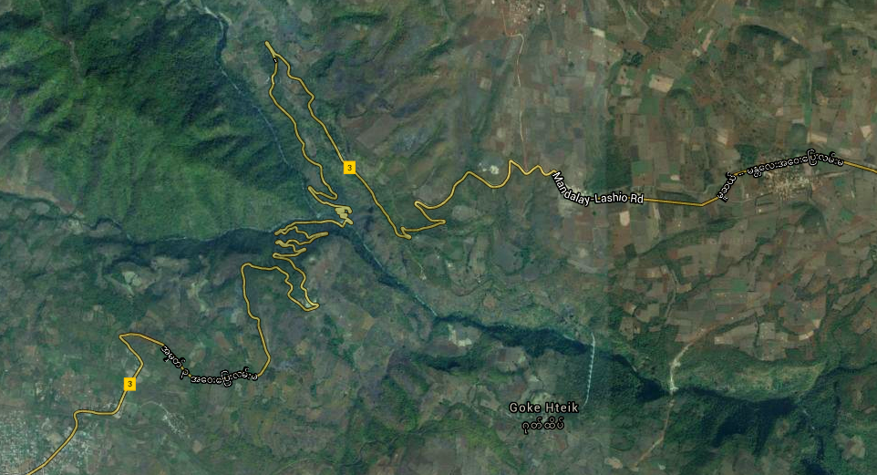
It doesn't look like that much but the gorge is easily 1,000 feet deep. Google Maps view.
So when we finally started dropping off the plateau, winding down, down, down through fields of corn and rolling grasslands, the feeling of about to drop off the edge of the world started coming up. I could see some far off cliffs that looked like they could be the opposite wall of a massive canyon, and sure enough, we finally rolled around a series of corners, and there it was in front of us: a dark green wedge through the rolling jungle and grasslands. We couldn't the bottom from our position, but we could already tell we had a long way to go. So, pausing momentarily to snap a bad photo of the bridge, we quickly dropped down into the gorge.
Gokteik Viaduct from afar.
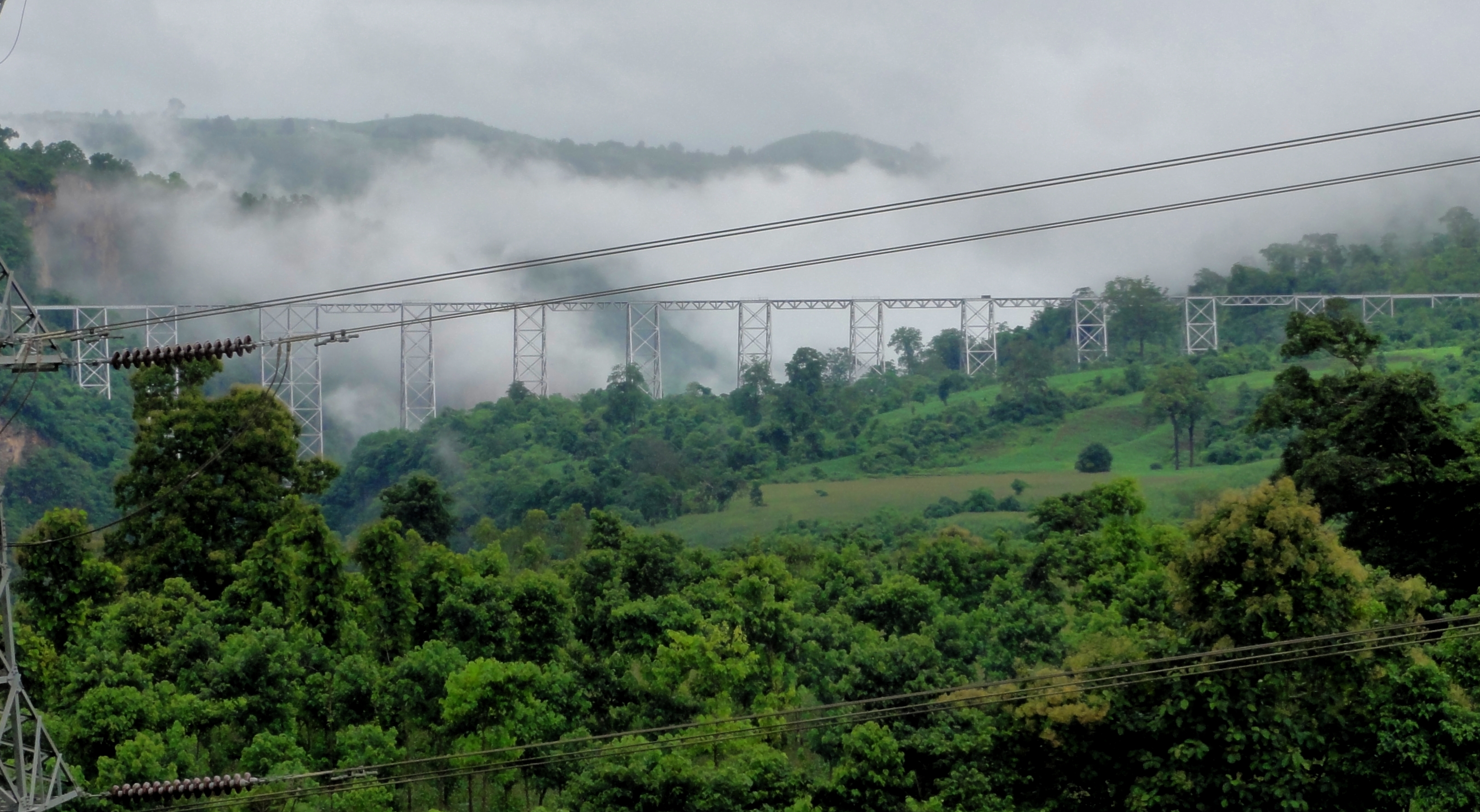
And from a little closer, stupid powerlines....
|
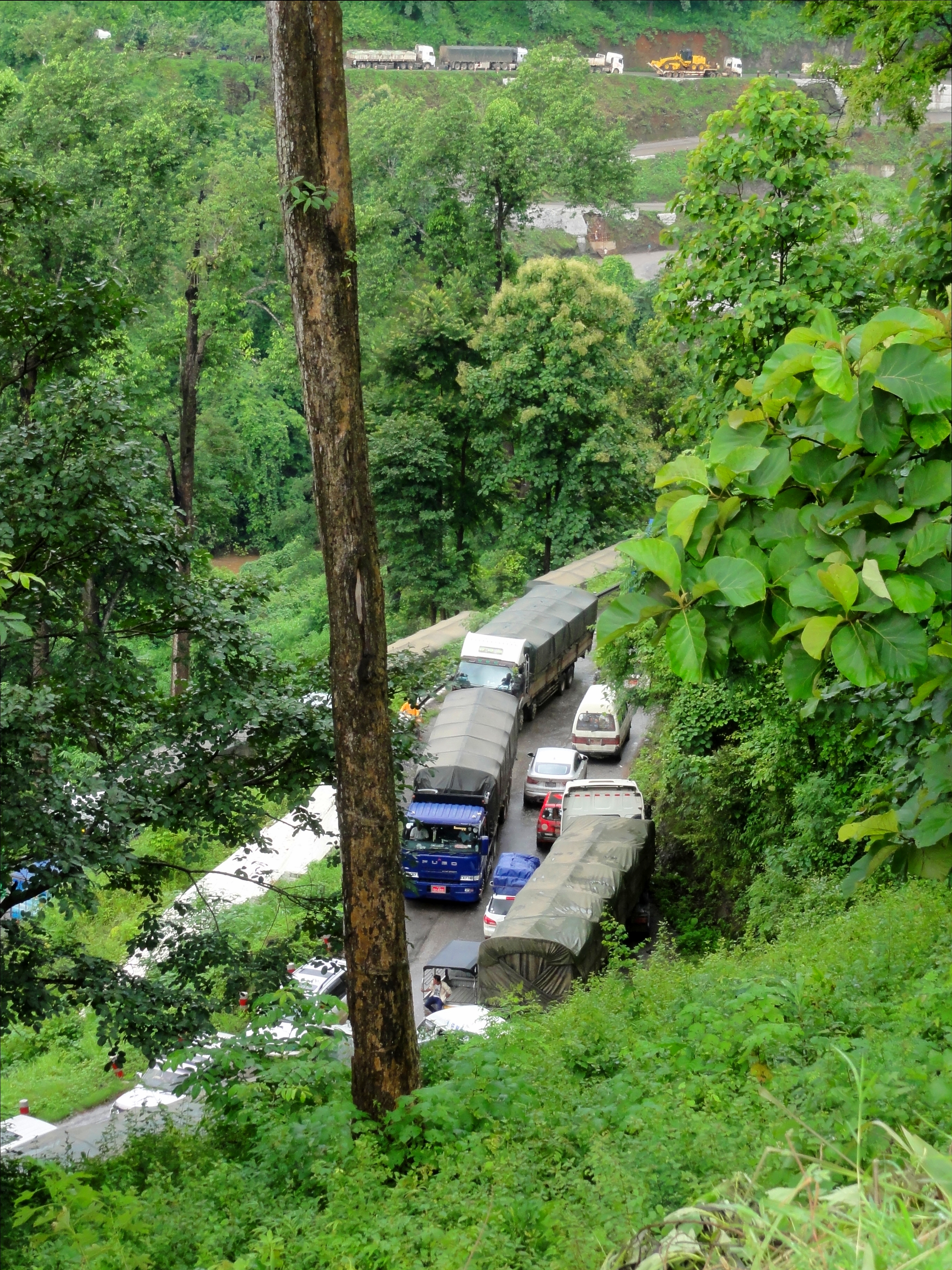
We only made it a few more corners down the road until we came upon this ->
....a massive traffic jam that, if you look closely in the photo, extended up the far side of the canyon at least as far up as we were right now. There must have been hundreds of vehicles stopped, from taxis like ours, to small trucks and giant lorries, and shuttle buses and full size coaches. To this day I am still not sure why we were stopped, but our car didn't move for an hour. Fortunately we had stopped in a place where we had a good view of the gorge, so it was nice to be able to shoot some photos while we waited for the mess to clear out, especially of the caves across the canyon. 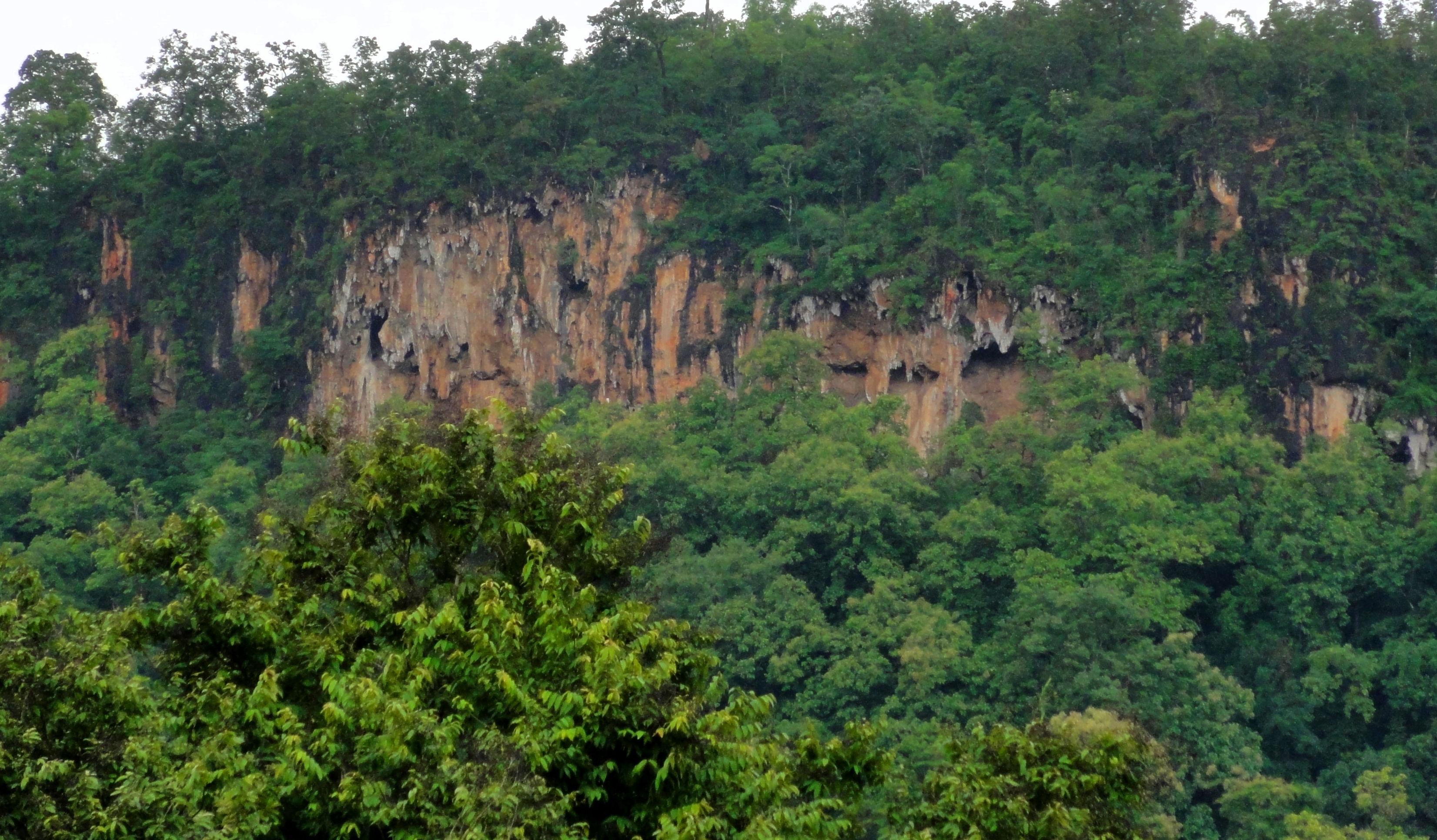
Caves high on the opposite wall.
|
If you look closely you can see traffic stopped on the other side of the gorge.
|
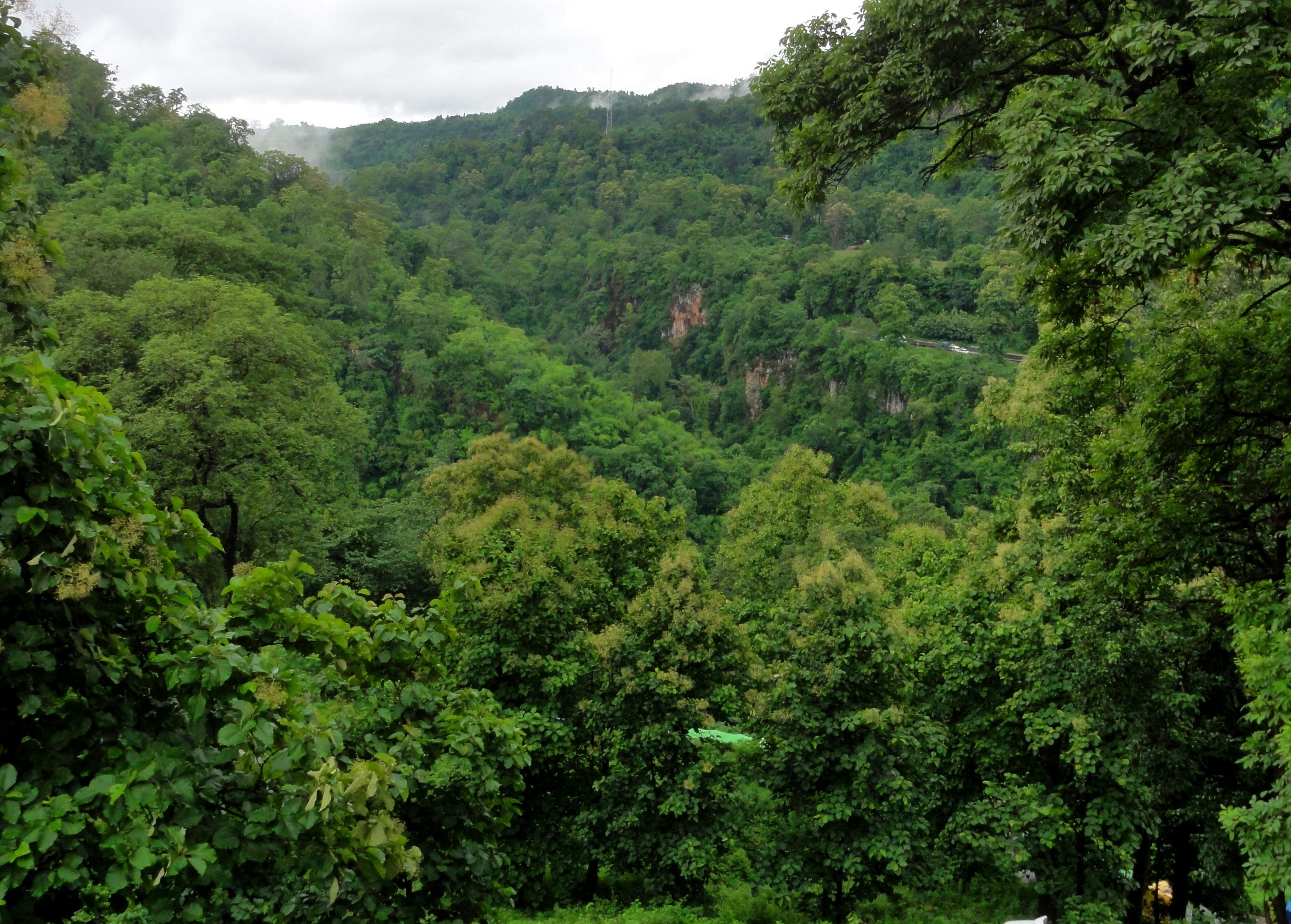
Gokteik Gorge running from left to right, with a tributary canyon coming in from the opposite side in the middle of the frame.
Waiting...
|
Kelsey while waiting...
|
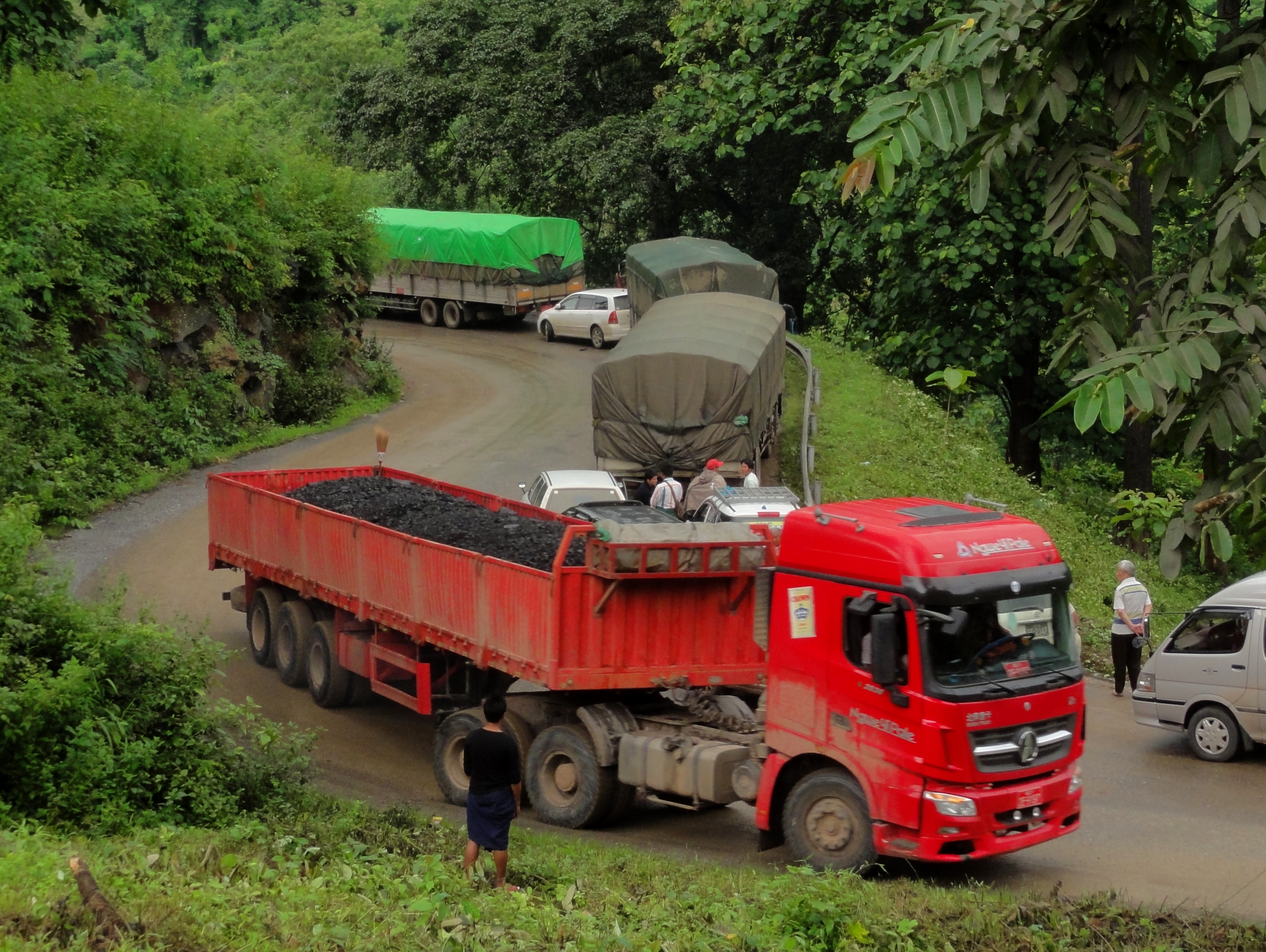
Chinese coal truck.
|
...and finally chugging up the other side!
|
|
Of course, once we were back in the car and moving, it wasn't like we were moving fast, as we were now in a scrum of hundreds of vehicles, and our pace down to the river bottom and back up the other side was measured out quite slowly. However, the further we got from the gorge, the better it became, and within 30 kilometers we had found the open road again and were cruising at 80 kmh. I wish we had stopped for a photo or two along this stretch. Here we were rolling across open plateau, with hills off in the distance, and mountains and clouds hiding in the background. It was a very wild place, and felt very much like we were really driving into the unknown. It was very mysterious and seemed like we were driving to the ends of the earth.
|
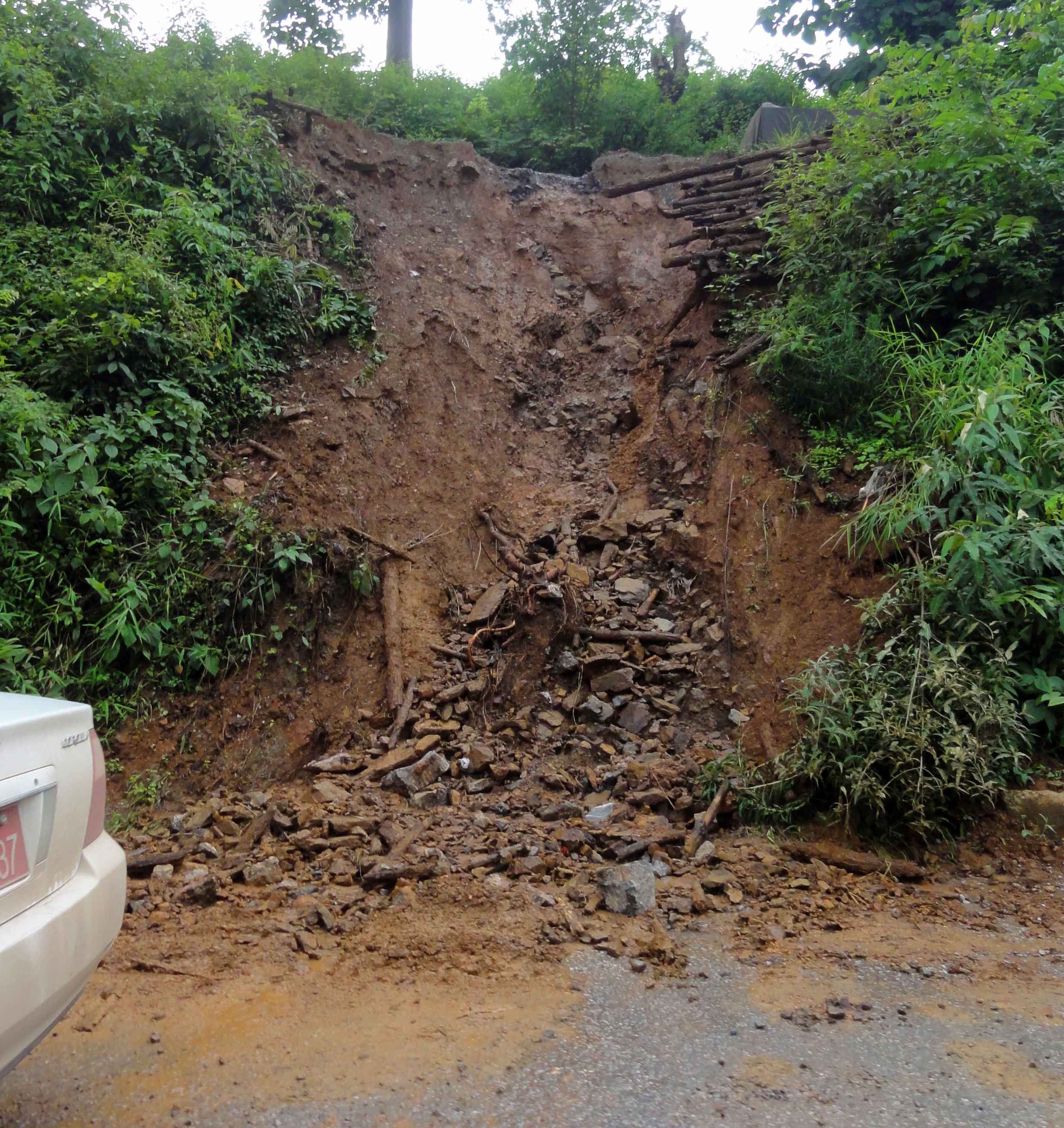
Small landslides everywhere.
|
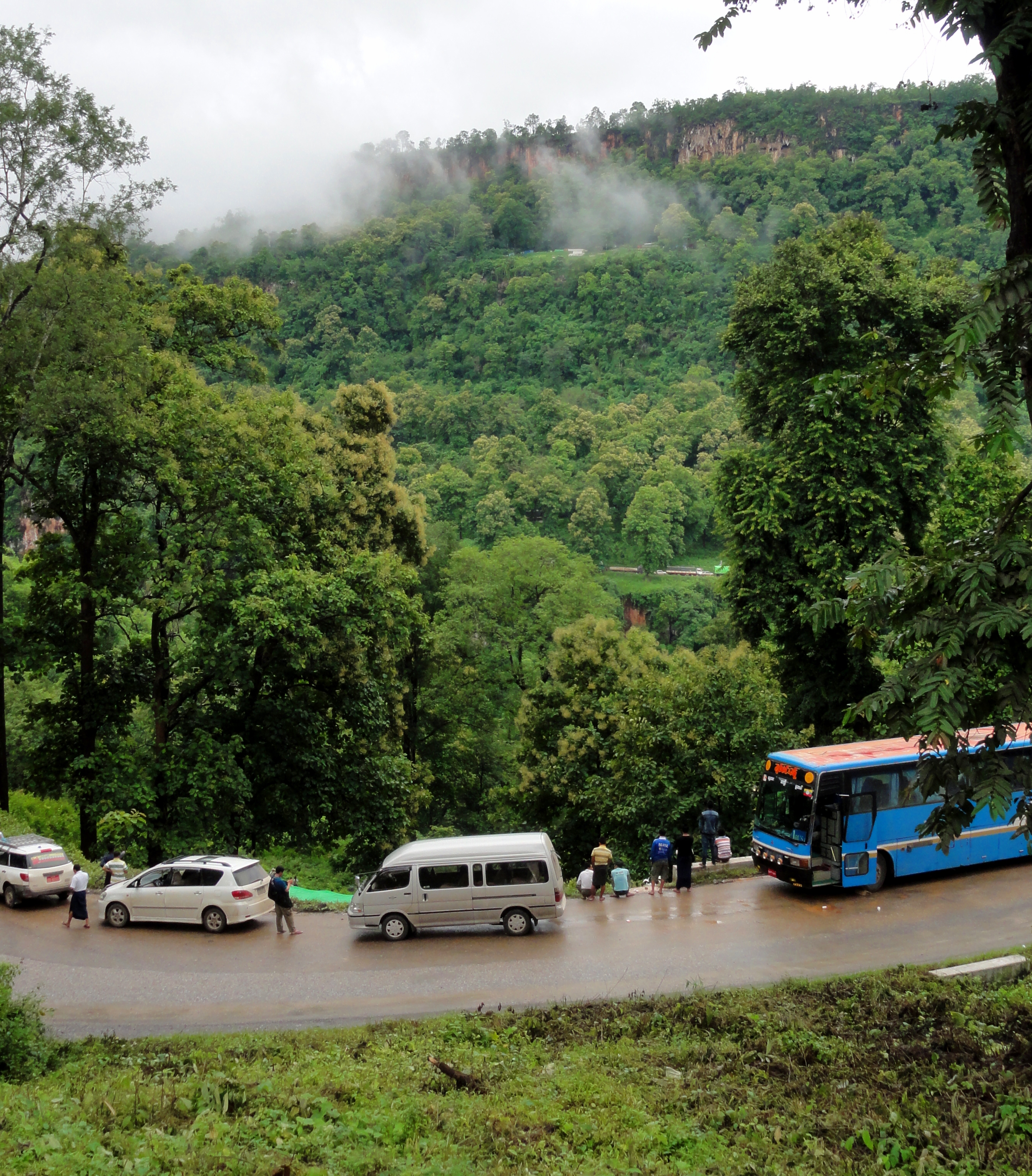
Another feature of the drive that made us feel like were going somewhere really wild was the number of checkpoints we had to go through as we drove. The biggest one is just west of the Gokteik, and was quite serious, with random car searches, and numerous soldiers from both the Burmese army and Shan State Army milling around, with AK-47s around their soldiers. It was quite clear that we were entering areas controlled not by the national military, but by the Shan State Army.
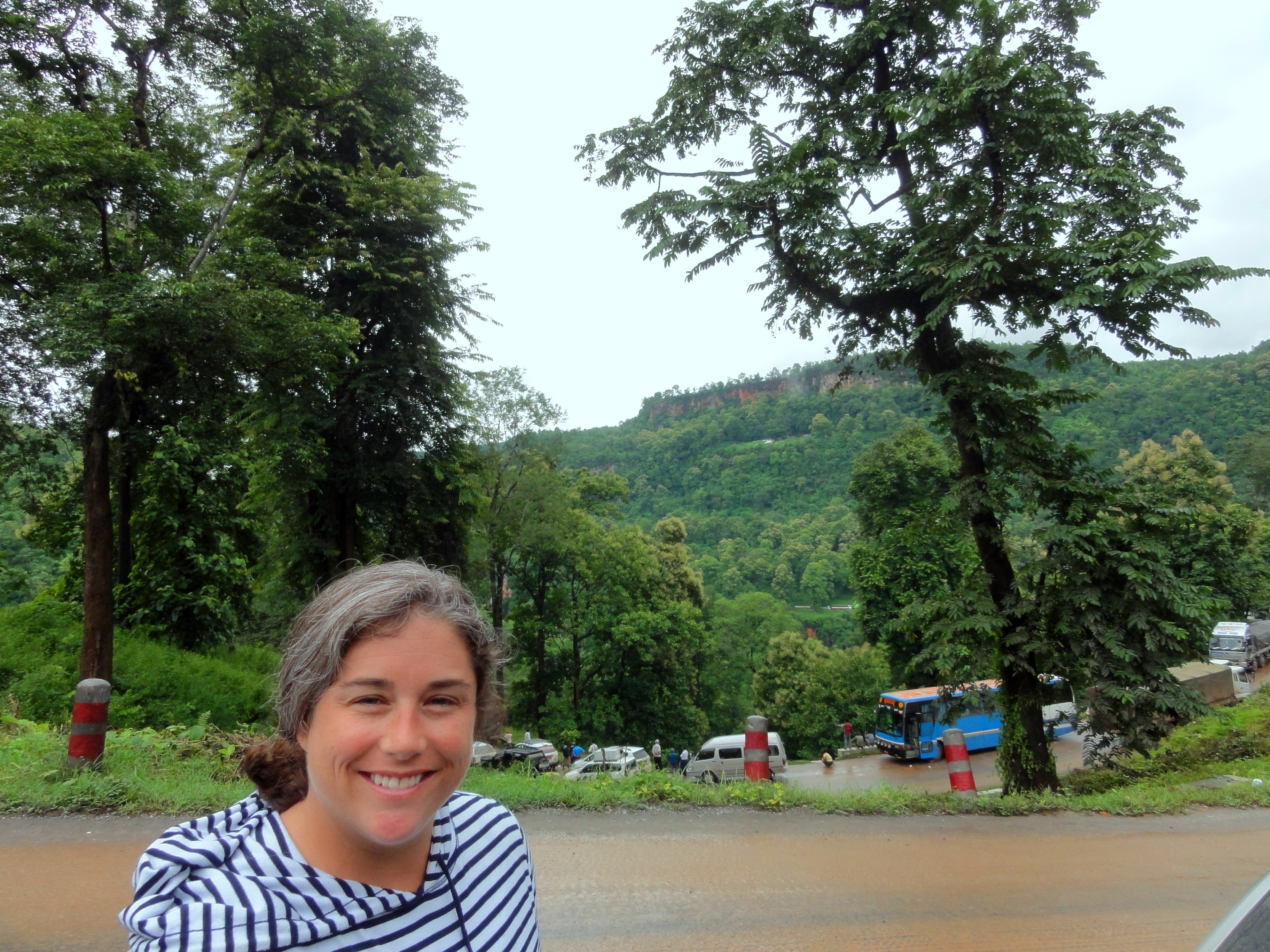
Soon enough we rolled into a small town stopped for some lunch. We were about 5 hours into our quoted "six hour drive" to Lashio, and by way of the map we figured we had come about halfway. Still, it was only 1 pm, and we figured now that we had crossed the mountains, and got through the Gokteik Gorge, the map made it seem like everything was pretty easy from here on out, so we thought the rest of the trip would be quick and uneventful. How wrong we were!
Soon enough we rolled into a small town stopped for some lunch. We were about 5 hours into our quoted "six hour drive" to Lashio, and by way of the map we figured we had come about halfway. Still, it was only 1 pm, and we figured now that we had crossed the mountains, and got through the Gokteik Gorge, the map made it seem like everything was pretty easy from here on out, so we thought the rest of the trip would be quick and uneventful. How wrong we were!
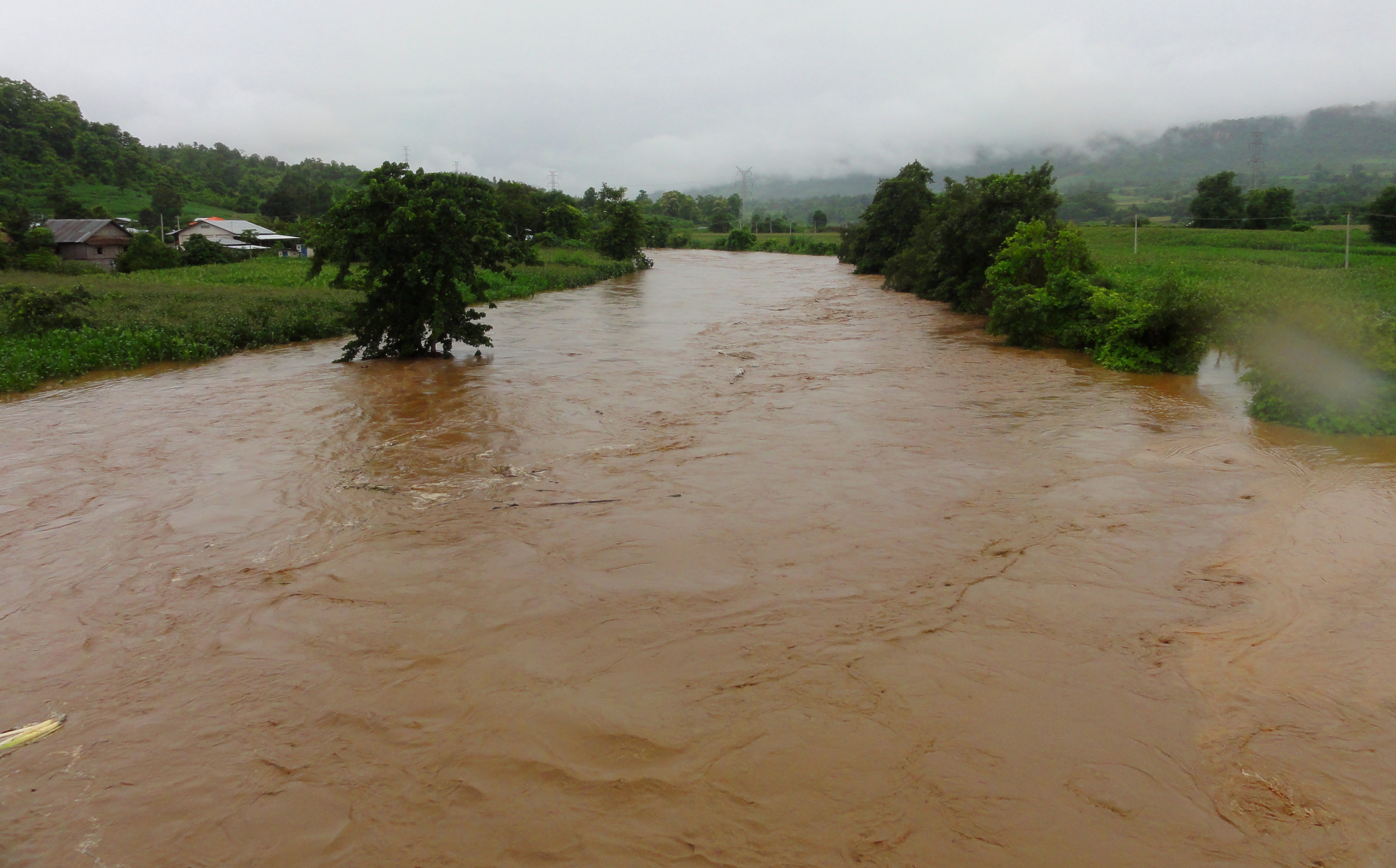
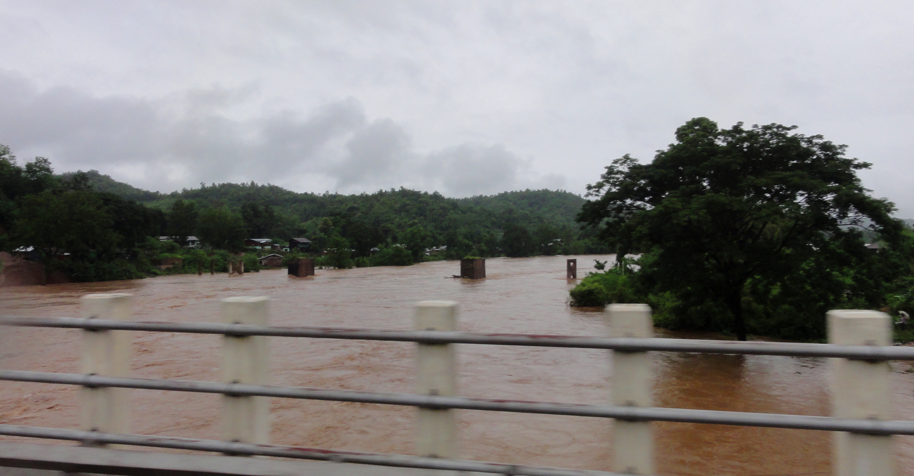
Dokehtawady River Flooding
The river was quite close to the bottom of the bridge.
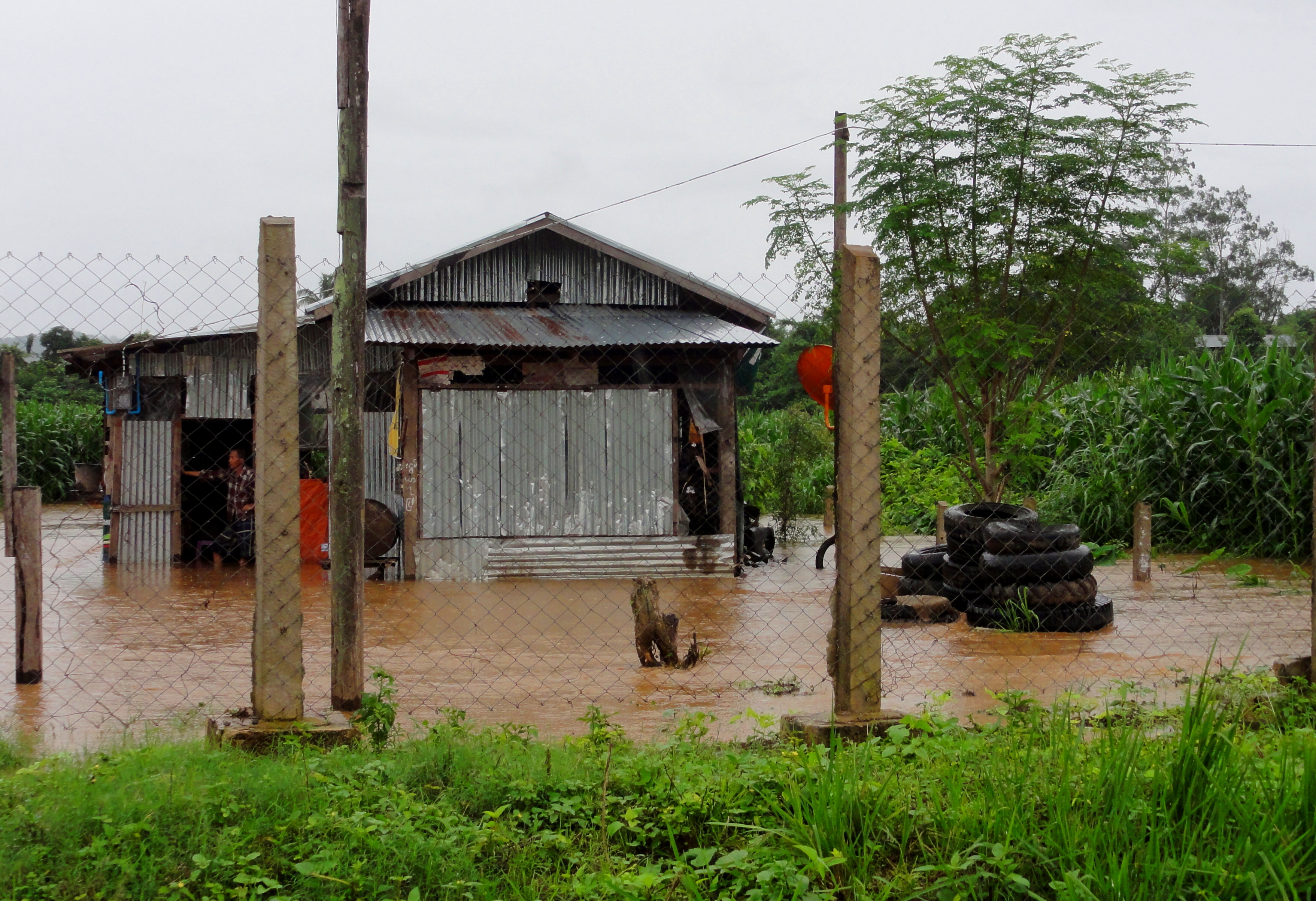
After lunch, we piled back in the car and headed out. As we continued east, we eventually rolled off the top of the plateau, and started heading down into a valley. Rounding a corner, we suddenly had a view of an beautiful, green, flat-bottomed valley, with a brown river twisting through it, and it was clear that the river was flooding big time. Over it's banks and filling the neighboring fields with water, we oo'ed and ah'ed, but didn't think much of it at the moment. A few minutes later, we were down in the valley, and crossed over the same flooded river on a bridge, and quickly came to halt in a long line of stopped cars. The river drained the hills and mountains north of us, and we quickly put two and two together and realized that the super intense rain storm we got hit with the day before in Mandalay, was responsible for this flood as well.
When we drove through a few days later the tree on the left was out of the water.
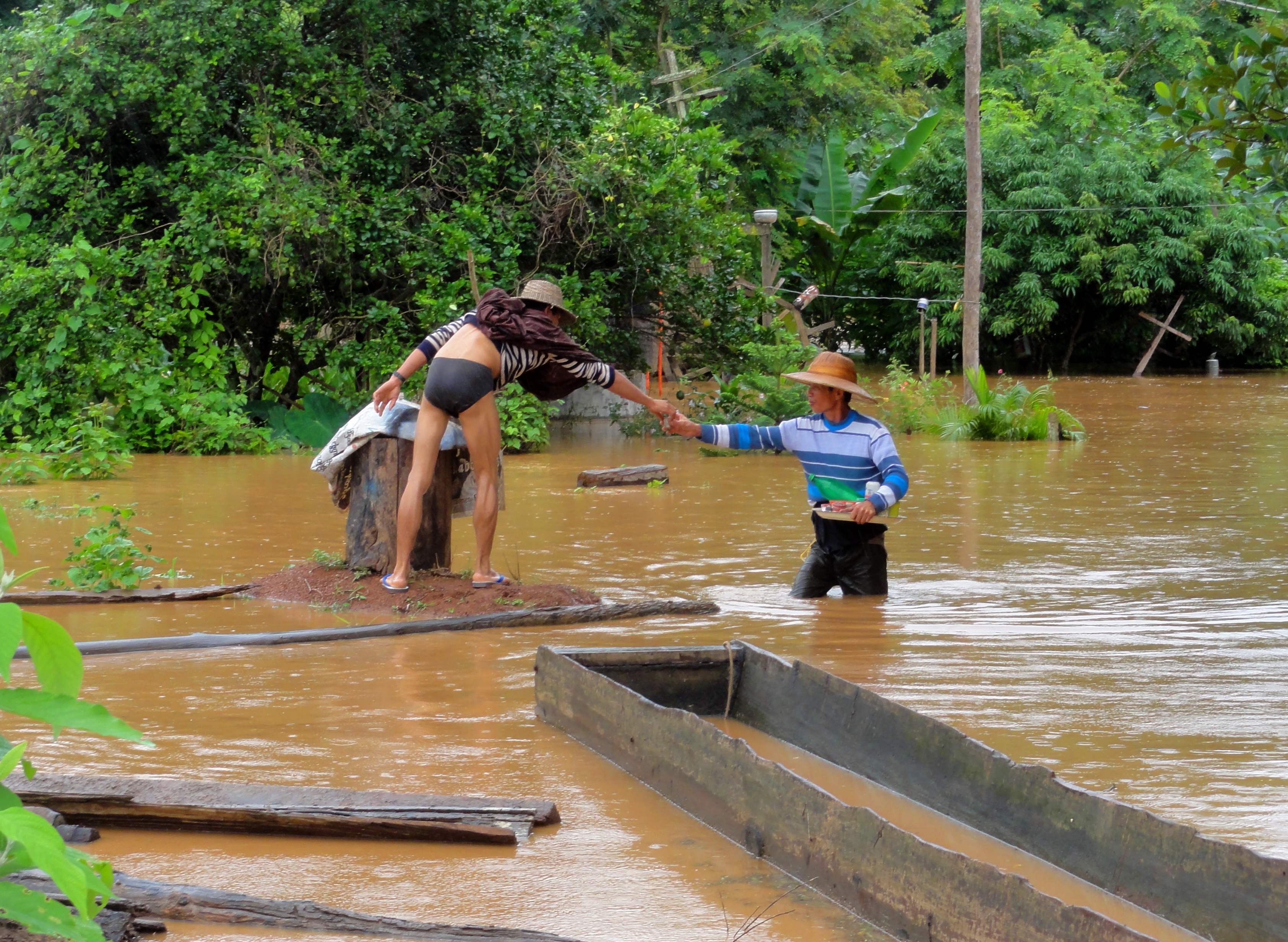
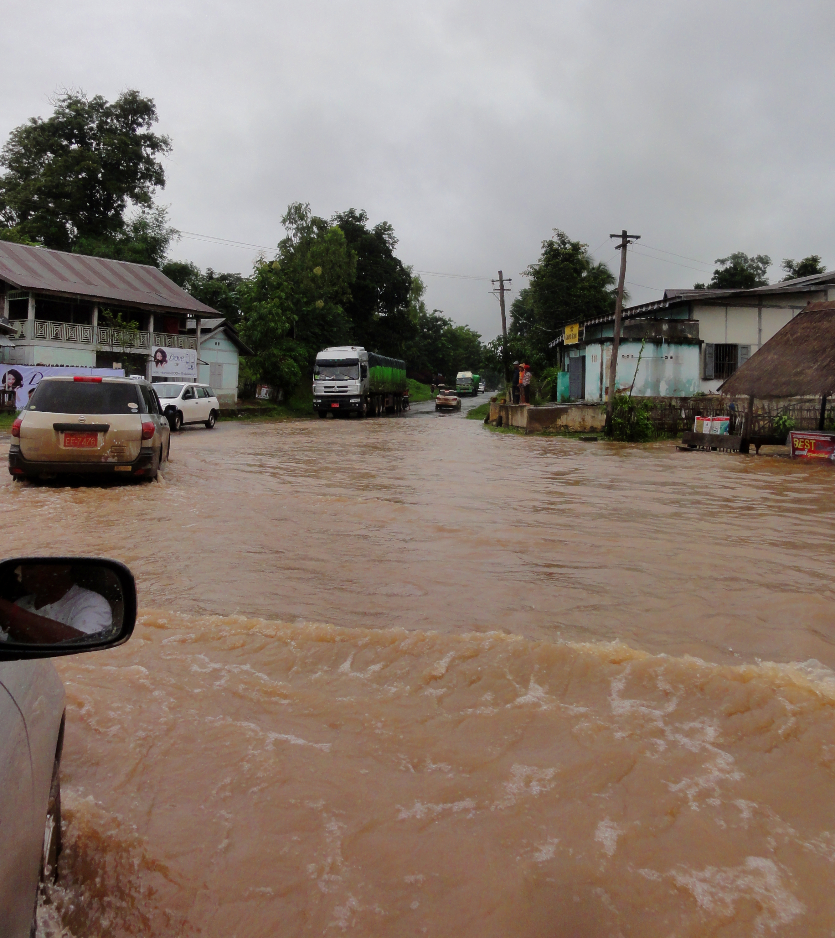
We got out of the cars and walked a little ways down the road to see what was going on. As it turned out, since the flow had overrun the banks, a separate channel had formed to . We stood around for about 15 minutes, wondering what to do, before deciding to risk it and try and drive through it. Fortunately, this crossing didn't seem to be that deep, and we made it across without incident. However, further along the road, we soon came to a stop again, this time in a much larger pack of traffic. Figuring the river was over the road again, we got out of the car and started walking. We had to walk almost a quarter kilometer to get to the flooded area, and the number of cars, buses, and trucks that were stopped was pretty remarkable. The flooded pool itself was quite large, perhaps 75 meters, and the word from locals crossing it on their motorbikes was that it was just under a meter in depth. At the moment, too deep for our simple car taxi to cross, so we had no other option but to wait.
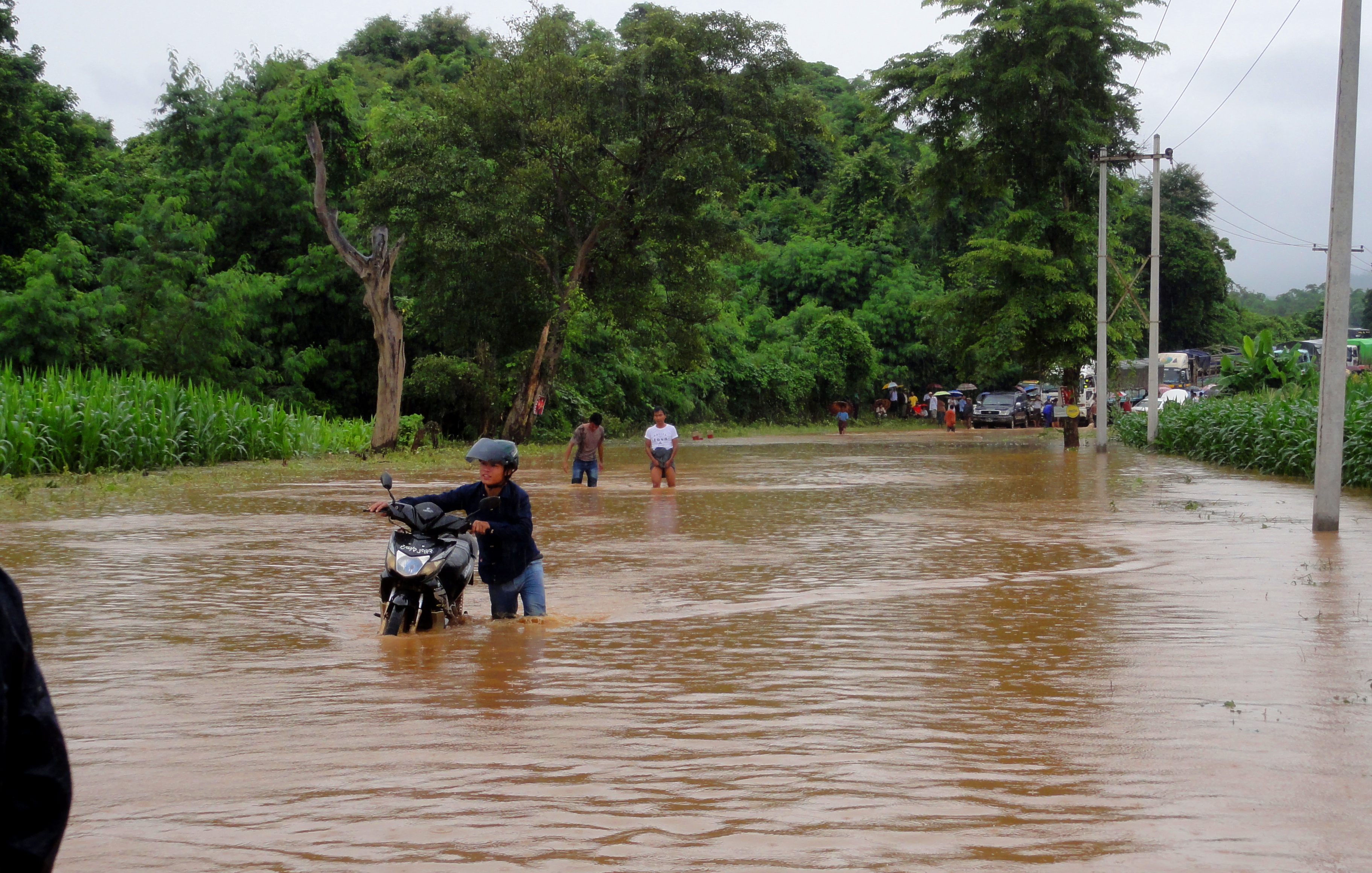
The big lake that made us wait for two and a half hours.
We held a brief council of war to figure out our options. It was now roughly 2 pm. Our driver (and our other passenger), who was from Lashio, was content to wait for the water to drop, however long that would end up being. We had the next four nights reserved and paid for in Lashio, but we weren't honestly sure if we were going to get to Lashio. Our driver said we were about 5 kilometers west of Hsipaw, and that Lashio was only 40 kilometers beyond that. So, we weren't far......should we wait, or try and catch on a bus headed the other direction and go back to Mandalay with our tail between our legs. Since it was only 2 pm, and we had roughly 5 hours of daylight left, we figured we could at least wait a few more hours and see what happened, before we would need to make a decision. So, we sat tight, alternating between reading in the back of the car, and going and checking the flow, and generally milling around. With the huge number of vehicles stopped, and all of the local farmers out and milling around, there was a little bit of a carnival atmosphere around.
A little wet but life as usual in Myanmar.
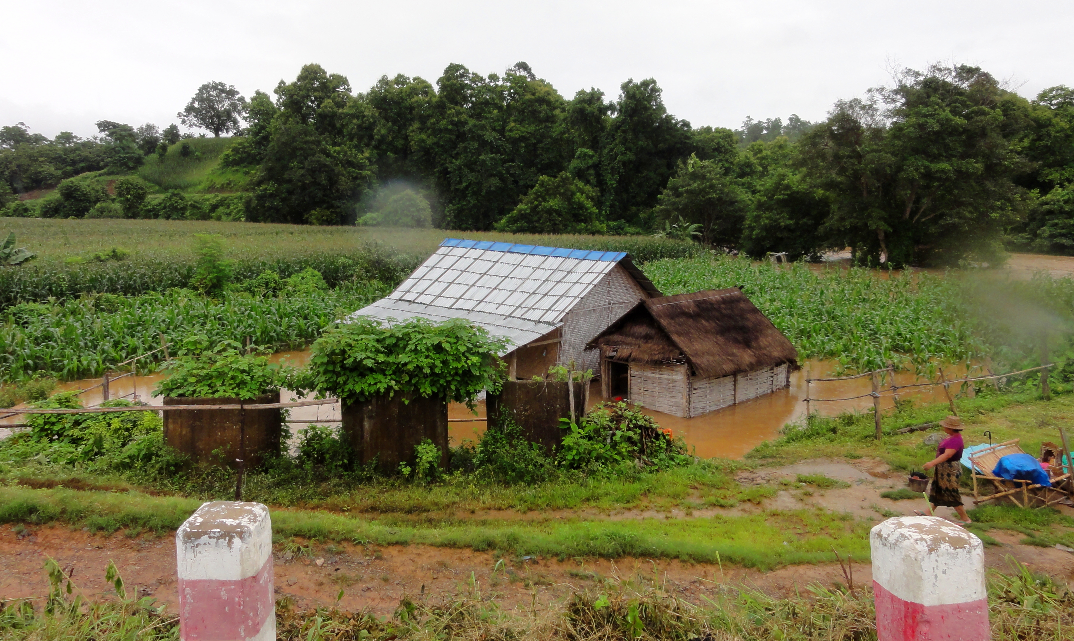
Local farm flooded.
|
And another.
|
Smaller crossing between the two above.
|
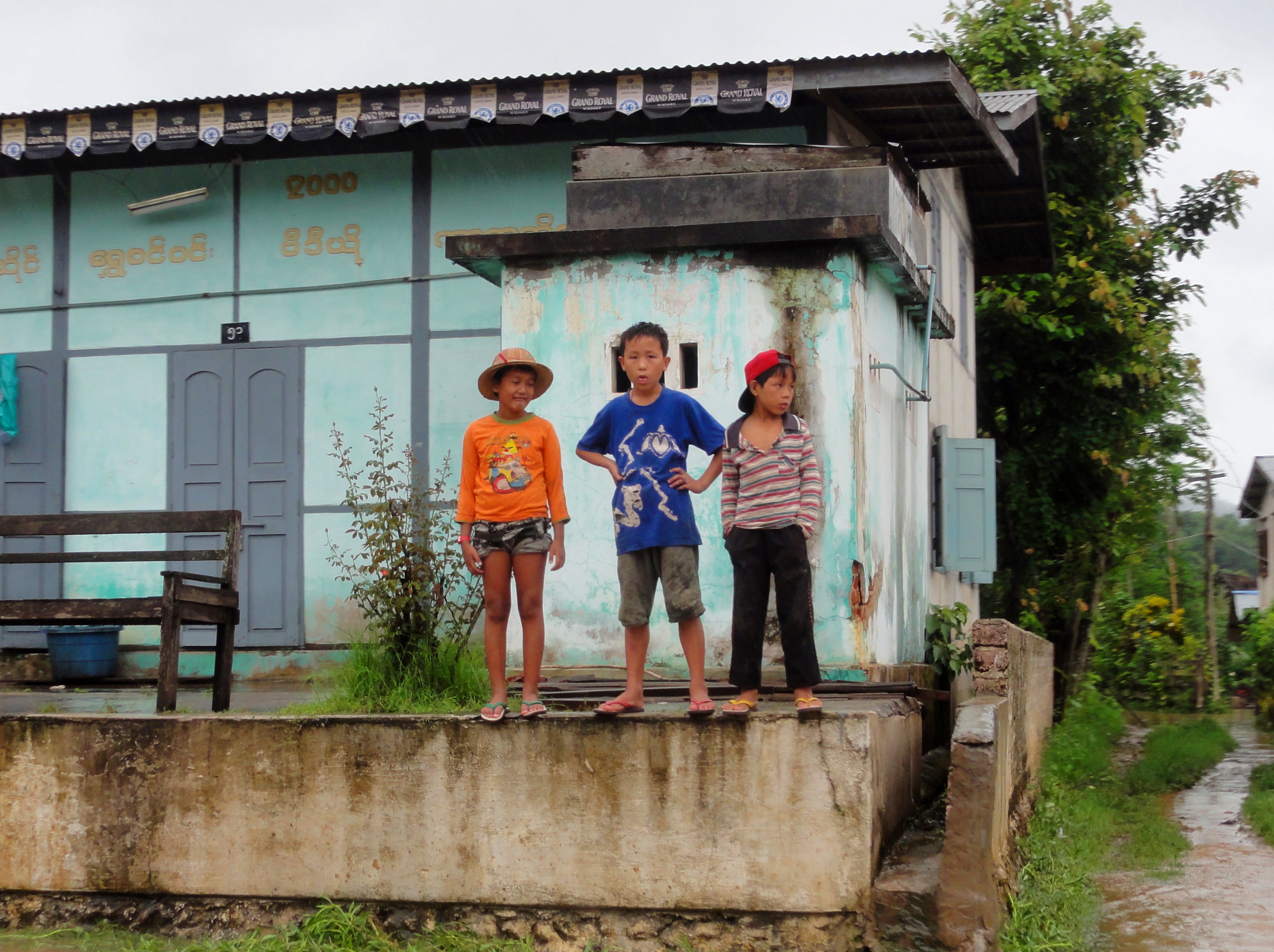
Local boys watching the action.
|
About an hour into our wait, the soldiers of the Shan State Army showed up to take control of the scene. They were quite friendly and were interested in seeing how they could help. Unfortunately there wasn't that much to be done at that point, so just like the rest of us they settled in to wait. After about 90 more minutes, or 2.5 hours into our wait, a truck came chugging along headed the other direction. It had successfully crossed the water! Finally, timidly, several other vehicles began to make the crossing as well, and it was quickly realized that the water had indeed dropped enough so that most vehicles could start to get through. Slowly, we approached the water, took it nice and gentle, and before we knew it, we were high an clear on the other side! Yay! On to Lashio!
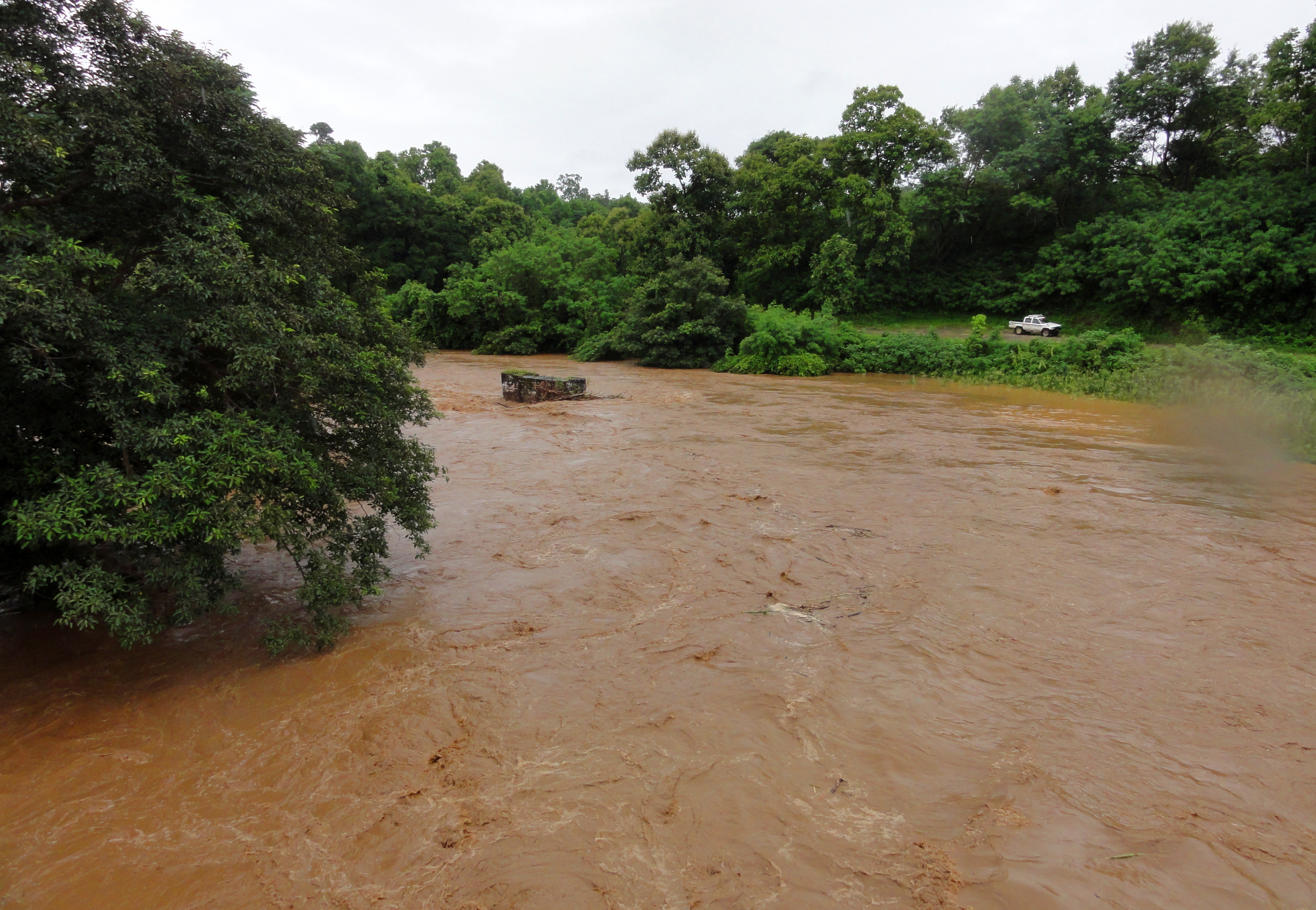
Another shot of the Dohketawady, this time near Hsipaw.
On to Part IX - Lashio...
All photos copyright Kit Davidson, unless otherwise cited.
