Blue Water Desert Treasure
|
Put In: Just below Joe's Valley Dam
Takeout: end of gradient & canyon Length: ~ 3.5 mi Flow: min (solo boats): ~180 cfs min (rafts): no rafts max: ~2000 cfs Rating: III+ (IV) |
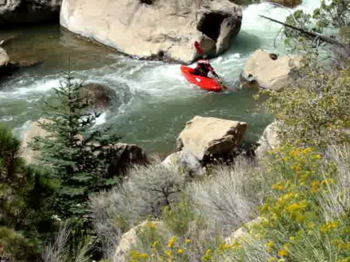
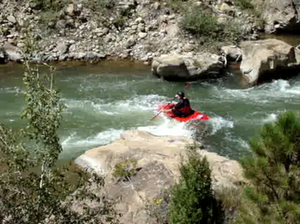
Busy water in the middle.
|
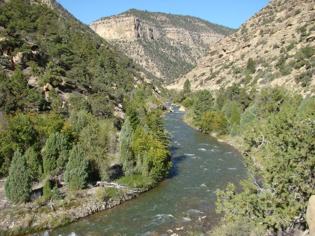
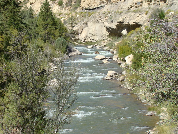
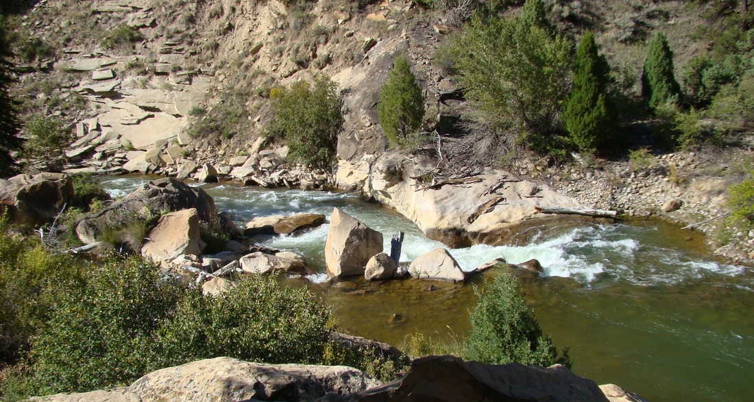
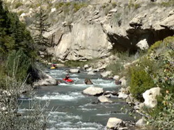
Aside from it's notable "classic" desert multi-day trips, Utah is not really known as a kayaker's best friend. Of course, there are some gems here and there, and there are some areas that are holding, such as the Western Uintahs and the northern Wasatch Front, but on the whole Utah is known much more for it's desert landscapes and not it's riverine corridors. One of the gems that exists carves it's way out of the southern Wasatch Plateau and into the San Rafael Swell is Cottonwood Creek, one of the main tributary streams of the San Rafael River. In the middle part of this watershed there is a large artifical lake called Joe's Valley Reservoir, which was built at the head of a beautiful, five mile long sandstone canyon, and the section of creek that flows through this canyon is a beautiful slice of class III and IV complete with clear blue water.
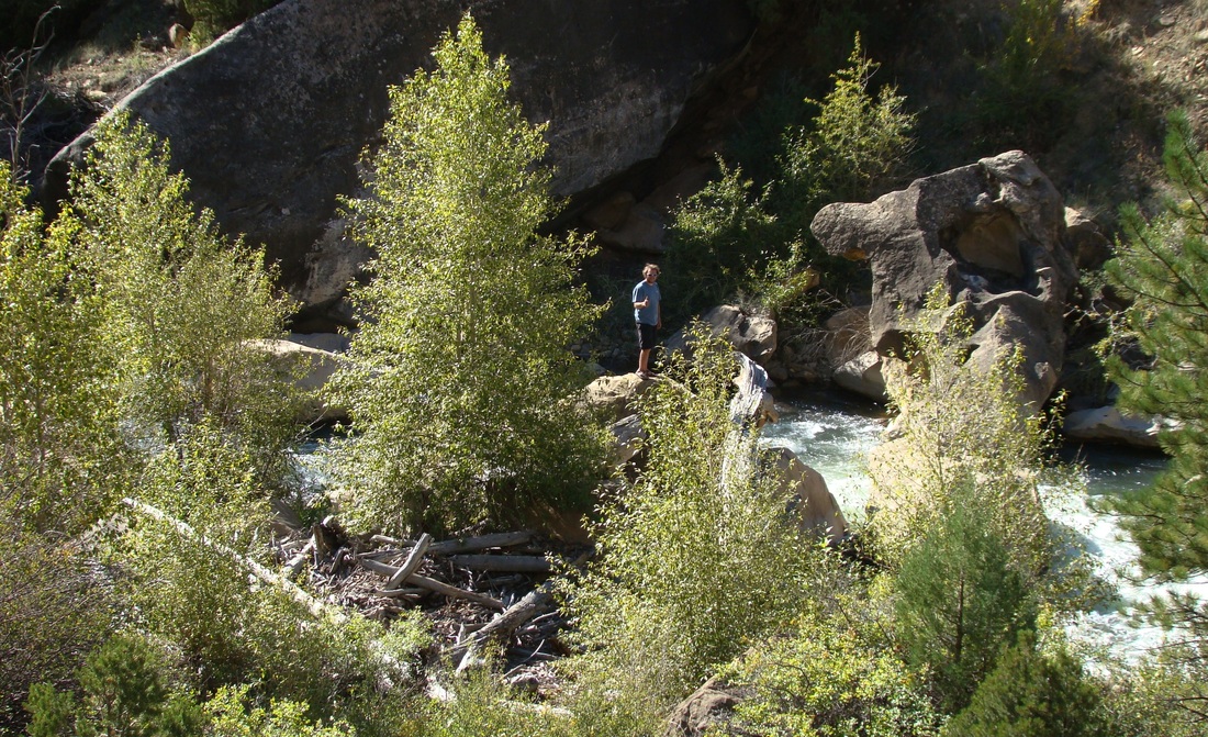
Looking up canyon from the bottom. PK Davidson photo.
The creeks that come out of the southern Wasatch Plateau are a little sediment filled, but still fairly clear, so when they hit the reservoir, they lose their sediment load, and the water that comes out the bottom into the creek is amazingly clear. It seems to be a little more blue in color than most streams too, so the creek is like something like you'd see in the Sierra Nevada of California, or Norway, crystal blue and completely see through. The whitewater has such a pure white to it, and it feels so soft as you splash through it.
The canyon itself cuts through Cretaceous era sandstones, and while it is a desert canyon, it is also different from typical desert canyon as it has lots of ponderosa pines and other desert shrubs and bushes covering the rocks, adding a level of greenery to the canyon. The eastern edge of the Wasatch plateau is like that, and all of the canyons that descend through it north and south, Muddy, Ferron, Huntington, etc, all look like this. So with a creek that looks like something right out of Cali, and a fairly rare desert-yet-green canyon, you can understand why this is such a gem.
The canyon itself cuts through Cretaceous era sandstones, and while it is a desert canyon, it is also different from typical desert canyon as it has lots of ponderosa pines and other desert shrubs and bushes covering the rocks, adding a level of greenery to the canyon. The eastern edge of the Wasatch plateau is like that, and all of the canyons that descend through it north and south, Muddy, Ferron, Huntington, etc, all look like this. So with a creek that looks like something right out of Cali, and a fairly rare desert-yet-green canyon, you can understand why this is such a gem.
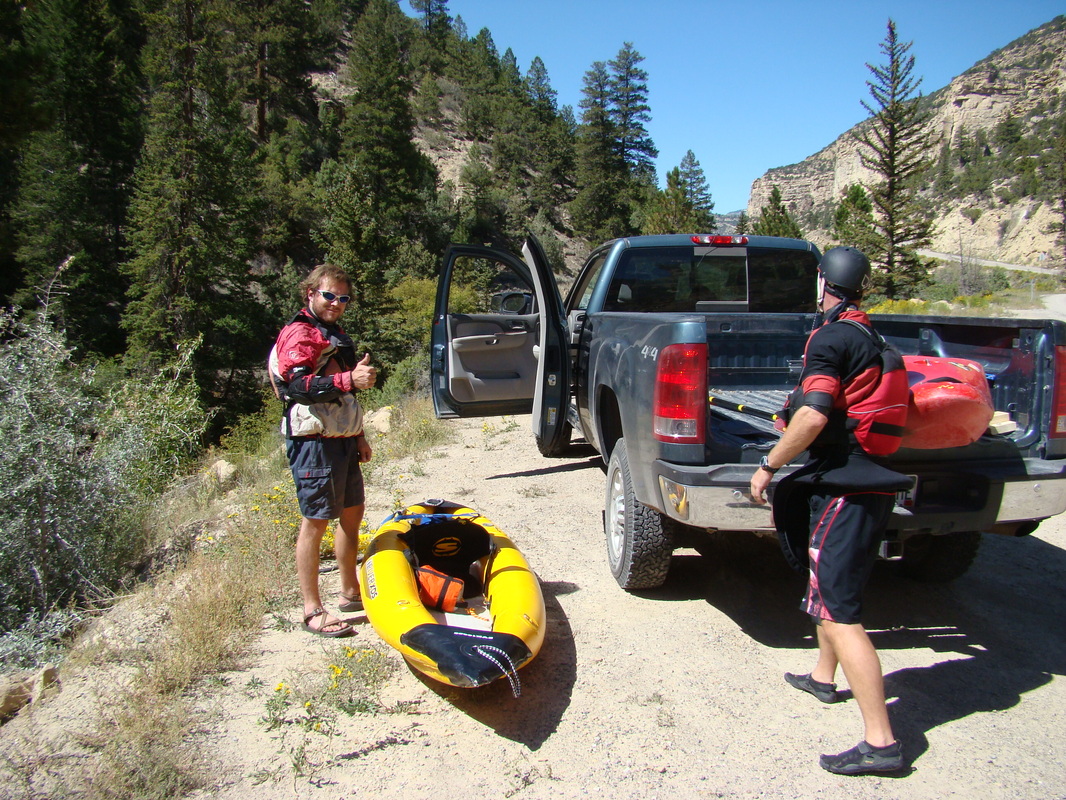
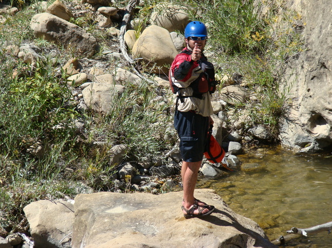
Getting ready to put on. PK Davidson photo.
The only downside of the run is that flows are often too low to run. Despite the extra greenery, this is still a desert, and there isn't a whole lot of water to go around. The creeks that drain the eastern side of the Wasatch Plataeu have been tapped heavily for irrigation, and there is a complex network of reservoirs and canals that criss cross the area and provide water for the power plants and coal mines in the area. To get good flows you have to look at the series of "teacup" diamgrams on a friendly website courteously provided by the Emery County Water Conservancy District. For this creek to run you need to have to proper amount of storage in the other reservoirs of the project, and an ample snowpack above. Given that it is a desert, those flows are somewhat uncommon, making this a rare treat.
We were able to catch this run in early September, which is very rare. The reason we were able to is due to an error in flow storage during the summer; too much water was held back in Joe's Valley during the summer months, and when the fall came around, the numbers didn't quite match up and more water ended up needing to be released, so they announced a 200 cfs flow window for a couple of weeks, and as soon as I heard that we dropped what we were doing and headed over. I put the word out on some whitewater forums I am a member of and was able to meet up with an awesome and friendly guy named Tim VanHaitsma, who came out from the Wasatch Front, for a fun midday run.
We were able to catch this run in early September, which is very rare. The reason we were able to is due to an error in flow storage during the summer; too much water was held back in Joe's Valley during the summer months, and when the fall came around, the numbers didn't quite match up and more water ended up needing to be released, so they announced a 200 cfs flow window for a couple of weeks, and as soon as I heard that we dropped what we were doing and headed over. I put the word out on some whitewater forums I am a member of and was able to meet up with an awesome and friendly guy named Tim VanHaitsma, who came out from the Wasatch Front, for a fun midday run.
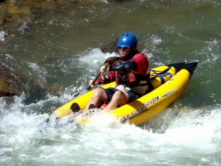
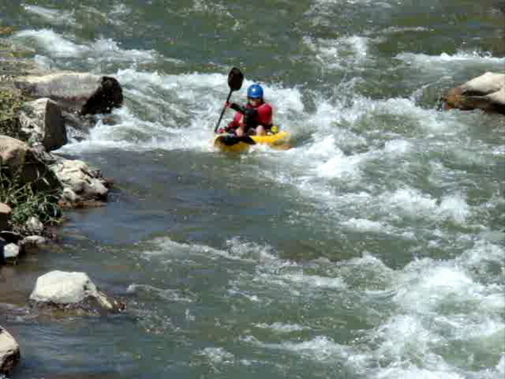
Tim in the mess of it.
|
Me finishing up "Two Tongues" Rapid.
|
You can technically put on close to the base of the dam, but it involves either driving down a technically closed and off limits road or hiking down that same road if the gate is down. There is a short stretch (perhaps 1/3 of a mile) of whitewater for a reward for that. Otherwise put on at the put in at that confluence. Whitewater starts right below this, and the big drops come spaced fairly evenly after that, mixed in between sections of fast flat and class II rapids. There is a fair amount of gradient, so the creek clips along at a good pace.
Splashing through some easy waves.
|
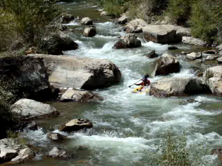
More busy water.
|
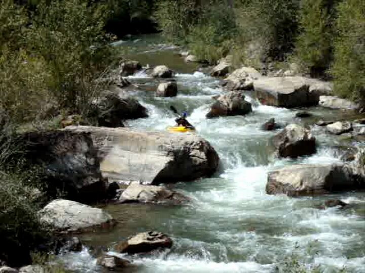
Good looking creek with lots of fun rapids. PK Davidson photo.
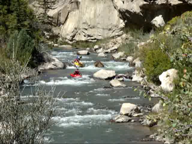
Many of the drops are quite sizeable, and a little bigger than they look from a scout, or even from just looking at it from upriver. Some of the ledge drops, holes and pocket slides are surprisingly strong, and you may find yourself paddling a bit harder or taking a bigger drop and impact that you thought. It's a bit rowdier than you would expect. There is one drop fairly early on that comes on a brief crook of the canyon that we dubbed "Two Tongues" because it had two small sliding holes back to back. Ultra fun and surprisingly powerful!
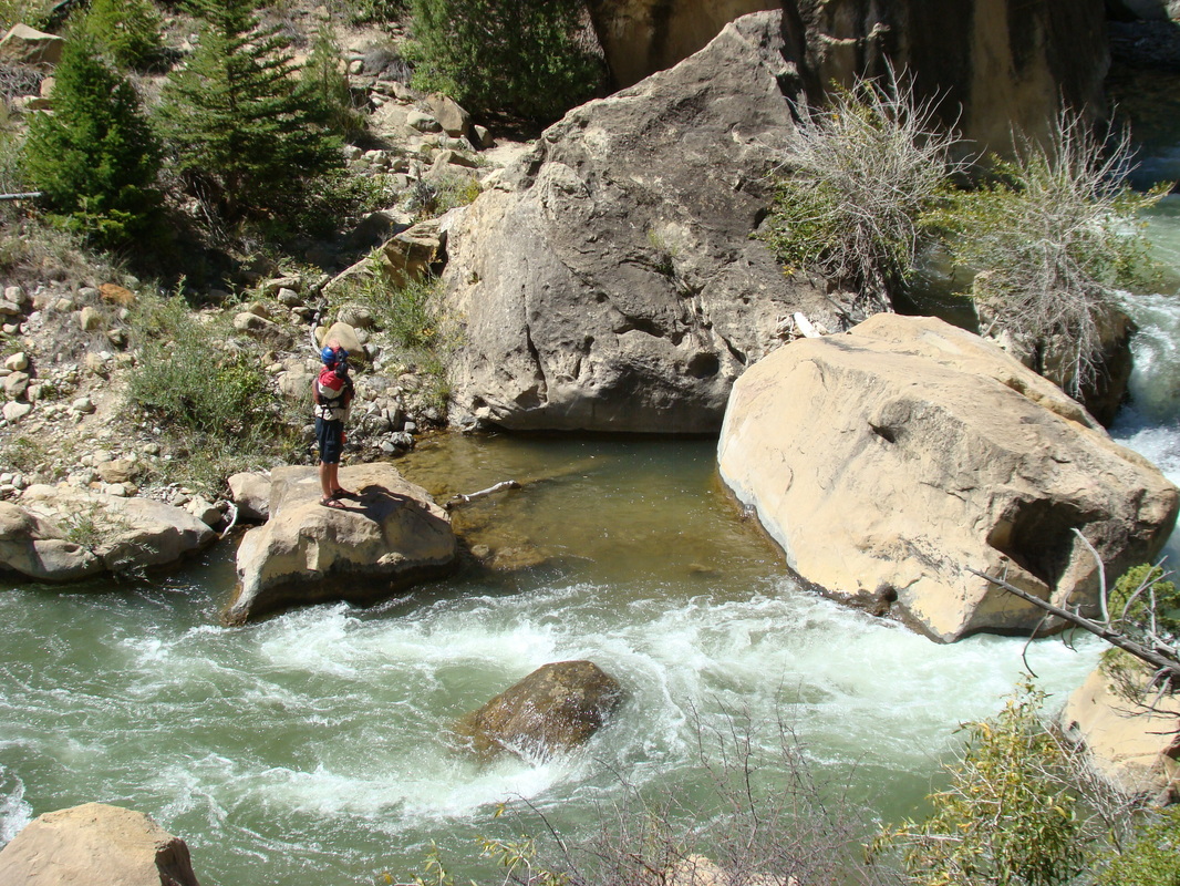
Scouting "The Crack House". PK Davidson photo.
One of the bigger drops is an ugly drop we called "The Crack House", because most of the flow went down the left side of the rapid, with lots of boulders mid stream splitting the flow into two channels. It's ugly; I chose to portage it while my friend Tim decided to run it. I set safety and he headed in; his run was not classic, although he did end up upright at the top. I wasn't sad about portaging it at all.
|
|
Good sequence of Tim VanHaitsma running; shots by my pops.
|
|
...and everything is good! PK Davidson photo.
There was another good drop that came out of nowhere on a left hand bend of the river that involved an awkward drop over a four foot ledge, but you had to go over it as you squeezed between a tree and a rock. You didn't see the ledge until you were right above it, and there was a nice slide between some boulders immediately below. It was a lot of fun. It wasn't too far down from this drop to the biggie of the run, "Ore Cart".
Makin' moves.
|
Another "Two Tongues" shot.
|
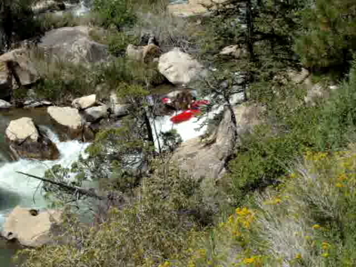
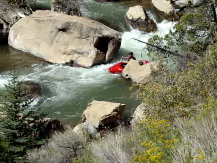
Ore Cart is the biggest of the run, and is a fairly big drop. It has multiple separate sections, starting with a big slide and ledge drop into a sizeable pool, and this is followed up with a lovely rowdy section through a short little box. Below this is a series of holes mixed between boulders, and the whole section from top to bottom is a thrill ride. When we went the low flow made the rapid a little bit manky for my boat, so I had to walk around, but Tim ran it and greased it nicely. The rapid sits on an obvious fault line where the creek crosses a vein of harder rock and drops more steeply for a short spell.
The upper part of Ore Cart Rapid. PK Davidson photo.
Me scouting Ore Cart Rapid.
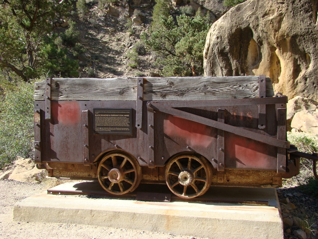
The Ore Cart the rapid is named for.
|
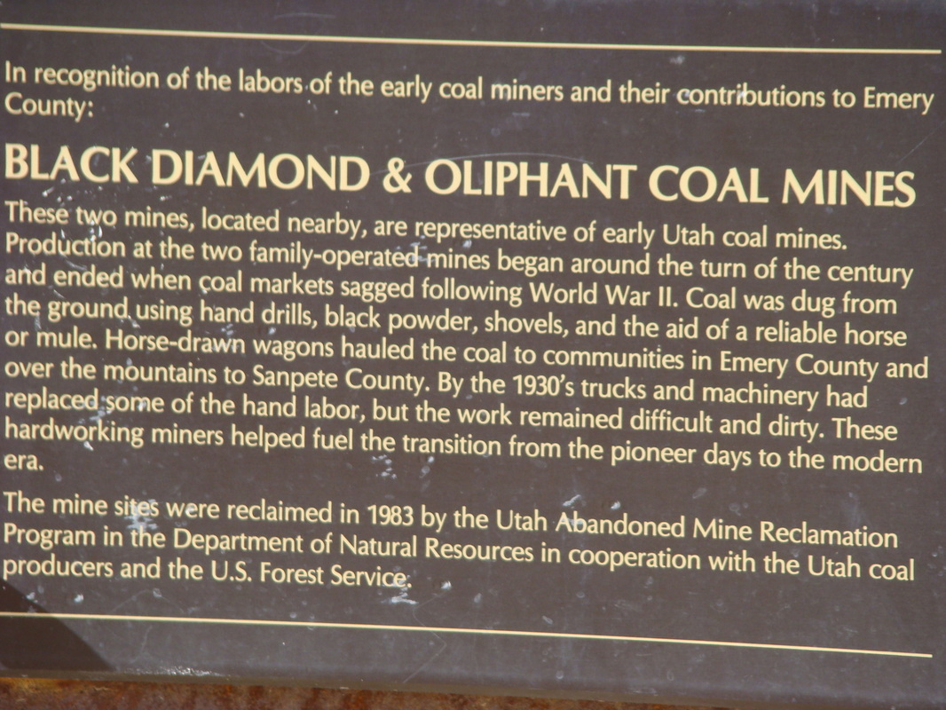
Plaque on the Ore Cart.
|
Below Ore Cart the creek stays fun and splashy. There are two takeouts that work can be used for this run, but if you choose to run to the second takeout, beware of an ugly drop a short ways below takeout #1. It is an artificial drop that allows a canal (subsurface) to pull water off the creek, and while it isn't a fully-symmetrical low-head shape, it will still chunder you nicely if you give it a chance. The first takeout is better anyway as it has a cleaner and more accessible parking area. The lower "takeout" is nothing more than a small shoulder space where you can park for a few minutes and load up. If you are leaving a vehicle here then I would suggest using the first takeout. Intrepid explorers willing to deal with some inconveniences may find it possible to continue down a mile or two to another takeout, this will give you more class II-III busy water, and a handful of fun drops. The only thing to be aware of is fences.
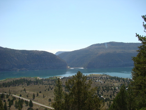
Looking down at Joe's Valley Reservoir and the creek coming out of it.
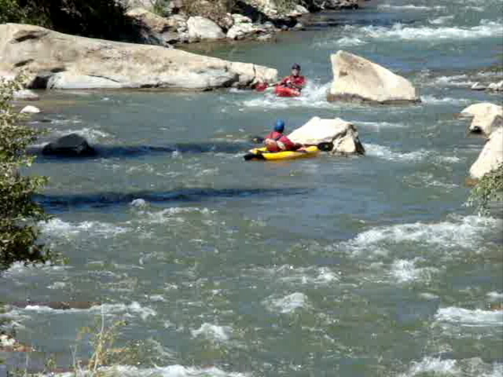
 One last shot of the fun.
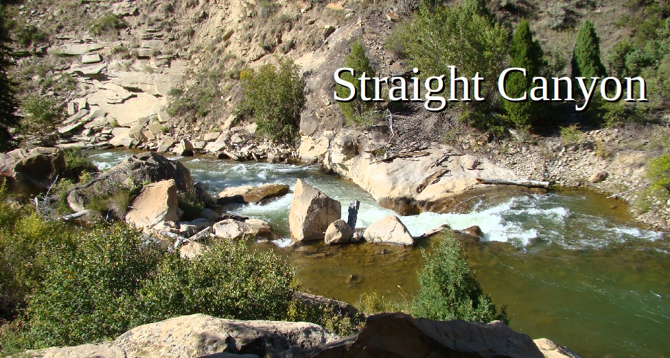
Just one last note on nomenclature: this section of creek is one that doesn't really have a name. The streams that come together to form Joe's Valley Reservoir are called Lowry, Seely, and Dragon Creeks, and the creek that comes out of the bottom isn't given a new name. Most of this creek downstream is known as "Cottonwood Creek", but the actual Cottonwood Creek watershed is a tributary of this that joins the main stem about 3 miles east of the dam. So really, the creek has no name for about three miles; in that span it is simply known as "Straight Canyon". So ultimately this creek doesn't have a specific name, as some people call it "Cottonwood Creek", while others call it "Straight Canyon", and others have taken to calling it "Joe's Valley Creek".
Whatever name you decide to use, it is a blast of an adventure, and it's well worth making a drive to if the flows are good. We drove about six hours to reach what was 199.9 cfs, and it was worth it. Supposedly this can be run as high as 1000 cfs, and while I think I would opt out at that flow, it will probably be a blast for better boaters. I'd like to go back at around 400 cfs, which is widely agreed by many to be one of the most fun and friendly flows possible.
Whatever name you decide to use, it is a blast of an adventure, and it's well worth making a drive to if the flows are good. We drove about six hours to reach what was 199.9 cfs, and it was worth it. Supposedly this can be run as high as 1000 cfs, and while I think I would opt out at that flow, it will probably be a blast for better boaters. I'd like to go back at around 400 cfs, which is widely agreed by many to be one of the most fun and friendly flows possible.
All photos copyright Kit Davidson unless otherwise noted.
