The whole reason for the trip.
"Horshette" Canyon / Book Cliffs Recon Mission
In spring 2013, I had a hankering to get out and do a solo camping/exploration mission. Nothing big or crazy, just a quick one nighter out to the bush to get a little alone time. So, I borrowed my Dad's truck, and one Friday I set out towards Grand Junction to go check out some things I had wanted to explore in the area.
Unnamed tributary of Plateau Creek.
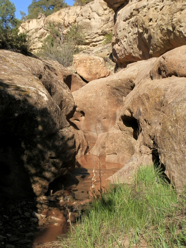
I had my eye on a couple of small canyon systems located to the east, and north, of Grand Junction. It is in these areas, known as the Bookcliffs and Plateau Creek Canyon, that the farthest eastern reaches of the Colorado Plateau make their last appearances before the mountains of Colorado. As such, there is a good slice of sandstone layers hanging out and being exposed by the canyons, gullies and washes cutting through them. We had found a short but decent slot in Big Wash, a tributary of Plateau Creek, earlier in the year, so I was eager to do a little more recon on the area and see what else I could sniff out.
Local layers of rock, taken from the Big Wash Mission.
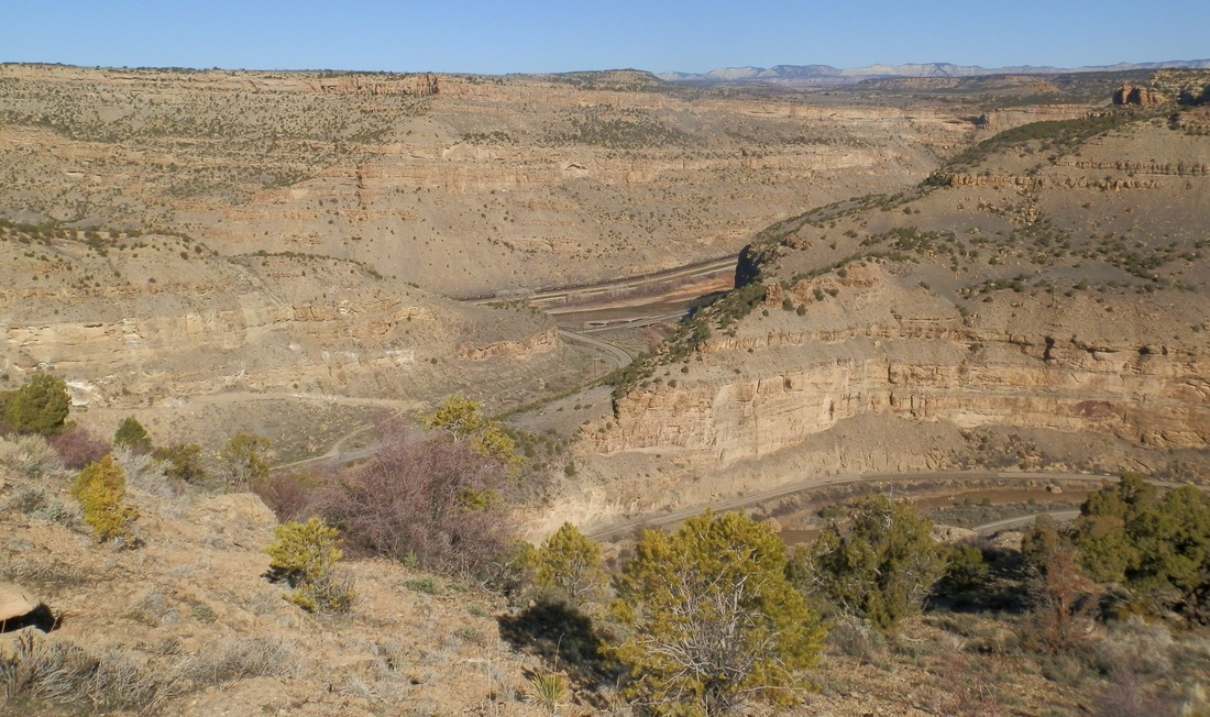
My first stop was to cruise up Plateau Creek Canyon and try to suss out the entrance to the canyon next door to Big Wash. On Google Maps and ArcGIS recon it looked like it had a nice narrows, perhaps even a slot, but the exit was suspect as the canyon mouth was on private ground. We had already established access from the top wasn't going to work because the roads that went to the canyon higher up were MUCH higher up than we wanted. So I wanted to see if there was a break in the canyon wall of Plateau Creek enough to let access up to the mesa top, so we could at least get access to the canyon rim and see what was inside. Sure enough, looking with my binoculars, I found a way up and filed it under things of "to be done later".

The route to the mesa top!
After that I went back downcanyon to try and find a way into Shire Gulch, a short, promising looking canyon that likely didn't have any sort of narrows or slots but looked like it could be a fun canyoning route with a couple rappels. They key was to find a way to the top from the bottom, so it could be as a one-vehicle out and back trip. I scampered up along the hillside for a while, and although I didn't make it all the way, I feel confident that there is a usable (if a little sketchy) route to get up to the top of the canyon. Another one to do later. This canyon looks fun because it's last rappel, probably in the neighborhood of 40 to 50 feet, is plainly visible from the highway.

The bottom of Shire Gulch, with it's last rappel in the middle of the frame.
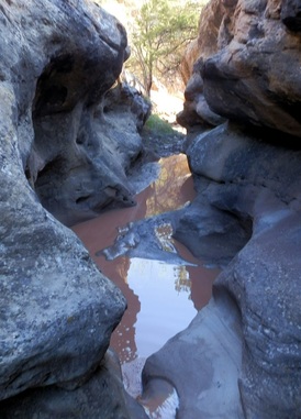
Finally, I had just enough sunset to scamper up a small side canyon that came down and had a visible section of bedrock and small pools right next to the highway. It looked promising so I hoofed upcanyon as far as I could, until my progress was stymied by a large dryfall that I could neither scamper up nor bypass around. Back down to the car and it was off to find a place to camp, and tonight I had settled on Island Acres State Park, located along the Colorado River in the middle of Debeque Canyon. Some people complain about campgrounds like this, with an interstate on one side and a train track on the other, but I really don't mind. Something comforting about the noise of stuff happening that keeps America running. Either way, on an air mattress in the back of the truck, I slept great. Nice showers to boot. Win!

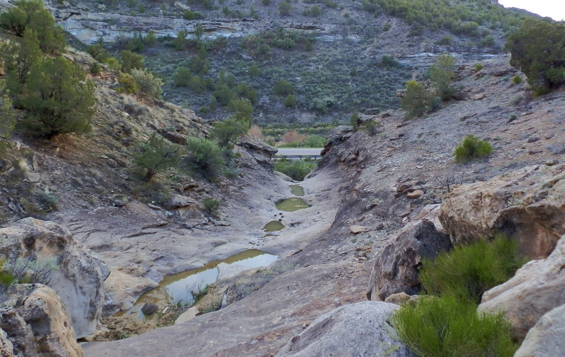
The unnamed tributary again.

The dryfall that stopped my progress.
|

Plateau Creek Canyon in the evening light.
|
 Island Acres morning.
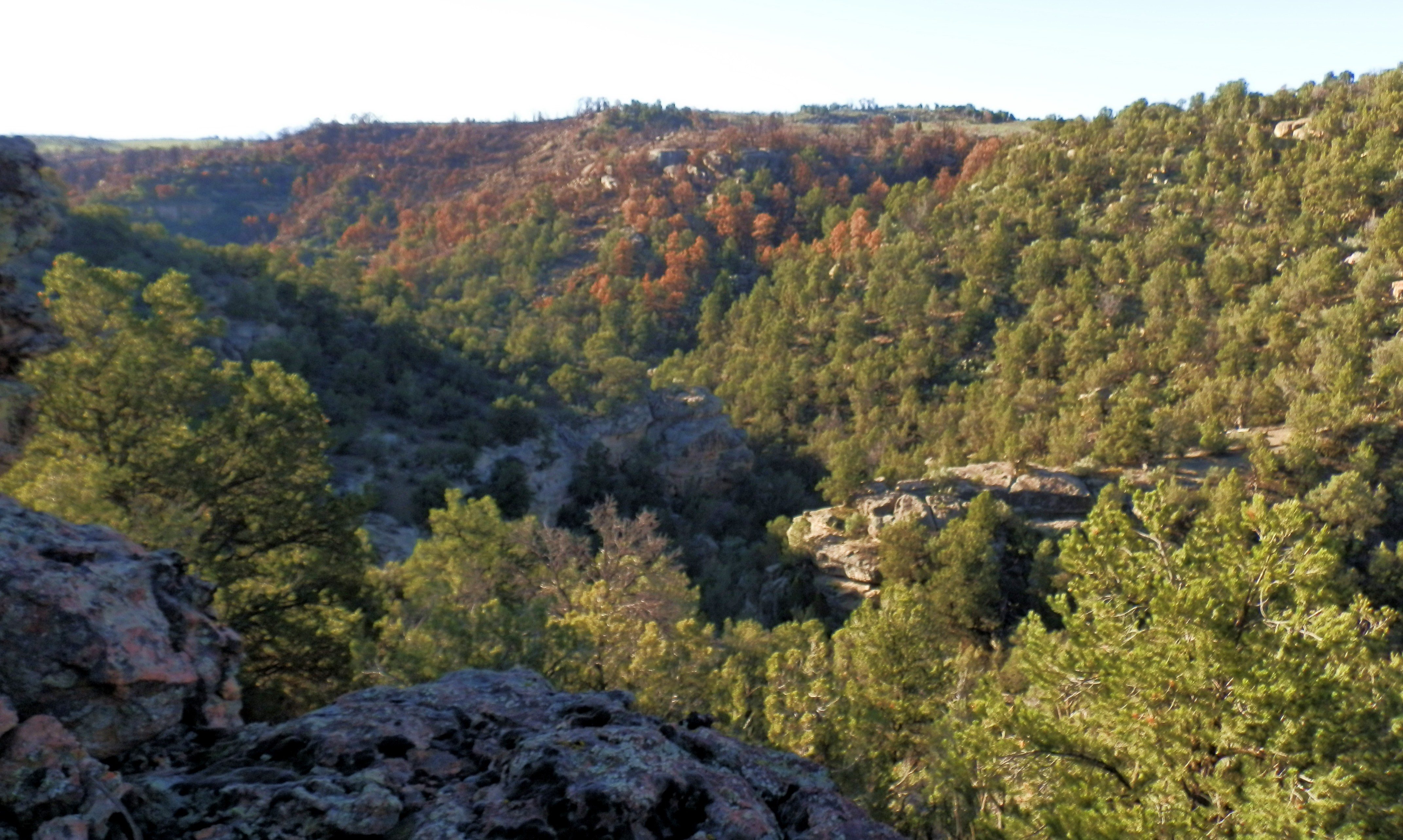
The next morning I with the sun, and spent some time being lazy in camp, just hanging out. Eventually I got my shit together, went across the highway to the Eagle Truck Stop and had some awesome chocolate donuts for breakfast. After that I cruised out to the small town of DeBeque, where I found myself on the mess of roads in the crazy maze of canyons and hills that makes up the upper part of the Bookcliffs. I had scouted how to get to canyon I was after, Horseshoe Canyon, and had set up a travel map ahead of time, so I knew which way to go at every turn. The entire Bookcliffs area is rich in natural gas and petroleum, and the infamous technique known as "fracking" is used in some places in the area. The drill pads are unsightly and loud, but they do need easy access in and out, and since the canyon I wanted to scout out had a drill pad right on the rim, I had a nice road all the way there. Once at the rim of the canyon I could see the charred remains leftover from the Black Ridge Fire the year before.

One of the numerous gas pads that dot the Bookcliffs area.
Horseshoe Canyon.
I was able to literally park twenty feet from the canyon rim. Initially, a large cliff band at the top of wall stopped me, until I traversed about 15 minutes downcanyon, where I found a nice break in the cliffs. The narrows were just out of view around the corner, although I could tell the canyon was narrowing up nicely from just looking below. There was some flow to it as well, perhaps half a cubic foot per second. There was a handful of other cliff bands to pass and I dropped down to the floor of the canyon, but none of them presented any problem, and about 30 minutes after starting down I was next to the creek.

Some interesting pink rocks (quartzite intrusion? Limestone? Don't really know....) on the hike down.
|

The slot appears!
|
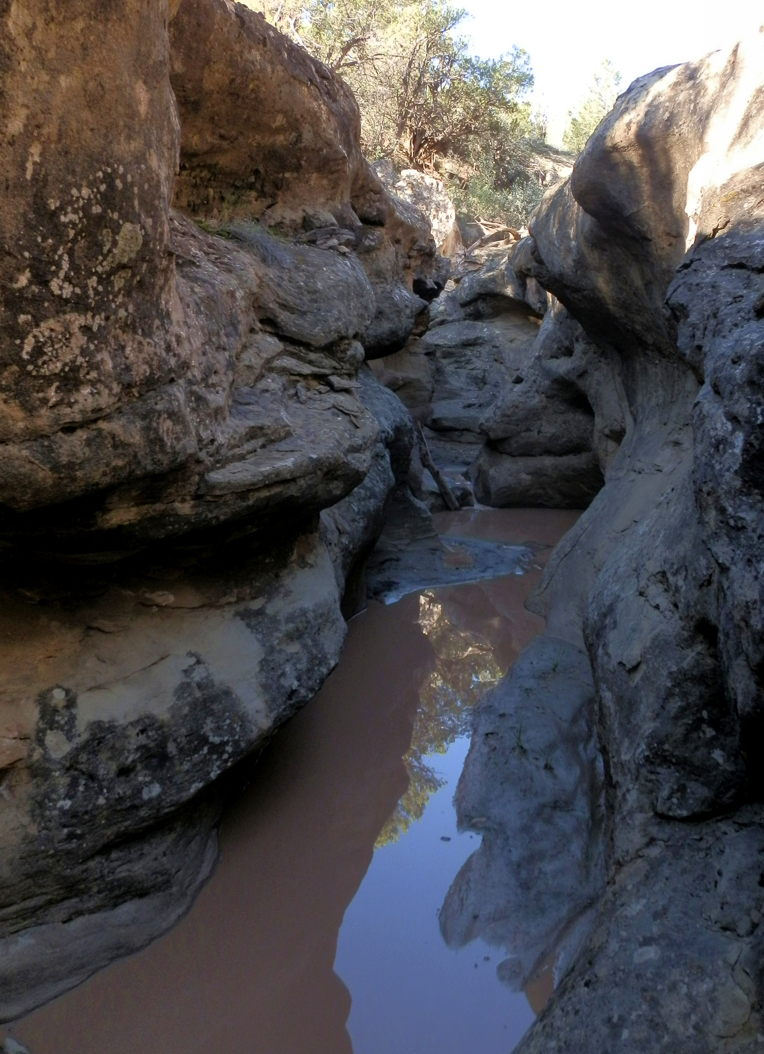
A handful of minutes around the corner and the slot finally showed up. At first it was an extremely shallow and cute little slot, like a slot canyon for action figures or small rabbits. A little lower down, however, it dropped into a nice little hallway that was 10+ feet deep. Next to the canyon was a small cliff face, and a nice alcove of rock underneath it. It was perfectly situated to catch the morning sun, so I sat my stuff down and relaxed here for a long time, enjoying the solitude and peacefulness of the whole place.
All: Views of the slot in Horseshoe Canyon.

|

|

|

|
|

|
Below, the slot continued a little ways down before petering out. There were several small falls with pools, that without water would likely be fun downclimbs. As it was I didn't want to get too wet, so I stayed out of the water as much as I could.

If you look closely you can see my hang out alcove on the right.
Looking back into the slot.
|

....and down into a small falls.
|

The falls from below.
|

Mini slot.
|

After laying around in the sun for a long time, not doing much and just enjoying nature, I figured I had better think about getting back to Gunnison. So, I leisurely made my way back up the creek, to my entrance route, which I backtracked no problem. Once on the rim I detoured a little bit, so that I could walk through some of the stands of timber that had been burned during the Black Ridge Fire. Freshly burnt landscapes are an interesting place to see. The road out passed by numerous drill pads, and also a section of South Shale Mountain that looked like it could be a lot of fun to hang out at- hoodoos, boulders, and formations remeniscent of Goblin Valley or other similar locations in Utah. Yet another thing to file away for a later mission!

Burn scar from the Black Ridge Fire.

Charred forest.
|

Charred forest + drill pad.
|

South Shale Mountain in the background.

The badlands in the middle right of this photo are worthy of later exploration.
