Fremont River - Roadside Section
|
Put In: near ponds OR Giffords Birdge OR Hickman Bridge TH
Takeout: End of the canyon OR Cathedral Valley Road ford Length: 6 to 12 miles (variable) Flow: min (solo boats): ~80 cfs min (rafts): n/a max: 500+ cfs Rating: II+/III- |
|
The Beta
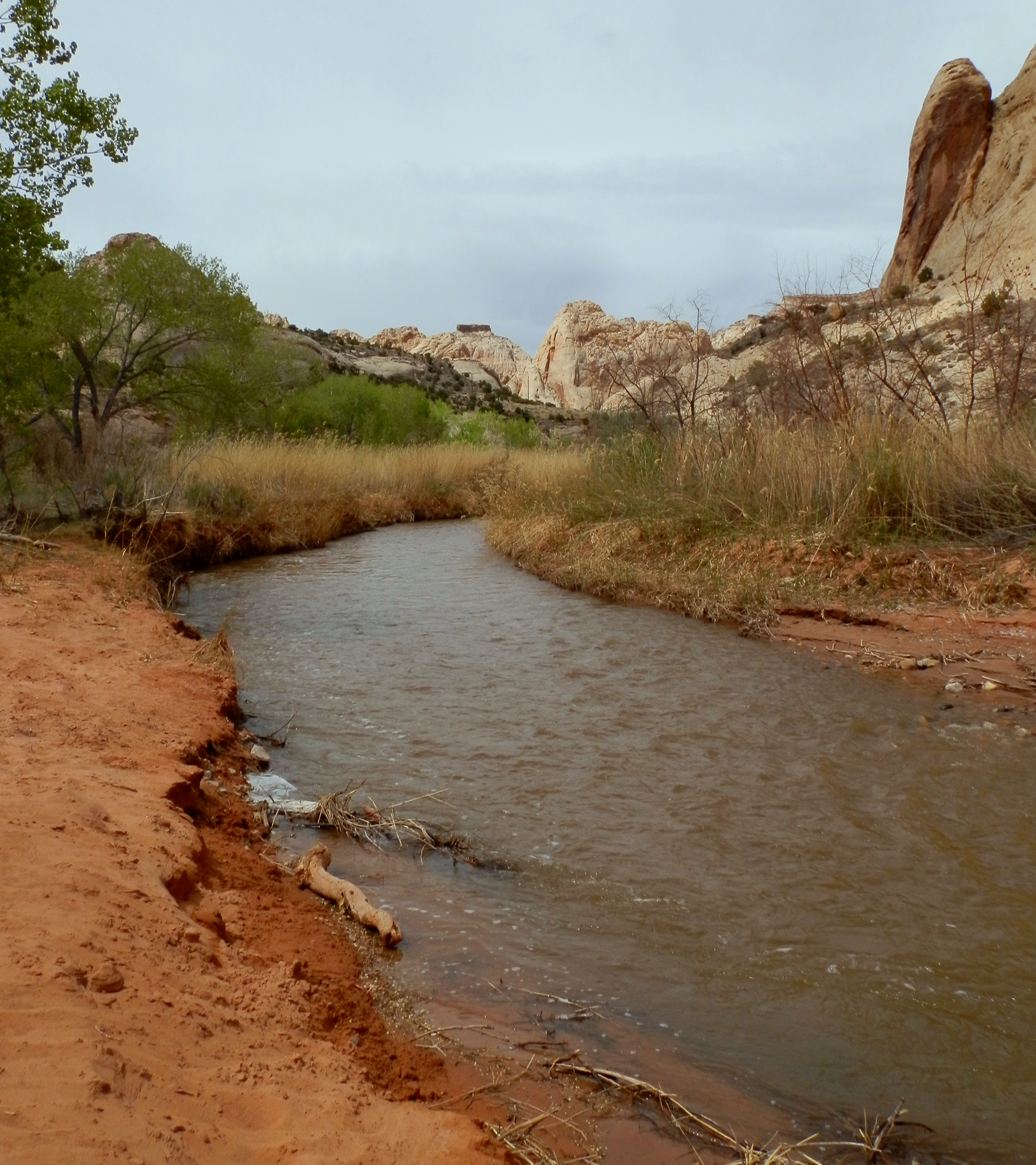
While it will never be a glamour run on the top of "to-do" lists, and it pales in excitement to it's harder sibling stretch upstream, this stretch is a bit of an overlooked and surprisingly enjoyable few-hour run. Starting in the majestic and beautiful cradle of Fruita, Utah, this stretch of the river cuts right through the Capitol Reef and provides some dramatic canyon scenery and some fun small rapids to fill a few hours with more fun than you imagined.
Where you put in depends on your tolerance for fast, narrow, willow-lined manky class II+ with no eddies. If you like that sort of thing, that's weird, but you can put in a bit higher up, near some ponds that are used by the NPS for the local facilities. Or you can hike up from the CG and put in wherever you feel like you can take the bush bitch slapping from. A more conventional access should either be at the bridge next to the Old GIffords Homestead, where you get a tiny little bit of bush slapping before it opens up, or the Hickman Bridge TH just downstream. By putting in at Hickman Bridge you can also get a handful more cfs thanks to Sulphur Creek. Ordinarily that's not much to speak about but on the low flow desert river everything helps....
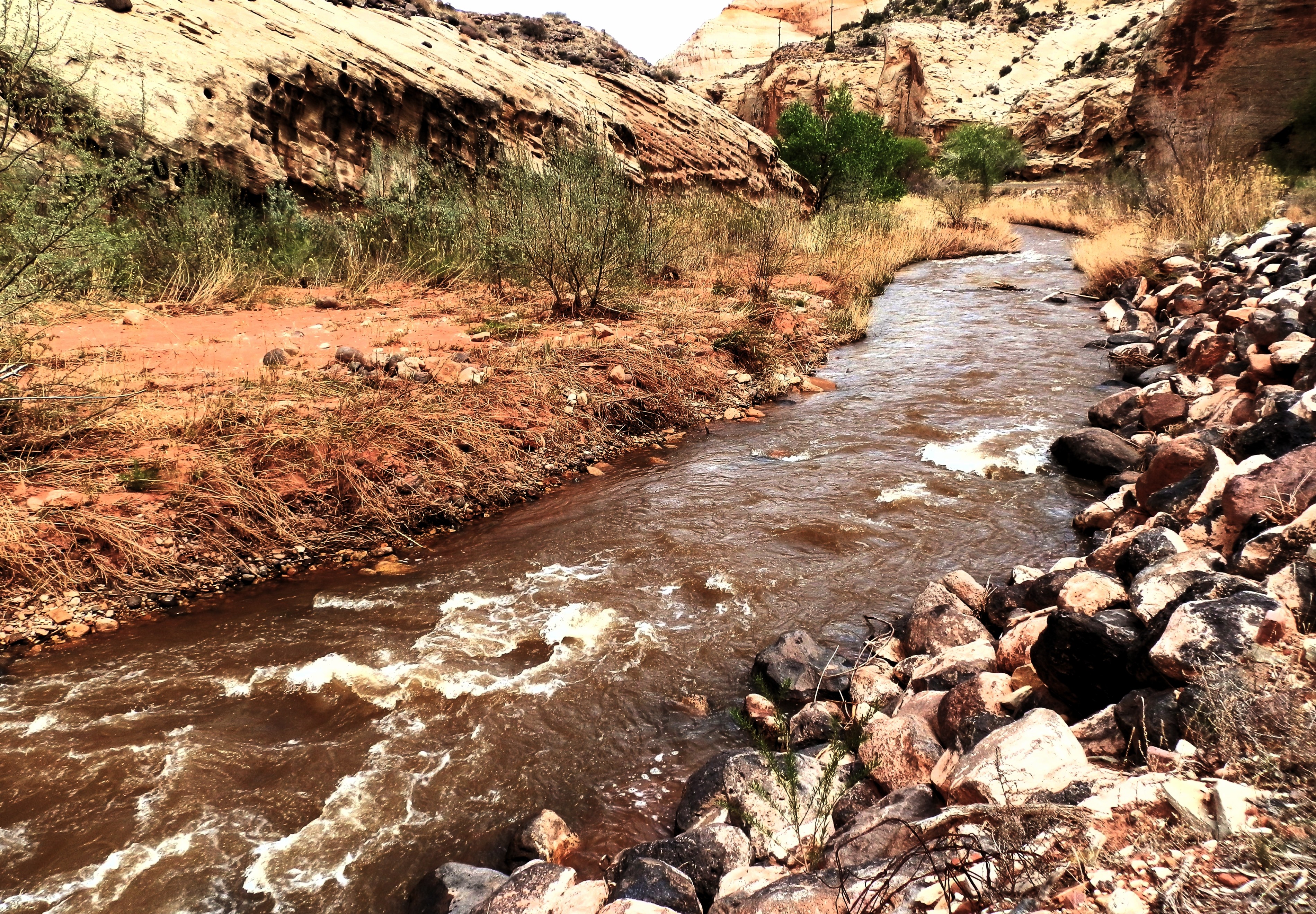
From the Hickman Bridge TH down, the river maintains a pretty consistent character all the way to the end of the canyon. This means periods of moving riffles, spaced by the occasional small rapid. It's sometimes manky but at the same time you will be surprised just how easily a lot of stuff goes. Always be on the watch for wood or brush hazards, but these shouldn't present too much of a problem. For the aggressive boaters you could likely do this whole stretch in a matter of an hour or so, but it would be worth it to slow down and enjoy the canyon scenery and possible side hikes. It would be worth it to hike up Spring Canyon, even just up to the first bends for 30 minutes. Other than the artificial falls, it's almost all class II+ like in the video below all the way to the canyon end, where it opens up and the gradient dissipates and it turns into a meandery stream.
Video courtesy PK Davidson.
The Falls - Warning!
|
When Utah State Highway 24 (UT24) was built, in the process of routing the new high-speed road through they canyon, they ended up chopping an old stream meander on the Fremont River off. The river was then forced into an artificial channel akin to a drainage ditch between the highway and the cliff face. As a result, the river loses it's gradient now in one furious punch, rather than over the course of a kilometer-long meander, and the artificial waterfall that was formed is a major hazard to 99% of boaters, and should be portaged by everyone. It's an easy portage (try to be as discreet and low-key as possible when moving past it though), but do be aware it's there.
|
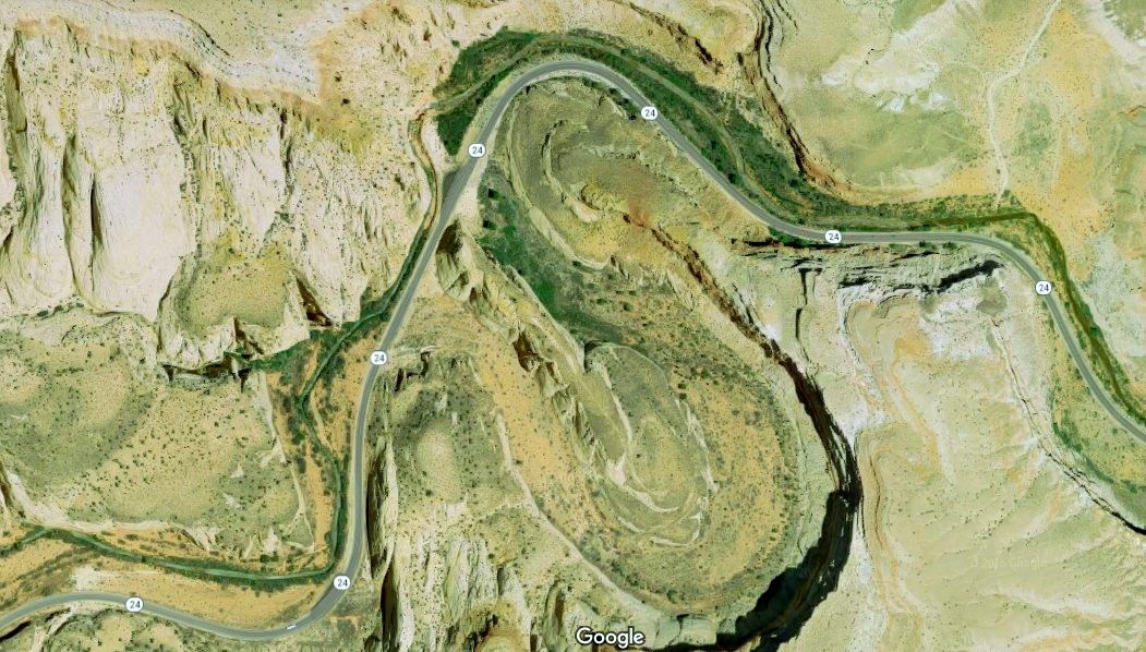
Copyright Google Maps.
|
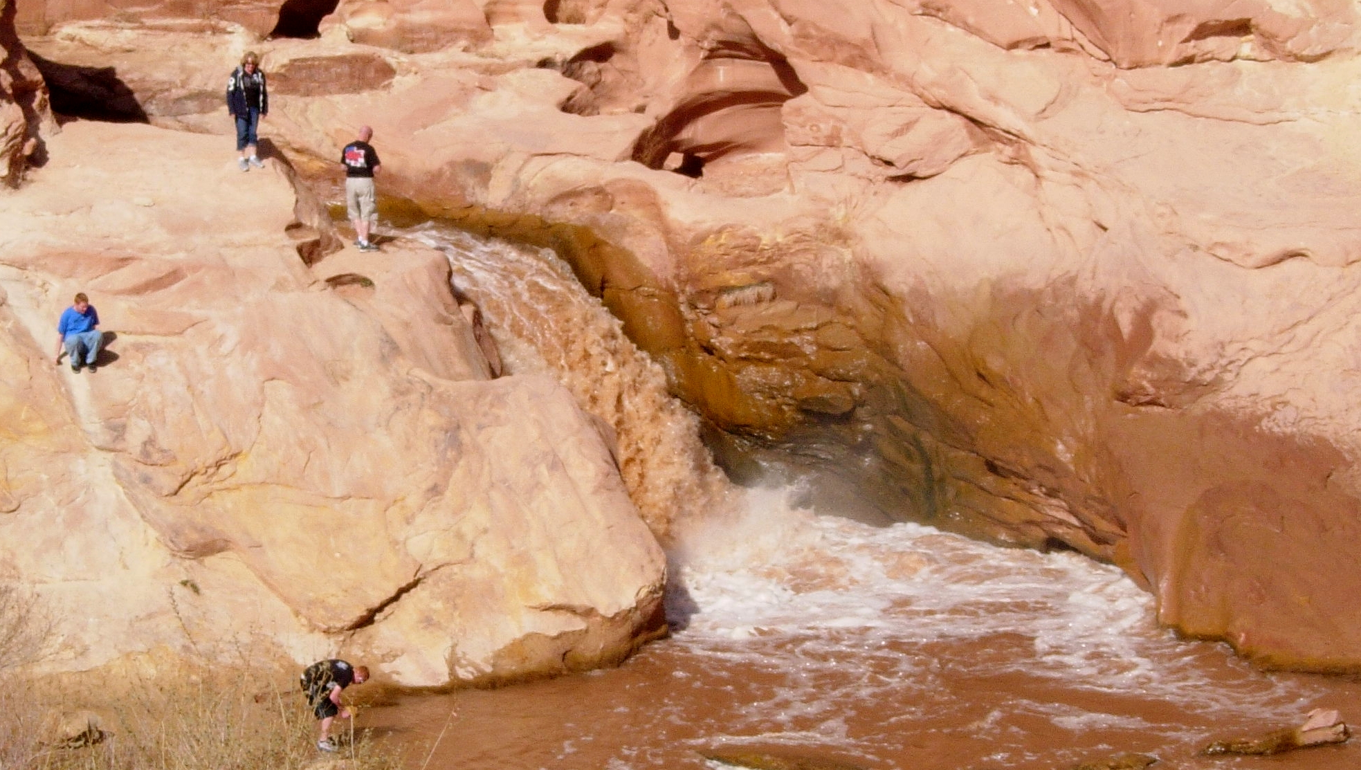
The bitch of it is.....sometimes the falls looks almost good to go. I'm not one advocating for running dangerous lines or anything, and I'm pretty sure the Park Service would have a bit of a conniption fit if they saw you doing it. But, that being said, I think there are definitely times and situations where this could be a reality. You'd want to set some strong safety but if you're thinking of doing this you don't need me to tell you that. But for most sane people, the falls comes at the end of a long straightaway wedged between the cliff and the road. Get out as early as you can because the further you go in the harder it gets to get out. You can put back in right at the base, or anywhere below.
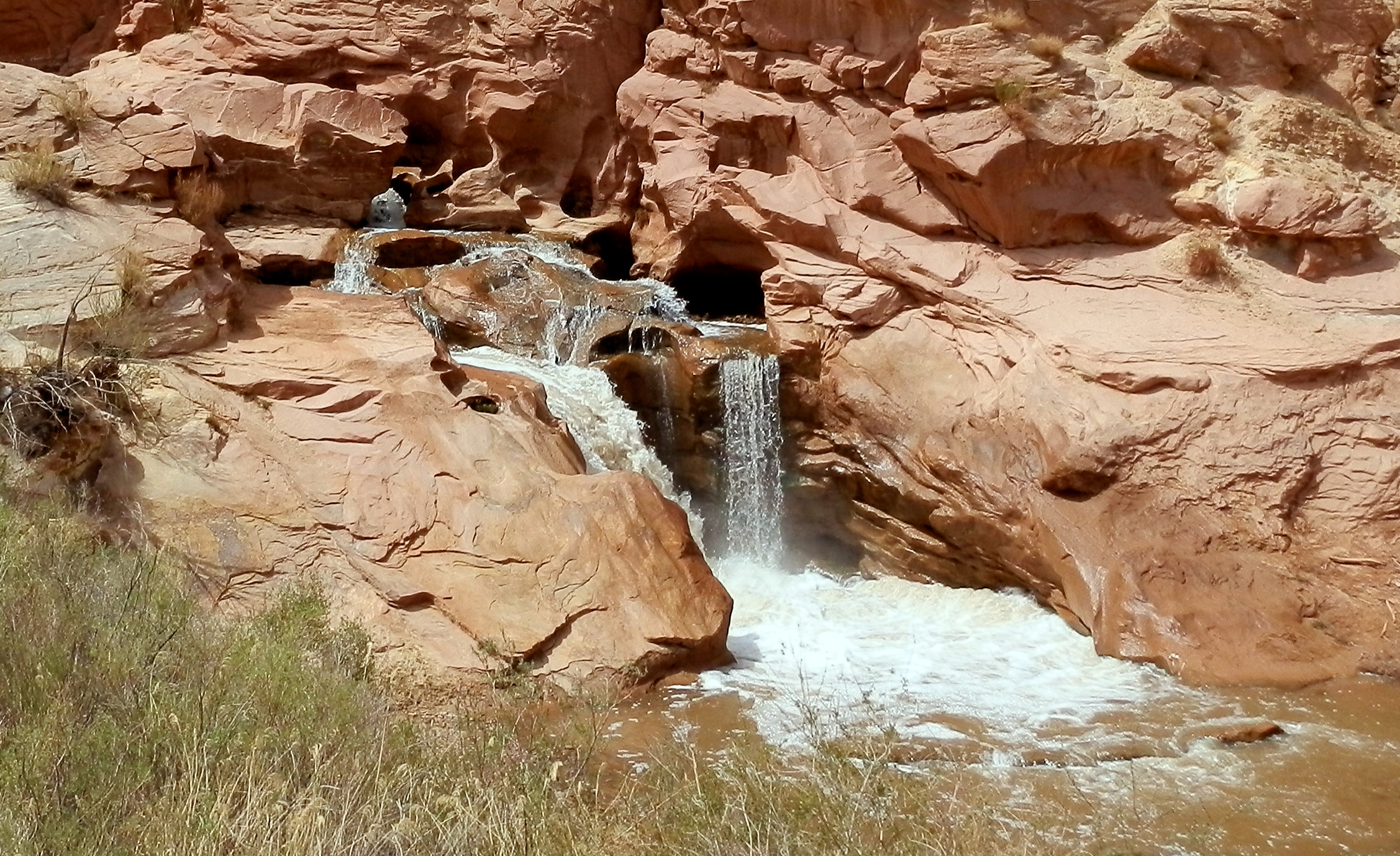
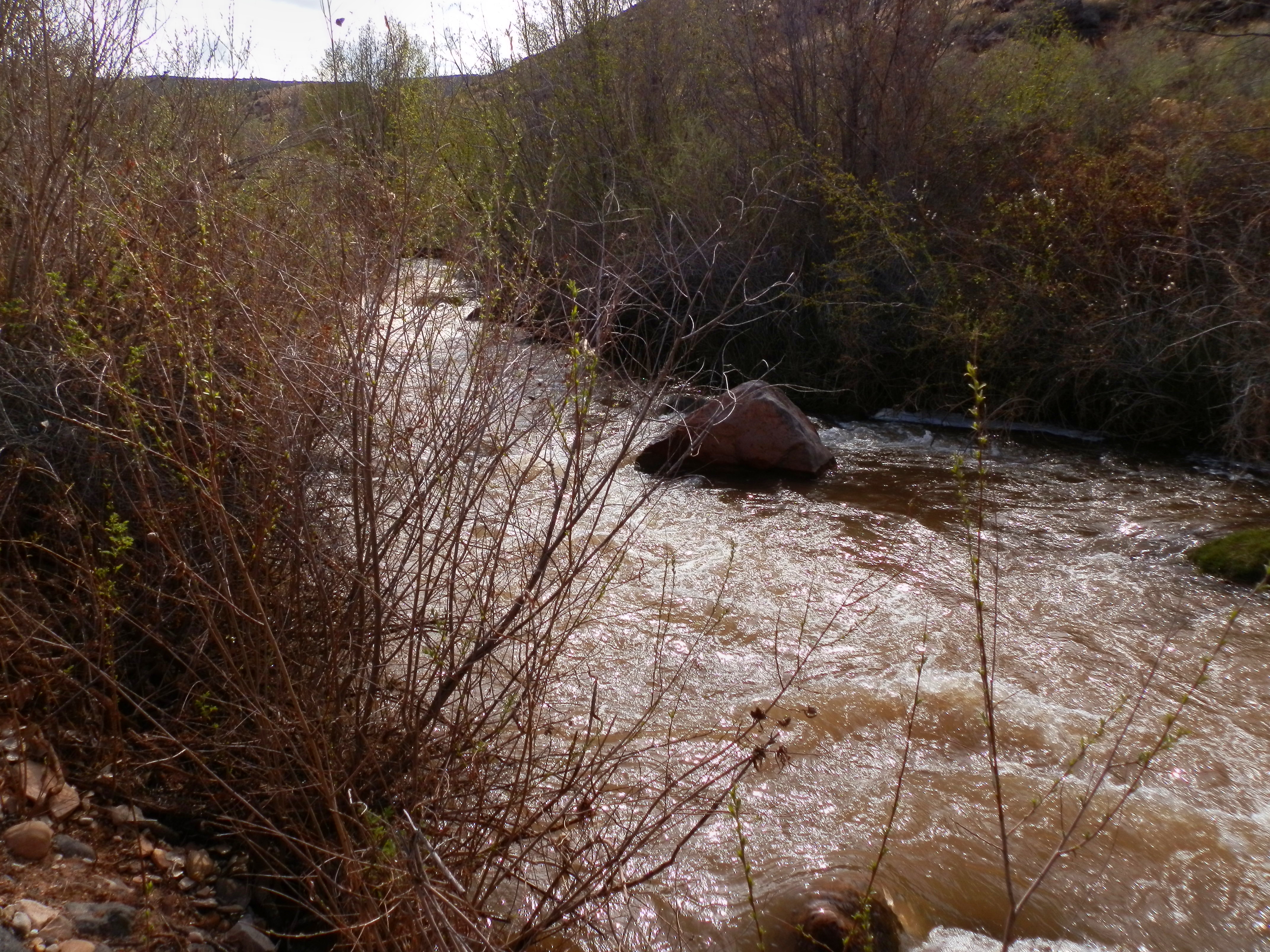
Below the falls the canyon opens pretty quick, and before you know it the canyon walls have been replaced with wider vistas. The stream will only get more flat, more diverted, and less interesting the further you continue downstream. So, should you not exit right at the falls, you can cruise down another couple of kms to the exit of your choice. There is one pullout right next to the road just a short ways below the falls, or you can continue down to the Cathedral Valley Road ford, which is about the last reasonable exit you'd want to consider.
The Map
Map base copyright Google Maps. Map created with Google MyMaps by Kit Davidson.
Flow Information
The Utah boating guidebook lists the minimum for this run as 180 cfs. However, I was able to boat this just fine when the gage read ~80 cfs in March 2010. Now, this could be to a gage change over the years, or it could be from an era of longer boats. I don't really know. I do know that I don't think I would have wanted much less at that point, perhaps in the neighborhood of 70-75 cfs might make a reasonable ELF cutoff. As far as maximum levels, I imagine that at a certain point this becomes sketchy not because of the rapids, but because of the non-stop nature of it. The drainage ditch feel of it would likely get too much to handle should an accident occur at high flows. This would have to be in the neighborhood of 500+? Just to hazard a rough guess. As for season, the best time to look is early Spring. Thanks to it's desert and lower elevation, this run can start flowing in March and its doubtful it woud last past April or May. This area can also see some impressive flash floods in the later summer Monsoon season, and while you shouldn't go near it when it's flooding, cautious boaters could likely catch it at the tail end of a flood as the water goes back down. These can occur anything from July through September.
All pictures, maps, and videos copyright Kit Davidson unless otherwise noted.
