Ma Cooih Road
An Diem <-> Ma Cooih / "Land of the Giants" & "Sentinel Canyon"
|
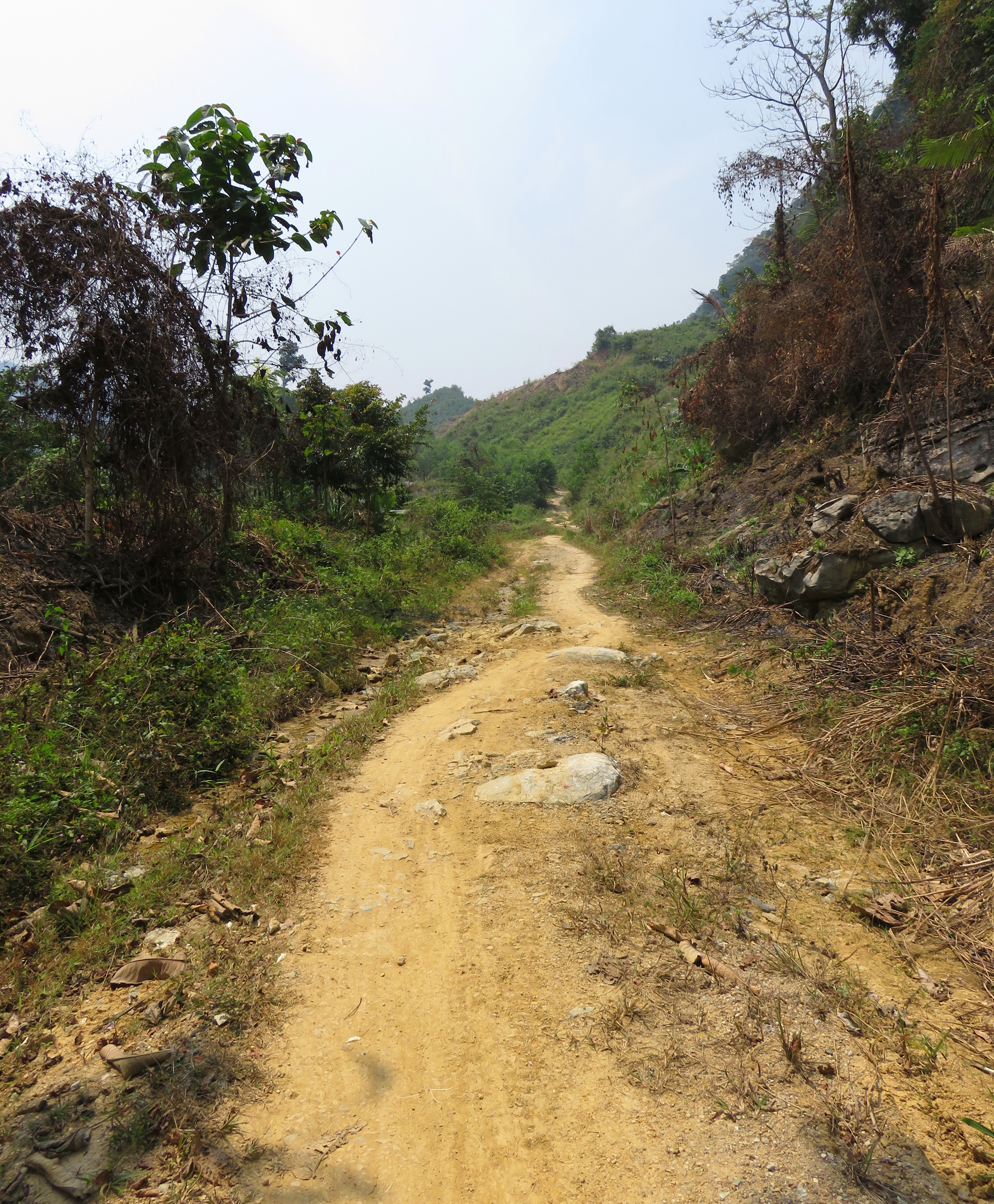
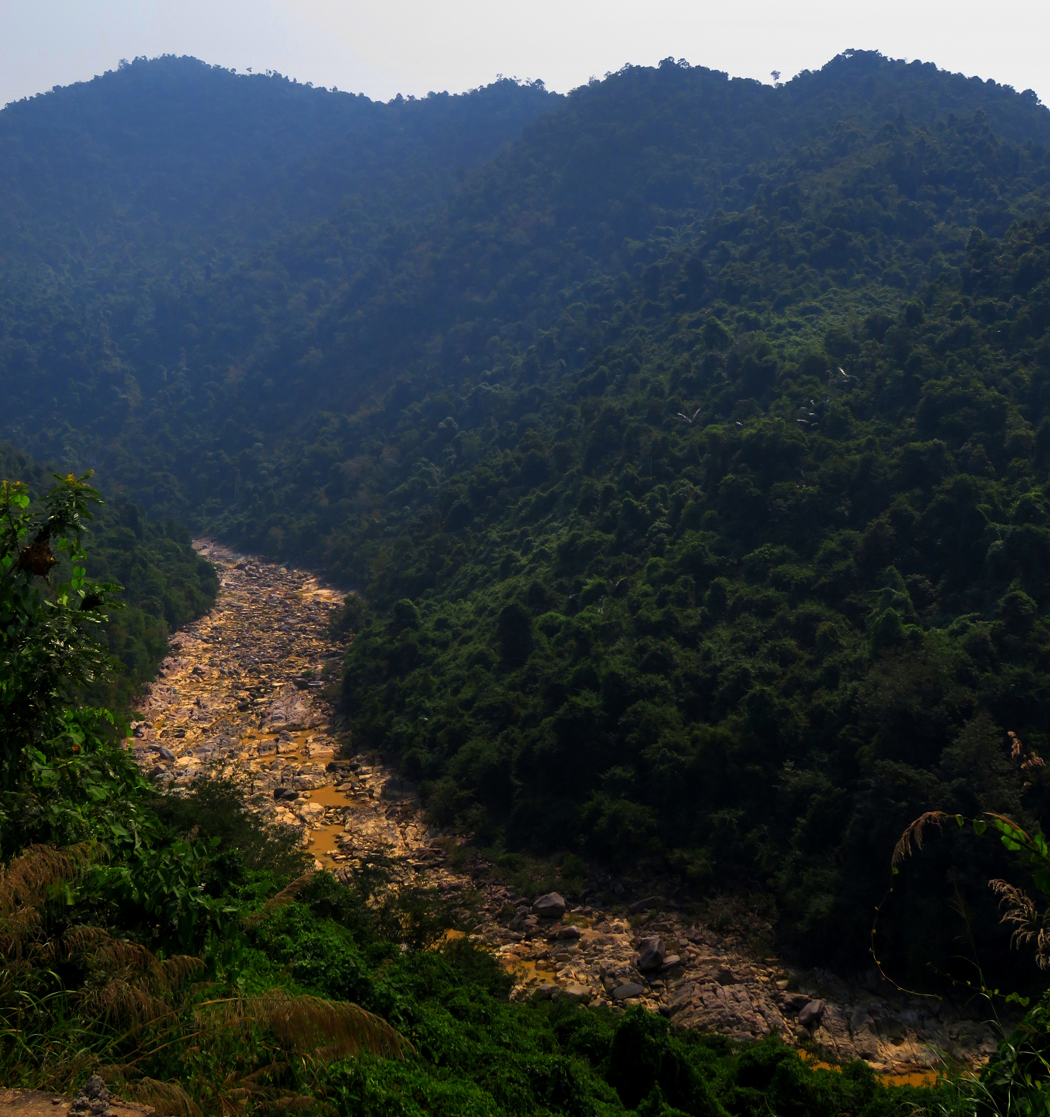
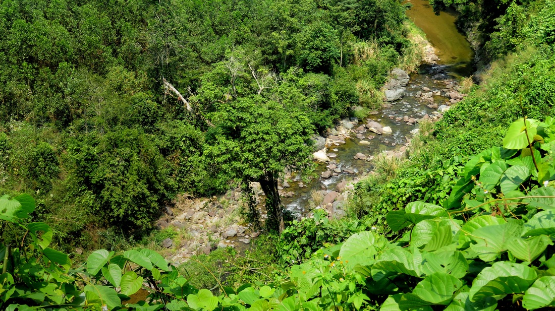
My tire slips out yet again as I three point my way over another series of head-sized rocks. Well, not rocks, more like small boulders. I'm basically standing on the rocks with the bike underneath me, goose-ing it in first gear as I struggle to get it through this stretch of rocks. It's hot and sweaty, my arms are tired, and my teeth feel like they are about to be chattered right out of my mouth. I've been struggling over terrain just like this for the past kilometer, and it's been slower going than if I was just walking. I clench a little tighter and keep going.
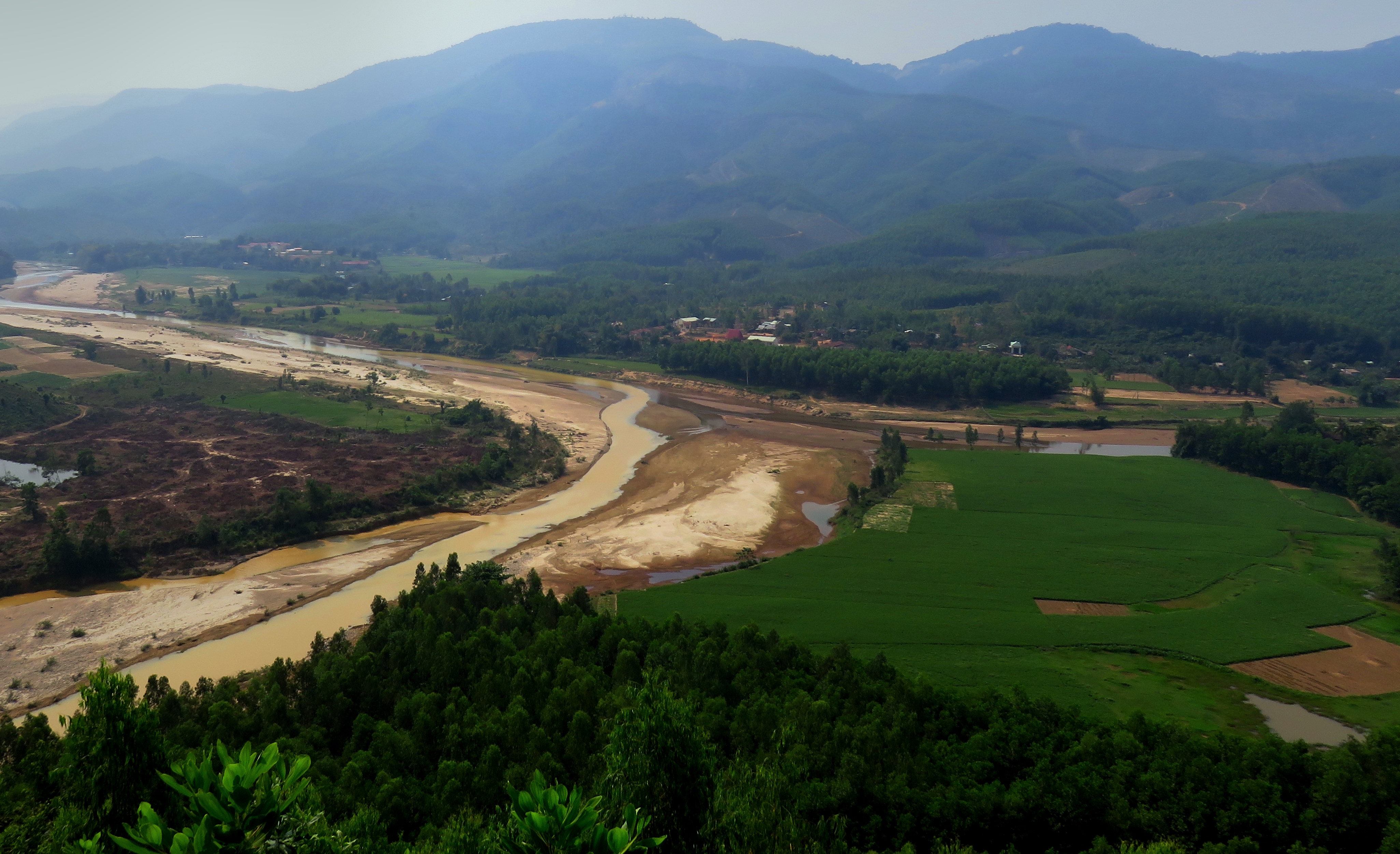
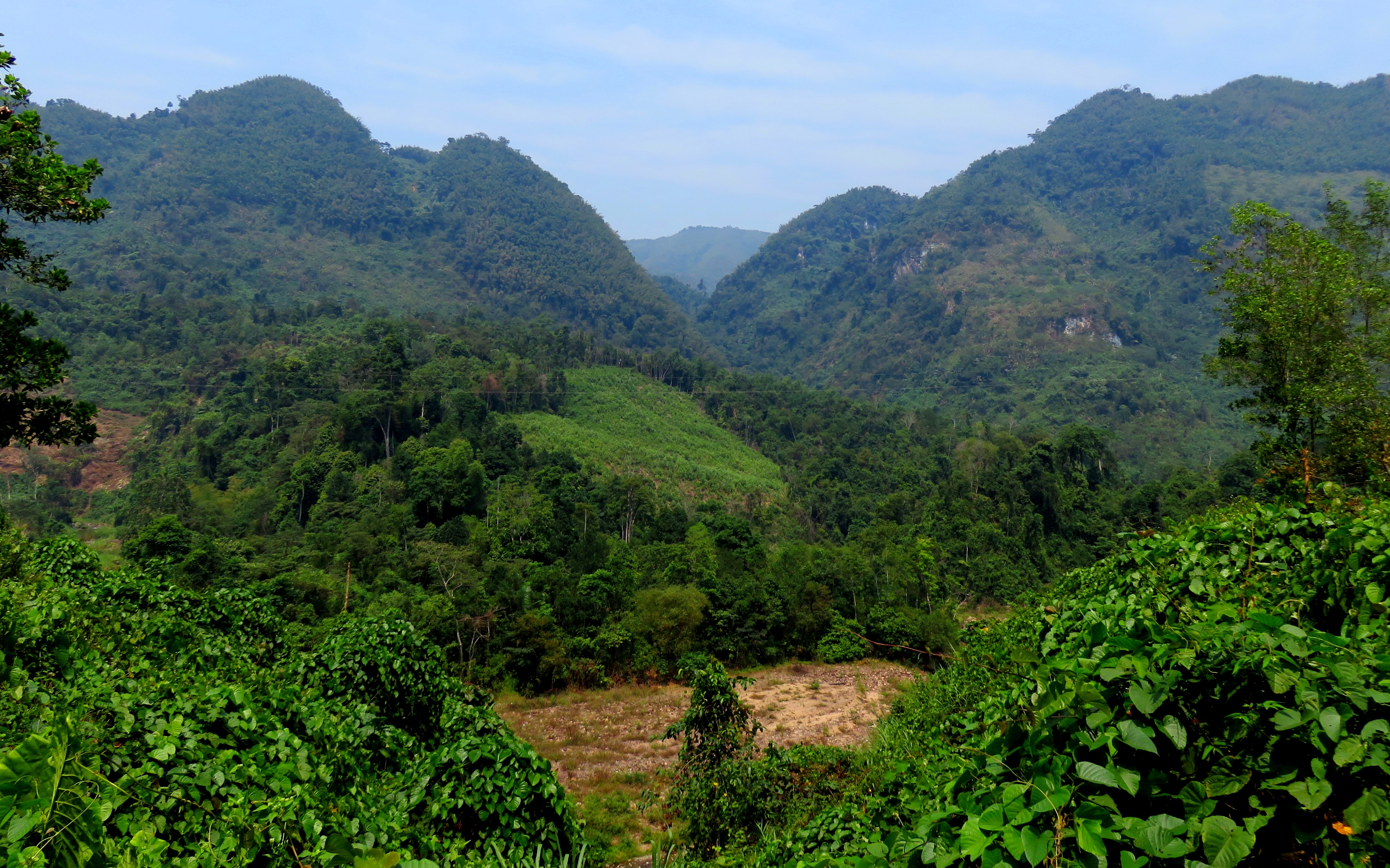
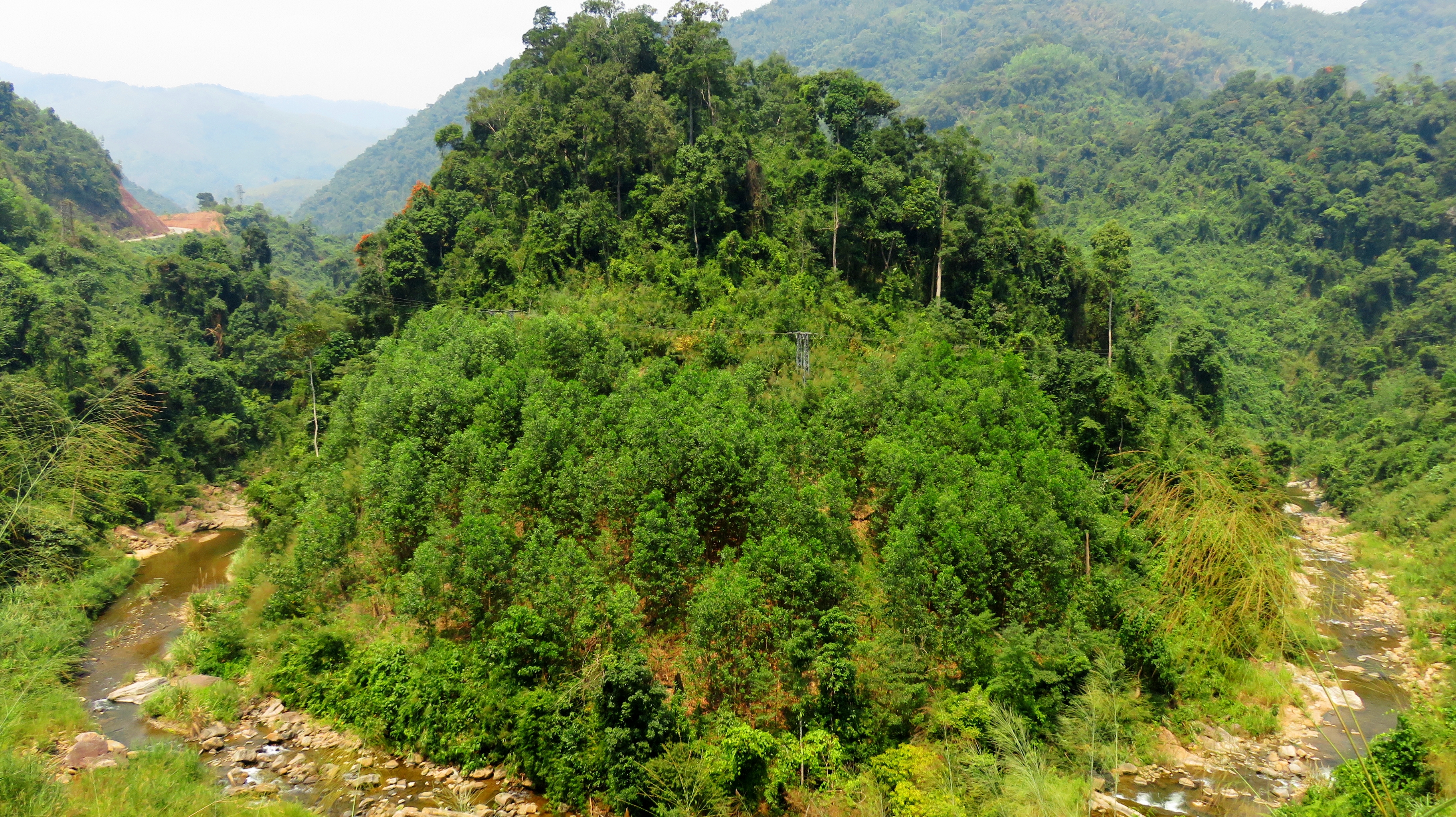
Passing a small hill, I turn a corner into a flat section of road that isn't so bad. I pull my bike to the side, turn it off, and get off. The view is intense. Massive, hulking mountains, draped in untouched old-growth mountain jungle, rise quickly from the creek and dominate the southern side of the canyon. Simply stunned, there's nothing for me to do except stand there and take it in. The frustration and pain of the road to get here was all worth it, for views like this do not come very often. |
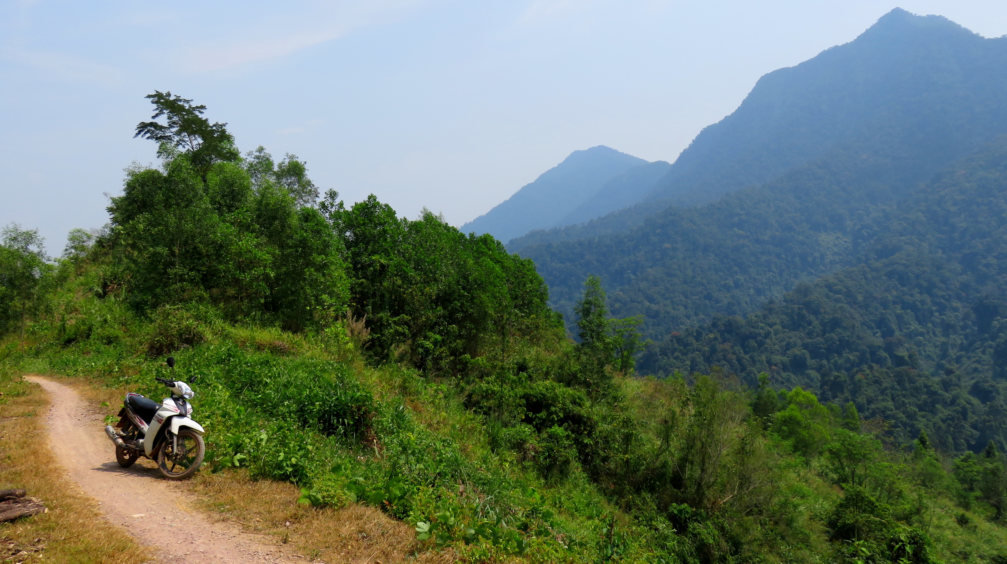
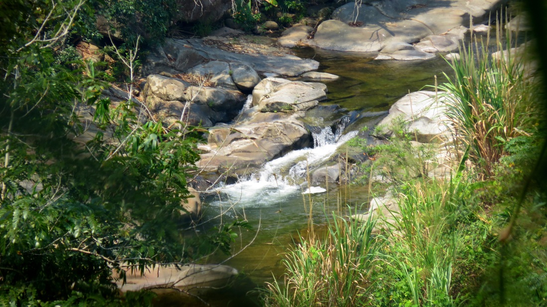
On the singletrack.
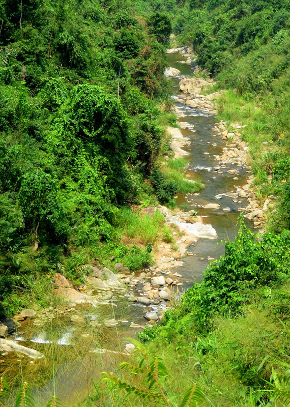
|
The view that makes it worth it.
Rewinding a few days, this adventure came as a result of looking at maps and seeing roads while driving on other roads and wondering where those roads went. Having recently completed a loop drive in the nearby area, and seeing a road go deeper into the mountains, I busted out my maps and started looking at what I was working with. Basically, I was looking for a road that would take me from Dai Lanh, along the Song Vu Gia, across the mountains to the Ho Chi Minh Highway, somewhere in the neighborhood of Ma Cooih. A couple of different maps showed a thin black line coursing up the Song Kon and Suoi Prang, over the top and down into the valley of the A Vuong River. Google Earth confirmed that there was indeed some sort of white ribbon all the way. Of course it was impossible to tell what it would look like until I got there in person.
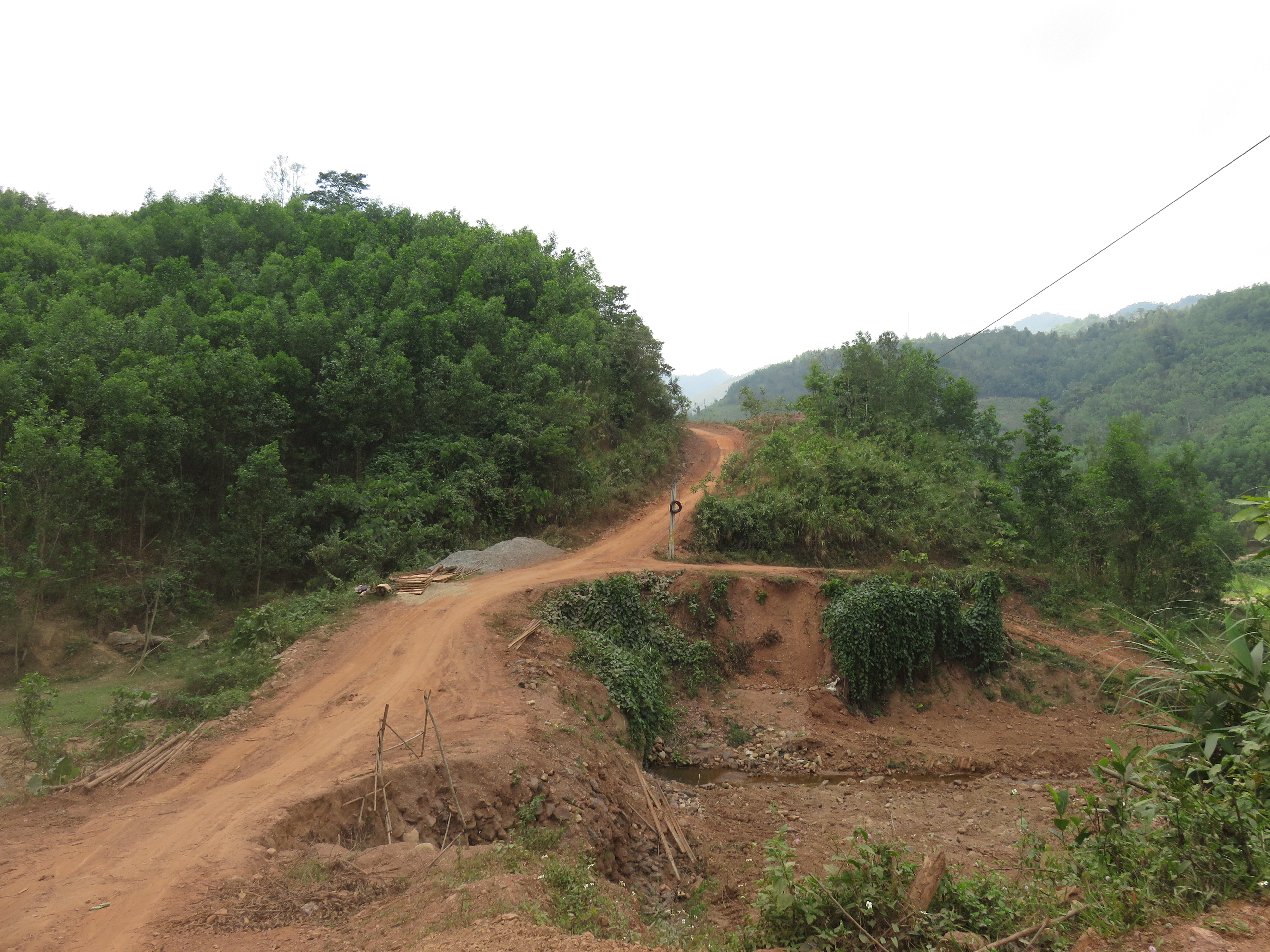
An intersection of roads.
|
With Kelsey out of town for a mock ASEAN summit in Singapore with her students, I decided it was time to take a solo rally mission and enjoy a nice walkabout to cleanse my mind. It had been a while since I had done a solo mission and I was ready to get out. Everything aligned itself and soon enough I found myself headed out of town on a nice sunny spring day.
I made great time down to Dai Lanh, where I stopped for some mi quang and a coffee. The next stretch to An Diem was in pretty rough shape, but still pavement at least. In An Diem (probably most known for it's lrage prison complex) the road changed to dirt, and while it looks like they are going to eventually pave this section, it doesn't look like it is going to happen any time soon. The road stays kind of rough for a while, and after a couple of bends in the canyon you come to the confluence with the Song Vang ("Yellow River"), whose headwaters are on the western slopes of Nui Chua [Ba Na Hills], as it comes out of it's canyon that it has cut through the mountains of Dai Loc. |
Dai Lanh.
|
Song Vang/Song Kon confluence.
Song Vang Detour
It was here where I took a short detour out of my day to do some quick recon. The Song Vang cuts a major gorge through the mountains of northern Dai Loc, and while there is a road of some kind that traverses the whole canyon, the roads both up from the bottom and down from the top never actually meet. There is a gap of less than a kilometer between the two but it still prevents a total canyon transit. Eventually it would be nice to travel along both of these roads and see the whole canyon. I wanted to check out the lower road first, so I took fifteen minutes and had a scout.
Song Vang Canyon.
|
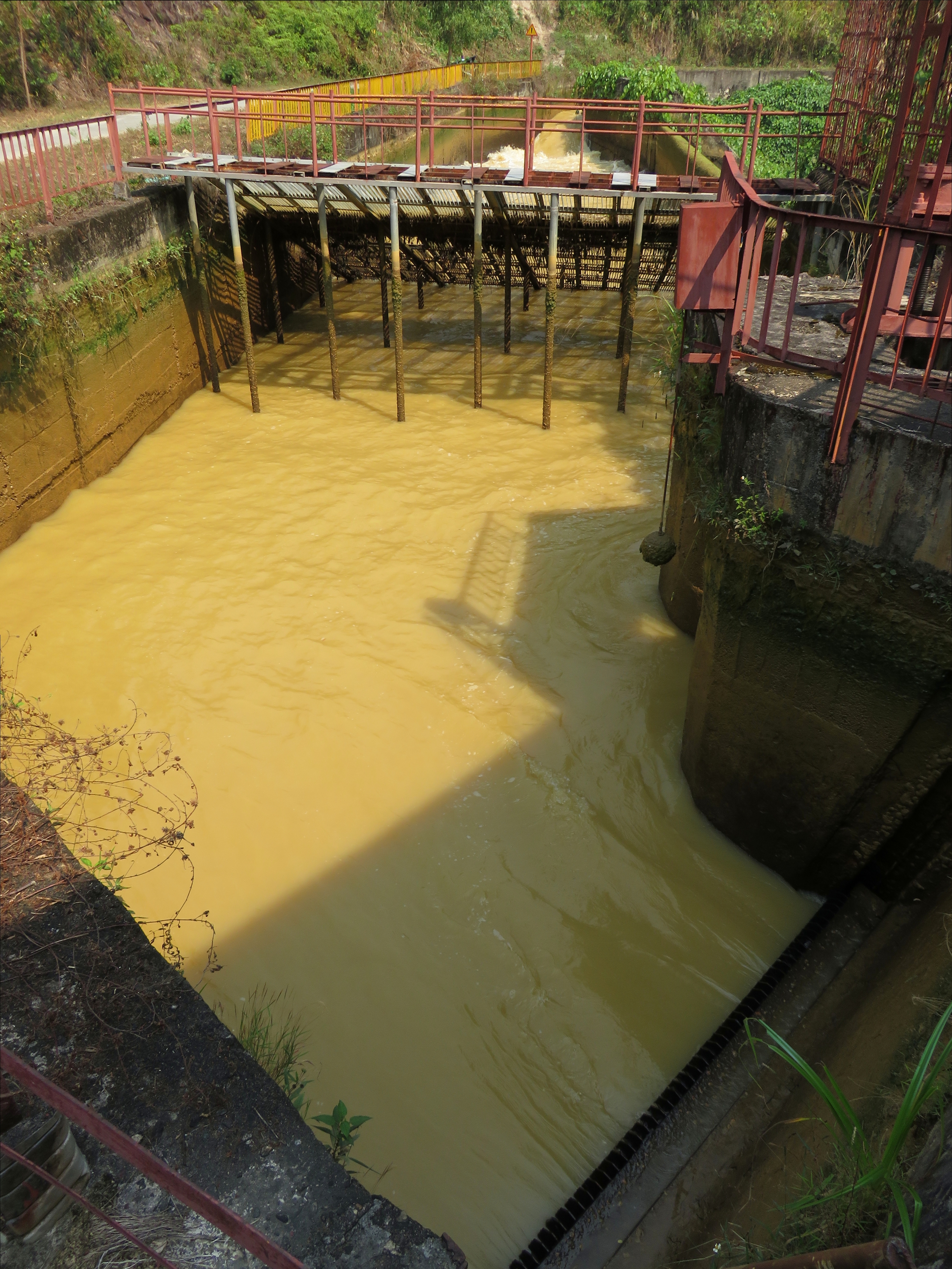
Song Vang hydro canal, the water drops just out of frame right down a tunnel to the river and powerhouse far below.
|
The canyon of the Song Vang is home to not one, but TWO hydroelectric power projects. I believe they are all tied into the same larger project but there are two separate capture-fall-return systems in the canyon. The first one extends nearly the whole length of the canyon, whilst the bottom one only covers a couple of kilometers. For the lower one, the water is not run underground in tubes like the upper project, but is instead funneled through a diversion ditch that runs the length of the road from it's capture dam to it's final plunge down to the turbines. It's an interesting sight to see the end of the canal as it pours into a catchment basin and then drops down a huge tube into the earth. You can hear the sound of the water falling and it's not a little bit creepy.
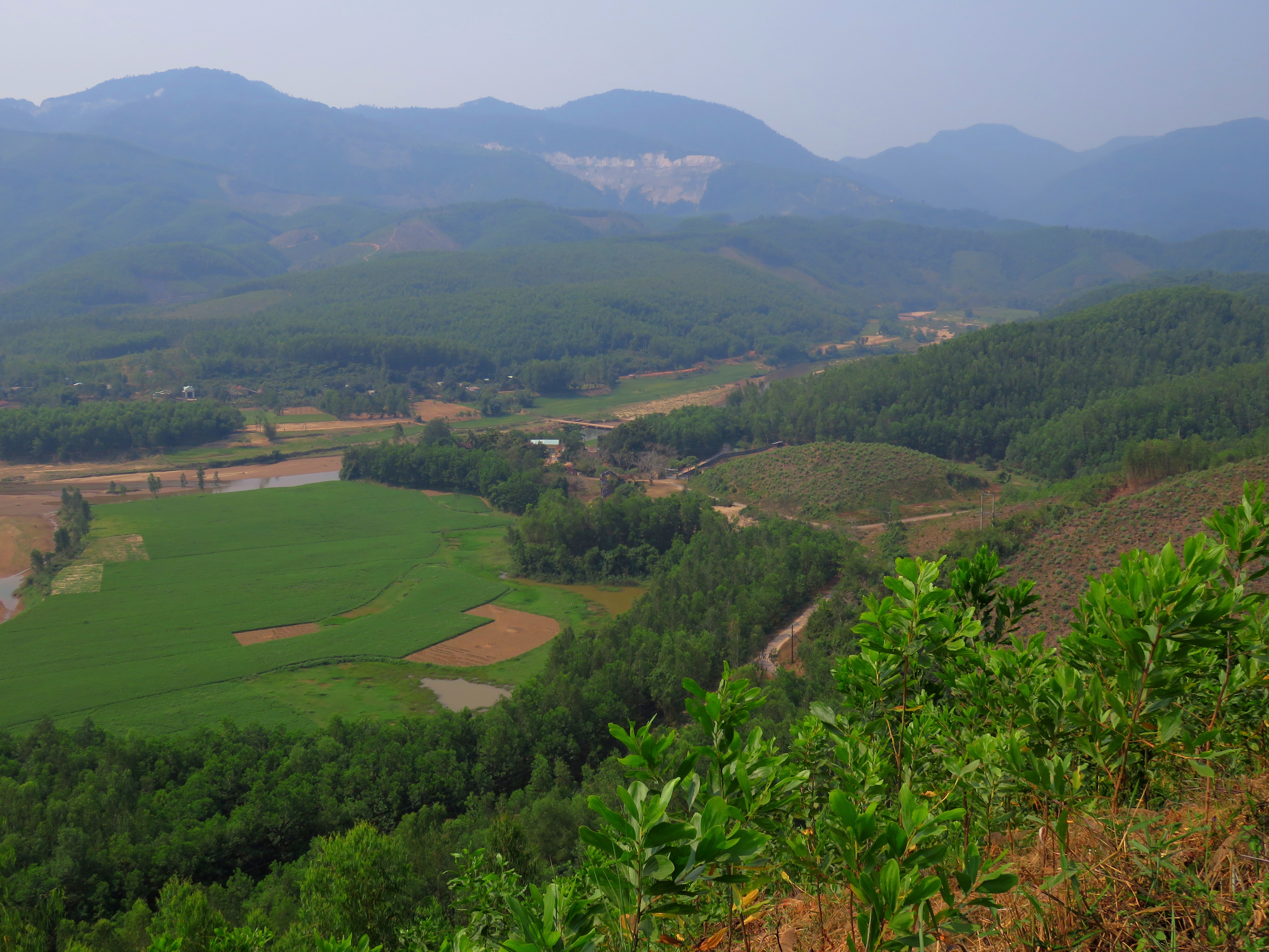
Looking up the valley of the lower Song Kon.
|
It's really a bummer they dammed this canyon; there was some large ledges and gradient drops that looked like they would be pretty incredible with water. I'm going to have to drive up this canyon during a heavy rain event and check it out. Back down the canyon, I stopped to snap a photo of the valley I was to drive up, as well as try to get a photo of the quarries across the valley, on the mountains rising to the south. These would be germain to what I would see soon as I continued along the main road.
|
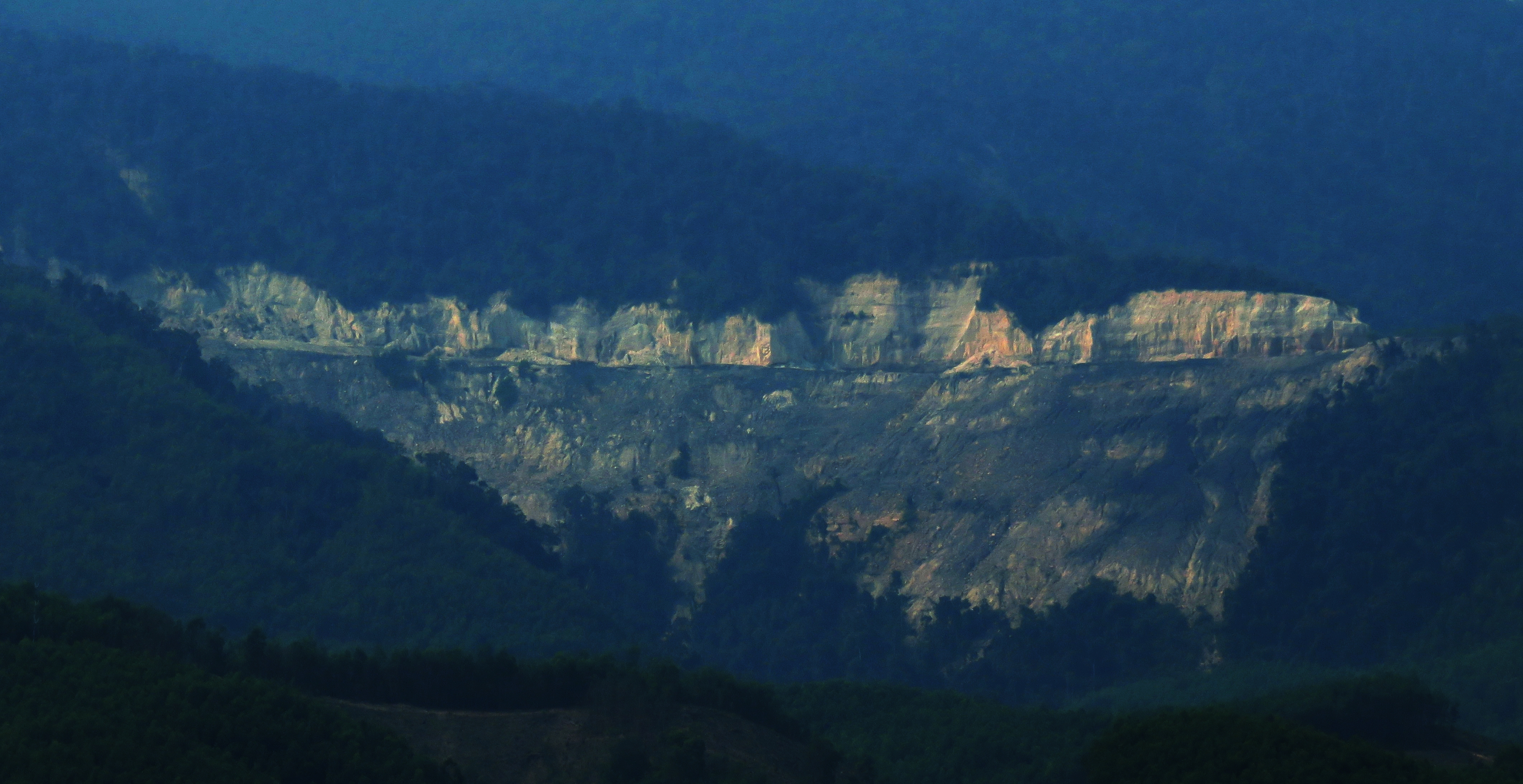
Quarry.
|
Back on track, I continued up the dirt road, which stayed between not bad and not good for quite a while. Around a couple of bends and I crossed a drainage where the valley bottom had been filled with sediment from what looked like a flash flood or debris flow; the road was also damaged and the construction crews were in the process of rebuilding the crossing over the water course. It was quite disturbing to see. It's a direct result of the resource extraction pictured above. I'm not sure exactly what it is they are extracting but it's a pretty major effort underway, and the waste rock and de-nuding of hillsides is leading to major debris flows channeling down the canyons below the quarries. These quarries are only along specific elevations at certain points, and they are limited to these localized mountains, so I'm curious as to what it is they are taking out.
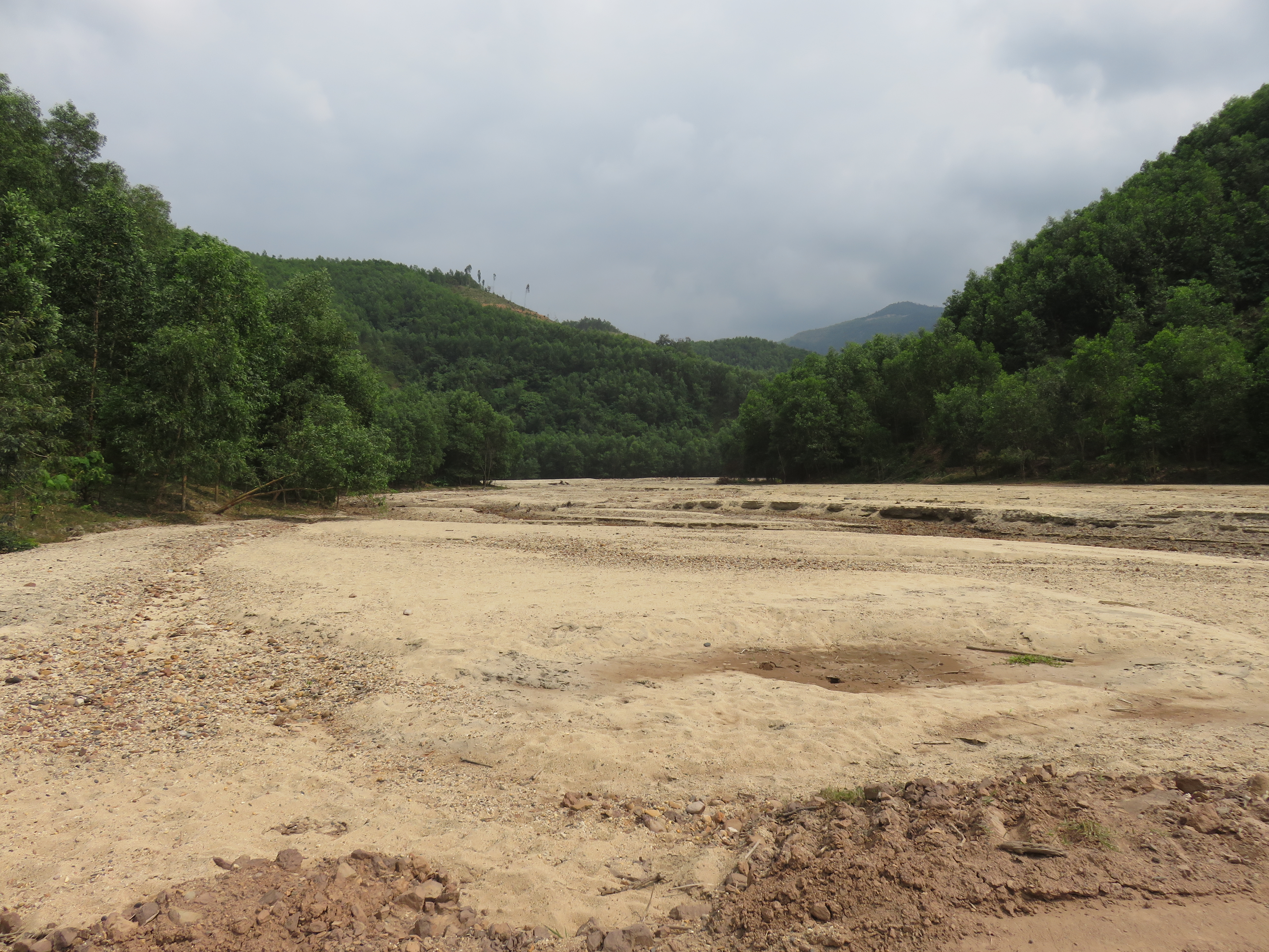
Washed out gully with flash flood sediments.
|
Soon enough we passed the confluence with the Song Kon, which like the Song Vang, comes pouring out of the mountains after cutting a serious gorge through the mountains northern Dai Loc. Interestingly, while the waters of the Song Vang are a deep yellow-brown from all the sediment carried down from it's headwaters, the Song Kon flows refreshingly clear and blue. Above this it was small villages and gorgeous rice paddies for a few kilometers. I passed the Ka Dang school at one point, and went out to a bridge for some pictures and ended up getting some good photos of some local boys.
Somewhere in here the road changed to a paved surface that was in surprisingly good shape. I enjoyed the change from the slow dirt and stones and got to cruising for a while. There were more small villages scattered along in this section, each one beautiful and quiet and very peaceful, with rice paddies filling the gaps between. |

Boys outside Ka Dang School.
|
Just outside of Ka Dang.
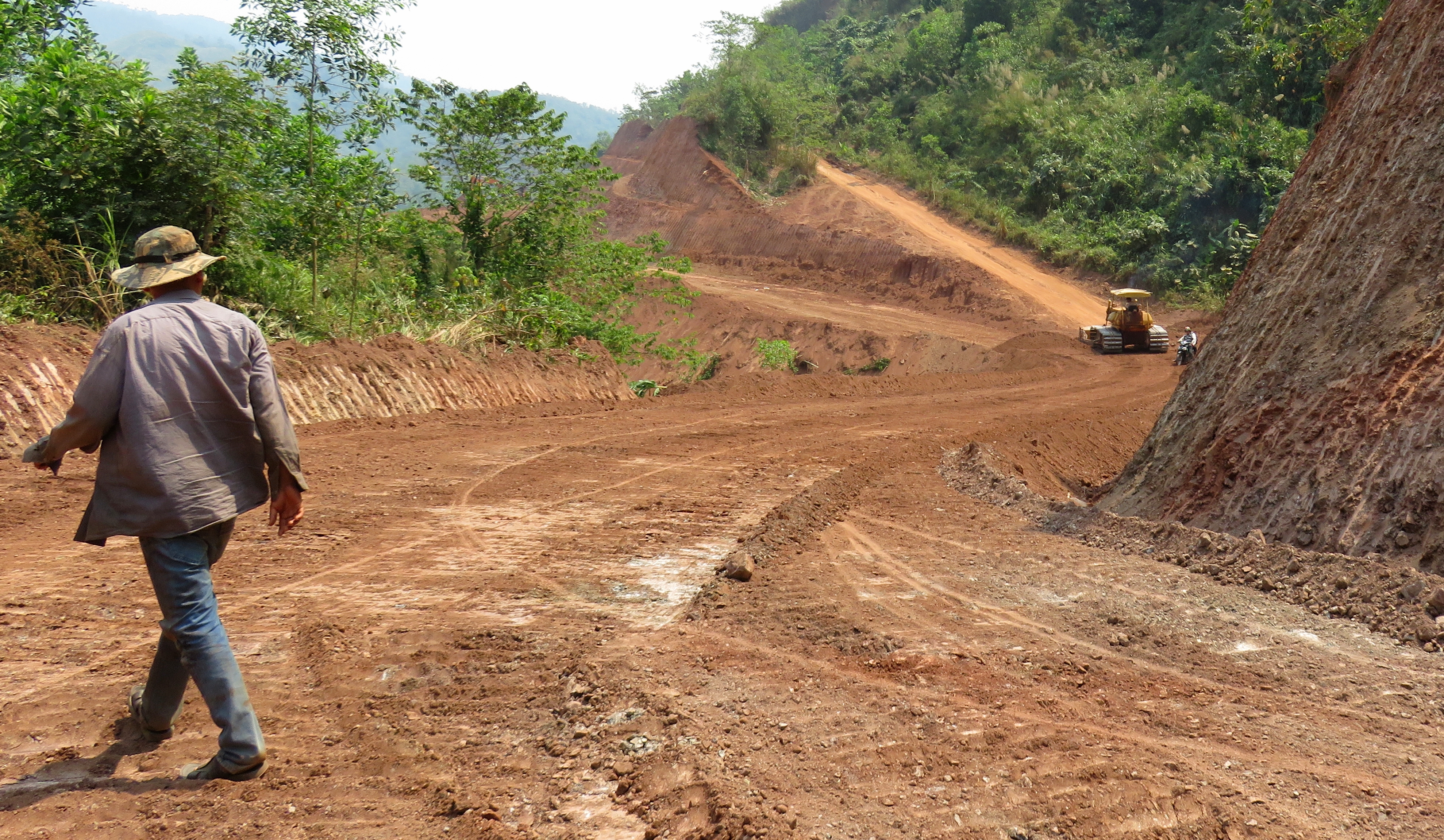
The road is being improved.
|
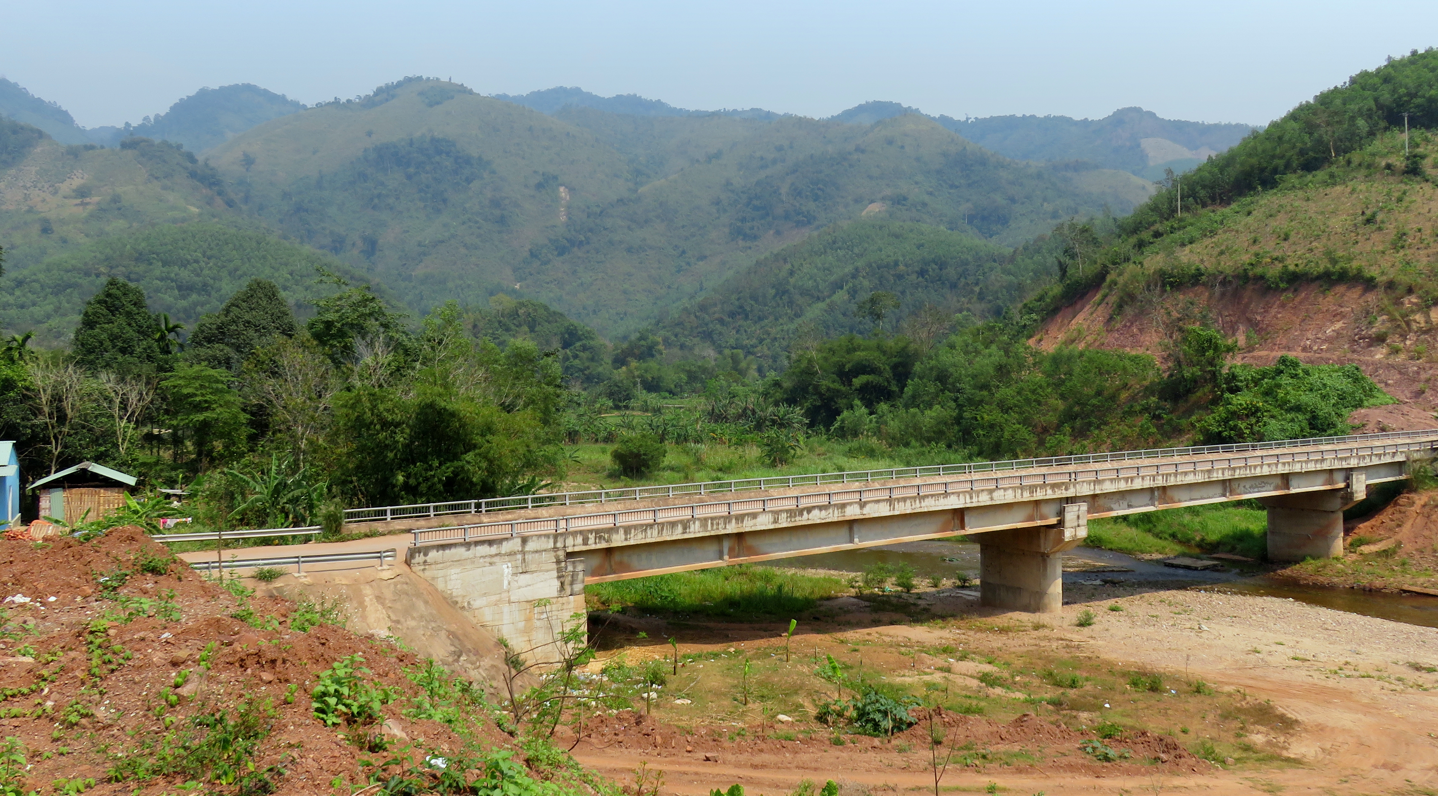
This bridge goes to some local villages, and nothing else.
|
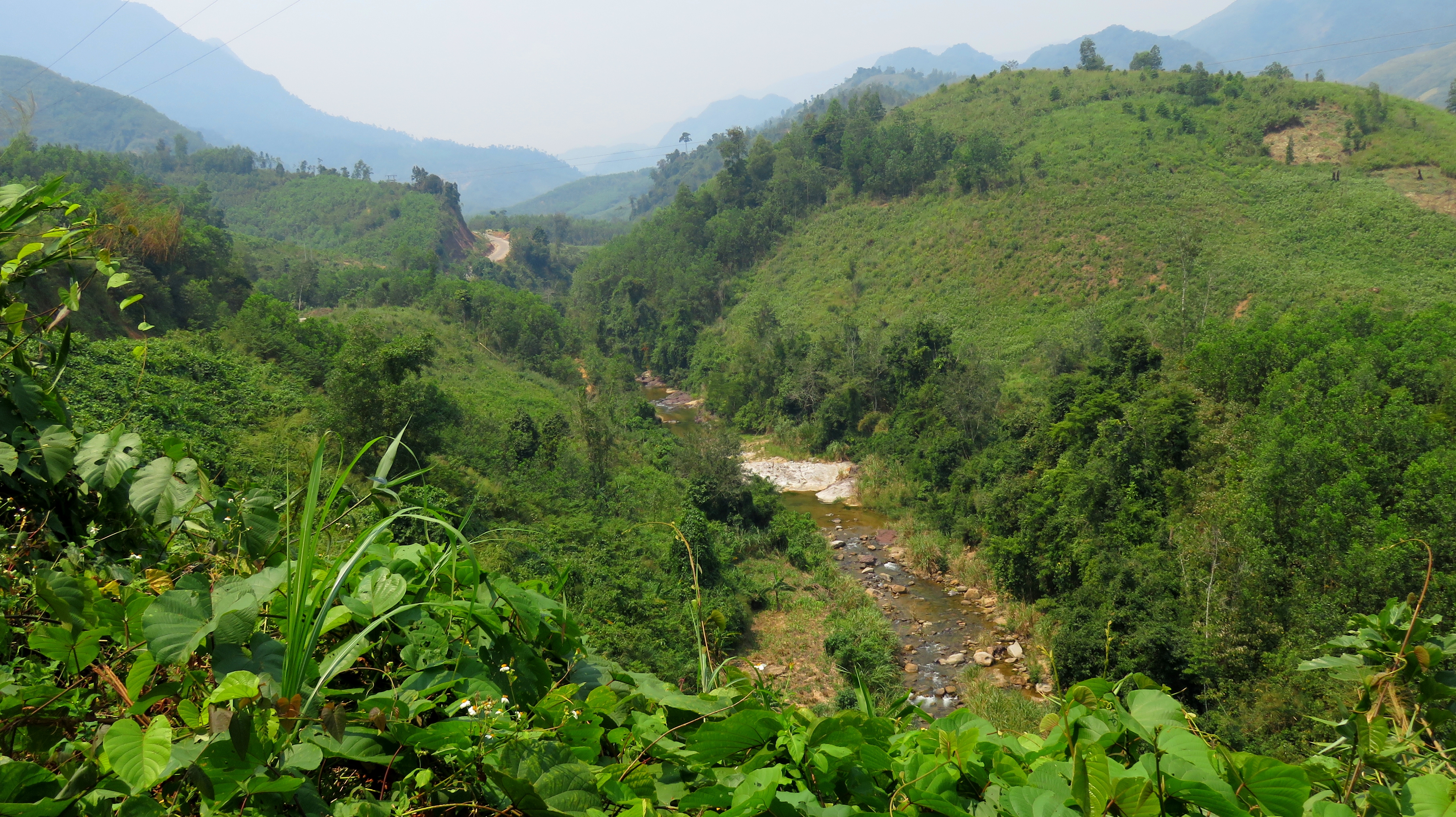
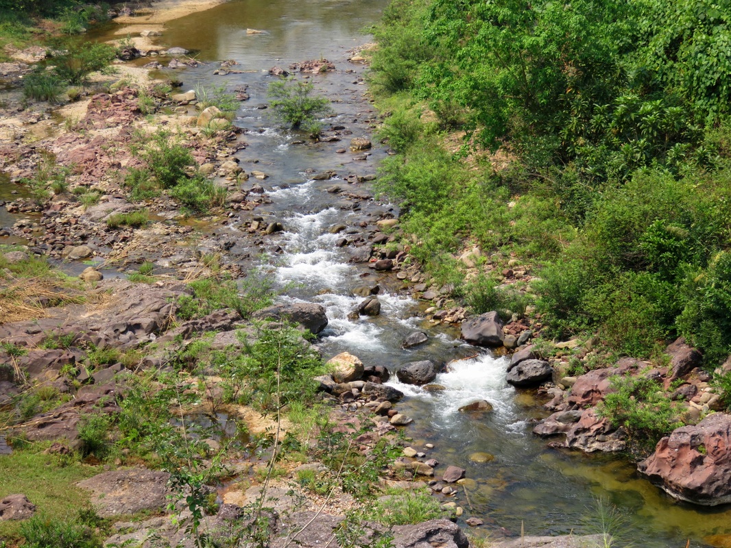
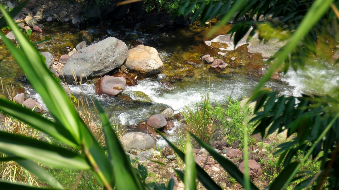
Soon the villages fell away and the canyon started to become more defined, bigger, and steeper. Glimpses of the canyon far below the highway revealed a river that would quite enjoyable to run in a ducky. Small waterfalls, slides and rapids dotted the course, never offering anything super serious but always looking like a lot of fun. Shortly above one of the villages a major side fork came down from the mountains and the riverbed showed itself to look like clean, polished granite. Using the zoom on my camera, I was able to hone in and get a decent picture of a rapid that looks like it is right out of California. Definitely enticing to come back and explore.
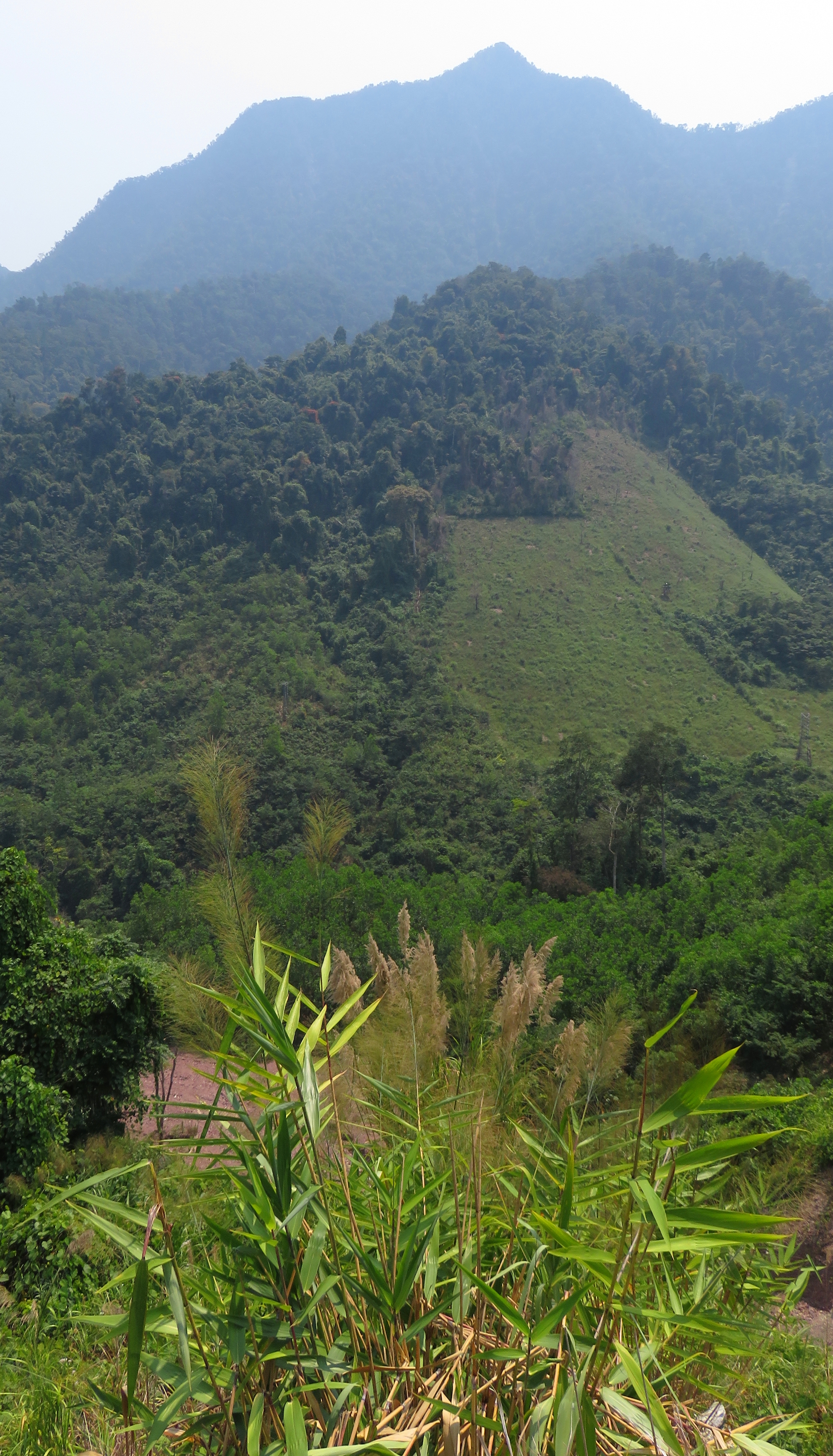
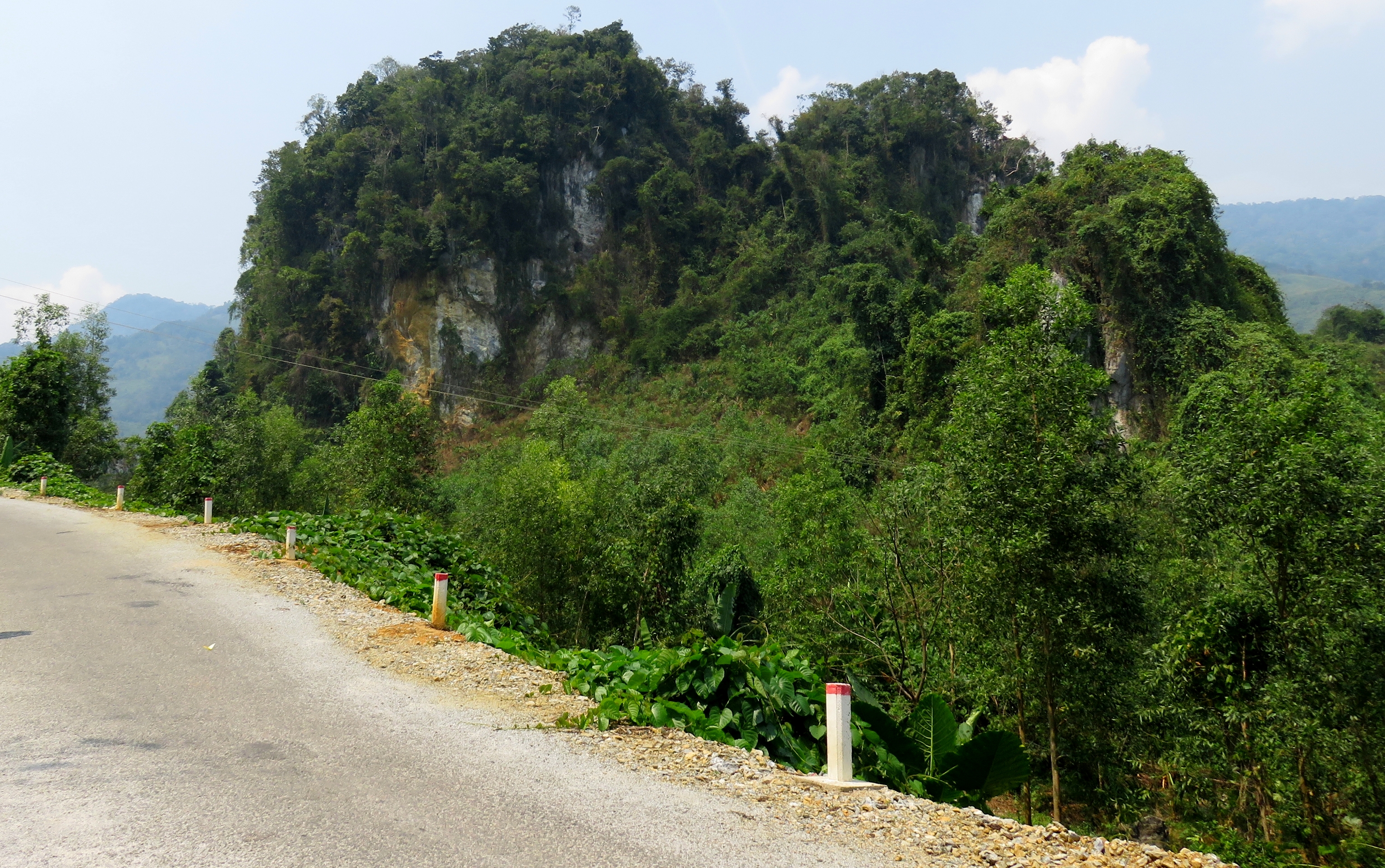
After passing one more small village, the next bit of scenery was quite impressive: on the left the mountains leading up to the Nui Djerone were drawing in close, and on the other side some impressive limestone stacks popped up out off the jungle. I was seeing two different kinds of geology, and was obviously driving up and old fault between the two geologic structures. It felt like I was in the Land of the Giants, and reminded much more of other areas of Vietnam, especially areas in the north-central and northern parts of the country. It certainly didn't feel like Hai Van, Ba Na, or some of the other areas around Da Nang with their granitic mountains.
In the Land of the Giants.
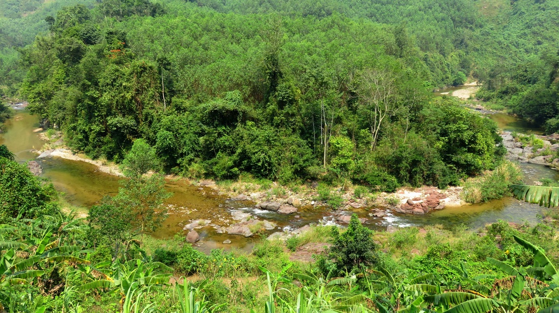
Big bend in the river, Land of the Giants.
|
Rounding a couple more bends, I abruptly ran out of road. Well, that's not true; I had run out of good road. What stretched before was first nothing more than a simple dirt road. I dropped it into 2nd and took it quite easily. However, around the corner, the shit really hit the fan and the true nature of the road revealed itself. Large, chunky stones, between the size of grapefruits and bowling balls, but with much more jagged shapes, made up the "road". Looking up the road, it was clear that there wasn't that far until the top of the pass, perhaps 2 kilometers or less. Deciding that I hadn't come all this way just to turn around, I dropped it into first and started working my way up the madness. Along the way, the road itself went over some impressive geologic layers. At first it was driving up soil and alluvium, but that was quickly replaced with some granite. That then changed to limestone, and after an abrupt and bizarre chunk of sandstone, and some weird metamorphosed veins, I seemed to be in the limestone for a little while anyway. The abuse was worth it, however, as near the top is when I encountered the view talked about in the introduction. I stopped here for about 15 minutes, taking in the views and trying to take photos in the awkward, washed out lighting of the day.
|
The Sentinel.
|
Nui Djerone, with The Sentinel on the left.
Limestone tower near the road.
|
The range across the way is known as Nui Djerone, and there is one peak in the middle that seems to dominate the landscape here, so I dubbed it "The Sentinel", and thus, "Sentinel Canyon" stuck.
I would've loved to have stayed and hung out longer, but I needed to make tracks, so I was quickly back on the bike and headed off. In some sections of the road there were decent retaining walls, and it went through some serious road cuts here and there too, so somebody spent some time and manpower to build it. However, seeing the condition and shape it's in now means that it hasn't had any sort of maintenance in years and years. So, my thought is that it was from the US War, and was an old supply road between the coastal plains and the Ho Chi Minh Trail network, but who knows? Either way, its been reduced to a rough single track and it would take a mega project to return it to top standards at this point. Finally I crest over the top. My route squeezes between two stacks of limestone, with a third directly in front of me, and my first thoughts about caves possibly occurring in this area began to happen. |
Ma Cooih Area
Just after the singletrack ends.
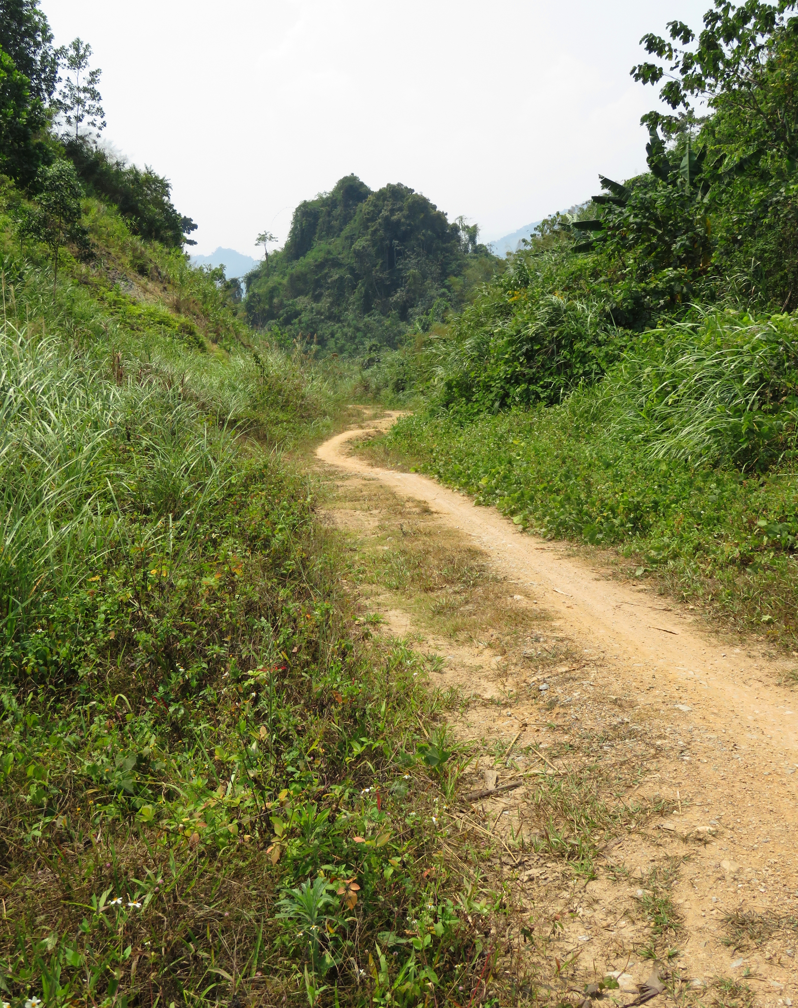
If I had to describe the Ma Cooih area in very short terms, I would say "limestone towers and ethnic villages". Once I came over the "pass", I dropped down the hill and around the limestone tower I could see from the top, and right away passed a couple of houses, a small lake, and some cultivated land. The road grew to be as wide as an actual road, not singletrack, and just a hundred meters or so later I came around the corner and was not only back on a paved road, but was also in the middle of some local villages.
Azal Village.
|
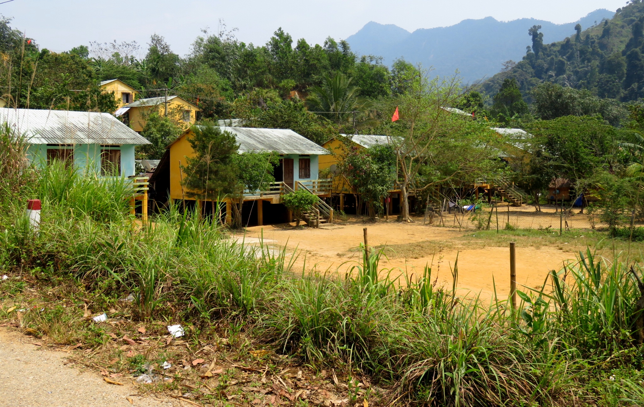
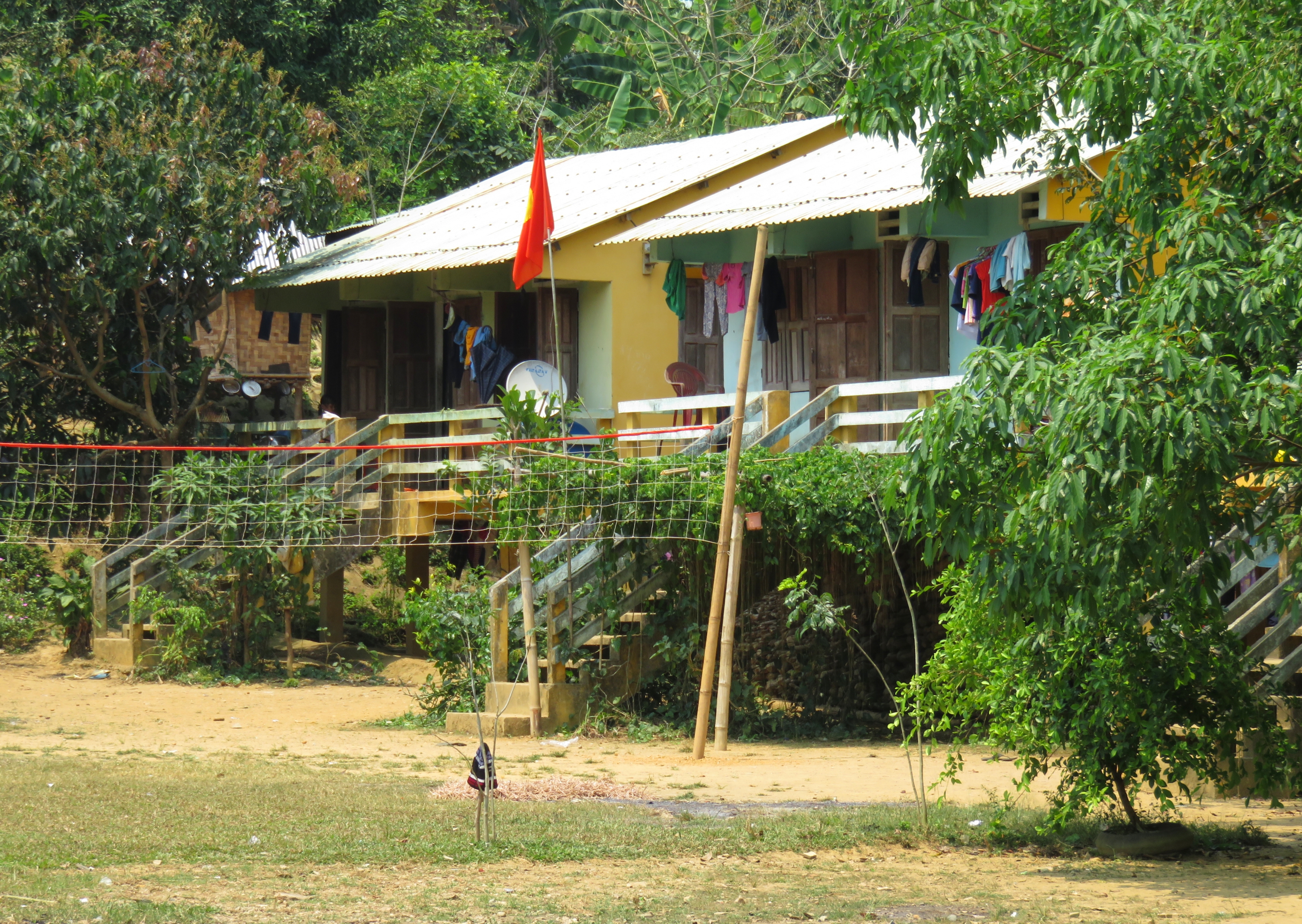
These villages are quite interesting. All of the structures are the same, and they are built along nice rows and with typical circular communal houses located in the middle of each one. I'm not positive, but my guess is that the people in this village likely came from the areas that were flooded when the A Vuong River was dammed just over the hill to the west.
Ta Reng Village.
|
Azal Village.
|
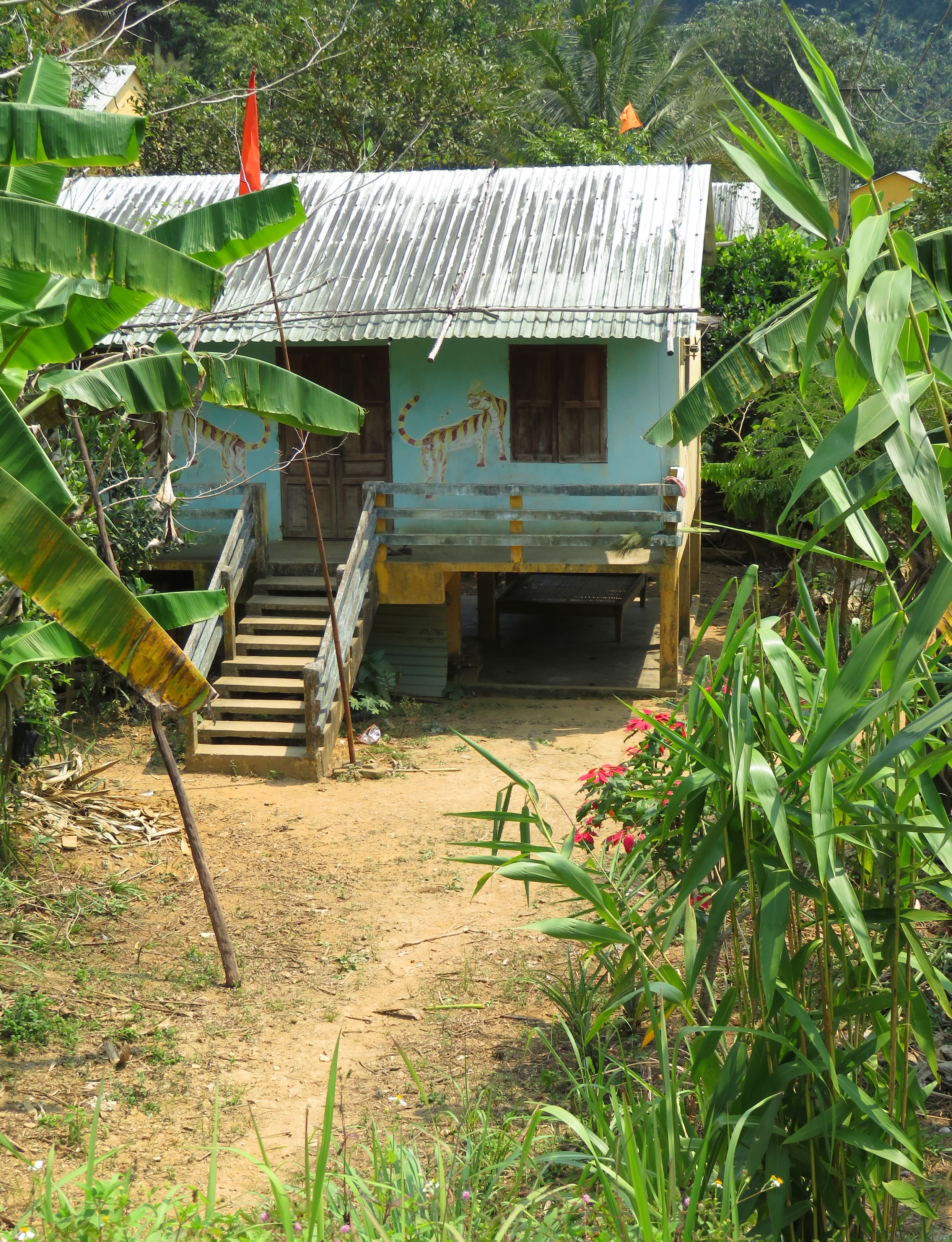
I parked on the road and quietly walked into one of the villages, a small place known as Ta Reng. I didn't stay long, as I didn't want to be too much of a gaping tourist. So, I stayed by the entrance, and took a few photos. It was during the middle of the day so most people were snoozing inside but the few people I did see were very friendly and waved and said hello. The houses themselves were one story, with one central room (although a few of them have two rooms) and a smaller building outside that is typically used for cooking, bathing, and the toilet. Since the local people traditionally lived in stint houses above the forest floor, the concrete structures are built in the same way, with a large space under each house out of the rain that acts as a storage area/garage/outside room. Accessed by a concrete stairway and with a metal roof, they are neither big nor unique, but they do get the job done. There are other resettlement areas in the general area that were built on very poor sites for villages, with no land for agriculture or personal use, and with poor access to water. However, the villages here seem to be doing well enough. There are crops all around the communities, and it has abundant and close water supplies. The local school also looked like it was quite well used, which is always a great sign.
Limestone towers near Ma Cooih.
Aside from the villages, the other interesting thing about the Ma Cooih area is the proliferation of limestone towers stretching from near Ka Dang all the way to the shores of the A Vuong 1 Reservoir. These stacks closely resemble those found in at Marble Mountain, near Da Nang, or the other limestone areas of Vietnam, Ninh Binh, Ha Long, and Quang Binh. These towers had a bit more vegetation than our local towers at Ngu Hanh Son [Marble Mountain] but they were beautiful and classic all the same. These stacks also represent a bit of a geologic anomaly in the local area. While the mountains to the north and south are both mostly dominated by granite bedrock, there happens to be a random streak of limestone that runs along some local fault lines. This streak of rock runs generally west-southwest and stretches for several kilometers, and after having driven around the area quite a bit now, I am very curious as to whether there are caves or not. Certainly you can see cave openings in the faces of stone, so the question is how developed are the passages in such a small area of limestone? Certainly an interesting thing to think about, considering Vietnam's cave potential. The local villages are located in and around several of these.
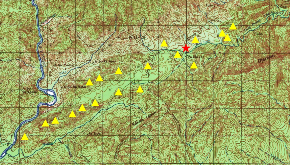
Limestone towers [yellow] in the area surrounding Ma Cooih [red].
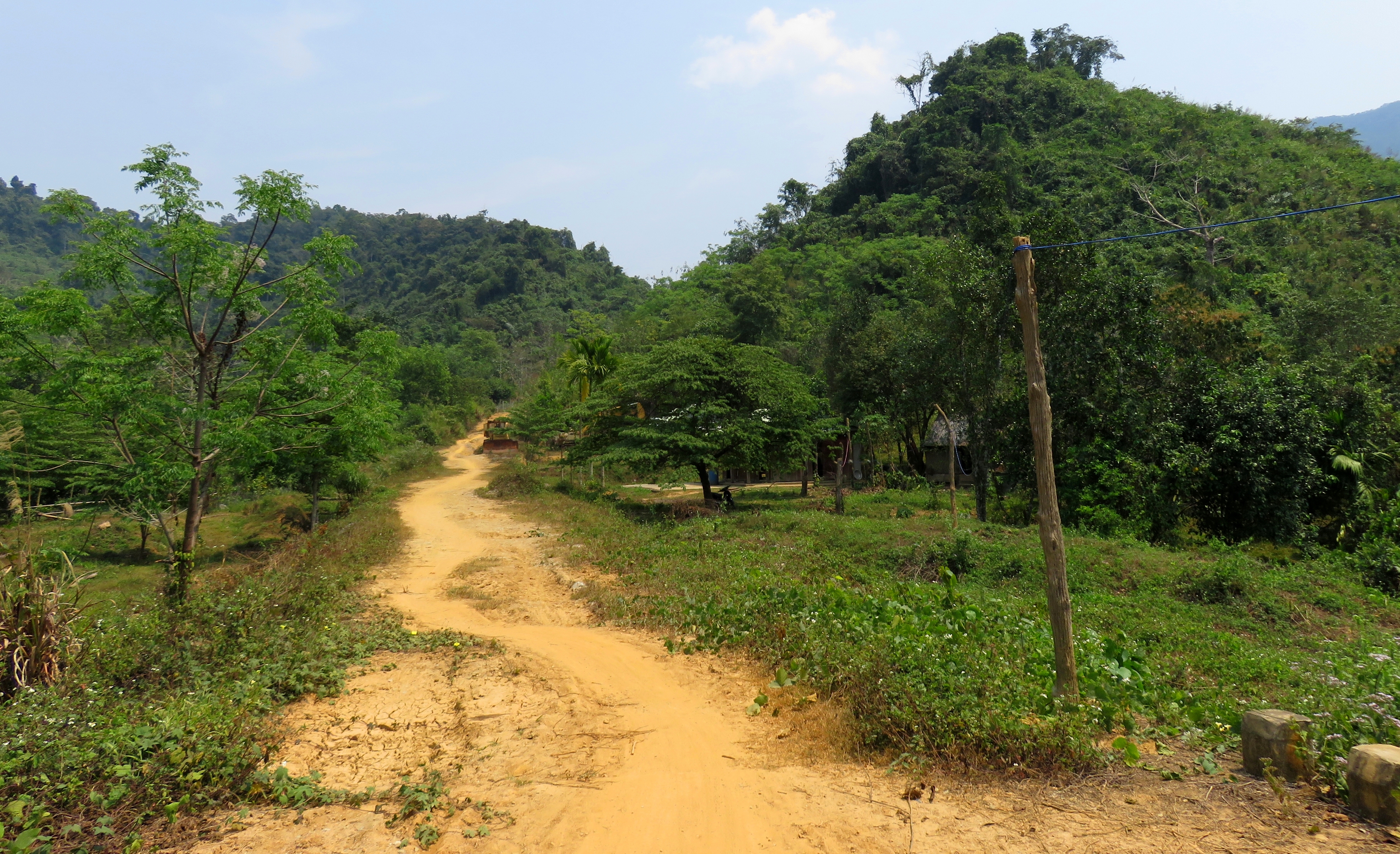
Soon after cruising around some of the the limestone towers, the road went through a small neighborhood and before I knew it, I was turning onto the Ho Chi Minh Highway. My journey started in Da Nang at 8 am, and I was pulling onto the Ho Chi Minh Road just before 1 pm, and that was with a fair number of short stops. I don't know if I would ever do this road on a consistent basis, and to be honest I may only have one more trip up this road in my life. The stretch from The Land of Giants up to Ta Reng and Azal was intense and jarring. However, the view at the crux of the trip, of the Nui Djerone towering over the canyon and valley and villages below is pretty damn impressive and may just be worth it once or twice. People with bigger, more aggressive dirtbike-style bikes may enjoy this road more than the average driver. However, for those looking for a real adventure with a shorter crux section, it's worth a visit.
The Map
All photos copyright Kit Davidson unless otherwise noted.
Maps copyright US Army and GoogleMaps.
Maps copyright US Army and GoogleMaps.
