After our time in Savannakhet came to an end, it was time to head south for the next leg of our Laotian adventure, and make our way to the city of Pakse. The bus ride turned out to be a hoot, as you can read about here. Once we hit Pakse, we were obligatorily ripped off by a tuk-tuk driver and got to our hotel, called the Hotel Sisouk, which turned out to be quite nice, and one we were pretty happy with.
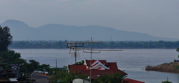
Pakse turned out to be quite an interesting place. It's clear that it used to be a much quieter and smaller place, but development has come to Pakse rapidly, and the city and it's suburbs are growing quickly, and construction on the roads and new buildings is everywhere. The city is one of many markets, with both numerous local markets and a couple of new "International" (read: Thai) markets springing up. Just Savannakhet, the city sits on the shores of the mighty Mekong River, although in this case the Mekong is entirely in Laos, and the border with Thailand is actually a 45 minute drive west from the river. The city is cradled between several small groups of granitic hills, and is quite beautiful, framed by those small lush islands of green rising behind the buildings of town.
Pakse turned out to be quite an interesting place. It's clear that it used to be a much quieter and smaller place, but development has come to Pakse rapidly, and the city and it's suburbs are growing quickly, and construction on the roads and new buildings is everywhere. The city is one of many markets, with both numerous local markets and a couple of new "International" (read: Thai) markets springing up. Just Savannakhet, the city sits on the shores of the mighty Mekong River, although in this case the Mekong is entirely in Laos, and the border with Thailand is actually a 45 minute drive west from the river. The city is cradled between several small groups of granitic hills, and is quite beautiful, framed by those small lush islands of green rising behind the buildings of town.
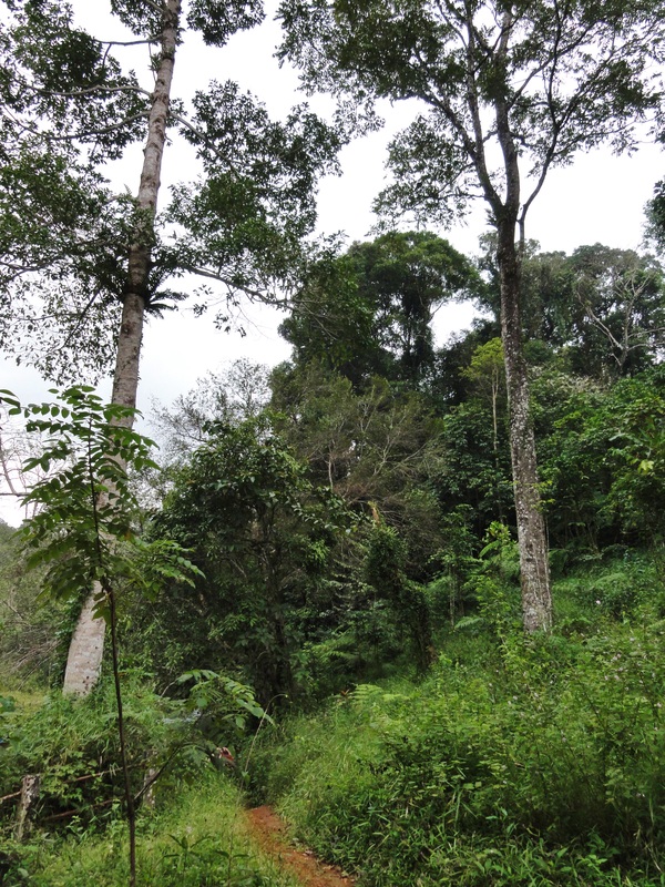
West of Pakse rises one of the dominant landforms in southern Laos, a huge volcanic uplift called the Bolaven Plateau. This large massif rises almost 3,000 vertical feet or 1,000 vertical meters, above the surrounding plains of the Mekong. Sometimes that relief is extremely abrupt, as is the case on the east and southern peripheries of the Plateau, but on the west side the slopes rise gradually but consistently all the way up. The top of the Plateau is dominated by coffee plantations, centered around the town of Paksong. We looked at staying in Paksong but none of the lodging options were calling our names so we passed and stayed in Pakse instead. The plateaus is comprised of Neogene-era Basalts, which are between 10 and 20 million years old, quite new in geologic terms, and are a result of the same volcanic action that brought the Kontum and Gia Lai basalts in south central Vietnam into being. There are Cretaceous-era sedimentary rocks underneath, of about 80-100 million years in age, but those are not visible, nor is the interesting 60-80 million year unconformity between the two. Over time, numerous rivers and streams have cut into deep into the basalts of the plateau, creating (as would be expected) deep gorges and numerous waterfalls of varying sizes. The area looks a lot like the Pacific Northwest, only with a different vegetation type, and certainly very much like the canyon country around Kontum and Pleiku, Vietnam.
When we had been researching and planning for the trip, one of the things I wanted to do was spend a day hunting out and finding as many waterfalls as I could on the west side of Pakse. Here, the road climbed steadily up, up, and up from town all the way to Paksong, and numerous waterfalls could be accessed on either side, as the road traveled up a ridge that was flanked by two large gorges on either side. This would give us easy access to falls on both sides of the road.
|
|
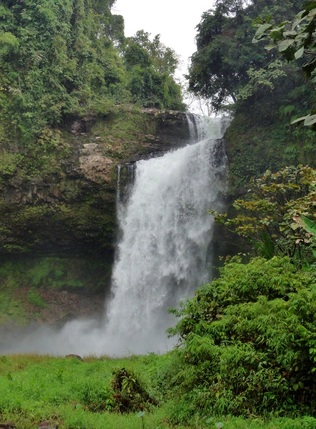
The first falls we visited was on the river to the north, the Vang Ngon River, an impressive falls of about 25-30 meters called Tad E Tou. A few of the falls in this area are well advertised, and this one was no exception. Driving off the road is impressive in this part of the world, as once you leave that blacktop, it feels incredibly rural and local right away. The houses are small and simple, with small fields of crops around them. As with other falls on the Vang Ngan, you park on the canyon rim and walk down below the falls. The stairway was sketchy, a long set of a stone, brick, and root steps sometimes accompanied with a "handrail". But soon enough we were down and admiring the falls from below. The falls is an impressive two-stage drop, with the first tier falling about 8-10 meters onto a shelf, and the second falling about 20 into a churning pool. It was at the very end of rainy season when we were there, so the falls was still running pretty high volume, misting us with spray despite being 50 meters from the base of it. The kayaker in me wanted to run the small rapids and falls below this drop.
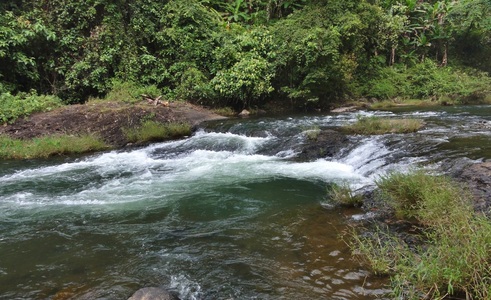
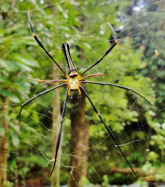
Our next stop was just up the road, on the same side, on the same river, just a couple of kilometers further up. Tad Champee was a beautiful fulls that was more of a "curtain" type falls, with a wide lip creating a wall of water, rather than one concentrated flow spout. This one had a bit easier of a trail to the base, taking a longer but less steep route than the one at E Tou. Champee had a beautiful pool in the bottom of it that invited a nice swim, but I was a little fearful of leeches in the water so I skipped it. After viewing, I wanted to look at the rapids below it, as I could hear some "river thunder" growling in the gorge just a short ways below the big falls, so we went bushwhacking into the jungle and headed towards the sounds. We didn't get too far, however, because Kelsey quickly noticed there were some itty bitty leeches moving in and eating our toes. Naturally, this freaked her out big time, so after stopping long enough to snap a picture of a huge golden orb weaver spider nearby, we bailed and headed back to our bike.
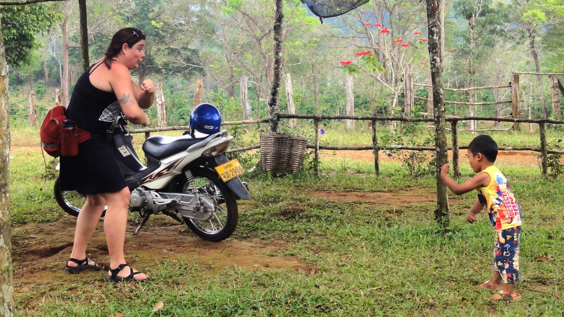
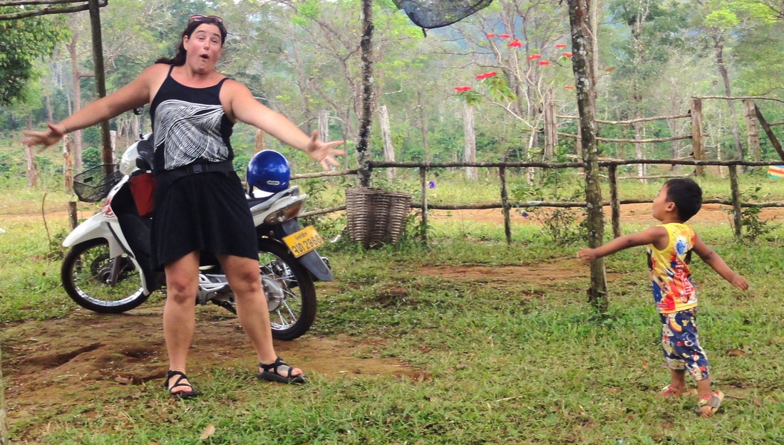
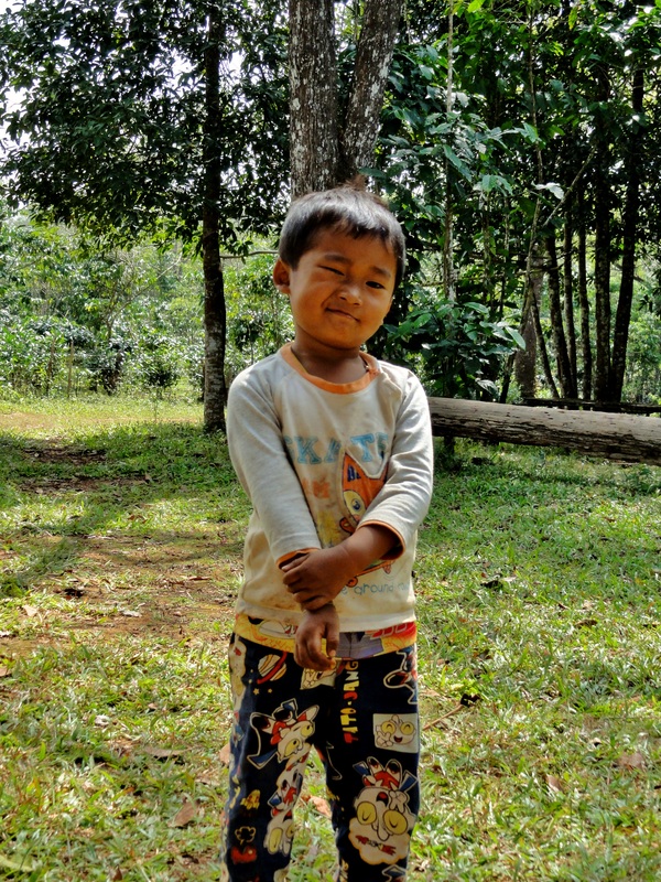
Back op top, the little boy who was hanging out with his mom, the nice lady who sold us our entrance pass, was super excited to see us, so Kelsey and him started playing, enjoying some interaction with the locals. Mom watched on with a big smile, and we lingered around for 20 minutes before resuming our hunt.
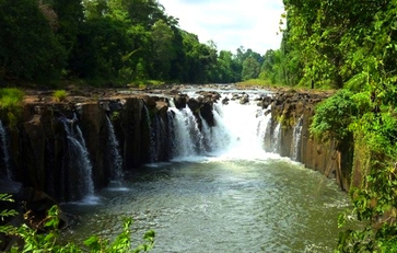
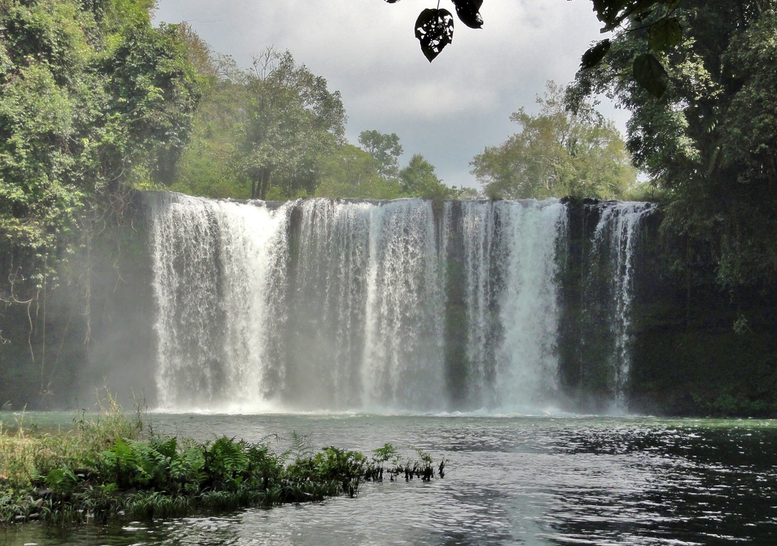
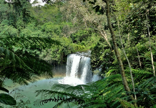
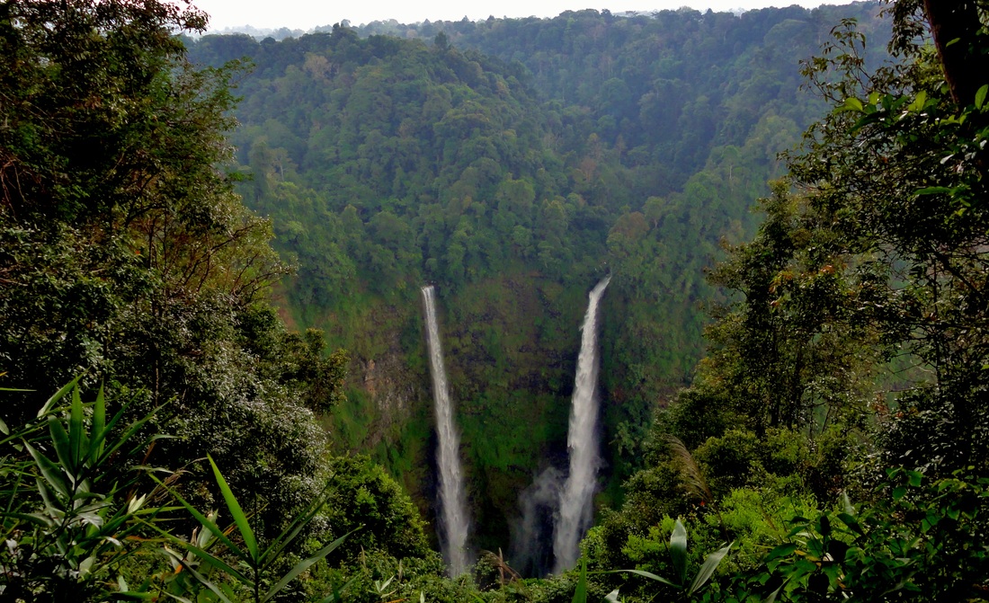
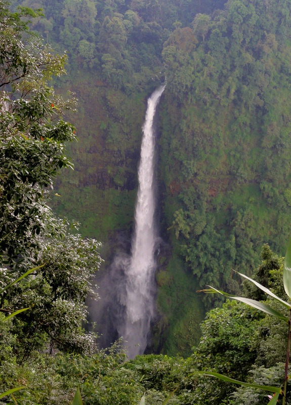
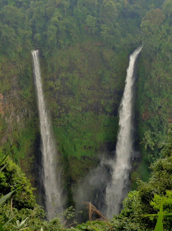
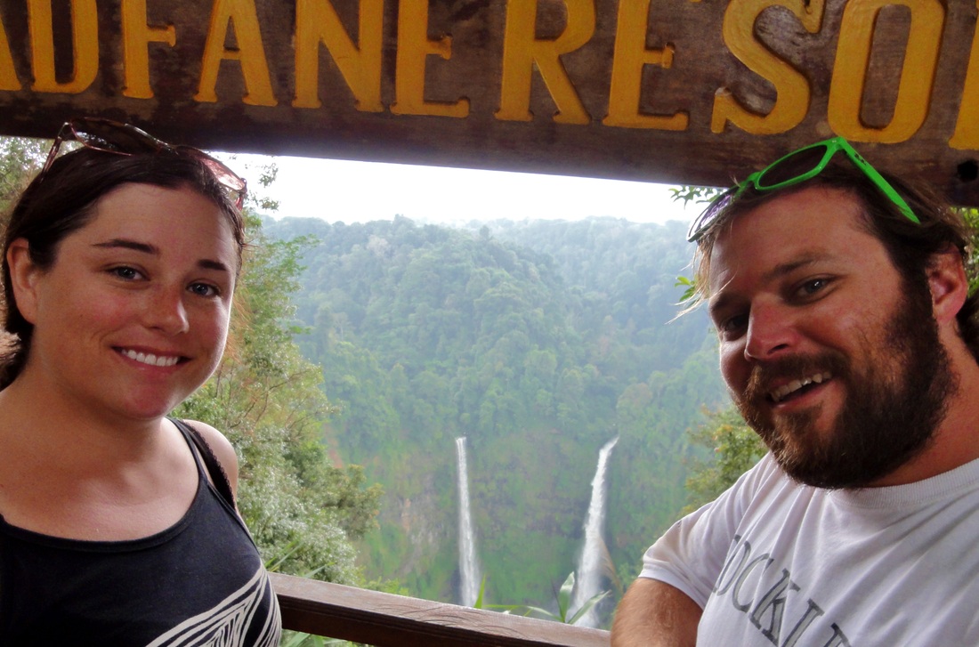
We had now spent most of our morning getting out of town and exploring these two falls, and our stomach's were beginning to growl. So, we decided to spin it over to Tad Fane, which not only was the tallest waterfall in Lao at apprx. 120 meters, but also sports a resort on the rim above it, allowing us to not only view another falls but also chow on some lunch. The food was typical Laotian tourist food- filling, but uninspired. Tad Fane is spectacular, because it isn't just one falls, there are two of them that drop off the same plateau and into a gigantic bowl in the earth below. The falls were so tall that from our vantage point we were unable to see the base, and had to hike a ways down the ridge after lunch just to peer back up and get a glimpse of the whole thing. This is only the second time I had actually seen the tallest waterfall in any country, after Yosemite Falls in USA.
|
|
After a leisurely lunch at Tad Fane, timed perfectly to avoid the rainstorm that popped up while we were eating, it was back on the road to finish our trip to Paksong. I wasn't sure what to expect from the little town on the top of the plateau. It was really the central cofus of activity on the top, from the coffee plantations to the local towns. I had wanted to visit it, especially after decided not to stay there. It was kind of an odd place. There isn't a central business district like you see in most places, instead only a few business and small market stalls spread up and down the road for a couple of kilometers. It was also quite cool, and we were feeling a bit chilly in just our shorts and t-shirts, so we were quite glad we were staying down in the jungles. With Paksong seen, it was back down the hill to Pakse, and a nice leisurely stroll through the city before dinner.
All photos and information copyright Kit Davidson unless otherwise noted.
