In early 2016 my good friend Kong told me about a waterfall he had visited before, down in Quang Nam, that he thought I would really enjoy. We kept making plans to go see it, but those plans kept getting interrupted by unexpected things coming up. However,, in late March of 2016, we finally put the team together and made it out to the falls, and got a great day trip out of it as well into Nam Giang District of Quang Nam.
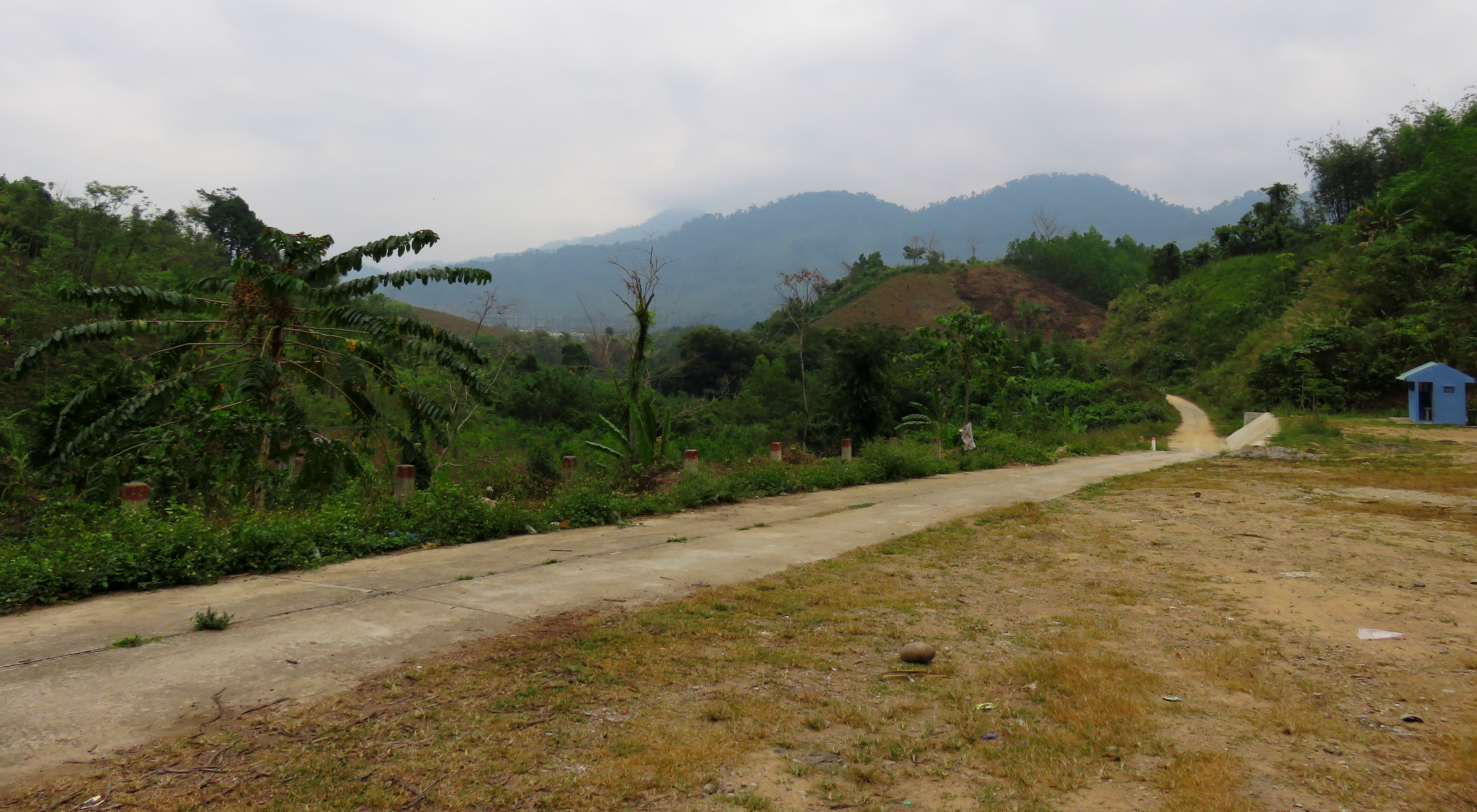
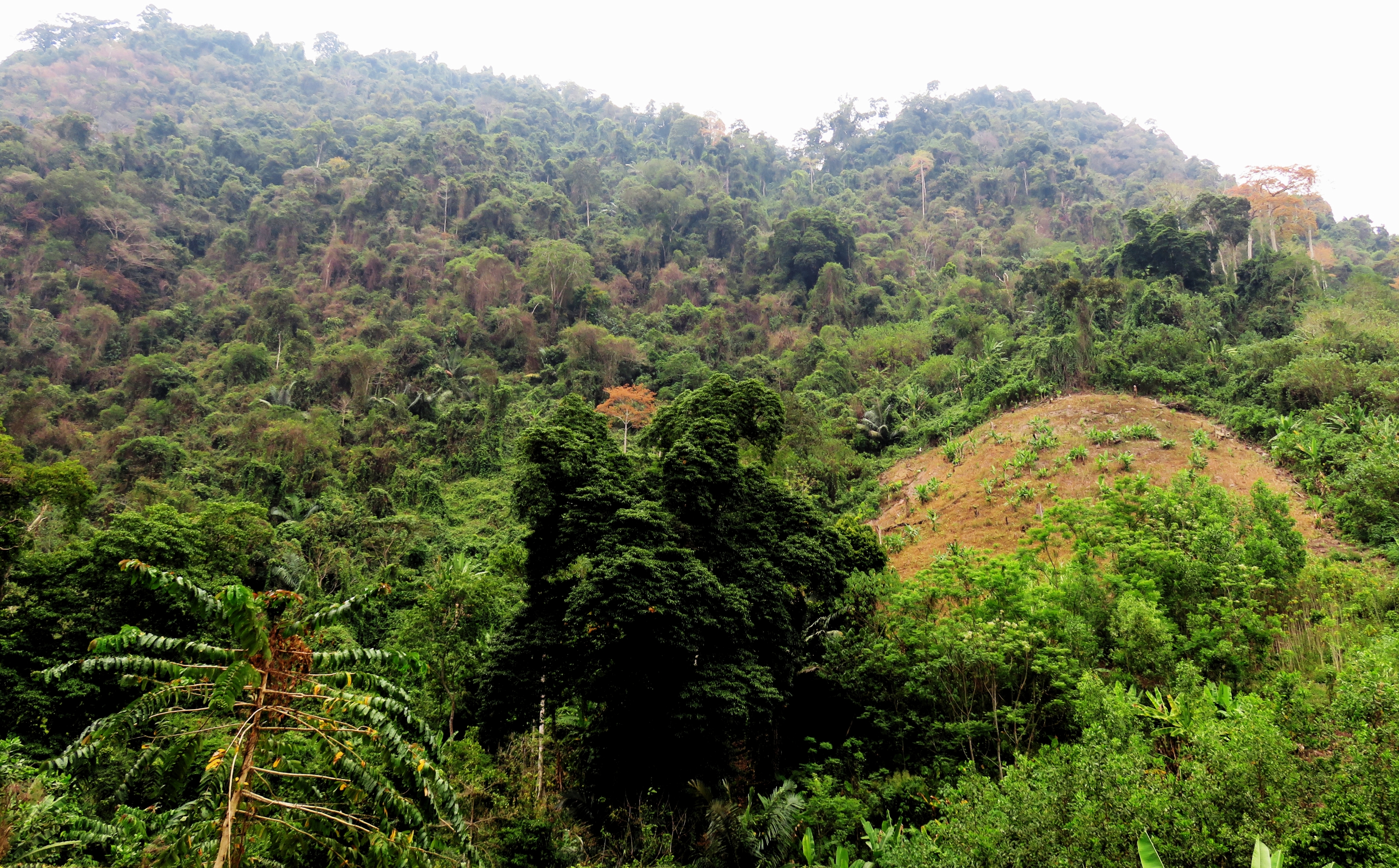
Quang Nam mountains.
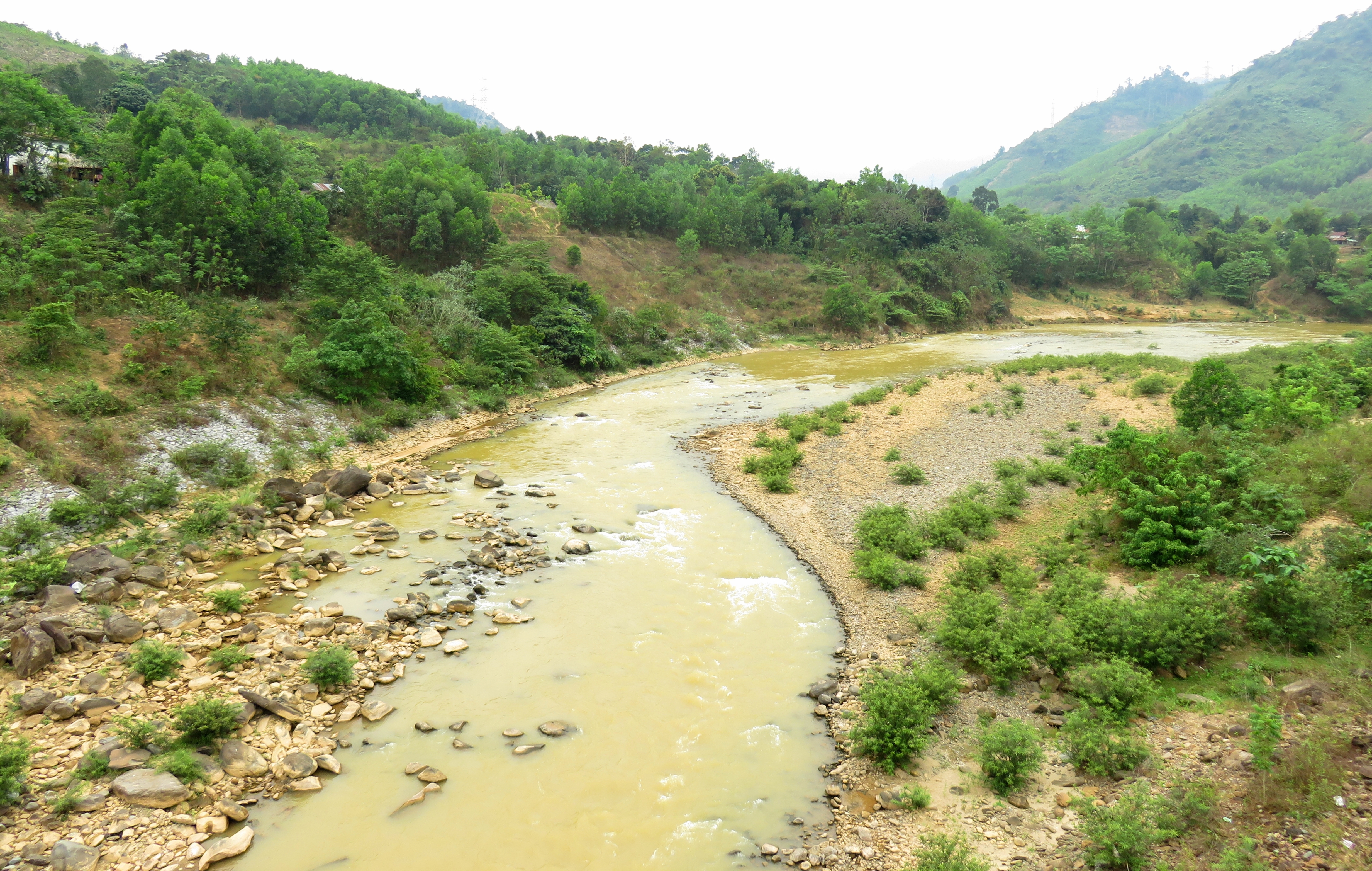
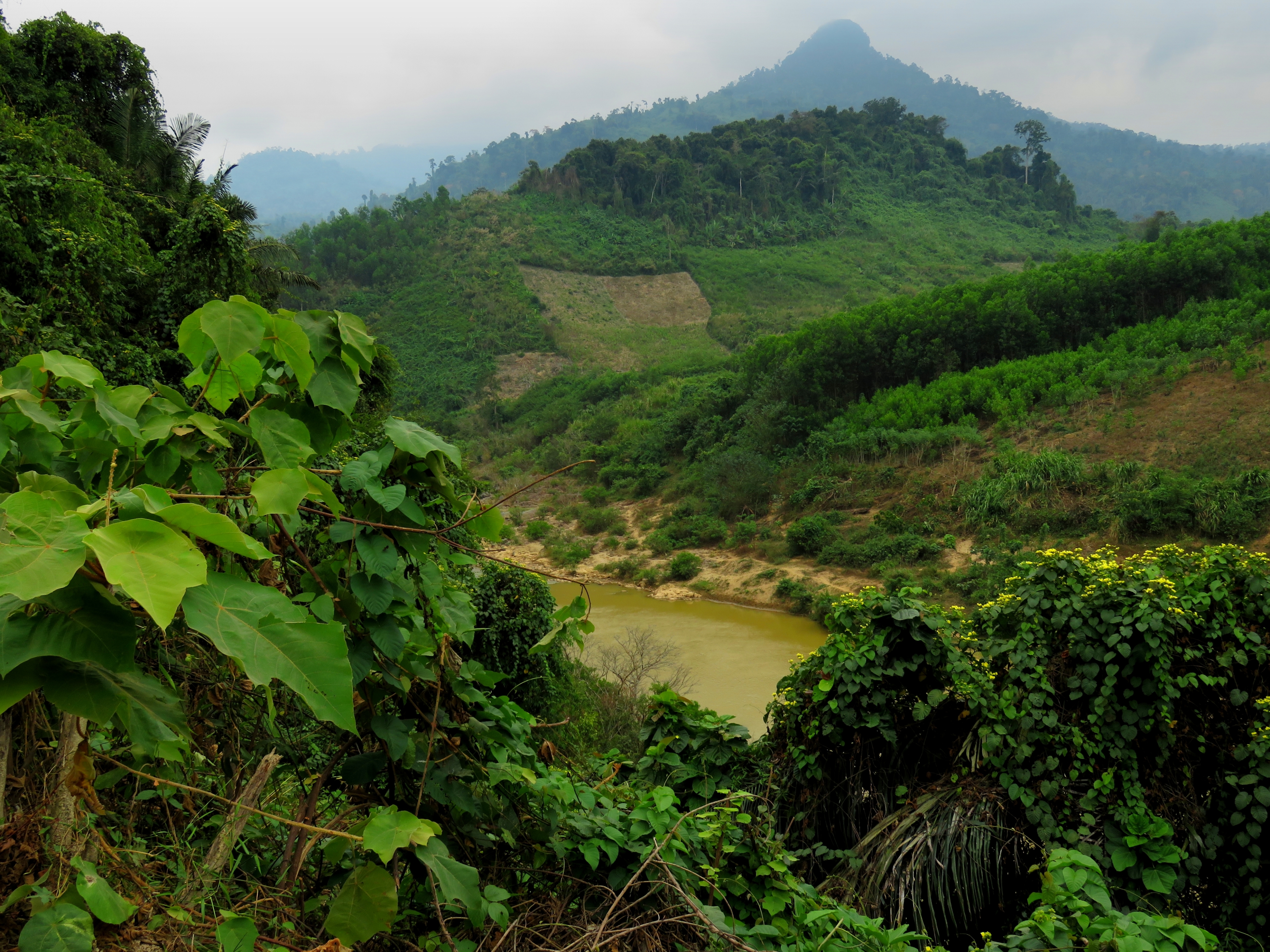
Now getting to Nam Giang in the first place requires driving a couple hours southwest of Da Nang to a place called Thanh My. This town, located along the Ho Chi Minh Road, is a convenient access point for a lot of areas in northwestern Quang Nam. Roads lead north to Prao, south to Kon Tum, and west to the Lao border, and although there isn't a border gate there, there is a huge amount of natural beauty and ethnic communities along the way. We cruised through Thanh My, and made our way west a handful of kilometers and turned onto highway 14-D, between the communities of Ben Giang and A Roong, at the confluence of the Thanh and Cai Rivers.
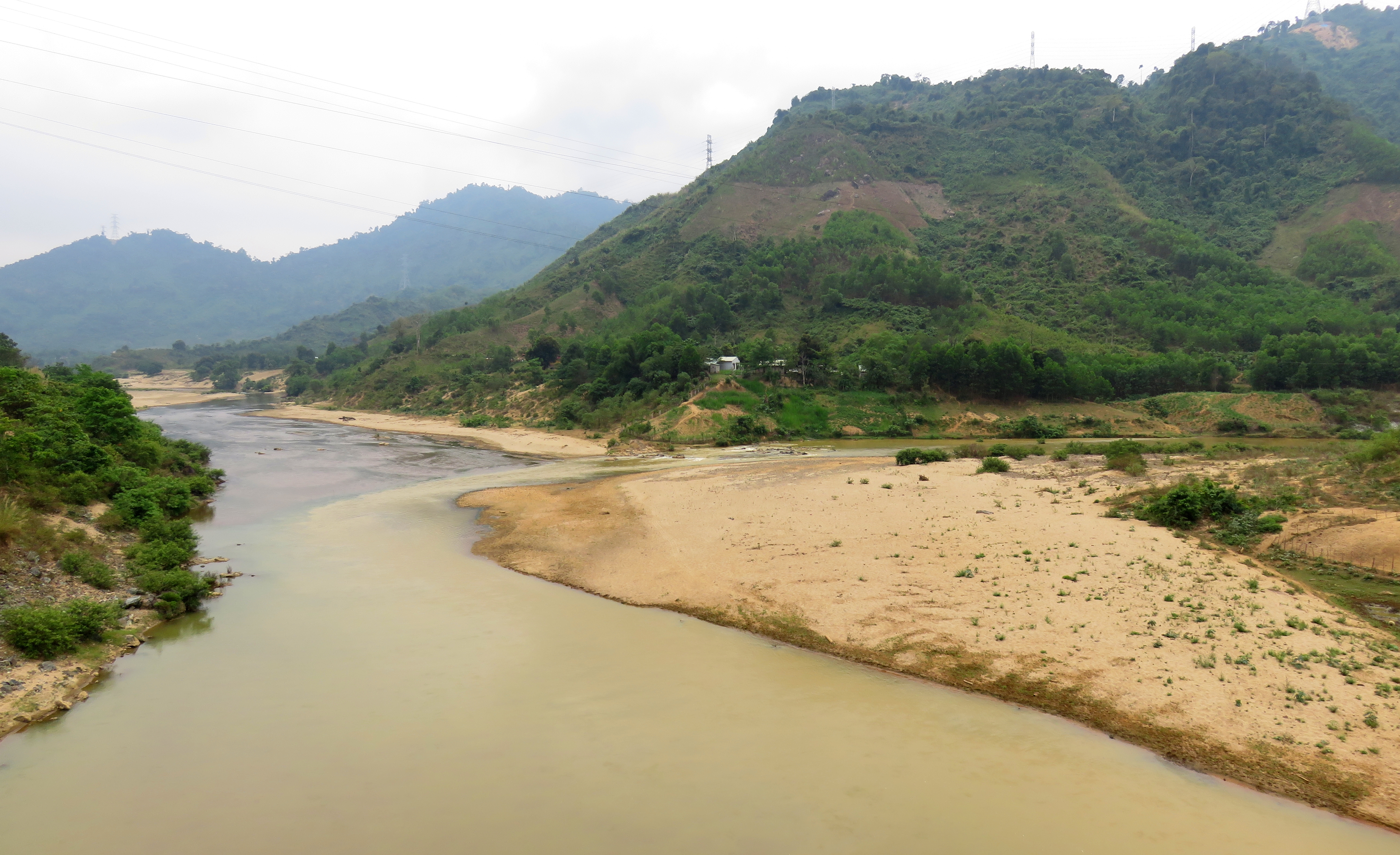
Confluence of the Song Cai & Song Thanh.
The bridge that you must cross to access this road is a bit dated, and it does feel like you are entering an area that is a bit outside the sphere of the modern world. I love driving across bridges of any kind and this was a great one. While there are several ethnic groups within the greater area, by far the biggest is the Co Tu, or K'tu, whose total number in Vietnam runs around 63,000. Although it's possible to see other groups in the area such as Gie Rieng or Duc Rieng, the Co Tu are the most ubiquitous and visible.
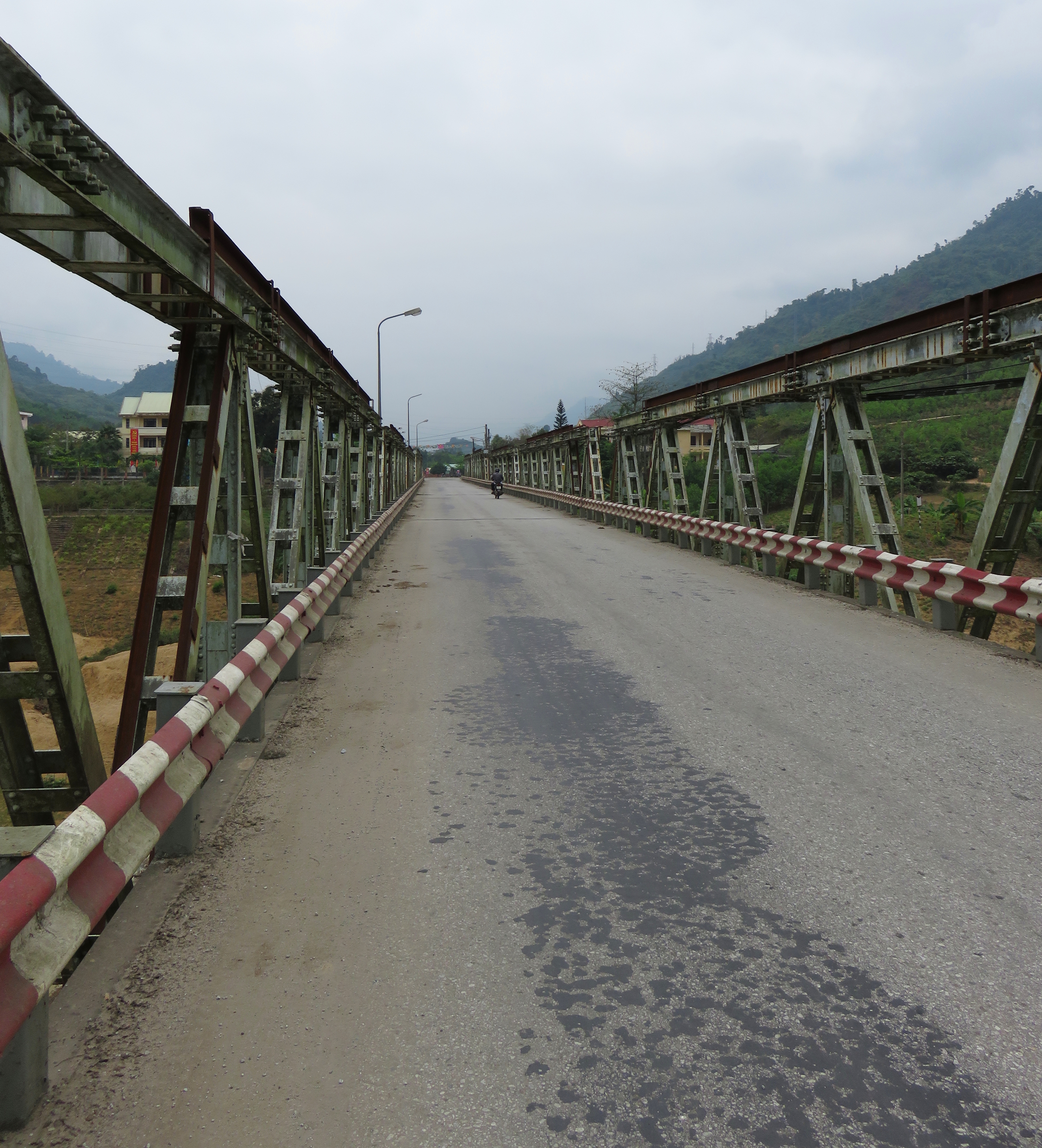 Bridge leading into the ethnic areas. | 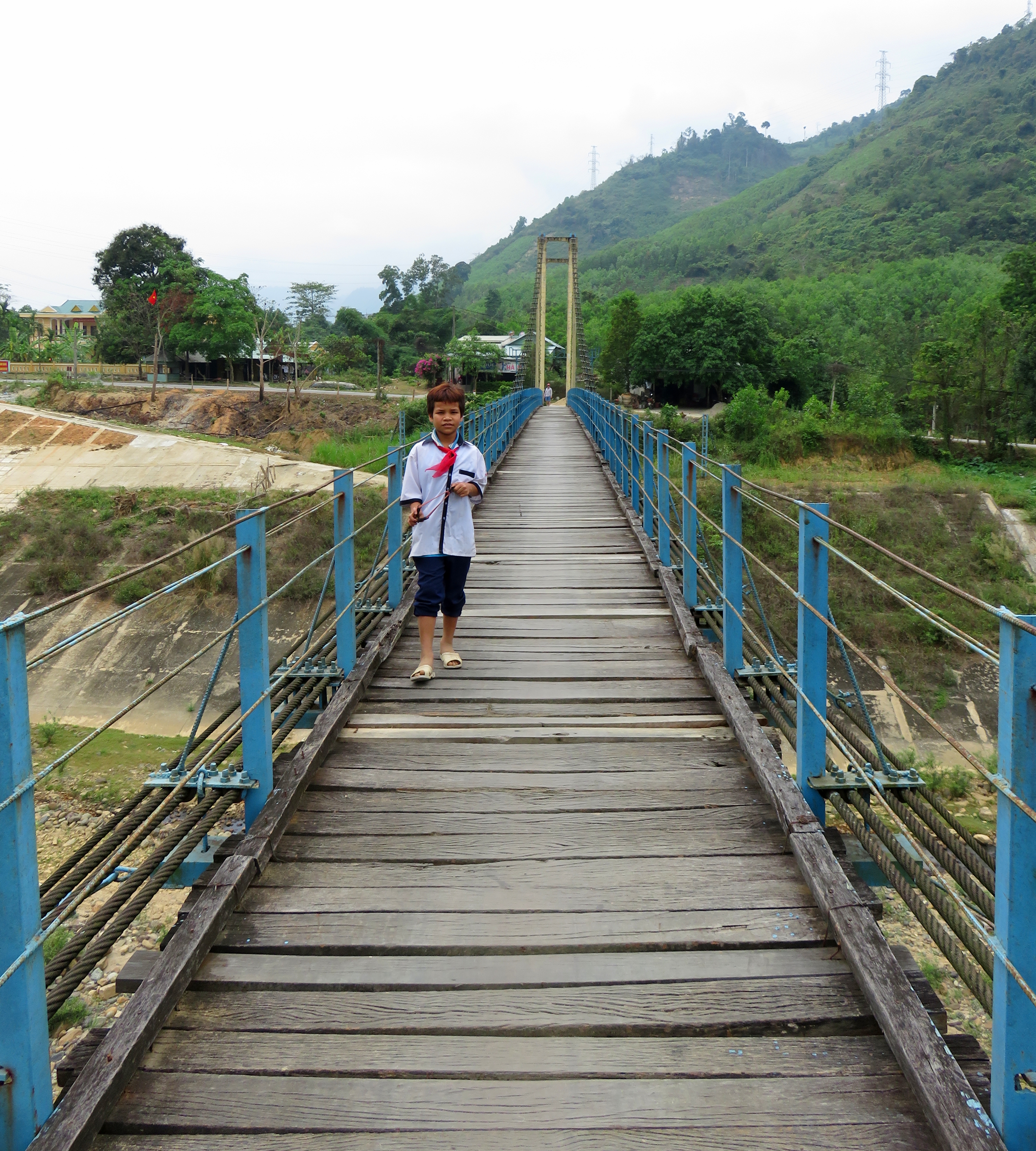 Small bridge in A Roong. |
Song Thanh.
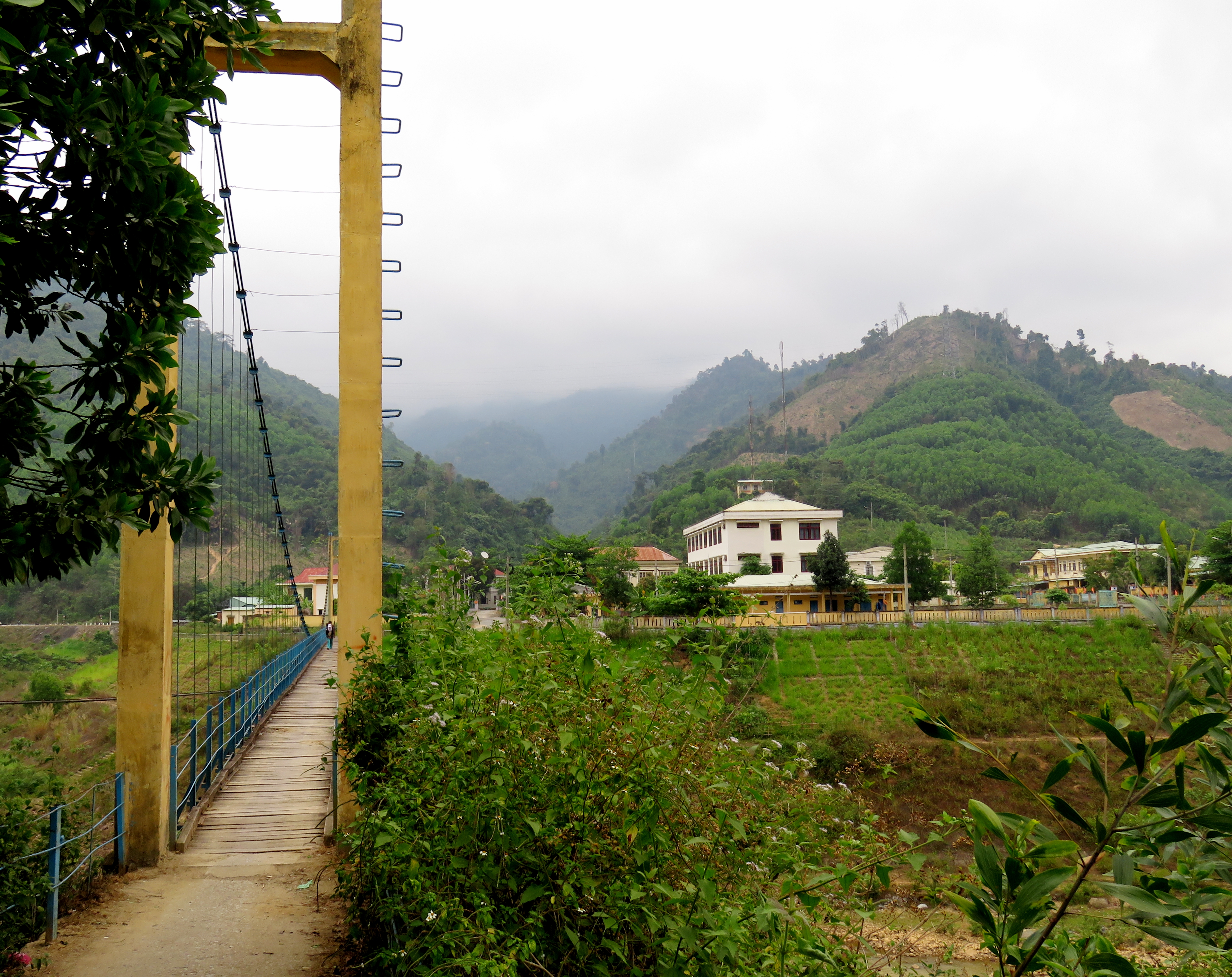
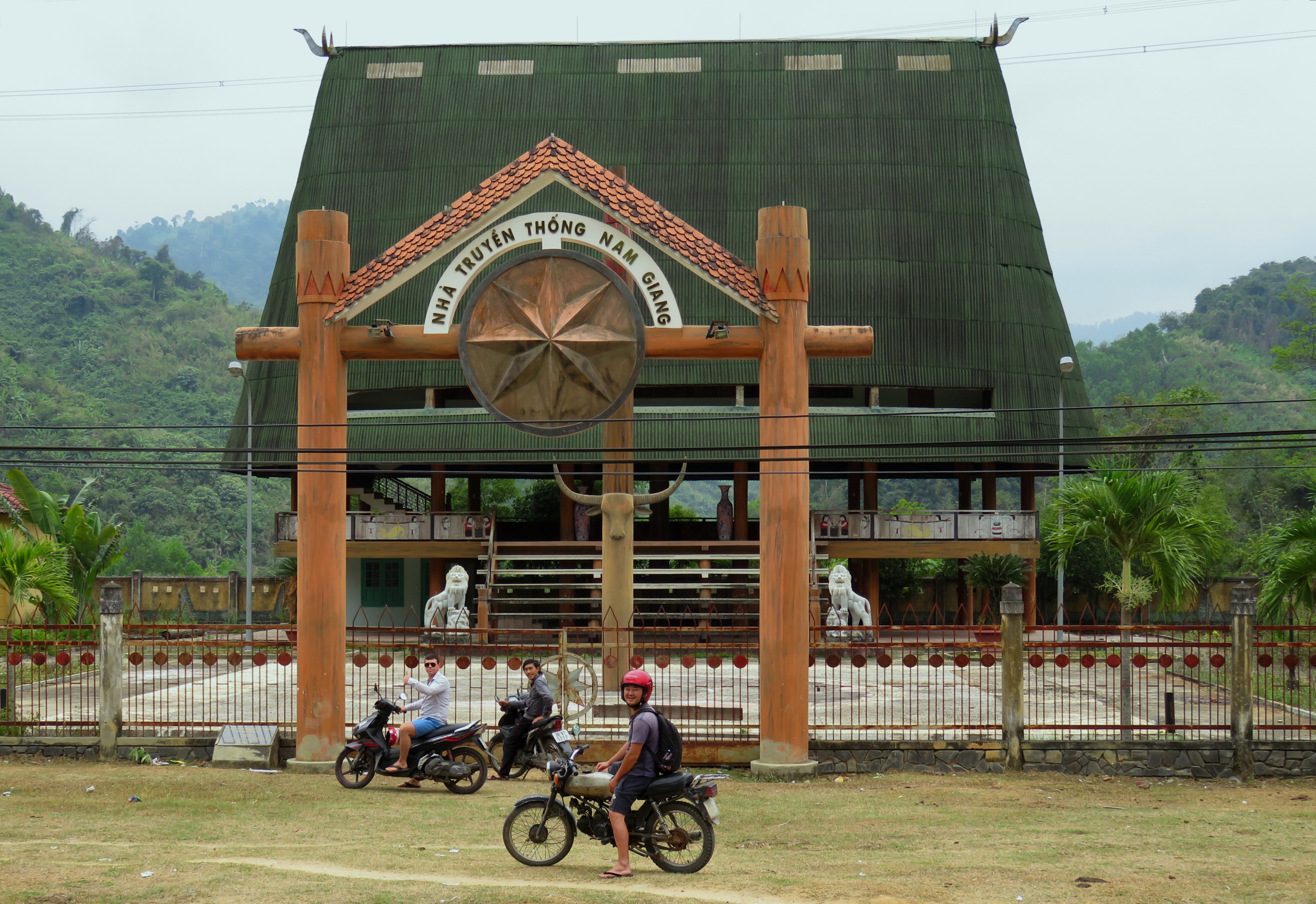
Immediately across the bridge we took a left and crossed one of the classic rural Vietnamese suspension bridges over the Song Thanh. While the main highway stays on the right side of the river as it proceeds up the valley, by taking this bridge and another one a scant 100 meters up the right, you can cruise (please do it slowly) through the village of A Roong, which has a large ethnic population, and it shows in the dwellings and the people. Back on the main road, and around a couple of bends and we came across a large goul. These circular, stilted buildings are the community centers for Co Tu villages, and this one is used for cultural tourism in addition to the local use, so it's quite striking in appearance. It doesn't hurt that there is a dramatic limestone knob rising in the background.
A Roong and Quang Nam mountains.
Goul at A Roong
After A Roong, the road went up the beautiful valley of the Song Thanh, passing through small, almost entirely ethnic villages spaced every couple of kilometers. It's interesting seeing the people in these areas; they are clearly different from the Kinh majority ethnicity in Vietnam, and while most of the locals (both ethnic and Kinh) have started wearing modern clothing such as jeans, trousers, and t-shirts, the older generation often still wear their traditional outfits. It's common in this area to see old ladies sporting the traditional halter-top style shirt with patterns on the front. I don't want to be rude and ask for photos of these nice ladies, so you can just run a Google Search to see what I'm talking about.
Song Thanh river valley.
Finally we found the road up to the waterfall. When Kong had been here before he said there was no sign, nothing to indicate what was up there. Now there was a gigantic billboard 4 meters tall with big arrows. Uh-oh. The drive up to the parking lot is short, perhaps a kilometer, up to where the small canyon of the Suoi Ba Giang comes out of the mountains and joins the much larger Song Thanh valley. The falls is just above that opening. There is a decent sized parking lot, and it is an indicator of just how busy this place is during peak summer season. A beautiful local cabin sits in a clearing across the creek.
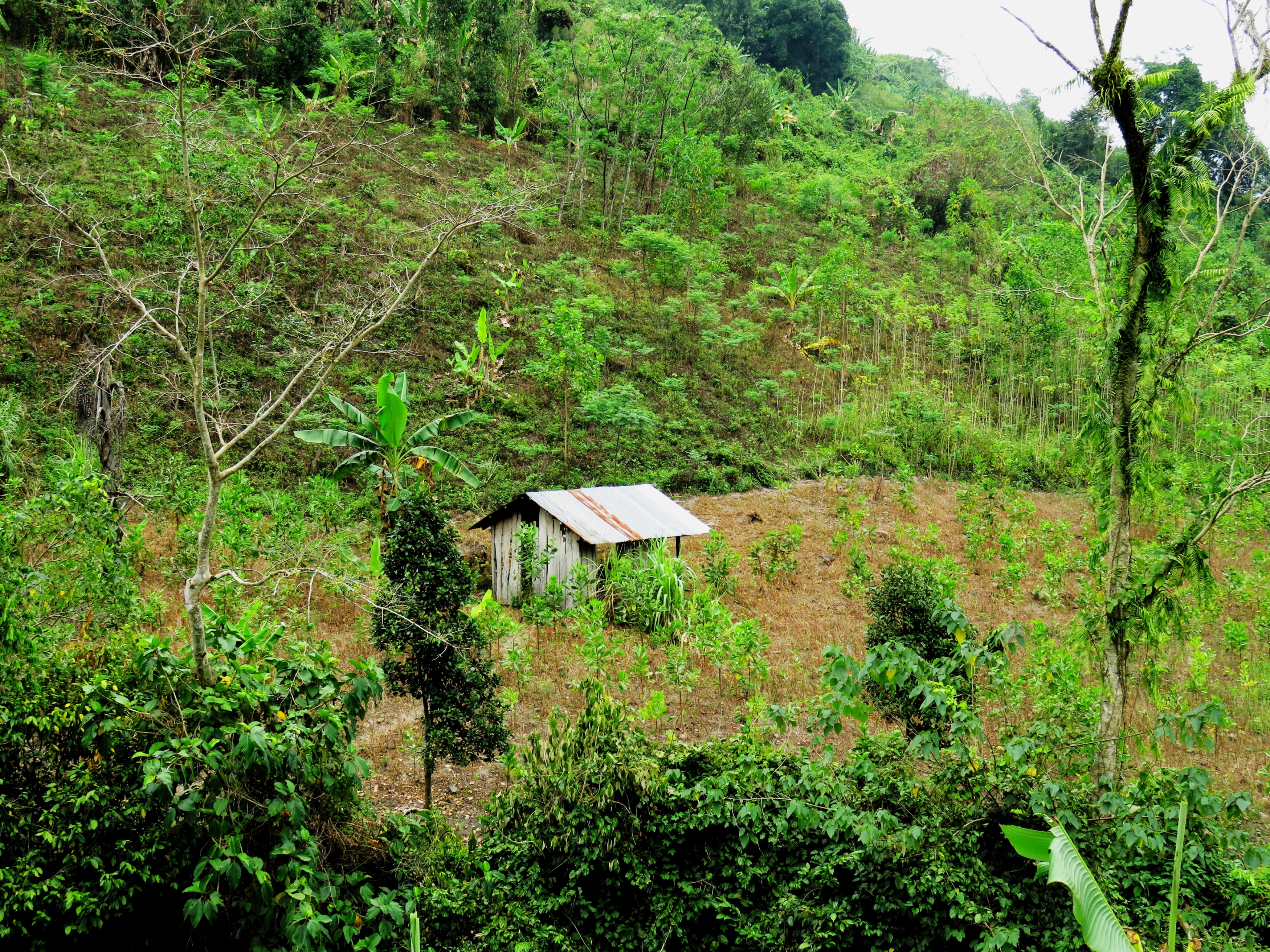
Cabin near the parking lot
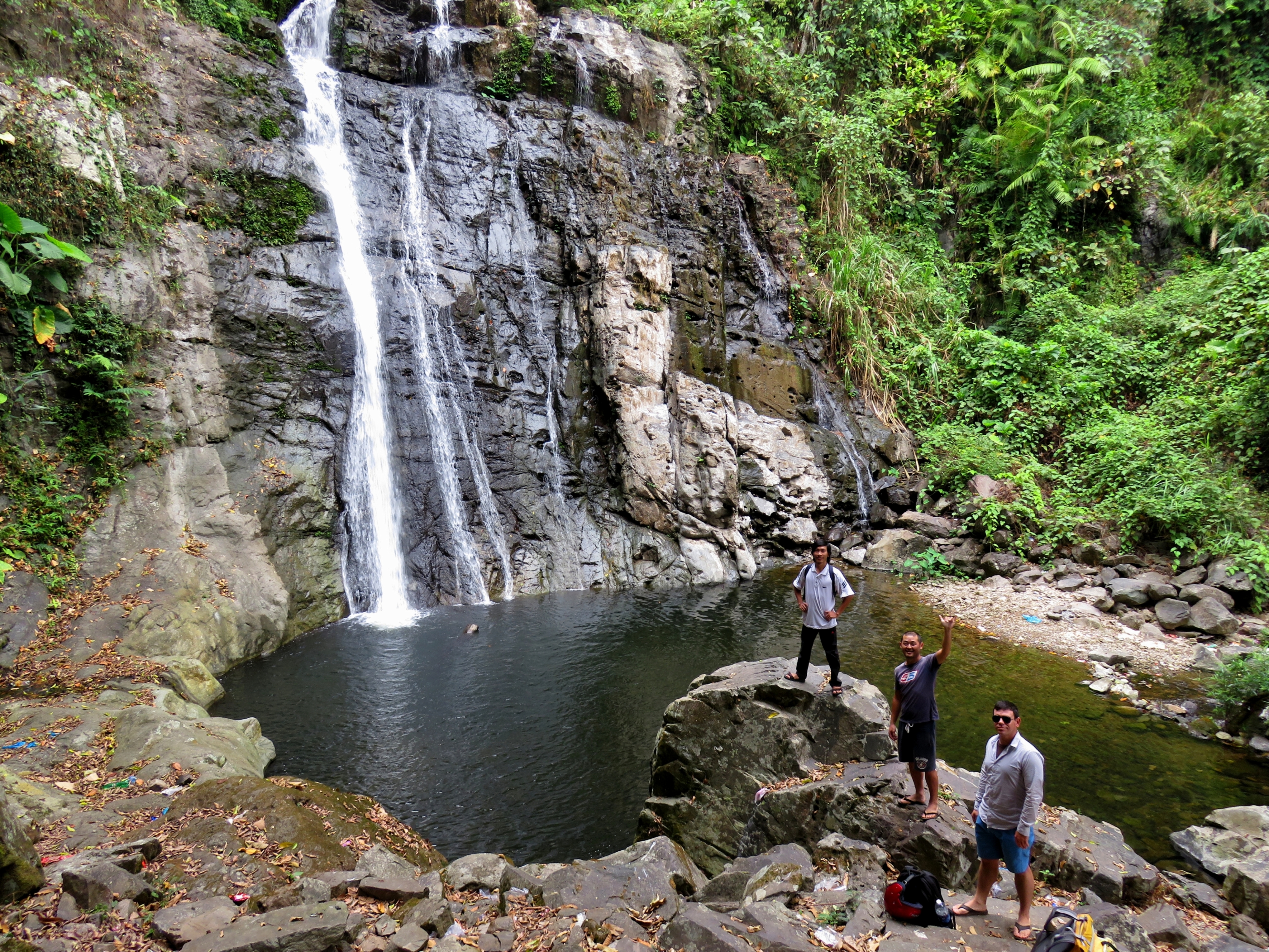
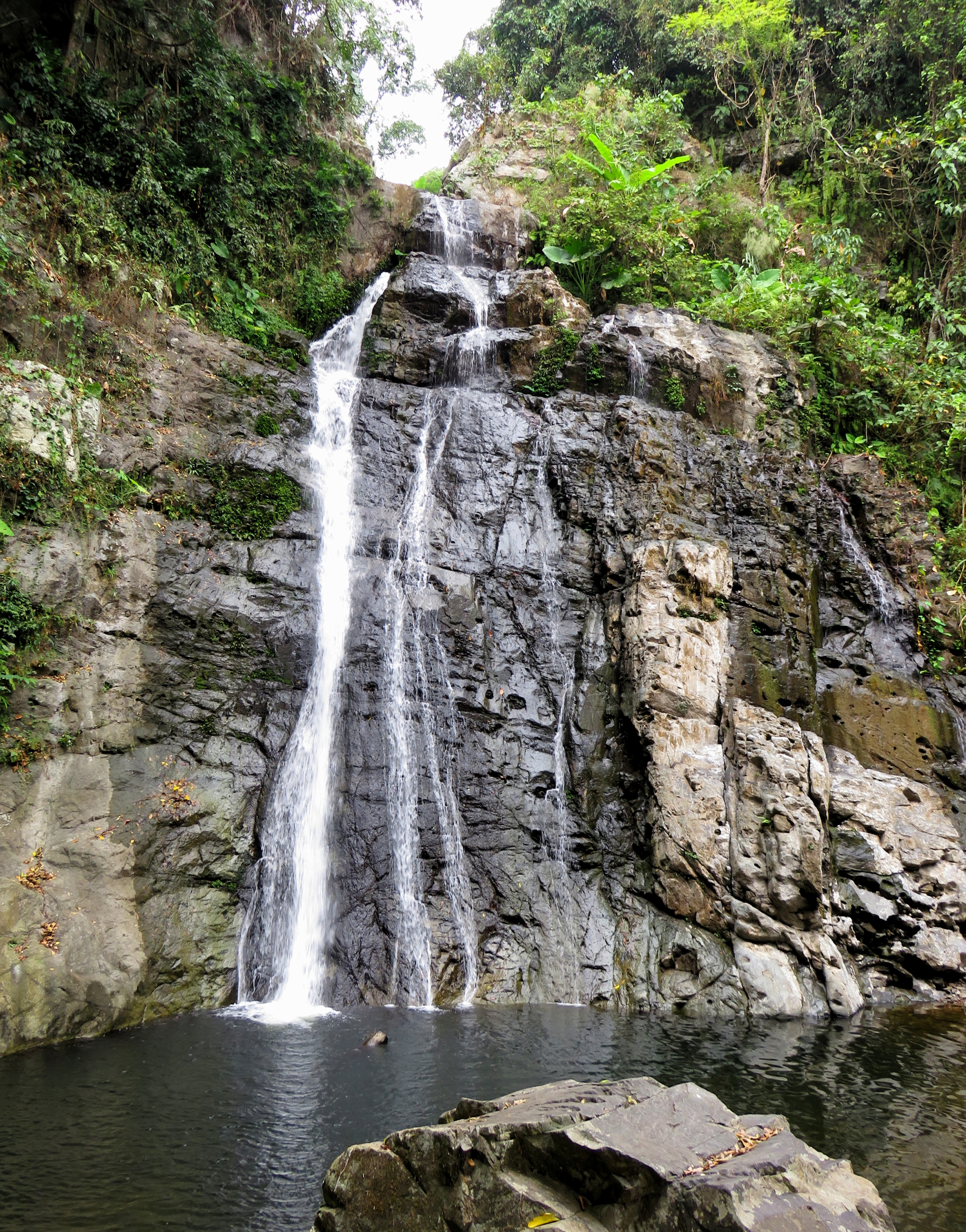
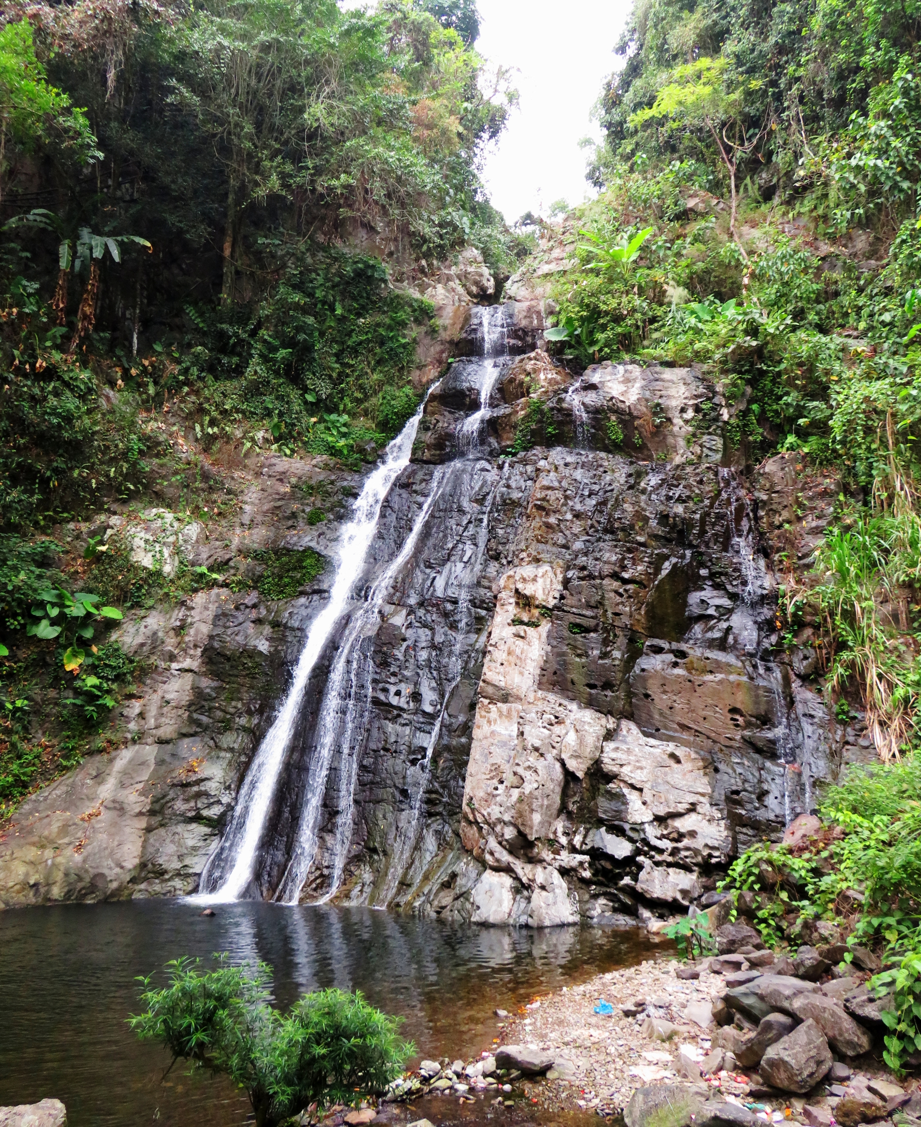
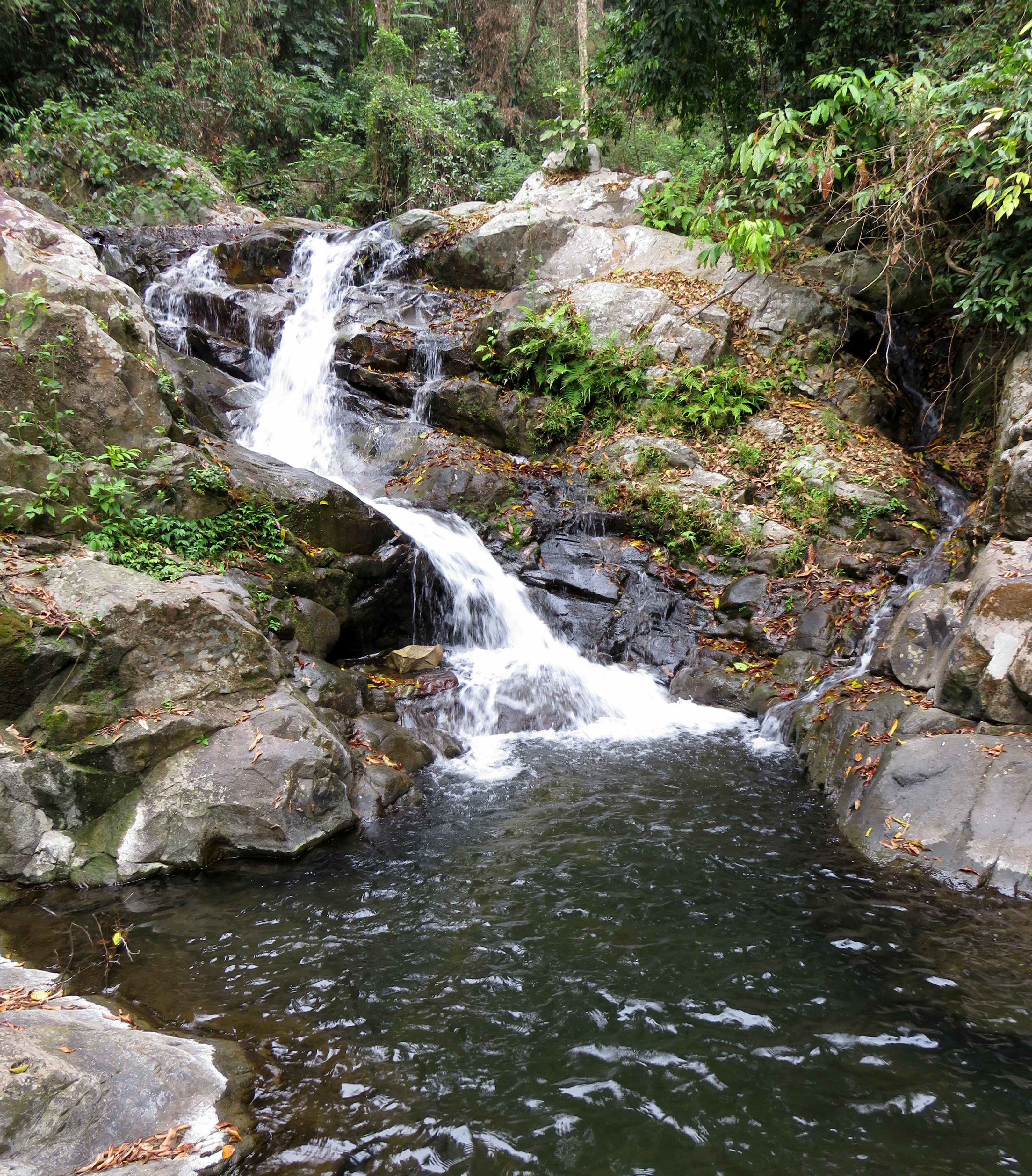
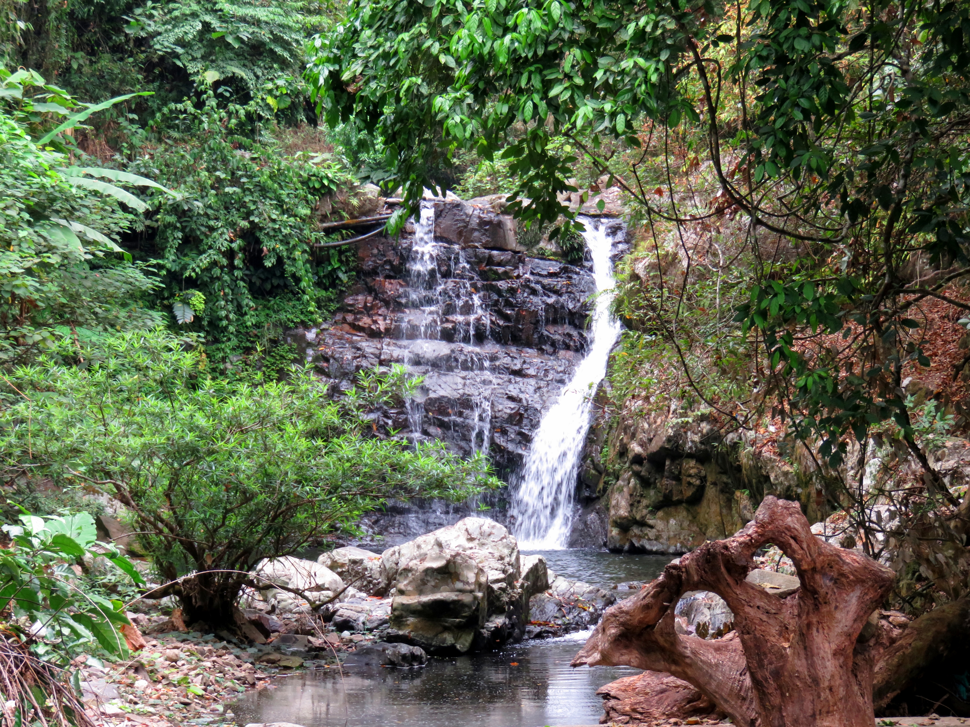
It's less than five minutes from the parking lot to the falls. The trail climbs gently at first, then goes up a set of stairs, and drops down into the area around the base of the falls. Limestone is the predominant rock type in this area, and this falls is caused by a ledge of harder limestone resisting erosion more than areas above and below. We figured the falls was between 25 and 30 meters, or between about 80 and 100 feet. It fell down a small drop at first, twisted, and then fell the remaining distance into a small but beautiful carved cauldron at it's base.
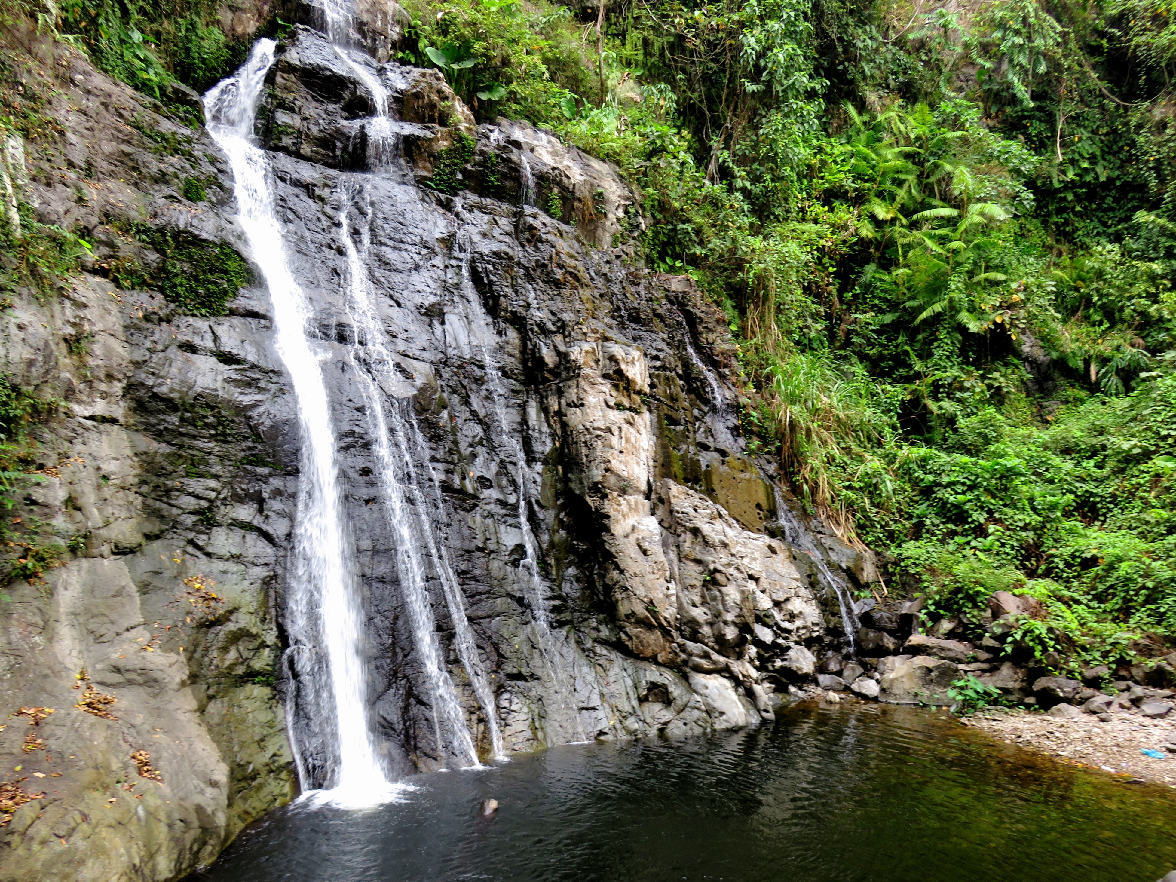
Thac Grac from multiple angles.
 |  |
Unfortunately, the beauty of the falls and the place is ruined by a common problem in Vietnam: trash. Rubbish, litter, waste, garbage, rac; whatever you want to call it, it is a huge problem in Vietnam. Many beautiful places around the country are suffering from getting "trashed out", and this waterfall is no different. Perhaps in the future someone will start managing the waterfall and put in some trash cans, but until that happens, trash is always going to happen, which is really a damn shame because otherwise this is magical.
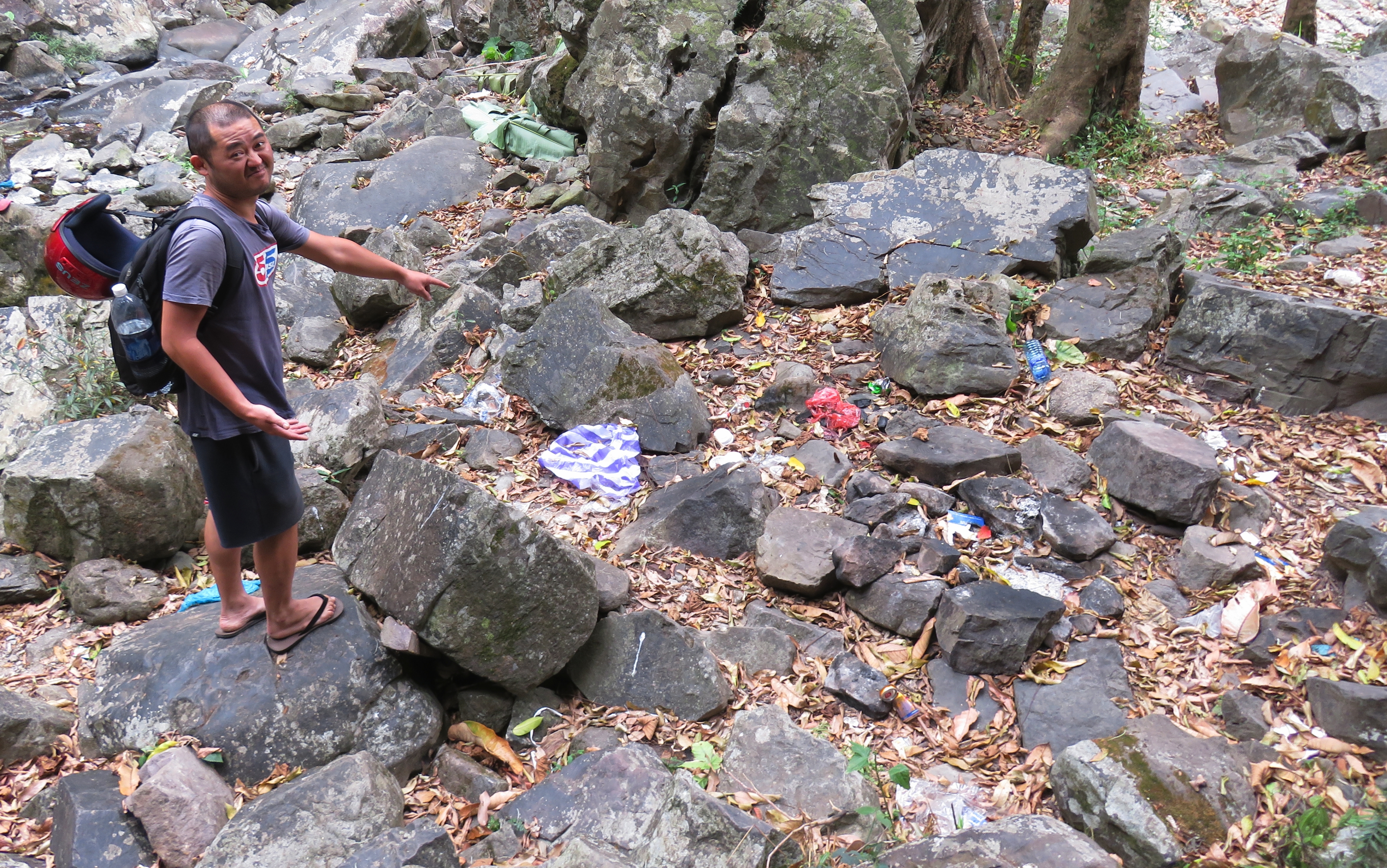 Kong not so stoked about the trash. | 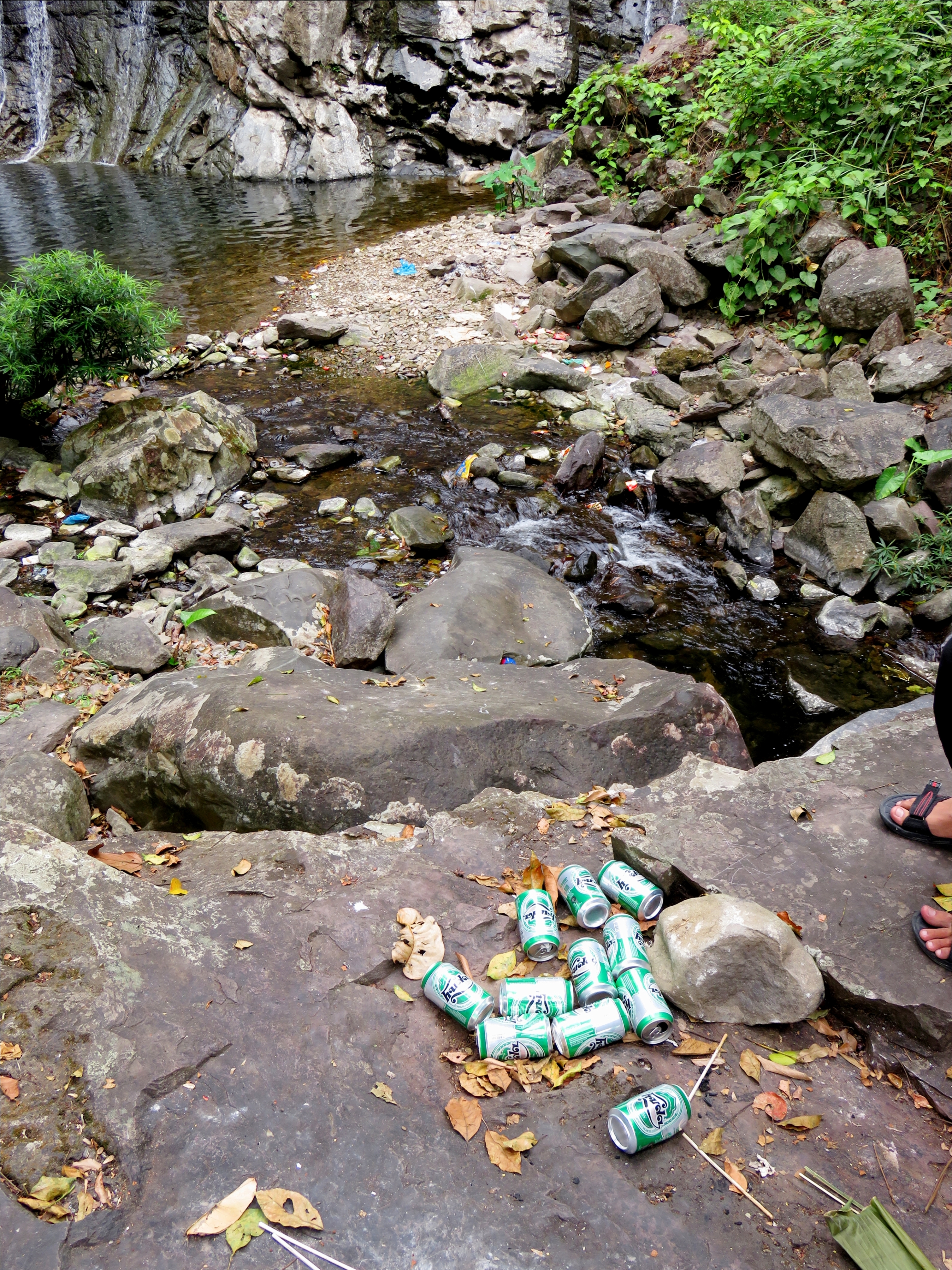 Huda! |
I had actually brought my canyoning gear all the way down with me, with the idea of possibly rappelling (that's abseiling for you silly Aussies) the falls. So we went back to the trail, where a long and steep series of stairs delivers you to the creek a short ways above the falls. It actually puts you on top of a waterfall above the big drop, and there isn't a great way to get down this small one to get to the lip of the big drop. That, coupled with the fact that the best anchors present would have made for an awkward start to the rap, made me back off and wait for another day when I've got a canyoning partner or two to back me up.
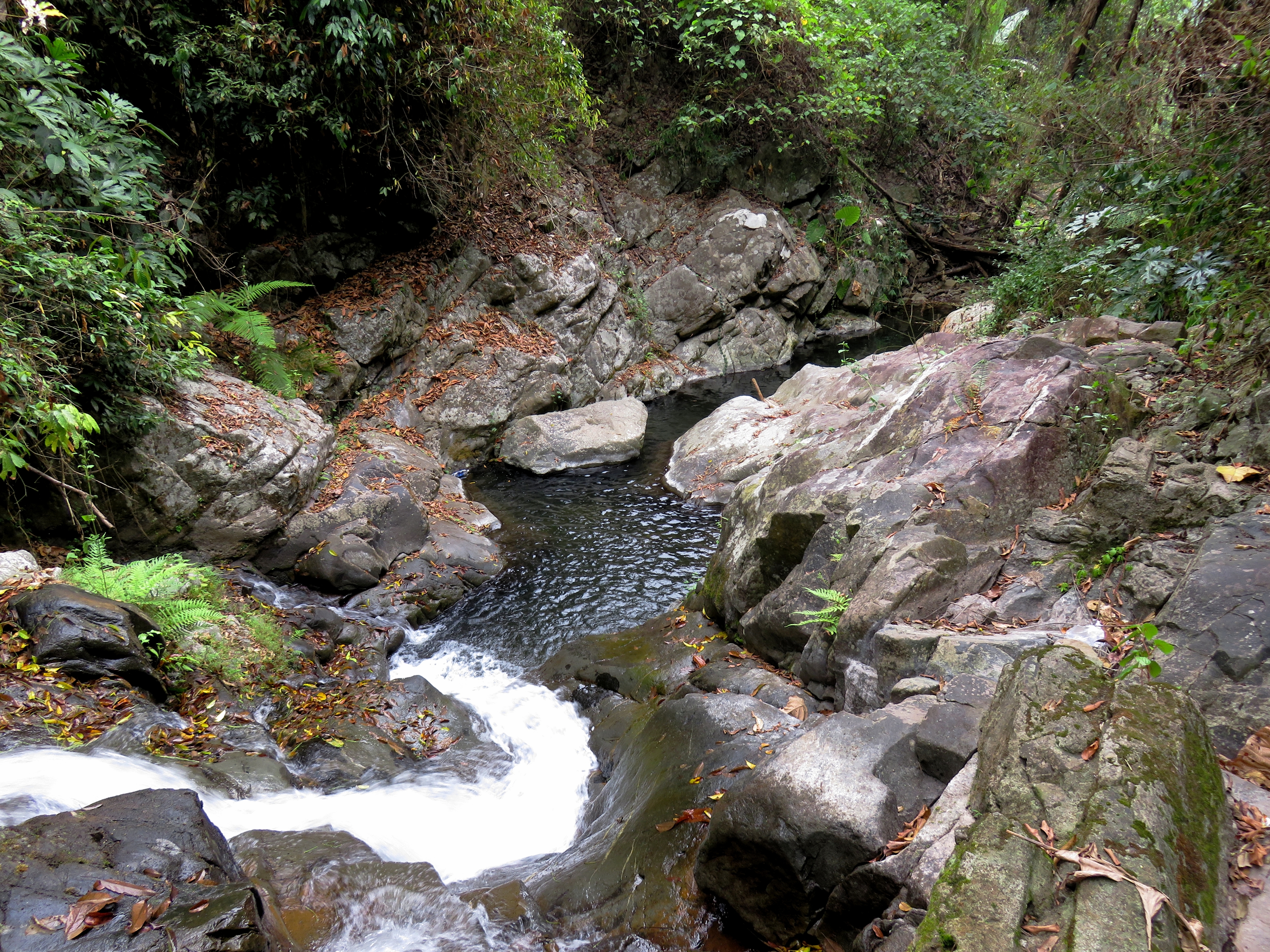
Falls above the big falls, and the beautiful jumping falls.
 | 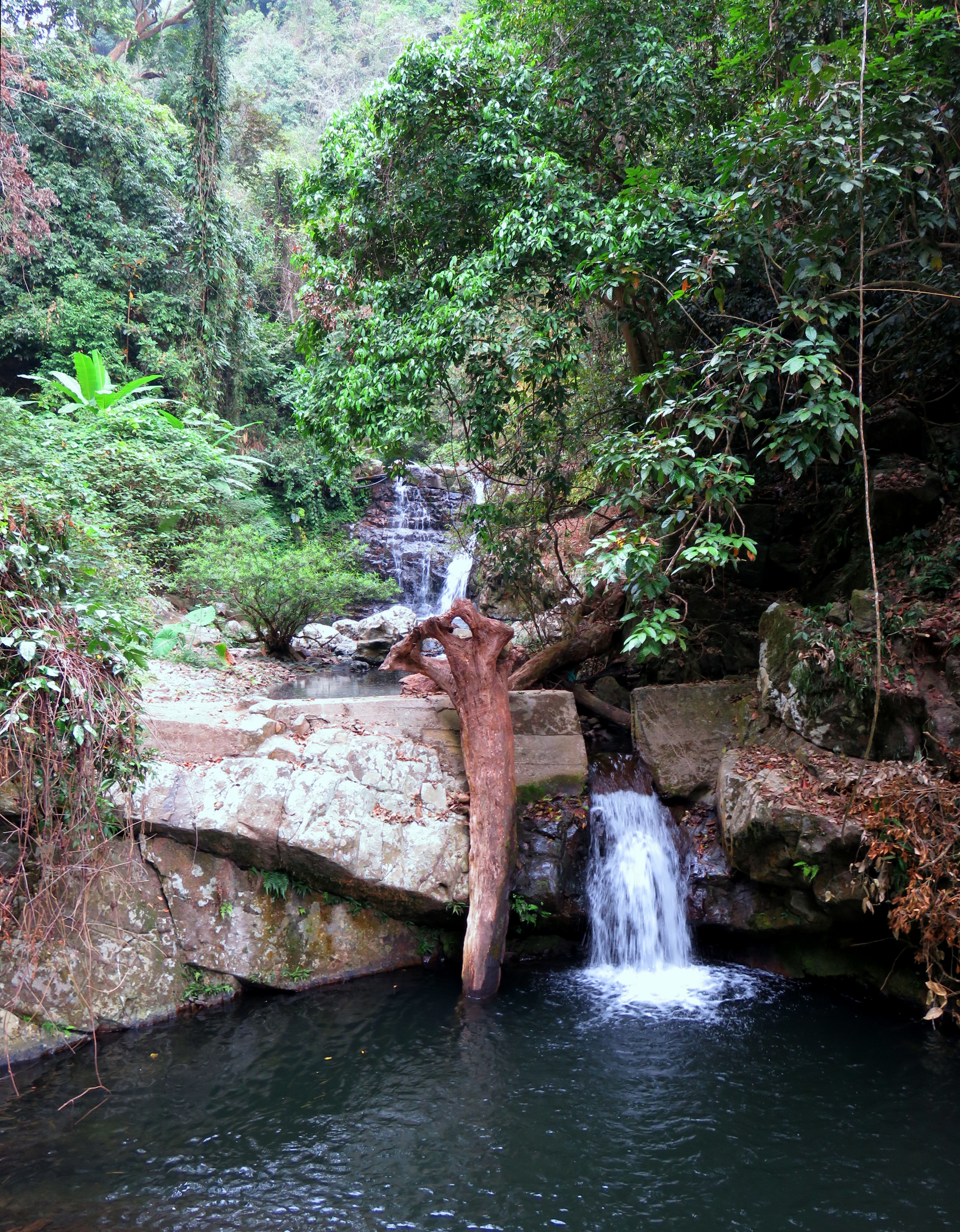 |
However, above this there was a beautiful pool that had been altered with a dam of concrete running across the creek. A chunk of the dam had been knocked out, resulting in a small waterfall cutting through an artificial wall. This upper area was also much less trashed than the lower pool, so it was much more inviting to swim as well. The pool looked plenty deep, so I did a test probe and couldn't touch bottom, so that then led to a nice jumpfest for the crew for the next hour.
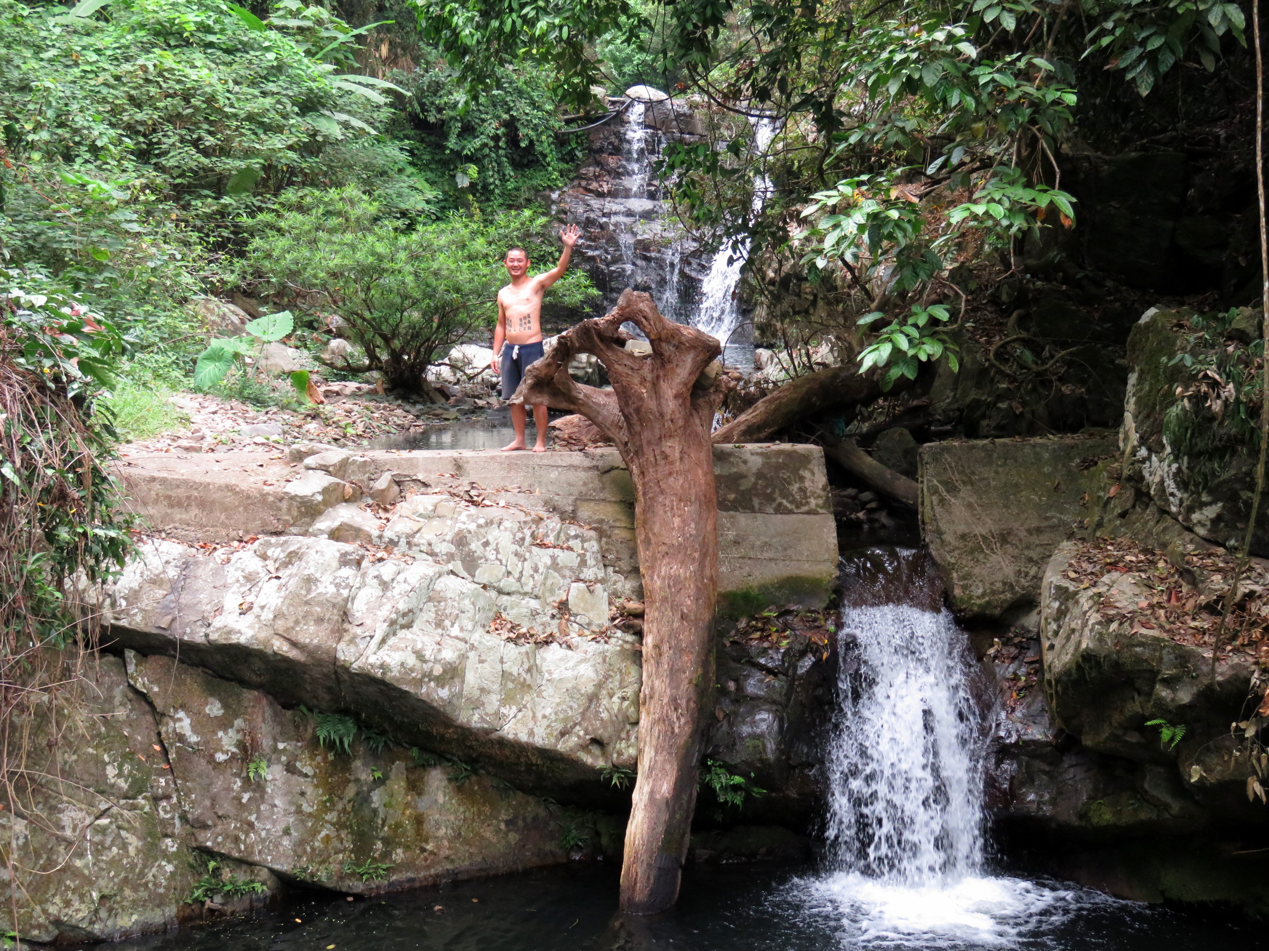
Kong pre-jump.
| | |
| |  |
After jumping for a while, and relaxing and enjoying the fact that we had this beautiful place to ourselves, we were starting to get hungry, so we walked back down to the bikes and headed back to Thanh My for lunch. Along the way we stopped to admire some of the massive trees that remain along the Song Thanh valley. Who knows how long they will continue to stand? In this area there are a few different species of large trees, and the difference is somewhat striking in appearance. Also, we took note of the different housing styles that existed along the valley. In just a short distance of less than 100 meters you can see three different kinds of houses: modern concrete block, traditional wood frame, or temporary woven-thatch. In these ethnic areas of Vietnam they are all well represented.
Big trees above the falls.
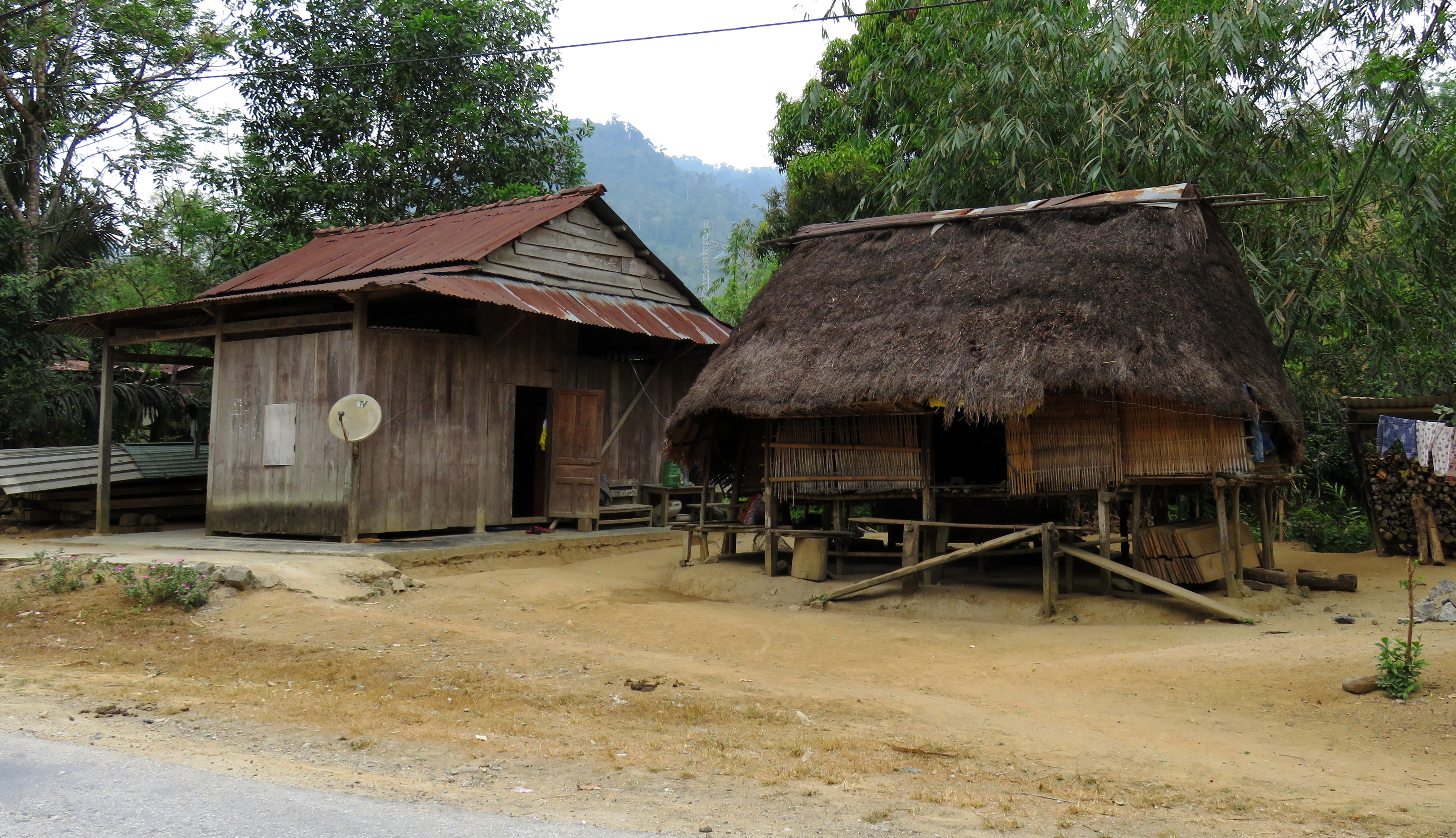
Houses along the way.
The trip back to the city was entirely uneventful, and it was actually surprising how short the trip really took. We left at 8:30, had a coffee on the way down, hung out and jumped at the falls, had lunch, and drove home and we were back before 4. Sometimes the places that seem so far away really aren't if the highways connecting the two are in decent enough shape. Fortunately, the road to Thanh My is one of those, and it's that ease of access that makes seeing amazing places like this possible. Thanks for reading!
All photos and videos copyright Kit Davidson.
 RSS Feed
